Wooburn Green

Last updated

Wooburn Green
Wooburn Green.jpg
Wooburn Green
Buckinghamshire UK location map.svg
Red pog.svg
Wooburn Green
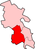
Location within Buckinghamshire
Population3,820 
OS grid reference SU913885
Civil parish
Unitary authority
Ceremonial county
Region
Country England
Sovereign state United Kingdom
Post town HIGH WYCOMBE
Postcode district HP10
Dialling code 01628
Police Thames Valley
Fire Buckinghamshire
Ambulance South Central
UK Parliament
List of places
UK
England
Buckinghamshire
51°35′17″N0°40′59″W / 51.5880°N 0.6831°W / 51.5880; -0.6831 Coordinates: 51°35′17″N0°40′59″W / 51.5880°N 0.6831°W / 51.5880; -0.6831

Wooburn Green is a village in the civil parish of Wooburn, Buckinghamshire, England. [1] [2]

Contents

Location

Wooburn Green is a village situated four miles south east of the town of High Wycombe. It neighbours Beaconsfield, Loudwater, Flackwell Heath, Wooburn Common and Bourne End. It is close to the M40 motorway, meaning London and Birmingham are easily accessible by road.

The village was once served by the High Wycombe to Maidenhead railway line, however the line and station closed in 1970.

The Green

The large village green (a conservation area) is fringed with trees and is surrounded by older cottages, small Victorian and Edwardian houses, modern shops and local businesses. A Village Fête and funfairs are held there regularly throughout the year. During the 1980s, the Green was used to host the Meadows School summer Fete.

1st Wooburn Scout Group meets at their headquarters in Watery Lane, Wooburn Green. You can see the old site of the railway. There are a couple of housing estates which have been built on part of the old railway line. [3]

Related Research Articles

<span class="mw-page-title-main">Flackwell Heath</span> Human settlement in England

Flackwell Heath is a village in the civil parish of Chepping Wycombe on the outskirts of High Wycombe, Buckinghamshire, England. With an elevation of about 150 metres (490 ft), in the Chiltern Hills. It has a population of around 6000.

<span class="mw-page-title-main">Bledlow Ridge</span> Human settlement in England

Bledlow Ridge is a village in the civil parish of Bledlow-cum-Saunderton in Buckinghamshire, England. In 2004 the population was 940. It is situated in the Chiltern Hills, about 4 miles SSW of Princes Risborough and on the road between the High Wycombe and Chinnor.

<span class="mw-page-title-main">Bourne End, Buckinghamshire</span> Village in Buckinghamshire England

Bourne End is a village mostly in the parish of Wooburn, but partly in that of Little Marlow in Buckinghamshire, England. It is about five miles (8 km) south-east of High Wycombe and three miles (5 km) east of Marlow, near the boundary with Berkshire and close to where the Buckinghamshire River Wye empties into the Thames.

<span class="mw-page-title-main">Cores End</span> Human settlement in England

Cores End is a hamlet in the civil parish of Wooburn, in Buckinghamshire, England.

<span class="mw-page-title-main">Wooburn</span> Human settlement in England

Wooburn is a large village in Buckinghamshire, England. It is located off the A4094 road between Wooburn Green and Bourne End in the very south of the county near the River Thames, about two miles south west of Beaconsfield and four miles east of Marlow. Wooburn is one of the two principal settlements within Wooburn, a civil parish in Wycombe district.

<span class="mw-page-title-main">River Wye, Buckinghamshire</span> River in Buckinghamshire, England

The River Wye is a river in Buckinghamshire, England. Around 10.5 miles (16.9 km) in length, it rises close to West Wycombe village in the Chiltern Hills and flows through High Wycombe before emptying into the River Thames at Bourne End, on the reach above Cookham Lock. In particularly wet years, the source can temporarily change and effectively extend the river by another mile, due to a chalk spring rising above the ground in a field further up the same valley.

<span class="mw-page-title-main">Beaconsfield (UK Parliament constituency)</span>

Beaconsfield is a constituency in Buckinghamshire represented in the House of Commons of the UK Parliament since 2019 by Joy Morrissey of the Conservative Party. She succeeded Independent and former Conservative Dominic Grieve, whom she defeated following his suspension from the party. The constituency was established for the February 1974 general election.

<span class="mw-page-title-main">Crossflatts</span> Ribbon development in West Yorkshire, England

Crossflatts is a ribbon development in Airedale along the old route of the A650 road between Bingley and Keighley, in the Metropolitan Borough of Bradford, West Yorkshire, England. The opening of the Aire Valley Trunk road in 2004 has seen a reduction of 51% of traffic through the village.

<span class="mw-page-title-main">Princes Risborough railway station</span> Railway station in Buckinghamshire, England

Princes Risborough station is a railway station on the Chiltern Main Line that serves the town of Princes Risborough in Buckinghamshire, England. It is operated by Chiltern Railways.

<span class="mw-page-title-main">Marlow branch line</span>

The Marlow branch line is a single track railway line in England, between Maidenhead station in Berkshire and Bourne End and Marlow stations in Buckinghamshire. It is 7 miles 10 chains (11.5 km) in length. Passenger services are operated by Great Western Railway using Class 165 and Class 166 diesel trains. The line connects to the Great Western Main Line at Maidenhead; it uses a section of the former Wycombe Railway line to High Wycombe together with the former Great Marlow Railway.

<span class="mw-page-title-main">Berghers Hill</span> Human settlement in England

Berghers Hill is a hamlet in Wooburn civil parish in Buckinghamshire, England.

<span class="mw-page-title-main">Astwood Bank</span> Human settlement in England

Astwood Bank is a district within Redditch. Astwood Bank is near the Warwickshire - Worcestershire border, near villages such as Studley, Sambourne, Callow Hill, Feckenham, and Cookhill.

The Wycombe Railway was a British railway between Maidenhead and Oxford that connected with the Great Western Railway at both ends; there was one branch, to Aylesbury.

<span class="mw-page-title-main">Beacon Hill, Buckinghamshire</span> Hill near Penn and on the outskirts of High Wycombe Buckinghamshire

The hamlet of Beacon Hill, is situated off the B474 near Penn and on the outskirts of High Wycombe Buckinghamshire. Nearby is the Golf Course at Wycombe Heights.

<span class="mw-page-title-main">Inchture</span> Human settlement in Scotland

Inchture is a village in Scotland between Dundee and Perth on the northern side of the Firth of Tay. It is approximately nine miles (14 km) from Dundee city centre and 13 miles (21 km) from Perth. The village is bypassed by on the A90 trunk road and benefits from a flyover (grade-separated) junction onto the road making it popular with commuters working in Dundee and further afield.

<span class="mw-page-title-main">Wooburn Green railway station</span> Former railway station in England

Wooburn Green railway station was a railway station which served Wooburn Green, Buckinghamshire, England, on the Wycombe Railway. It was opened in 1854, with the station located near the bottom of Whitepit lane. The station became a halt in 1968 because of a decreased service on the line.

<span class="mw-page-title-main">Glasinfryn</span> Human settlement in Wales

Glasinfryn is a small village in Gwynedd, Wales. It is situated between the village of Tregarth and the city of Bangor, Gwynedd, and in the community of Pentir. The village is residential in nature but with many outlying farms.

Wooburn, or Wooburn and Bourne End, is a civil parish in Buckinghamshire, England. South-east of High Wycombe, it comprises the villages of Wooburn, Wooburn Green and Bourne End and the hamlets of Berghers Hill, Cores End, Hawks Hill, Widmoor and Wooburn Moor. The Buckinghamshire River Wye flows through the area, emptying into the River Thames at Bourne End.

West Wycombe railway station was a railway station that served the village of West Wycombe, Buckinghamshire Situated about 12 mile (0.80 km) east of the village the station opened in 1862 and closed in 1958. Minutes of the Wycombe Railway state that construction of West Wycombe station in 1862 cost £430 8s 8d, equivalent to £42,731 in 2021, with additional general works at £417 8s 8d, equivalent to £41,441 in 2021.

References

  1. Ordnance Survey: Landranger map sheet 175 Reading & Windsor (Henley-on-Thames & Bracknell) (Map). Ordnance Survey. 2012. ISBN   9780319232149.
  2. "Ordnance Survey Election Maps". www.ordnancesurvey.co.uk. Ordnance Survey. Retrieved 18 February 2016.
  3. "Wooburn Scouts" . Retrieved 24 March 2016.

Commons-logo.svg Media related to Wooburn Green at Wikimedia Commons