Marsh, Buckinghamshire

Last updated

Marsh
Buckinghamshire UK location map.svg
Red pog.svg
Marsh
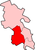
Location within Buckinghamshire
OS grid reference SP815095
Civil parish
Unitary authority
Ceremonial county
Region
Country England
Sovereign state United Kingdom
Post town AYLESBURY
Postcode district HP17
Dialling code 01296
Police Thames Valley
Fire Buckinghamshire
Ambulance South Central
UK Parliament
List of places
UK
England
Buckinghamshire
51°46′42″N0°49′12″W / 51.778243°N 0.820074°W / 51.778243; -0.820074 Coordinates: 51°46′42″N0°49′12″W / 51.778243°N 0.820074°W / 51.778243; -0.820074

Not to be confused with Wycombe Marsh, Buckinghamshire

Marsh is a hamlet in the parish of Great and Little Kimble in Buckinghamshire, England. The hamlet name comes from the name of the Earls of Pembroke in the 12th and 13th centuries and was previously called Marshals. [1] [2]

Formerly a parish in its own right, it was annexed into the parish of Great Kimble in the late medieval period when its manor was purchased by Lord Griffith Hampden (ancestor of John Hampden) who was also the lord of Great Kimble manor. [1] [2] In the English Civil War it was reputed that King Charles I of England spent some time in hiding in the pub in the hamlet.[ citation needed ]

Today the hamlet is just a small collection of houses, a pub and a couple of farms. The name Marsh is also given to the nearby Marsh Level Crossing on the railway line that runs from Princes Risborough to Aylesbury. Marsh is close to the Chiltern hills an area of outstanding beauty, surrounded in wildlife and farms it is a perfect habitat for animals.

Related Research Articles

Great and Little Kimble cum Marsh Human settlement in England

Great and Little Kimble cum Marsh, formerly Great and Little Kimble is a civil parish in Wycombe district, Buckinghamshire. It is located 5 mi (8.0 km) to the south of Aylesbury. In addition to the villages of Great Kimble and Little Kimble it contains the hamlets of Kimblewick and Marsh, and an area within Great Kimble is called Smokey Row.

Wendover Human settlement in England

Wendover is a market town and civil parish at the foot of the Chiltern Hills in Buckinghamshire, England. It is situated at the point where the main road across the Chilterns between London and Aylesbury intersects with the once important road along the foot of the Chilterns. The town is some 35 miles (56 km) north west of London and 5 miles (8 km) south east of Aylesbury, and is very popular with commuters working in London.

Great and Little Hampden Human settlement in England

Great and Little Hampden is a civil parish in Buckinghamshire, England, about three miles south-east of Princes Risborough. It incorporates the villages of Great Hampden and Little Hampden, and the hamlets of Green Hailey and Hampden Row. Great Hampden is the ancestral home of the Hobart-Hampden family, the most famous of whom was the English Civil War hero John Hampden.

Green Hailey is a hamlet in the parish of Great Hampden, in Buckinghamshire, England. It is located to the west of the main village of Great Hampden. The hamlet, as of the early 21st century, includes essentially just two cottages and a farm. It was farmed in the late 19th century by Richard Paxton, together with his wife Mary, who together had seven children.

Calverton, Buckinghamshire Civil parish in the Borough of Milton Keynes, England

Calverton is a civil parish in the Borough of Milton Keynes, England and just outside Milton Keynes itself. The parish consists of three hamlets: Upper Weald, Middle Weald and Lower Weald. Lower Weald is the largest, and Manor Farm, the parish church and the former parochial school are within its boundaries. It is assumed by many people to be Calverton.

Fleet Marston Human settlement in England

Fleet Marston is a civil parish and deserted medieval village in the Aylesbury Vale district of Buckinghamshire, England, about 2.5 miles (4 km) northwest of the centre of Aylesbury. The parish measures about 2.5 miles (4 km) north – south, but east – west it is nowhere more than about 34 mile (1.2 km) wide. It is bounded to the southeast by the River Thame, to the east by a stream that joins the Thame, and to the west by field boundaries. It has an area of 934 acres (378 ha).

Great Horwood Human settlement in England

Great Horwood is a small village and is also a civil parish within Aylesbury Vale district in Buckinghamshire, England with a population of about 1025 people. It is about five miles ESE of Buckingham, six miles WSW of Milton Keynes.

Great Kingshill Human settlement in England

Great Kingshill is a small village in the parish of Hughenden in Buckinghamshire, England. It is located in the Chiltern Hills, about five miles west of Amersham and two and a half miles south of Great Missenden.

Ickford Human settlement in England

Ickford is a village and civil parish in the Aylesbury Vale district of Buckinghamshire, England. It is on the boundary with Oxfordshire, about 4 miles (6.4 km) west of the market town of Thame.

Little Missenden Human settlement in England

Little Missenden is a village and civil parish on the River Misbourne in Buckinghamshire, England. It is in the Chiltern Hills, about 3 miles (5 km) southeast of Great Missenden and 3 miles (5 km) west of Amersham. The village lies on the River Misbourne in the Misbourne valley.

Marsh Gibbon Human settlement in England

Marsh Gibbon is a village and civil parish in Aylesbury Vale district in Buckinghamshire, England. It is close to the A41 and the border with Oxfordshire about 4 miles (6.4 km) east of Bicester.

Meadle human settlement in United Kingdom

Meadle is a hamlet in the civil parish of Longwick-cum-Ilmer, in Buckinghamshire, England. It is located to the north of the village of Monks Risborough and near Little Kimble. The current population of Meadle is about 75. Most of the buildings are very old: farmhouses and labourers' cottages build in traditional red clay brick with thatched roofs. A small stream rises in the village and ultimately joins the Thames.

Walton, Milton Keynes Civil parish in Milton Keynes, England

Walton (historically) was a hamlet that is now a district and civil parish in Milton Keynes, ceremonial Buckinghamshire, England. For local government purposes, it is part of the Danesborough and Walton electoral ward.

Wingrave Human settlement in England

Wingrave is a village in Buckinghamshire, England, about four miles north east of Aylesbury and three miles south west of Wing.

Cadsden Human settlement in England

Cadsden is a hamlet in South Buckinghamshire, England, two miles north east of Princes Risborough. At the 2011 Census the population of the hamlet was included in the civil parish of Lacey Green

Willingdon and Jevington Human settlement in England

Willingdon and Jevington is one of the civil parishes in the Wealden District of East Sussex, England. The two villages lie one mile (1.6 km) south of Polegate. The two parishes, two decades ago, were separate; the merger of the two has produced a parish of over 7,000 people. Willingdon is part of the built-up area which is Eastbourne, and lies on the main A22 road, whilst Jevington is on a minor road leading to Friston. In addition under the name of Willingdon it is also an electoral ward.

Addingrove Human settlement in England

Addingrove is a former hamlet in Buckinghamshire, about 4 miles (6.4 km) northwest of the market town of Thame in neighbouring Oxfordshire. The settlement is on the B4011 road between Oakley and Long Crendon.

Knotty Green Human settlement in England

Knotty Green was once a rural hamlet in the Buckinghamshire Chiltern Hills. It is characterised by large houses set in their own extensive grounds and though it remains within the civil parish of Penn today it has become contiguous with the market town of Beaconsfield.

Great Wolford Human settlement in England

Great Wolford is a village and civil parish in the Stratford-on-Avon district of Warwickshire, England. With the neighbouring parish of Little Wolford it is part of 'The Wolfords'.

Horton-cum-Studley Human settlement in England

Horton-cum-Studley is a village and civil parish in Oxfordshire about 6 12 miles (10.5 km) northeast of the centre of Oxford and bordering Otmoor, and is one of the "Seven Towns" of Otmoor. The 2011 Census recorded the parish's population as 455.

References

  1. 1 2 Page, William (1908). A History of the County of Buckingham: Volume 2. pp. 298–303. Retrieved 6 May 2012.
  2. 1 2 Quick, Kevin (3 January 2003). "Great Kimble". Genuki. Archived from the original on 6 June 2012. Retrieved 7 May 2012.