Fern, Buckinghamshire

Last updated

Fern is a hamlet in the parish of Little Marlow, in Buckinghamshire, England.

Hamlet (place) Small human settlement in a rural area

A hamlet is a small human settlement. In different jurisdictions and geographies, hamlets may be the size of a town, village or parish, be considered a smaller settlement or subdivision or satellite entity to a larger settlement. The word and concept of a hamlet have roots in the Anglo-Norman settlement of England, where the old French hamlet came to apply to small human settlements. In British geography, a hamlet is considered smaller than a village and distinctly without a church or other place of worship.

A parish is a territorial entity in many Christian denominations, constituting a division within a diocese. A parish is under the pastoral care and clerical jurisdiction of a parish priest, who might be assisted by one or more curates, and who operates from a parish church. Historically, a parish often covered the same geographical area as a manor. Its association with the parish church remains paramount.

Little Marlow a village located in Wycombe, United Kingdom

Little Marlow is a village and civil parish in Buckinghamshire, England.

Historically this was a wasteland area of the parish, off the Marlow to Bourne End road. A workhouse was built here in 1781, which was a productive needlework and embroidery manufactory during the Victorian times. After the workhouse was sold to private hands in the early twentieth century, it became known as Fern House, and other cottages and houses were built along what is now Fern Lane.

Marlow, Buckinghamshire town and civil parish in south Buckinghamshire, England

Marlow is a town and civil parish within Wycombe district in south Buckinghamshire, England. It is located on the River Thames, 4 miles (6 km) south south-west of High Wycombe, 5 miles (8 km) west north-west of Maidenhead and 33 miles (53 km) west of central London.

Bourne End, Buckinghamshire village in Buckinghamshire, England

Bourne End is a village mostly in the parish of Wooburn, but partly in the parish of Little Marlow, in Buckinghamshire, England. It is about five miles south-east of High Wycombe and three miles east of Marlow, near the border with Berkshire and close to where the River Wye empties into the Thames.

Workhouse place where those unable to support themselves were offered accommodation and employment

In England and Wales, a workhouse was a total institution where those unable to support themselves were offered accommodation and employment. The earliest known use of the term workhouse is from 1631, in an account by the mayor of Abingdon reporting that "wee haue erected wthn our borough a workehouse to sett poore people to worke".

The Little Marlow parish cemetery is located at the end of the road. It was consecrated in 1900 and has a small chapel. The popular crime writer Edgar Wallace is buried there.

Edgar Wallace British crime writer, journalist and playwright

Richard Horatio Edgar Wallace was an English writer.

There is a small, disused gravel pit in the hamlet, the Fern House Gravel Pit. Significant geological formations have been noted in the sides of the pit and this is now a Site of Special Scientific Interest.

Fern House Gravel Pit

Fern House Gravel Pit is a 1.3 hectare geological Site of Special Scientific Interest in Fern, near Bourne End in Buckinghamshire. It is also a Geological Conservation Review site.

Site of Special Scientific Interest Conservation designation denoting a protected area in the United Kingdom

A Site of Special Scientific Interest (SSSI) in Great Britain or an Area of Special Scientific Interest (ASSI) in the Isle of Man and Northern Ireland is a conservation designation denoting a protected area in the United Kingdom and Isle of Man. SSSI/ASSIs are the basic building block of site-based nature conservation legislation and most other legal nature/geological conservation designations in the United Kingdom are based upon them, including national nature reserves, Ramsar sites, Special Protection Areas, and Special Areas of Conservation. The acronym "SSSI" is often pronounced "triple-S I".

Adjacent to Fern, on Sheepridge Lane, is the headquarters of the Vulcan Explorer Scouts unit.

Coordinates: 51°35′20″N0°43′41″W / 51.589°N 0.7281°W / 51.589; -0.7281
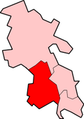
Geographic coordinate system Coordinate system

A geographic coordinate system is a coordinate system that enables every location on Earth to be specified by a set of numbers, letters or symbols. The coordinates are often chosen such that one of the numbers represents a vertical position and two or three of the numbers represent a horizontal position; alternatively, a geographic position may be expressed in a combined three-dimensional Cartesian vector. A common choice of coordinates is latitude, longitude and elevation. To specify a location on a plane requires a map projection.


Related Research Articles

Homerton town in London Borough of Hackney, United Kindom

Homerton is a district in London, England, in the London Borough of Hackney. It was a suburb of the metropolitan area of London until 1965 when it was reformed and expanded. It is bordered to the west by Hackney Central, to the north by Lower Clapton, in the east by Hackney Wick, Leyton and by South Hackney to the south.

Coldmoorholme is a hamlet in the parish of Little Marlow in Buckinghamshire, England. It is now considered part of the village of Bourne End, and locally the area is known as 'Spade Oak'.

Handy Cross is a hamlet in the parish of Little Marlow, Buckinghamshire, England. It is located on Marlow Hill, on the old road between Marlow and High Wycombe. At the 2011 Census the population of the hamlet was included in the civil parish of Great Marlow. Today the hamlet consists of a farm, several households and a Harvester pub & restaurant.

Lane End, Buckinghamshire village in the United Kingdom

Lane End is a village and civil parish within Wycombe district in Buckinghamshire, England. It is just south of the M40 from High Wycombe, about two miles (3 km) west of Booker. The village is twinned with Saint-Pierre-d'Oléron in France.

Terrick is a hamlet in the parish of Ellesborough, in Buckinghamshire, England. It is located in the north of the parish, where the lane leading to Chequers meets the main road from Stoke Mandeville to Little Kimble.

Burghfield village in the United Kingdom

Burghfield is a village and large civil parish in West Berkshire, England, with a boundary with Reading. Burghfield can trace its history back to before the Domesday book, and was once home to three manors: Burghfield Regis, Burghfield Abbas and Sheffield. Since the 1980s the population of Burghfield has nearly doubled with the construction of many new housing estates, dependent for its employment on, for instance, Reading, Newbury and Basingstoke and M4 corridor which bisects the edge of the area.

Piddington is a hamlet in the parish of Piddington and Wheeler End in Buckinghamshire, England. It is located on the main A40 between Stokenchurch and West Wycombe.

Stratton St Margaret parish in the Borough of Swindon, Wiltshire, England

Stratton St Margaret is a civil parish in the Borough of Swindon, Wiltshire, England. The parish covers north-eastern suburbs of Swindon including Stratton St Margaret itself along with Upper Stratton, Lower Stratton and Kingsdown. Since May 2015, Nythe has been legally separated from Stratton St. Margaret and now forms its own parish council.

Little Meadle is a hamlet in Buckinghamshire, England. It is part of the civil parish of Longwick-cum-Ilmer and is located between the hamlets of Owlswick and Meadle. It is approximately 5 miles (8.0 km) from Aylesbury and 20 miles (32 km) from Oxford. In addition to the Farm House it consists of a collection of houses built over the past 60 years, and it gained an official name with the Royal Mail in 2004, as well as being mapped with the Ordnance Survey 2006. The term Little Meadle is a relatively new one it has no historical meaning in itself, except that it is close to the village of Meadle and is a small hamlet that was previously known only by the name of the road in which it is situated Stockwell Lane.

Winterfold Forest is a wooded area of the broadest plateau of the western Greensand Ridge in Surrey, England. It blends seamlessly into the Hurt Wood or Hurtwood.

Mitcham Common common land in Mitcham, south London

Mitcham Common is 182 hectares (460 acres) of common land situated in south London. It is predominantly in the London borough of Merton, with parts straddling the borders of Croydon and Sutton. It is designated a Site of Metropolitan Importance for Nature Conservation.

St. Andrews Major village in United Kingdom

St. Andrew's Major is a village and parish in the community of Dinas Powys in the Vale of Glamorgan, between Barry and Cardiff in south-eastern Wales.

Sheepridge is a hamlet in the parish of Little Marlow, in Buckinghamshire, England.

Well End, Buckinghamshire human settlement in United Kingdom

Well End is a hamlet in the parish of Little Marlow, in Buckinghamshire, England. It is situated on the north-west side of the village of Bourne End. Although it lies in a separate parish, it is geographically contiguous with and subordinate to Bourne End; but unlike most of the hamlets consumed by its larger neighbour, it retains a distinct character, and the use of the name is common and well recognised locally.

Chisworth village and civil parish in Derbyshire, England

Chisworth is a hamlet near Glossop, Derbyshire, England. It is located 3 miles south-west of Glossop's town centre, on the south side of the Etherow valley. The parish of Chisworth was formed in 1896, out of the parish of Chisworth and Ludworth. In 1901, it had a population of 409. From 1896 until 1934 it was in the Glossop Rural District, when it was placed with Ludworth into the Chapel en le Frith Rural District. The village possesses a Methodist chapel. The A626 road passed through the hamlet. In June 1930, a local cloud burst caused flooding which killed one man and destroyed equipment at the mills, one of which never reopened.

Bolter End human settlement in United Kingdom

Bolter End is a hamlet 5 mi (8.0 km) to the west of High Wycombe in Buckinghamshire, England.

Fernhill, West Sussex farm village in the United Kingdom

Fernhill is a hamlet close to Gatwick Airport in West Sussex, England. Its fields and farmhouses formerly straddled the county boundary between Surrey and West Sussex, but since 1990 the whole area has been part of the county of West Sussex and the borough of Crawley. Fernhill is bounded on three sides by motorways and the airport. A fatal aeroplane crash occurred here in 1969.