Skirmett

Last updated

Skirmett
Hamlet
Old Shop, Skirmett, Buckinghamshire-geograph-3661233-by-Des-Blenkinsopp.jpg
The Old Shop in Skirmett
Buckinghamshire UK location map.svg
Red pog.svg
Skirmett
Location within Buckinghamshire
OS grid reference SU775899
Civil parish
Unitary authority
Ceremonial county
Region
Country England
Sovereign state United Kingdom
Post town HENLEY-ON-THAMES
Postcode district RG9
Dialling code 01491
Police Thames Valley
Fire Buckinghamshire
Ambulance South Central
UK Parliament
List of places
UK
England
Buckinghamshire
51°36′09″N0°52′48″W / 51.602572°N 0.880131°W / 51.602572; -0.880131

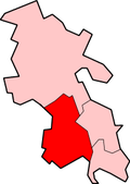
Skirmett is a hamlet in the parish of Hambleden, in Buckinghamshire, England. [1] It lies in the Hambleden Valley in the Chiltern Hills, between the villages of Hambleden and Fingest.

Contents

Toponymy

Skirmett: (la Skire..mote) (1307) [2]

The name element Skire is from Old English scîr (shire or district). [2] [lower-alpha 2] [lower-alpha 3]

The next element mote is from Old English môt (moot or meeting-place). [2] [lower-alpha 4]

Local history

The simple flint church of All Saints dated from the mid-19th century and has now been deconsecrated and converted into a private house.

There is a line of brick and timber-framed cottages along one side of the road and just the one public house, The Frog, formerly known as The Kings Arms.

There used to be a police presence in the village, and the local policeman was housed with his family in Hope Cottage, but this was sold a good while ago and is now a private residence.[ citation needed ]

Notes

  1. Skirmett - The moot or meeting-place of the shire or district [2]
    • Old English scîr : shire or district
    • Old English mote : moot or meeting-place
  2. Old English scîr: district, diocese, see, province, shire, parish [3]
  3. Old English scîr: The spelling is usually determined by origin [2]
    • Shîr: Anglo-saxon
    • Skîr: Danish or Norse
  4. Old English môt: moot (gemot), society, assembly, court, council [4]

Related Research Articles

Moot may refer to:

Shire is a traditional term for an administrative division of land in Great Britain and some other English-speaking countries such as Australia. It is generally synonymous with county. It was first used in Wessex from the beginning of Anglo-Saxon settlement, and spread to most of the rest of England in the tenth century. In some rural parts of Australia, a shire is a local government area; however, in Australia it is not synonymous with a "county", which is a lands administrative division.

<span class="mw-page-title-main">Ashendon</span> Human settlement in England

Ashendon is a small village and civil parish in Buckinghamshire, England. It is about nine miles west of Aylesbury and seven miles north of Thame.

<span class="mw-page-title-main">Walton, Aylesbury</span> Human settlement in England

Walton is a hamlet in the parish of Aylesbury, in Buckinghamshire, England. Although Aylesbury has grown to such an extent that it completely surrounds Walton by a couple of miles in each direction, the hamlet is still marked on modern maps.

<span class="mw-page-title-main">Chackmore</span> Human settlement in England

Chackmore is a hamlet in the parish of Radclive-cum-Chackmore, in north Buckinghamshire, England. The hamlet is approached using the avenue that links Buckingham with Stowe Park.

<span class="mw-page-title-main">Crafton, Buckinghamshire</span>

<span class="mw-page-title-main">Fingest</span> Human settlement in England

Fingest is a village in Buckinghamshire, England. It is in the Chiltern Hills near the border with Oxfordshire. It is about six miles WSW of High Wycombe. It lies in the civil parish of Hambleden.

Frieth is a village in the parish of Hambleden, in Buckinghamshire, England. It lies on the top of "Frieth Hill", which is part of the chalk escarpments of the Chiltern Hills.

<span class="mw-page-title-main">Hambleden</span> Human settlement in England

Hambleden is a small village and civil parish in south-west Buckinghamshire, England. The village is around 4 miles (6.4 km) west of Marlow, and around 3 miles (4.8 km) north-east of Henley-on-Thames in Oxfordshire.

Lane End is a village and civil parish in Buckinghamshire, England. It is just south of the M40 from High Wycombe, about 2 miles (3.2 km) west of Booker. The village is twinned with Saint-Pierre-d'Oléron in France.

<span class="mw-page-title-main">Little Missenden</span> Human settlement in England

Little Missenden is a village and civil parish on the River Misbourne in Buckinghamshire, England. It is in the Chiltern Hills, about 3 miles (5 km) southeast of Great Missenden and 3 miles (5 km) west of Amersham. The village lies on the River Misbourne in the Misbourne valley.

<span class="mw-page-title-main">Medmenham</span> Human settlement in England

Medmenham is a village and civil parish in south-west Buckinghamshire, England. It is on the River Thames, about 3+12 miles (5.6 km) southwest of Marlow and 3 miles (4.8 km) east of Henley-on-Thames. The parish also includes Danesfield, a housing estate predominantly for RAF officers, although families of other ranks from the RAF, Royal Navy and British Army also live there.

<span class="mw-page-title-main">Shackleford</span> Human settlement in England

Shackleford is a village and civil parish in the Borough of Guildford, Surrey, England centred to the west of the A3 between Guildford and Petersfield 32 miles (51 km) southwest of London and 5.2 miles (8.4 km) southwest of Guildford. Shackleford includes the localities of Eashing, Hurtmore, Norney and Gatwick.

<span class="mw-page-title-main">Anglo-Saxon law</span> Pre-conquest law in England

Anglo-Saxon law is a body of written rules and customs that were in place during the Anglo-Saxon period in England, before the Norman conquest. This body of law, along with early Medieval Scandinavian law and Germanic law, descended from a family of ancient Germanic custom and legal thought. However, Anglo-Saxon law codes are distinct from other early Germanic legal statements—known as the leges barbarorum, in part because they were written in Old English instead of in Latin. The laws of the Anglo-Saxons were the second in medieval Western Europe after those of the Irish to be expressed in a language other than Latin.

<span class="mw-page-title-main">Brignall</span> Human settlement in England

Brignall village is located in an elevated position adjacent to the River Greta, about 2 km upstream from Greta Bridge. The village is within the Teesdale district of south-west County Durham, England, the nearest town is the market town of Barnard Castle. The village is best known for the scenic valley section of the River Greta known as Brignall Banks, which is a Site of Special Scientific Interest.

<span class="mw-page-title-main">Chalgrave</span> Human settlement in England

Chalgrave is a civil parish in the Central Bedfordshire district of Bedfordshire, England. The hamlets of Tebworth and Wingfield are in the west of the parish, with the church and manor in the east. Nearby places are Toddington, Chalton, Houghton Regis, and Hockliffe. Before 1929, the parish also included part of the village of Hockliffe.

<span class="mw-page-title-main">Barstable Hundred</span>

Barstable was a Hundred in the English County of Essex. Both the hundred and the manor with the same name are mentioned in the Domesday Book of 1086. A number of parishes in the western part of the Barstable hundred are now in Thurrock.

<span class="mw-page-title-main">Finstock</span> Human settlement in England

Finstock is a village and civil parish about 2 miles (3 km) south of Charlbury in Oxfordshire, England. The parish is bounded to the northeast by the River Evenlode, to the southeast partly by the course of Akeman Street Roman road, and on other sides by field boundaries. The 2011 Census recorded the parish's population as 797. For most of its history Finstock was a township of the ancient parish of Charlbury. Finstock became a separate civil parish in the late 19th century.

<span class="mw-page-title-main">Shire Oak (Headingley)</span>

The Shire Oak was an ancient tree that stood in Headingley, now a suburb of the city of Leeds. It is thought to date from the time of the Danelaw in 9th-century England and is a shire oak, a tree that was used as a meeting point for local assemblies. The wapentake in this area was known as the Skyrack wapentake after the tree. The Shire Oak was felled by winds in 1941 and a plaque now marks the place in which it once stood.

<span class="mw-page-title-main">Eadwig's Charter to Abingdon Abbey c.957</span>

In a charter of c.957 AD, King Eadwig granted twenty hides of land to Abingdon Abbey.

aet Hengestesige , and aet Seofecanwyrthe , and aet Wihtham

References

  1. "MAGiC MaP : Skirmett hamlet, Buckinghamshire". Natural England - Magic in the Cloud.
  2. 1 2 3 4 5 Reaney 1969, p. 165.
  3. Clark Hall 1916, p. 540.
  4. Clark Hall 1916, p. 443.

Bibliography