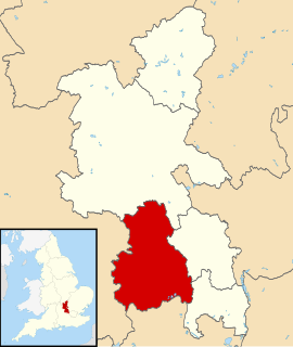
Wycombe District was a local government district in Buckinghamshire in south-central England. Its council was based in the town of High Wycombe. The district was abolished on 31 March 2020 and its area is now administered by the unitary Buckinghamshire Council.
Verney Junction is a hamlet in the parish of Middle Claydon in north Buckinghamshire, England. It is on the route of the former Varsity Line..

Crafton is a hamlet in the civil parish of Mentmore, in Buckinghamshire, England.
Westlington is a hamlet near the village of Dinton in the civil parish of Dinton-with-Ford and Upton, Buckinghamshire, England.
Upton is a hamlet in the civil parish of Dinton-with-Ford and Upton, in Buckinghamshire, England. It is located to the north of the main village of Dinton, on the junction between the new road from Aylesbury to Thame, and the old road before it was rerouted.
Wheeler End is a hamlet in the parish of Piddington and Wheeler End, in Buckinghamshire, England. The hamlet is located close to the main A40 between West Wycombe and Stokenchurch.

Wooburn is a village in Buckinghamshire, England. It is located off the A4094 road between Wooburn Green and Bourne End in the very south of the county near the River Thames, about two miles south west of Beaconsfield and four miles east of Marlow. Wooburn is one of the two principal settlements within Wooburn, a civil parish in Wycombe district.

The A404(M) is a motorway in Berkshire, England and can be referred to as the Maidenhead and Marlow Bypass or M4/M40 link road. It joins the M4 with the A404 dual carriageway to High Wycombe, Marlow and the M40. It was originally known as the A423(M) until the A423 between Maidenhead and Oxford was reclassified as the A4130.

Coombe Hill is a hamlet in the civil parish of Leigh in Gloucestershire, England. It lies on the A38 road between Gloucester and Tewkesbury, at the junction with the A4019 road to Cheltenham.
Little Meadle is a hamlet in Buckinghamshire, England. It is part of the civil parish of Longwick-cum-Ilmer and is located between the hamlets of Owlswick and Meadle. It is approximately 5 miles (8.0 km) from Aylesbury and 20 miles (32 km) from Oxford. In addition to the Farm House it consists of a collection of houses built over the past 60 years, and it gained an official name with the Royal Mail in 2004, as well as being mapped with the Ordnance Survey 2006. The term Little Meadle is a relatively new one it has no historical meaning in itself, except that it is close to the village of Meadle and is a small hamlet that was previously known only by the name of the road in which it is situated Stockwell Lane.
Gosford and Water Eaton is a civil parish in the Cherwell district of the county of Oxfordshire, England. It is north of the city of Oxford and is crossed nearby by two major roads for, or by-passing, the city. The parish contains the village of Gosford and the hamlet of Water Eaton and as at the 2011 census had 1373 people resident across its 8.75km².

Codrington is a settlement in South Gloucestershire, England. It is located near Junction 18 of the M4 motorway south of Wapley and Yate.
Winchbottom is a hamlet in the parish of Little Marlow, in Buckinghamshire, England.
The hamlet of Beacon Hill, is situated off the B474 near Penn and on the outskirts of High Wycombe Buckinghamshire. Nearby is the Golf Course at Wycombe Heights.

The Magic Roundabout in High Wycombe, Buckinghamshire, England, is similar to the roundabouts with the same name in Hemel Hempstead and other places. It is located on the junction of the A40 and A404. The junction is the second meeting point of the two roads, they interchange at the start of the A404 in Marylebone, London, with the A40 forming the Westway. The two roads follow different routes to reach Wycombe, the A40 coming via Beaconsfield and the A404 via North London and Amersham. From the roundabout, the A40 continues towards Oxford, Cheltenham, Gloucester and South Wales, whilst the A404 goes south to Marlow and Maidenhead.

The A4010 is an important primary north–south road in Buckinghamshire, Southern England. It runs from High Wycombe at Junction 4 of the M40 motorway to Stoke Mandeville, near Aylesbury on the A413.
The A333 is a short road in Surrey, England. It runs between the Hazel Grove junction of the A3 trunk road and the centre of Hindhead both in the large semi-rural civil parish of Haslemere, centred on the town of that name. It was a section of the A3 trunk road until it was re-numbered in 2011, as planned, on the Hindhead Tunnel's construction which bypasses it.

Handy Cross roundabout is a major road interchange at Handy Cross, High Wycombe, Buckinghamshire; the junction for High Wycombe, the M40 motorway and the A404 dual-carriageway. It is the terminus of the A4010 which runs to Aylesbury.

Bolter End is a hamlet 5 mi (8.0 km) to the west of High Wycombe in Buckinghamshire, England.

