This article needs additional citations for verification .(December 2023) |
Lacey Green | |
---|---|
Lacey Green Windmill in 2021 | |
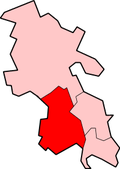
Location within Buckinghamshire | |
Population | 2,413 [1] 2,559 (2011 Census including Calsden, Loosley Row and Speen) [2] |
OS grid reference | SP824001 |
Civil parish |
|
Unitary authority | |
Ceremonial county | |
Region | |
Country | England |
Sovereign state | United Kingdom |
Post town | Princes Risborough |
Postcode district | HP27 |
Dialling code | 01844 |
Police | Thames Valley |
Fire | Buckinghamshire |
Ambulance | South Central |
UK Parliament | |
Website | Parish Council |
Lacey Green is a village and civil parish in the Buckinghamshire district, south-east of Princes Risborough, in the ceremonial county of Buckinghamshire, England. It is in the Chiltern Hills above the town. In 2021 the parish had a population of 2397.
The settlement was known as Leasy Green in the early 19th century. Hamlets within the parish include Loosley Row, Speen, [3] Wardrobes and Parslow's Hillock. [4]
RAF Bomber Command commandeered agricultural land for an airfield during World War II. The land has since reverted to agriculture, the school playing field and the village sports ground. [5]
The church of St John the Evangelist was built in 1822–1825, at first as a chapel of ease; the chancel was added in 1871 to designs of J. P. Seddon, with coloured brick to the interior. [6] The parish is within the area of the Risborough team ministry. [7] Primitive Methodists built a chapel on the main road around 1842, which remained in use until 2001. [8]
The village has a shop, sports club, village hall and a primary school. There are three pubs: the Black Horse in the village, the Whip Inn at Loosley and the Pink and Lily at Parslow's Hillock. It is twinned with Hambye, France.
Lacey Green was home to the chef Heston Blumenthal, whose parents used to own amusement arcades in the area.
Dated to 1650 by leading authority Stanley Freese, Lacey Green windmill is the oldest surviving smock mill in England [9] and was restored in the 1970s, from a state of almost total collapse, by volunteers under the auspices of the Chiltern Society. The octagonal structure has a brick base carrying a weatherboarded timber frame; the sails are modern but the machinery is largely original. The windmill was designated as Grade II* listed in 1985. [10]
Though it is widely believed that the mill was originally sited in nearby Chesham and moved to Lacey Green in 1821, no primary sources have been found to substantiate this and the Chiltern Society has been unable to trace the story beyond 1932. [11] A somewhat speculative theory to perhaps explain the story's origin has been advanced by Michael Highfield, author of the Chiltern Society's guide to the mill. He recounts a conversation with a 96-year-old lady who had lived in the area all her life and remembered being chased away from "Cheshums Mill" as a child. The Mill had been in the Cheshire family since the 1860s and was sometimes referred to locally as Cheshire's mill, applying the Buckinghamshire dialect possessive suffix 'ums', Cheshire's becomes Cheshums. [12]
The Chiltern Hills or the Chilterns are a chalk escarpment in southern England, northwest of London, covering 660 square miles (1,700 km2) across Oxfordshire, Buckinghamshire, Hertfordshire, and Bedfordshire, stretching 45 miles (72 km) from Goring-on-Thames in the southwest to Hitchin in the northeast. The hills are 12 miles (19 km) at their widest.
Monks Risborough is a village and ecclesiastical parish in the civil parish of Princes Risborough, Buckinghamshire, England, lying between Princes Risborough and Great Kimble. The village lies at the foot of the northern scarp of the Chiltern Hills. It is 8 miles (13 km) south of the county town of Aylesbury and 9.5 miles (15.3 km) north of High Wycombe, on the A4010 road.
Princes Risborough is a market town and civil parish in Buckinghamshire, England; it is located about 9 miles (14 km) south of Aylesbury and 8 miles (13 km) north-west of High Wycombe. It lies at the foot of the Chiltern Hills, at the north end of a gap or pass through the Chilterns; the south end of which is at West Wycombe. The A4010 road follows this route from West Wycombe through the town and then on to Aylesbury.
Haddenham is a village and civil parish in west Buckinghamshire, England. It is about 5 miles (8 km) south-west of Aylesbury and 4 miles (6 km) north-east of Thame in neighbouring Oxfordshire. At the 2011 Census, the population of the civil parish was 4,502.
Bledlow is a village and former civil parish, now in the parish of Bledlow-cum-Saunderton, in Buckinghamshire, England. It is about 2 miles (3.2 km) west-southwest of Princes Risborough, and is on the county boundary with Oxfordshire. In 1931 the parish had a population of 925. On 1 April 1934 the parish was abolished to form "Bledlow cum Saunderton".
Drayton Parslow is a village and civil parish in Buckinghamshire, England, about 3.5 miles (5.6 km) south of Bletchley, within the Buckinghamshire Council unitary authority area. In the 2001 census the parish had a population of 596, increasing at the 2011 census to 614.
Ellesborough is a village and civil parish in Buckinghamshire, England. The village is at the foot of the Chiltern Hills just to the south of the Vale of Aylesbury, two miles from Wendover and five miles from Aylesbury. It lies between Wendover and the village of Little Kimble.
Ibstone is a village and civil parish in Buckinghamshire, England. The village is in the Chiltern Hills on the border with Oxfordshire, about 2 miles (3.2 km) south of Stokenchurch. The population of the parish at the 2011 Census was 242, an increase from 237 at the 2001 Census.
Latimer is a village in Buckinghamshire, England, on the border with Hertfordshire. It is within the civil parish of Latimer and Ley Hill, which also includes the village of Ley Hill and the hamlet of Tyler's Hill.
The Lee is a village and civil parish in Buckinghamshire, England. It is located in the Chiltern Hills, about 2 miles (3.2 km) north east of Great Missenden and 3 miles (4.8 km) south east of Wendover. Within the parish is the hamlet of Lee Clump, named for a small group of houses separate from the main village. In 2011 the parish had a population of 698. From 1974 to 2020 it was in Chiltern district.
Loosley Row is a hamlet in the civil parish of Lacey Green, Buckinghamshire, England. It is located in the Chiltern Hills to the east of the main town of Princes Risborough. In the 2011 Census, the population was recorded in the Lacey Green Parish, which included Speen, parts of Walter's Ash, and Lacey Green, with a combined population of 2,559.
Aylesbury is a constituency in the House of Commons of the UK Parliament, currently represented by Laura Kyrke-Smith, a member of the Labour Party.
Chinnor is a large village and civil parish in South Oxfordshire, England, about 4 miles (6.4 km) southeast of Thame and close to the border with Buckinghamshire. The village is a spring line settlement on the Icknield Way below the Chiltern escarpment. Since 1932 the civil parish has included the village of Emmington. The 2011 Census recorded the parish's population as 5,924.
Ley Hill is a Chiltern village on the Buckinghamshire/Hertfordshire border in south-east England, near the town of Chesham. It is part of the civil parish of Latimer and Ley Hill, and comes under Chiltern District Council in the County of Buckinghamshire. Ley Hill lies in the Chiltern Hills and is contiguous with Botley.
Buerton is a village at SJ685435 and civil parish in the unitary authority of Cheshire East and the ceremonial county of Cheshire, England, about 7 miles south of the town of Nantwich and 1½ miles east of the village of Audlem, on the border with Shropshire. The parish also includes the small settlements of Hankins Heys, Moblake, Pinder's End and Three Wells, as well as parts of Chapel End, College Fields, Kinsey Heath, Longhill, Raven's Bank, Sandyford and Woolfall. In 2001, the total population was a little under 500, which had increased marginally to 503 at the 2011 Census. Nearby villages include Adderley, Audlem, Bridgemere, Hankelow, Hatherton, Hunsterson and Woore.
Burland is a village and former civil parish, now in the parish of Burland and Acton, in the unitary authority area of Cheshire East and the ceremonial county of Cheshire, England, about 2+1⁄2 miles west of Nantwich. The civil parish also included the small settlements of Burland Lower Green, Burland Upper Green, Hollin Green and Stoneley Green, as well as parts of Gradeley Green and Swanley. The eastern part of the village of Ravensmoor also falls within the civil parish.
Newhall is a village and civil parish in the unitary authority of Cheshire East and the ceremonial county of Cheshire, England. The village lies 3½ miles to the west of Audlem and 5 miles to the south west of Nantwich. The parish also includes the village of Aston, and the small settlements of Aston Heath, Barnett Brook, Brown's Bank, Dodd's Green, Grandford, Grindley Green, Hollingreen, Kingswood Green, Maiden Estate, Salesbrook, Sheppenhall and part of Sandford. Nearby villages include Audlem and Wrenbury.
Weston is a village and former civil parish, now in the parish of Weston and Crewe Green, in the unitary authority area of Cheshire East and the ceremonial county of Cheshire, England. The village lies 3 miles to the south east of Crewe. The parish also includes the small settlements of Carters Green, Gorstyhill, Rose Hill, Snape, Stowford and part of Englesea Brook, as well as the new settlements of Wychwood Park and Wychwood Village. Plans in 2015 to develop a golf course surrounding Wychwood Village for residential housing have been opposed by some residents. The plans were refused planning permission by Cheshire East Council; the developer was later unsuccessful in an appeal to the Secretary of State and the council's refusal was upheld. Nearby villages include Basford, Hough and Shavington. In 2011 the parish had a population of 1,855.
Hankelow is a village and civil parish in the unitary authority of Cheshire East and the ceremonial county of Cheshire, England. The village lies on the A529, around 1.25 miles (2.0 km) north east of Audlem and 4.5 miles (7.2 km) south of Nantwich. The civil parish has an area 369 hectares and also includes the small settlement of The Dell and part of Corbrook, with a total population of just over 260 in 2011. Nearby villages include Aston, Broomhall Green, Sound, Hatherton and Buerton in Cheshire and Woore in Shropshire.
Media related to Lacey Green at Wikimedia Commons