Fingest

Last updated

Fingest
Fingest Church.JPG
St Bartholomew's Church Fingest
Buckinghamshire UK location map.svg
Red pog.svg
Fingest
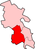
Location within Buckinghamshire
OS grid reference SU777912
Civil parish
Unitary authority
Ceremonial county
Region
Country England
Sovereign state United Kingdom
Post town HENLEY-ON-THAMES
Postcode district RG9
Dialling code 01491
Police Thames Valley
Fire Buckinghamshire
Ambulance South Central
UK Parliament
List of places
UK
England
Buckinghamshire
51°36′51″N0°52′37″W / 51.614232°N 0.876955°W / 51.614232; -0.876955

Fingest is a village in Buckinghamshire, England. [1] It is in the Chiltern Hills near the border with Oxfordshire. It is about six miles WSW of High Wycombe. It lies in the civil parish of Hambleden.

Contents

The parish church of St Bartholomew's dates from the early Norman period. It has an unusual tower, with a double vaulted roof. The church is a Grade I listed building. [2]

Name

Name history

Toponym

Fingest : ( Ting..hurst , Tyn..hurst ) 11-13th cent. [3]

The name is a hybrid of Old Norse and Old English.

The first element ' ting ' or ' tyn ' is from Old Norse Þing - ( ' thing' ) ( ” assembly place ” ). [lower-alpha 2] [lower-alpha 3] [lower-alpha 4] [lower-alpha 5]

The next element ” hurst ” is from Old English ” hyrst ” ( ” wood or wooded hill ” ). [4] [lower-alpha 6]

History

The ancient parish of Fingest included Cadmore End to the north of the village, which became a separate ecclesiastical parish in 1852. [7]

The manor of Fingest anciently belonged to St Albans Abbey. In 1163 it was given to the bishop of Lincoln. The ghost of Henry Burghersh, 14th-century Bishop of Lincoln, is reputed to haunt the area. [8] After this time it was used as the country residence for the Lincoln diocese until 1547 when it was seized by the Crown. It was then given two years later to the Duke of Somerset who exchanged it with a property belonging to Wells Cathedral. [7] The manor is now privately owned.

The civil parish of Fingest, originally based on the ecclesiastical parish, was enlarged in 1934 by adding land from the parishes of West Wycombe, Great Marlow and Hambleden. As a result, Lane End became the largest settlement in the parish, and the parish was renamed Fingest and Lane End in 1937. [9] In the 1980s the civil parish was abolished. The larger part became the parish of Lane End, and the village of Fingest was added to Hambleden parish.

Scenes of the period drama The Monuments Men were shot in Fingest in May 2013.[ citation needed ]


Notes

  1. Fingest - ” The wood or wooded hill where the assembly meet ” [4]
    • Old Norse Þing : ” assembly ”
    • Old English hyrst : ” wood or wooded hill ”
  2. Old Norse Þing : ” assembly place ” [4] [5]
  3. Old Norse Þing is pronounced ” thing ” , see Thing, British Isles
  4. People of Celtic origin found the ' Þ ' of the Old Norse language ( pronounced ” Th ” ) difficult, hence words that began ' Th ' were often shortened to begin with just ' T ' , ' H ' or ' F ' ( E.g. Number three - ” tree ” )
  5. Examples of place names derived from Old Norse Þing - ( ” thing ” ) :
  6. Old English hyrst : ” hillock, eminence, height, wood, wooded eminence ” [6]

Citations

  1. "MAGiC MaP : Fingest village, Buckinghamshire". Natural England - Magic in the Cloud.
  2. Historic England. "Church of St Bartholomew (1125708)". National Heritage List for England . Retrieved 17 May 2020.
  3. 1 2 3 4 Page 1925, pp. 42–45.
  4. 1 2 3 Reaney 1969, p. 165.
  5. Arthur 2002, p. 8.
  6. Clark Hall 1916, p. 373.
  7. 1 2 William Page, ed. (1925). "Parishes: Fingest". A History of the County of Buckingham: Volume 3. Institute of Historical Research. Retrieved 11 July 2011.
  8. "Green Man of Fingest - Mysterious Britain & Ireland". Mysterious Britain & Ireland. Archived from the original on 12 December 2010. Retrieved 29 August 2014.
  9. Vision of Britain website Archived 28 June 2011 at the Wayback Machine

Sources

Online

Books

Commons-logo.svg Media related to Fingest at Wikimedia Commons

Related Research Articles

<span class="mw-page-title-main">Buckinghamshire</span> County of England

Buckinghamshire, abbreviated as Bucks, is a ceremonial county in South East England. It borders Northamptonshire to the north, Bedfordshire to the north-east, Hertfordshire to the east, Greater London to the south-east, Berkshire to the south, and Oxfordshire to the west. The largest settlement is the city of Milton Keynes (256,385).

<span class="mw-page-title-main">High Wycombe</span> Town in Buckinghamshire, England

High Wycombe, often referred to as Wycombe, is a market town in Buckinghamshire, England. Lying in the valley of the River Wye surrounded by the Chiltern Hills, it is 29 miles (47 km) west-northwest of Charing Cross in London, 13 miles (21 km) south-southeast of Aylesbury, 23 miles (37 km) southeast of Oxford, 15 miles (24 km) northeast of Reading and 8 miles (13 km) north of Maidenhead.

<span class="mw-page-title-main">Chiltern Hills</span> Range of hills in Southeast England

The Chiltern Hills are a chalk escarpment in the UK northwest of London, covering 660 square miles (1,700 km2) across Oxfordshire, Buckinghamshire, Hertfordshire, and Bedfordshire, stretching 45 miles (72 km) from Goring-on-Thames in the southwest to Hitchin in the northeast. The hills are 12 miles (19 km) at their widest.

Monks Risborough is a village and ecclesiastical parish in Buckinghamshire, England, lying between Princes Risborough and Great Kimble. The village lies at the foot of the northern scarp of the Chiltern Hills. It is 8 miles (13 km) south of the county town of Aylesbury and 9.5 miles (15.3 km) north of High Wycombe, on the A4010 road.

<span class="mw-page-title-main">Downley</span> Human settlement in England

Downley is a village and civil parish in Buckinghamshire, England, which was included in Wycombe district before its abolition. It is high in the Chiltern Hills, overlooking the town of High Wycombe, although today it is almost indistinguishable from the urban spread of the latter town.

Frieth is a village in the parish of Hambleden, in Buckinghamshire, England. It lies on the top of "Frieth Hill", which is part of the chalk escarpments of the Chiltern Hills.

<span class="mw-page-title-main">Hambleden</span> Human settlement in England

Hambleden is a small village and civil parish in south-west Buckinghamshire, England. The village is around 4 miles (6.4 km) west of Marlow, and around 3 miles (4.8 km) north-east of Henley-on-Thames in Oxfordshire.

Lane End is a village and civil parish in Buckinghamshire, England. It is just south of the M40 from High Wycombe, about 2 miles (3.2 km) west of Booker. The village is twinned with Saint-Pierre-d'Oléron in France.

<span class="mw-page-title-main">Medmenham</span> Human settlement in England

Medmenham is a village and civil parish in south-west Buckinghamshire, England. It is on the River Thames, about 3+12 miles (5.6 km) southwest of Marlow and 3 miles (4.8 km) east of Henley-on-Thames. The parish also includes Danesfield, a housing estate predominantly for RAF officers, although families of other ranks from the RAF, Royal Navy and British Army also live there.

<span class="mw-page-title-main">Radnage</span> Village in Buckinghamshire, England

Radnage is a village and civil parish in the Buckinghamshire district of Buckinghamshire, England. It is in the Chiltern Hills about two miles north east of Stokenchurch and six miles WNW of High Wycombe.

<span class="mw-page-title-main">Hawkhurst</span> Village in Kent, England

Hawkhurst is village and civil parish in the borough of Tunbridge Wells in Kent, England. The village is located close to the border with East Sussex, around 12 miles (19 km) south-east of Royal Tunbridge Wells and within the High Weald Area of Outstanding Natural Beauty.

<span class="mw-page-title-main">Goudhurst</span> Village and civil parish in the borough of Tunbridge Wells in Kent, England

Goudhurst is a village and civil parish in the borough of Tunbridge Wells in Kent, England. It lies in the Weald, around 12 miles (19 km) south of Maidstone, on the crossroads of the A262 and B2079.

<span class="mw-page-title-main">Wycombe (UK Parliament constituency)</span> Parliamentary constituency in Buckinghamshire

Wycombe is a constituency in Buckinghamshire represented in the House of Commons of the UK Parliament since 2010 by Steve Baker, a Conservative.

<span class="mw-page-title-main">Hambleden Rural District</span> Historical rural district

<span class="mw-page-title-main">Hob Hurst's House</span> Bronze Age barrow in Derbyshire, England

Hob Hurst's House is a Bronze Age barrow on Beeley Moor near Bakewell in Derbyshire. It is unique in that instead of the normal round shape, Hob Hurst's barrow is rectangular. Originally made with 13 stones, only five remain today.

<span class="mw-page-title-main">Skirmett</span> Hamlet in England

Skirmett is a hamlet in the parish of Hambleden, in Buckinghamshire, England. It lies in the Hambleden Valley in the Chiltern Hills, between the villages of Hambleden and Fingest.

<span class="mw-page-title-main">Thynghowe</span> Ancient open-air assembly place

Thynghowe was an important Viking Era open-air assembly place or thing, located at Sherwood Forest, in Nottinghamshire, England. It was lost to history until its rediscovery in 2005 by the husband and wife team of Stuart Reddish and Lynda Mallett, local history enthusiasts.

Ackhampstead or 'The Moor' was an ancient township in the Chiltern Hills, south of Lane End.