This article relies largely or entirely on a single source .(September 2022) |
Widmer End is a hamlet in the parish of Hughenden, in Buckinghamshire, England.
The Village of Widmer End is situated about three miles north of High Wycombe town centre. In the last half century it has grown from a rural hamlet into a commuter suburb while still retaining much of its attractiveness. It boasts a population of about 2000, a church, a pub now closed after 150 years (Enterprise Inns the last owners), a school, some shops, and a village hall and recreation ground. The latter two are owned by the village itself and are the centre for many sports and social activities.
Widmer End has expanded significantly over the years, particularly inside the "George's Hill triangle" which adjoins Hazlemere. The centre of the old village is around a road junction overlooked by the Royal Standard public house.
A short distance to the south-west of Widmer End is the hamlet of Four Ashes, and Cryers Hill is to the west.
Author and former local girl Kitty Aldridge captures the 1960s expansion of Widmer End in her 2007 novel Cryers Hill.
The Widmer End newsletter is run by local residents to inform, entertain and promote community cohesion. Local businesses and schools are promoted and residents have the opportunity to write in, submit articles, poetry, opinion and inform other residents of local history.
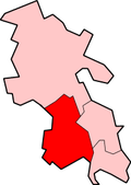
51°39′36″N0°43′37″W / 51.660°N 0.727°W
Aldridge is a town and civil parish in the Walsall borough, West Midlands, England. It is historically a village that was part of Staffordshire until 1974. The town is 3 miles (4.8 km) from Brownhills, 5 miles (8 km) from Walsall, 6 miles (9.7 km) from Sutton Coldfield and 7 miles (11 km) from Lichfield. The town is also the second-largest town in the Walsall Borough.
Hughenden Valley is an extensive village and civil parish in Buckinghamshire, England, just to the north of High Wycombe. It is almost 8,000 acres (32 km2) in size, divided mainly between arable and wooded land. It is situated 3 miles (4.8 km) north of central Wycombe, 12.5 miles (20.1 km) south of the county town of Aylesbury and some 35 miles (56 km) west-northwest of London.
Great Kingshill is a small village in the parish of Hughenden in Buckinghamshire, England. It is located in the Chiltern Hills, about five miles west of Amersham and two and a half miles south of Great Missenden.
Meadle is a hamlet in the civil parish of Longwick-cum-Ilmer, in Buckinghamshire, England. It is located to the north of the village of Monks Risborough and near Little Kimble. The current population of Meadle is about 75. Most of the buildings are very old: farmhouses and labourers' cottages built in traditional red clay brick with thatched roofs. A small stream rises in the village and ultimately joins the Thames.
Brownhills is a town in the Metropolitan Borough of Walsall, West Midlands, England. A few miles south of Cannock Chase and close to the large Chasewater reservoir, it is 6 miles (9.7 km) northeast of Walsall, a similar distance southwest of Lichfield and 13 miles (20.9 km) miles north-northwest of Birmingham. It is part of the Aldridge-Brownhills parliamentary constituency and neighbours the large suburban villages of Pelsall and Walsall Wood. It lies within the boundaries of the historic county of Staffordshire.
Penn is an area which is divided between the City of Wolverhampton and South Staffordshire district. The population of the Wolverhampton Ward taken at the 2011 census was 12,718. Originally, it was a village in the historic county of Staffordshire. There is considerable confusion about exactly which areas fall within Penn. In 19th century censuses, Merry Hill, Bradmore are understood to form part of Penn, although these areas are generally understood to be separate today. However, there has never been any doubt that the two historic settlements of Upper and Lower Penn form the core of the area.
Piddington is a hamlet in the parish of Piddington and Wheeler End in Buckinghamshire, England. It is located on the main A40 between Stokenchurch and West Wycombe.
South Brent is a large village on the southern edge of Dartmoor, England, in the valley of the River Avon. The parish includes the small hamlets of Aish, Harbourneford, Lutton, Brent Mill, and many scattered farmhouses. It is five miles (8 km) north-east of Ivybridge and 14 miles (22 km) east-northeast of Plymouth.
North Common is a village just outside Warmley, Bristol, in South Gloucestershire, England. Historically this was a rural hamlet surrounded by farmland. The residents are fortunate enough that to the east of the village is attractive rolling countryside, with views of Lansdown, and the surrounding hills. The village is on the eastern outskirts of Bristol and approximately halfway between Bristol city centre and the neighbouring city of Bath.
Giggs Hill Green is a triangular park in Thames Ditton bordered on one side by the Portsmouth Road which has, since 1833, contained as a major part of it, the village's cricket green.
Cryers Hill is a hamlet in the parish of Hughenden and in Buckinghamshire, England. It was formerly known as Ravensmere.
Offley is a civil parish in the English county of Hertfordshire, between Hitchin and Luton. The main village is Great Offley, and the parish also contains the nearby hamlets of Little Offley and The Flints. In the south-west of the parish, near Luton, there are the hamlets of Cockernhoe, Mangrove Green and Tea Green, and also the Putteridge Bury estate; these have LU2 postcodes and 01582 telephone numbers.
Chiltern Green railway station was built by the Midland Railway in 1868 on its extension to St. Pancras.
West End is a neighbourhood or locality of Esher, Surrey, England centred 0.8 miles (1.3 km) south-west of the town centre.
Mogador is a hamlet in the Reigate and Banstead district, in the English county of Surrey. It is at the edge of Banstead Heath, which provides it a green buffer from other communities, and about 1⁄2 mile (0.8 km) from the top of the north-facing dip slope of the North Downs. At an elevation of about 200 metres (660 ft) it is one of the highest settlements in south-east England. It is just north of the M25 motorway.
Norfolk County in the Canadian province of Ontario consists of a long list of communities. Its four designated population centres are Simcoe, Port Dover, Delhi, and Waterford.
Fernhill is a hamlet close to Gatwick Airport in West Sussex, England. Its fields and farmhouses formerly straddled the county boundary between Surrey and West Sussex, but since 1990 the whole area has been part of the county of West Sussex and the borough of Crawley. Fernhill is bounded on three sides by motorways and the airport. A fatal aeroplane crash occurred here in 1969.
St Edmund's Church is the Roman Catholic parish church of Godalming, a town in the English county of Surrey. It was built in 1906 to the design of Frederick Walters and is a Grade II listed building. The church stands on a "dramatic hillside site" on the corner of Croft Road just off Flambard Way close to the centre of the town.
North End Road is an ancient thoroughfare linking the former hamlet of North End, renamed "West Kensington", with the former village of Walham Green, renamed "Fulham Broadway" in Fulham in London.