This article needs additional citations for verification . (January 2008) (Learn how and when to remove this template message) |
North Lee is a hamlet in the parish of Ellesborough, in Buckinghamshire, England. It is located in the very north of the parish, near the main road that links Aylesbury with Wendover.
A hamlet is a small human settlement. In different jurisdictions and geographies, hamlets may be the size of a town, village or parish, be considered a smaller settlement or subdivision or satellite entity to a larger settlement. The word and concept of a hamlet have roots in the Anglo-Norman settlement of England, where the old French hamlet came to apply to small human settlements. In British geography, a hamlet is considered smaller than a village and distinctly without a church or other place of worship.
A parish is a territorial entity in many Christian denominations, constituting a division within a diocese. A parish is under the pastoral care and clerical jurisdiction of a parish priest, who might be assisted by one or more curates, and who operates from a parish church. Historically, a parish often covered the same geographical area as a manor. Its association with the parish church remains paramount.
Ellesborough is a village and civil parish in Wycombe district in Buckinghamshire, England. The village is at the foot of the Chiltern Hills just to the south of the Vale of Aylesbury, two miles from Wendover and five miles from Aylesbury. It lies between Wendover and the village of Little Kimble.
The hamlet name is a compound of English and Anglo Saxon languages, and refers to the northernmost clearing. The name refers to the adjacent hamlet of Nash Lee.
English is a West Germanic language that was first spoken in early medieval England and eventually became a global lingua franca. It is named after the Angles, one of the Germanic tribes that migrated to the area of Great Britain that later took their name, as England. Both names derive from Anglia, a peninsula in the Baltic Sea. The language is closely related to Frisian and Low Saxon, and its vocabulary has been significantly influenced by other Germanic languages, particularly Norse, and to a greater extent by Latin and French.
Nash Lee is a hamlet in the parish of Ellesborough, in Buckinghamshire, England. It is located to the north of the village, about two miles west of Wendover.
Today North Lee has survived more or less unscathed from the construction of the Wendover Bypass, though the road that leads to North Lee is now a dead end rather than a through road to Wendover.
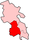
Coordinates: 51°46′16″N0°47′24″W / 51.771°N 0.790°W
A geographic coordinate system is a coordinate system that enables every location on Earth to be specified by a set of numbers, letters or symbols. The coordinates are often chosen such that one of the numbers represents a vertical position and two or three of the numbers represent a horizontal position; alternatively, a geographic position may be expressed in a combined three-dimensional Cartesian vector. A common choice of coordinates is latitude, longitude and elevation. To specify a location on a plane requires a map projection.
The A413 is a major road in England that runs between Gerrards Cross to Towcester. It passes through or near various towns and villages including Amersham, Great Missenden, Wendover, Aylesbury, Winslow, and Buckingham. Most of the road is in Buckinghamshire, with a part at the north end in Northamptonshire.
Wendover is a market town and civil parish at the foot of the Chiltern Hills in Buckinghamshire, England. It is situated at the point where the main road across the Chilterns between London and Aylesbury intersects with the once important road along the foot of the Chilterns. The town is some 35 miles (56 km) north west of London and 5 miles (8 km) south east of Aylesbury, and is very popular with commuters working in London.
Butlers Cross is a hamlet within the parish of Ellesborough, in Buckinghamshire, England. It is located south of the main parish, on the crossroads between the road from Ellesborough to Little Kimble, and the road from Terrick to Chequers.
Chalkshire is a hamlet in the parish of Ellesborough(where the 2011 Census population was included), in Buckinghamshire, England. It is situated on the road that runs from Butlers Cross to Terrick.
Chivery is a hamlet located in the Chiltern Hills in the present day parish of Aston Clinton, in Aylesbury Vale District in the county of Buckinghamshire, England.
Ford is a hamlet in the parish of Dinton-with-Ford and Upton, in Buckinghamshire, England. It is located in the south eastern corner of the main parish.
Handy Cross is a hamlet in the parish of Little Marlow, Buckinghamshire, England. It is located on Marlow Hill, on the old road between Marlow and High Wycombe. At the 2011 Census the population of the hamlet was included in the civil parish of Great Marlow. Today the hamlet consists of a farm, several households and a Harvester pub & restaurant.
Horsenden is a hamlet in Wycombe district, Buckinghamshire, England and is in the civil parish of Longwick-cum-Ilmer. It is approximately one mile West of Princes Risborough, seven miles south of Aylesbury and three miles east of Chinnor in Oxfordshire. The Icknield Way passes just to the north of the village from north-east to south-west, although there is no connecting road through the hamlet itself.
Littleworth is a hamlet in the parish of Wing, in Buckinghamshire, England. It is situated between the main village and the hamlet of Burcott.
Upper Bacombe and Lower Bacombe are two hamlets in the parish of Wendover, in Buckinghamshire, England. They are located to the south east of the main town, on and at the foot of Bacombe Hill, which is a Local Nature Reserve, and part of the Bacombe and Coombe Hills Site of Special Scientific Interest.
Terrick is a hamlet in the parish of Ellesborough, in Buckinghamshire, England. It is located in the north of the parish, where the lane leading to Chequers meets the main road from Stoke Mandeville to Little Kimble.
Pednor is a hamlet in the parish of Chartridge, in Buckinghamshire, England. It is located in the Chiltern Hills two miles northwest of Chesham and seven miles southeast of Wendover.
Upton is a hamlet in the civil parish of Dinton-with-Ford and Upton, in Buckinghamshire, England. It is located to the north of the main village of Dinton, on the junction between the new road from Aylesbury to Thame, and the old road before it was rerouted.
Shipton Lee is a hamlet in the parish of Quainton, in Buckinghamshire, England.
Stone is a village in Buckinghamshire, England. It is located southwest of the town of Aylesbury, on the A418 road that links Aylesbury to Thame. Stone with Bishopstone and Hartwell is a civil parish within Aylesbury Vale district and also incorporates the nearby settlements of Bishopstone and Hartwell.
Coombe is a hamlet in the parish of Ellesborough in the English county of Buckinghamshire, situated between Coombe Hill and Chequers, the official country residence of the Prime Minister of the United Kingdom. At the 2011 Census the population of the hamlet was included in the civil parish of Wendover.
Heath End is a hamlet in the parish of Great Missenden in Buckinghamshire, England. At the 2011 Census the population of the hamlet was included in the civil parish of Little Missenden. During the 20th century, it became attached to Great Kingshill to the south west. The old centre of the hamlet is where Spurlands End Road meets Heath End Road. Although Heath End is now attached to Great Kingshill there are still road signs indicating to the hamlet.
Langley is a hamlet and civil parish in the North Hertfordshire District, in the county of Hertfordshire. The population had increased to 175 at the 2011 Census. It is located four miles south of Hitchin, on the B656 road near the large town of Stevenage. It was formerly a detached part of Hitchin parish. Minsden Chapel lies within the parish.
World's End is a hamlet 0.5 miles (0.80 km) north of Wendover, Buckinghamshire. It is part of the civil parish of Wendover which is in Aylesbury Vale district. Today the settlement straddles the B4009. Prior to the construction of the Wendover Bypass World's End was on the A413.