The Chiltern Hills is a chalk escarpment in England.
Lane End is a village and civil parish in Buckinghamshire, England. It is just south of the M40 from High Wycombe, about 2 miles (3.2 km) west of Booker. The village is twinned with Saint-Pierre-d'Oléron in France.

Stokenchurch is a village and civil parish in south-west Buckinghamshire, England. It is located in the Chiltern Hills, about 3 miles (5 km) south of Chinnor in Oxfordshire and 6 miles (10 km) west of High Wycombe. Stokenchurch is a commuter village, served by junction 5 of the M40 motorway to London, Oxford and Birmingham. The Stokenchurch BT Tower, to the west of the village, is a highly visible landmark on the edge of the Chilterns and pinpoints the village's location for miles ahead.

Wheeler End is a hamlet in the parish of Piddington and Wheeler End, in Buckinghamshire, England. The hamlet is located close to the main A40 between West Wycombe and Stokenchurch.
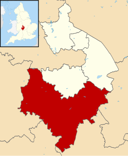
Stratford-on-Avon is a local government district in southern Warwickshire, England.
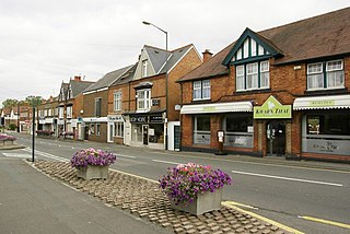
Studley is a large village and civil parish in the Stratford-on-Avon district of Warwickshire, England. Situated on the western edge of Warwickshire near the border with Worcestershire, it is 3.5 miles (6 km) southeast of Redditch and 13 miles (21 km) northwest of Stratford-upon-Avon. The Roman road of Ryknild Street, now the A435, passes through the village on its eastern edge, parallel to the River Arrow. The name derives from the Old English leah, being a meadow or pasture, where horses, stod, are kept.

Piddington is a hamlet in the parish of Piddington and Wheeler End in Buckinghamshire, England. It is located on the main A40 between Stokenchurch and West Wycombe.

Beacon's Bottom, also known as Bacon's Bottom, is a hamlet on the A40 between Piddington and Stokenchurch in England. Until 1895 it was administratively part of Oxfordshire, and was transferred to Buckinghamshire with its parent parish Stokenchurch in 1896. It was one of the principal sites of High Wycombe's 19th Century chair-making industry, known locally as bodging.

Bolter End is a hamlet 5 mi (8.0 km) to the west of High Wycombe in Buckinghamshire, England.

Aston Rowant National Nature Reserve is located on the north-west escarpment of the Chiltern Hills, in the Chilterns Area of Outstanding Natural Beauty. It has an area of 159.1 hectares, and most of it is a 128.5 hectares biological Site of Special Scientific Interest. It is listed as a Grade 1 site in A Nature Conservation Review. The reserve is in several sections, mostly in the parish of Lewknor in Oxfordshire, with smaller sections in the parish of Stokenchurch in Buckinghamshire.
Gorcott Hill is a small hamlet in the English county of Warwickshire. It is near the villages of Mappleborough Green & Studley, which are both in Warwickshire. Gorcott Hill is also near the large Worcestershire town of Redditch.

Horton-cum-Studley is a village and civil parish in Oxfordshire about 6+1⁄2 miles (10.5 km) northeast of the centre of Oxford and bordering Otmoor, and is one of the "Seven Towns" of Otmoor. The 2011 Census recorded the parish's population as 455. Although traditionally a rural community, according to the latest demographic data, it is now home to professionals who work in Oxford and the surrounding urban centers of Bicester, High Wycombe and West London. There are many younger professional families in the village because of a popular village school in nearby Beckley. A majority of residents in the village work in the Healthcare and Educational Sectors.

Studley Priory was a small house of Benedictine nuns, ruled by a prioress. It was founded some time before 1176 in the hamlet of Studley in what is now the village of Horton-cum-Studley, 7 miles (11 km) northeast of Oxford in Oxfordshire, England, at 1 Horton Hill Road. In 1176, the priory received a grant from Bernard of St. Walery. The nuns were unhappy to be served poor beef and new beer on Thursday and Sunday nights, and no mutton. The priory was declared closed by 1536, but appears to have experienced a brief revival before its suppression in 1539. The priory lands were sold to the Croke family. The family built the house now known as Studley Priory, which still stands in its 10 acres (4.0 ha) of grounds, in 1587; a member of the Croke family was a judge in the 1649 trial of Charles I. The house and its estate was owned by the Croke family until around 1870 when it was sold to the Henderson family, who occupied it until World War II. During the war, it was a sanatorium for Royal Air Force officers.

Calne Without is a civil parish in Wiltshire, England. It is a rural parish surrounding the town of Calne, extending west to the Avon and south to the Roman road from London to Bath. Settlements in the parish are the village of Derry Hill; the small villages of Calstone Wellington, Sandy Lane, Stockley and Studley; the dispersed settlement of Stock; the hamlets of Blackland, Broad's Green, Buck Hill, Mile Elm, Pewsham and Theobald's Green; and part of the hamlet of Ratford. The parish also encompasses the former tithing of Calstone, and the country house estates of Bowood and Whetham.

Horsleys Green is a hamlet located on the A40 between Piddington and Stokenchurch in Buckinghamshire, England. It consists of a few houses situated either side of a narrow lane.

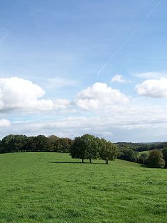
Waterend is a hamlet located on the A40 between Piddington and Stokenchurch in Buckinghamshire, England. Together with the adjacent hamlets of Horsleys Green, Beacon's Bottom and Studley Green, it is in an area known collectively as 'Studley Green'. It is within the Chiltern Area of Outstanding Natural Beauty.

Bottom Wood is a 14.5-hectare (36-acre) woodland in the English county of Buckinghamshire, located just north of the A40 near the hamlet of Studley Green. Since 1984, the wood has been owned by the Chiltern Society, which manages it as a nature reserve with the help of volunteers. Although an ancient woodland, most of the trees in the wood date from the end of the 1940s or later, as much of the wood was felled during the Second World War to produce Bryant and May matches. The wood is now home to a diverse range of flora and fauna, including rare species of butterfly and moth.

Studley is an unincorporated community in Sheridan County, Kansas, United States, approximately 16 miles east of Hoxie along U.S. Route 24. It is on the eastern edge of the county in Valley Township, bordering Graham County. It was named after the Studley Royal Park, in England.


