Marlow Bottom

Last updated

Marlow Bottom
Marlow Bottom - geograph.org.uk - 753763.jpg
Marlow Bottom
Buckinghamshire UK location map.svg
Red pog.svg
Marlow Bottom
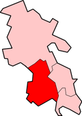
Location within Buckinghamshire
Population3,295  [1]
3,438 (2011 Census) [2]
OS grid reference SU845885
Civil parish
  • Marlow Bottom
Unitary authority
Ceremonial county
Region
Country England
Sovereign state United Kingdom
Post town MARLOW
Postcode district SL7
Dialling code 01628
Police Thames Valley
Fire Buckinghamshire
Ambulance South Central
UK Parliament
List of places
UK
England
Buckinghamshire
51°35′24″N0°46′54″W / 51.5901°N 0.7816°W / 51.5901; -0.7816

Marlow Bottom is a linear village occupying a valley to the north of Marlow, Buckinghamshire. It is also a civil parish in the Buckinghamshire district having been created in November 2007. Formerly it was part of the parish of Great Marlow.

Contents

Marlow Bottom is 25 to 30 minutes walk from the centre of Marlow town, and the river Thames. It has shops, including a newsagent, vet, chemist, dentist, coffee shop, dog grooming parlour, Italian restaurant and fish & chip shop, a large primary school, (Burford School), a private members club (The Barn Club, for valley residents), a village hall and a church which is part of a Local Ecumenical Partnership "The Lantern", where the local Boy Scout and Girl Guide groups and similar voluntary groups meet.

Education

The primary school in Marlow Bottom is Burford County Combined School. It provides schooling for children aged 4–11, who will go on to either a local grammar school or secondary modern school depending on their results in the eleven-plus exam.

Points of interest

Related Research Articles

<span class="mw-page-title-main">High Wycombe</span> Town in Buckinghamshire, England

High Wycombe, often referred to as Wycombe, is a market town in Buckinghamshire, England. Lying in the valley of the River Wye surrounded by the Chiltern Hills, it is 29 miles (47 km) west-northwest of Charing Cross in London, 13 miles (21 km) south-southeast of Aylesbury, 23 miles (37 km) southeast of Oxford, 15 miles (24 km) northeast of Reading and 8 miles (13 km) north of Maidenhead.

<span class="mw-page-title-main">Tadley</span> Town in Hampshire, England

Tadley is a town and civil parish in the Basingstoke and Deane district of Hampshire, England, 5.5 miles (8.9 km) north of Basingstoke and 11 miles (17 km) south west of Reading.

<span class="mw-page-title-main">Maidenhead</span> Market town in England

Maidenhead is a market town in the Royal Borough of Windsor and Maidenhead in the county of Berkshire, England, on the southwestern bank of the River Thames. In the 2021 Census, it had an estimated population of 70,374 and forms part of the border with southern Buckinghamshire. The town is situated 27 miles (43 km) west of Charing Cross, London and 13 miles (21 km) east-northeast of the county town of Reading. The town differs from the Parliamentary constituency of Maidenhead, which includes a number of outer suburbs and villages, including villages which form part of the Borough of Wokingham such as Twyford, Charvil, Remenham, Ruscombe and Wargrave.

Woughton is a civil parish in south central Milton Keynes, Buckinghamshire, England. The parish council uses the term Community Council.

<span class="mw-page-title-main">Hughenden Valley</span> Human settlement in England

Hughenden Valley is an extensive village and civil parish in Buckinghamshire, England, just to the north of High Wycombe. The civil parish is still named Hughenden as of 2024. It is almost 8,000 acres (32 km2) in size, divided mainly between arable and wooded land. It is situated 3 miles (4.8 km) north of central Wycombe, 12.5 miles (20.1 km) south of the county town of Aylesbury and some 35 miles (56 km) west-northwest of London.

<span class="mw-page-title-main">Akeley, Buckinghamshire</span> Human settlement in England

Akeley is a village and civil parish in north-west Buckinghamshire, England. The village is on the A413 road, between Lillingstone Dayrell and Maids Moreton, and around 2.5 miles (4 km) north of Buckingham. The 2011 Census recorded the population of the parish as 514, down from 545 at the 2001 Census.

<span class="mw-page-title-main">Bourne End, Buckinghamshire</span> Village in Buckinghamshire England

Bourne End is a village mostly in the parish of Wooburn, but partly in that of Little Marlow in Buckinghamshire, England. It is about five miles (8 km) south-east of High Wycombe and three miles (5 km) east of Marlow, near the boundary with Berkshire and close to where the Buckinghamshire River Wye empties into the Thames.

<span class="mw-page-title-main">Fawley, Buckinghamshire</span> Human settlement in England

Fawley is a village and civil parish in Wycombe district in the south-western corner of Buckinghamshire, England. It is on the boundary between Buckinghamshire and Oxfordshire, about seven miles west of Great Marlow and north of Henley-on-Thames.

<span class="mw-page-title-main">Hambleden</span> Human settlement in England

Hambleden is a small village and civil parish in south-west Buckinghamshire, England. The village is around 4 miles (6.4 km) west of Marlow, and around 3 miles (4.8 km) north-east of Henley-on-Thames in Oxfordshire.

<span class="mw-page-title-main">Marlow, Buckinghamshire</span> Town in Buckinghamshire, England

Marlow is a town and civil parish within the Unitary Authority of Buckinghamshire, England. It is located on the River Thames, 4 miles (6 km) south-southwest of High Wycombe, 5 miles (8 km) west-northwest of Maidenhead and 33 miles (53 km) west of central London.

Lane End is a village and civil parish in Buckinghamshire, England. It is just south of the M40 from High Wycombe, about 2 miles (3.2 km) west of Booker. The village is twinned with Saint-Pierre-d'Oléron in France.

<span class="mw-page-title-main">Wing, Buckinghamshire</span> Village in Buckinghamshire, England

Wing, known in antiquated times as Wyng, is a village and civil parish in east Buckinghamshire, England. The village is on the main A418 road between Aylesbury and Leighton Buzzard. It is about 8 miles (13 km) north-east of Aylesbury, 3 miles (5 km) west of Leighton Buzzard, and 12 miles (19 km) south of Milton Keynes.

Great Marlow is a civil parish within Wycombe district in the English county of Buckinghamshire, lying north of the town of Marlow and south of High Wycombe. The parish includes the hamlets of Bovingdon Green, Burroughs Grove, Chisbridge Cross and Marlow Common. Prior to November 2007 the major settlement in Great Marlow was Marlow Bottom which has now become a civil parish in its own right.

North Marston is a village and also a civil parish in the Buckinghamshire district in the ceremonial county of Buckinghamshire, England. It is located about three miles south of Winslow, and four miles north of Waddesdon.

<span class="mw-page-title-main">Hurley, Berkshire</span> Village and civil parish in England

Hurley is a village and rural civil parish in Berkshire, England. Its riverside is agricultural, except for Hurley Priory, as are the outskirts of the village. The Olde Bell Inn adjoining the priory is believed to date from 1135.

<span class="mw-page-title-main">Carterton, Oxfordshire</span> Human settlement in England

Carterton is a town in West Oxfordshire district in the county of Oxfordshire, England and is 4 miles (6.4 km) south-west of Witney. The 2011 Census recorded the parish's population as 15,769.

Clayton, or Clayton Village, is a civil parish in the City of Bradford metropolitan borough in West Yorkshire, England, situated 3 miles (4.8 km) to the west of Bradford city centre. It is listed in the Domesday Book, meaning it dates back to at least the 11th century and was privately owned from 1160 to 1866. It was noted for its clay. More recently, Clayton was a key location in the British and international wool trade, being the home of the British Wool Marketing Board headquarters. The old building was demolished and converted into housing in the late 1990s. The village re-acquired civil parish status with a parish council in 2004.

<span class="mw-page-title-main">Steeple Aston</span> Human settlement in England

Steeple Aston is a village and civil parish on the edge of the Cherwell Valley, in the Cherwell District of Oxfordshire, England, about 12 miles (19 km) north of Oxford, 7 miles (11 km) west of Bicester, and 10 miles (16 km) south of Banbury. The 2011 Census recorded the parish population as 947. The village is 108 metres (354 ft) above sea level. The River Cherwell and Oxford Canal pass 1 mile (2 km) east of the village. The river forms part of the eastern boundary of the parish. The parish's southern boundary, 12 mile (800 m) south of the village, also forms part of Cherwell District's boundary with West Oxfordshire.

Old Stratford is a village and wider civil parish in the south of the English county of Northamptonshire. The population of the civil parish at the 2011 Census was 1,935. The 'Stratford' part of the village name is Anglo-Saxon in origin and means 'ford on a Roman road'. The Roman road in this sense is the Watling Street that runs through the middle of the village.

<span class="mw-page-title-main">Sarratt</span> Human settlement in England

Sarratt is both a village and a civil parish in Three Rivers District, Hertfordshire, England. It is situated 4 miles (6.4 km) north of Rickmansworth on high ground near the county boundary with Buckinghamshire. The chalk stream, the River Chess, rising just north of Chesham in the Chiltern Hills, passes through Sarratt Bottom in the valley to the west of the village to join the River Colne in Rickmansworth. The conditions offered by the river are perfect for the cultivation of watercress. Sarratt has the only commercially operating watercress farm in Hertfordshire. The valley to the east of Sarratt is dry.

References

  1. 2001 Census
  2. "Civil Parish population 2011". Neighbourhood Statistics. Office for National Statistics. Retrieved 24 November 2016.