Askett

Last updated

Askett
Askett Junction, B4009 - geograph.org.uk - 1449150.jpg
Askett Junction, B4009
Buckinghamshire UK location map.svg
Red pog.svg
Askett
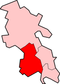
Location within Buckinghamshire
OS grid reference SP8105
Civil parish
Unitary authority
Ceremonial county
Region
Country England
Sovereign state United Kingdom
Post town PRINCES RISBOROUGH
Postcode district HP27
Dialling code 01844
Police Thames Valley
Fire Buckinghamshire
Ambulance South Central
List of places
UK
England
Buckinghamshire
51°44′N0°49′W / 51.73°N 00.82°W / 51.73; -00.82

Askett is a picturesque hamlet in the civil parish of Princes Risborough, Buckinghamshire, England. It is situated where the steep escarpment of the Chiltern Hills meets the flat expanse of the Vale of Aylesbury. It lies within an Area of Outstanding Natural Beauty and Conservation Area [1] less than four miles from Chequers, country home of the UK Prime Minister.

One mile from the market town of Princes Risborough, Askett is served with The Three Crowns pub and an Indian restaurant, The Coco Tamarind. The nearby Monks Risborough railway station provides direct access to London Marylebone.

History

The Manor house at Askett sat on the site of Old Manor Close estate. At the beginning of the 20th century small cottages resided on the original land but by 1969 had been demolished and in 1983 five new houses were built. Opposite the entrance to the estate stood the wheelwrights shop where a modern bungalow now stands.

In the 19th Century, the small hamlet was a renowned village for lacemaking. By the 20th Century, villages like Askett and Kimble became the stopping point on the way to Aylesbury, Dillons Garage was a small well-known service station opened in Askett in 1933 which has since been demolished.

The village still holds many old fashioned cottages and bungalows. The area has more recently been described as 'A Hamlet in a Meadow'. [2]

Related Research Articles

<span class="mw-page-title-main">Aylesbury</span> County town of Buckinghamshire, England

Aylesbury is the county town of Buckinghamshire, South East England. It is home to the Roald Dahl Children's Gallery and the Waterside Theatre. It is located in central Buckinghamshire, midway between High Wycombe and Milton Keynes.

<span class="mw-page-title-main">California, Buckinghamshire</span> Human settlement in England

California is a hamlet to the south side of Aylesbury town centre in Buckinghamshire in England, although today it has been completely swallowed up by the urban growth of Aylesbury.

Monks Risborough is a village and ecclesiastical parish in Buckinghamshire, England, lying between Princes Risborough and Great Kimble. The village lies at the foot of the northern scarp of the Chiltern Hills. It is 8 miles (13 km) south of the county town of Aylesbury and 9.5 miles (15.3 km) north of High Wycombe, on the A4010 road.

<span class="mw-page-title-main">Princes Risborough</span> Market town in Buckinghamshire, England

Princes Risborough is a market town and civil parish in Buckinghamshire, England, about 9 miles (14 km) south of Aylesbury and 8 miles (13 km) north west of High Wycombe. It lies at the foot of the Chiltern Hills, at the north end of a gap or pass through the Chilterns, the south end of which is at West Wycombe. The A4010 road follows this route from West Wycombe through the town and then on to Aylesbury.

<span class="mw-page-title-main">Whiteleaf, Buckinghamshire</span> Human settlement in England

Whiteleaf is a hamlet in the civil parish of Princes Risborough and the ecclesiastical parish of Monks Risborough in Buckinghamshire, England. It is located 7 miles south of the county town of Aylesbury and 8 miles north of High Wycombe. It lies halfway up the northern scarp of the Chilterns, about half a mile from the parish church of Monks Risborough.

<span class="mw-page-title-main">Quainton</span> Human settlement in England

Quainton is a village and civil parish in Buckinghamshire, England, 7 miles (11 km) north-west of Aylesbury. The population of the civil parish at the 2011 Census was 1,295. The village has two churches, a school and one public house. The location means that while many commute to London, others are employed in neighbouring towns and villages.

<span class="mw-page-title-main">Haddenham, Buckinghamshire</span> Village in England

Haddenham is a village and civil parish in west Buckinghamshire, England. It is about 5 miles (8 km) south-west of Aylesbury and 4 miles (6 km) north-east of Thame in neighbouring Oxfordshire. At the 2011 Census, the population of the civil parish was 4,502.

<span class="mw-page-title-main">Ashendon</span> Human settlement in England

Ashendon is a small village and civil parish in Buckinghamshire, England. It is about nine miles west of Aylesbury and seven miles north of Thame.

<span class="mw-page-title-main">Walton, Aylesbury</span> Human settlement in England

Walton is a hamlet in the parish of Aylesbury, in Buckinghamshire, England. Although Aylesbury has grown to such an extent that it completely surrounds Walton by a couple of miles in each direction, the hamlet is still marked on modern maps.

<span class="mw-page-title-main">Waddesdon</span> Human settlement in England

Waddesdon is a village in Buckinghamshire, England, 6 miles (10 km) west-north-west of Aylesbury on the A41 road. The village also includes the hamlets of Eythrope and Wormstone, Waddesdon was an agricultural settlement with milling, silk weaving and lace making enterprises.

<span class="mw-page-title-main">Fleet Marston</span> Human settlement in England

Fleet Marston is a civil parish and deserted medieval village in the Aylesbury Vale district of Buckinghamshire, England, about 2.5 miles (4 km) northwest of the centre of Aylesbury. The parish measures about 2.5 miles (4 km) north – south, but east – west it is nowhere more than about 34 mile (1.2 km) wide. It is bounded to the southeast by the River Thame, to the east by a stream that joins the Thame, and to the west by field boundaries. It has an area of 934 acres (378 ha).

<span class="mw-page-title-main">Horsenden</span> Human settlement in England

Horsenden is a hamlet and former civil parish, now in the parish of Longwick-cum-Ilmer, in Buckinghamshire, England. It is approximately one mile West of Princes Risborough, seven miles south of Aylesbury and three miles south-west of Chinnor in Oxfordshire. The Icknield Way passes just to the north of the village from north-east to south-west, although there is no connecting road through the hamlet itself. In 1931 the parish had a population of 53.

<span class="mw-page-title-main">Loosley Row</span> Hamlet in Buckinghamshire, England

Loosley Row is a hamlet in the civil parish of Lacey Green, Buckinghamshire, England. It is located in the Chiltern Hills to the east of the main town of Princes Risborough. In the 2011 Census, the population was recorded in the Lacey Green Parish, which included Speen, parts of Walter's Ash, and Lacey Green, with a combined population of 2,559.

<span class="mw-page-title-main">Marsh Gibbon</span> Human settlement in Buckinghamshire, England

Marsh Gibbon is a village and civil parish in Buckinghamshire, England. It is close to the A41 and the border with Oxfordshire about 4 miles (6.4 km) east of Bicester.

<span class="mw-page-title-main">Radclive</span> Human settlement in England

Radclive is a village on the River Great Ouse just over 1 mile (1.6 km) west of Buckingham in Buckinghamshire, England. It is in the civil parish of Radclive-cum-Chackmore in Aylesbury Vale district. The parish includes the hamlet of Chackmore about 1.5 miles (2.4 km) north of Buckingham.

<span class="mw-page-title-main">Weston Turville</span> Human settlement in England

Weston Turville is a historic village and civil parish in the Vale of Aylesbury in Buckinghamshire, England. The village is at the foot of the Chiltern Hills, 3 miles (4.9 km) from the market town of Wendover and 3.5 miles (5.7 km) from Aylesbury.

<span class="mw-page-title-main">Wingrave</span> Human settlement in England

Wingrave is a village in Buckinghamshire, England, about four miles north east of Aylesbury and three miles south west of Wing.

<span class="mw-page-title-main">Chinnor</span> Human settlement in England

Chinnor is a large village and civil parish in South Oxfordshire about 4 miles (6.4 km) southeast of Thame, close to the border with Buckinghamshire. The village is a spring line settlement on the Icknield Way below the Chiltern escarpment. Since 1932 the civil parish has included the village of Emmington. The 2011 Census recorded the parish's population as 5,924.

<span class="mw-page-title-main">Sedrup</span> Human settlement in England

Sedrup is a hamlet in Buckinghamshire, England. It is located south west of the town of Aylesbury, close to the villages of Stone, Bishopstone and Hartwell which also provide the name of the civil parish within which Sedrup lies.

<span class="mw-page-title-main">A4010 road</span> Road in Buckinghamshire, England

The A4010 is an important primary north–south road in Buckinghamshire, Southern England. It runs from High Wycombe at Junction 4 of the M40 motorway to Stoke Mandeville, near Aylesbury on the A413.

References

  1. Askett conservation area character survey wycombe.gov.uk [ dead link ]
  2. "Welcome to the Risborough Area Portal | Princes Risborough, Buckinghamshire Askett » Welcome to the Risborough Area Portal | Princes Risborough, Buckinghamshire". Archived from the original on 1 July 2016. Retrieved 27 November 2020.