Great Kingshill

Last updated

Great Kingshill
The Common, Great Kingshill - geograph.org.uk - 146210.jpg
The Common, Great Kingshill, 2006
Buckinghamshire UK location map.svg
Red pog.svg
Great Kingshill
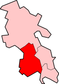
Location within Buckinghamshire
OS grid reference SU877979
Civil parish
Unitary authority
Ceremonial county
Region
Country England
Sovereign state United Kingdom
Post town HIGH WYCOMBE
Postcode district HP15
Dialling code 01494
Police Thames Valley
Fire Buckinghamshire
Ambulance South Central
UK Parliament
List of places
UK
England
Buckinghamshire
51°40′22″N0°43′51″W / 51.6729°N 0.7308°W / 51.6729; -0.7308

Great Kingshill is a small village in the parish of Hughenden in Buckinghamshire, England. It is located in the Chiltern Hills, about five miles west of Amersham and two and a half miles south of Great Missenden.

Contents

Village

The village name 'Kingshill' is fairly self-explanatory, meaning a hill in possession of the king. Local folklore suggests it was King John who provided the name; there is certainly evidence of King John granting the manor at Kingshill to Hugh de Gournay in 1213, although this same document states that the land was previously possessed by Geoffrey fitzPeter. [1] The affix 'Great' was added later to differentiate between Great Kingshill and neighbouring Little Kingshill. There is some evidence of a settlement called Pirenore that was granted to Missenden Abbey in 1275. The settlement was discovered in Brand's Fee in Great Kingshill, and evidence suggests it was settled between the 11th and 16th centuries. [2] [3] It is possible that the settlement was wiped out by bubonic plague. [4]

Great Kingshill has a small local common, forming the heart of the village. It contains a younger children's playground, an older children's playground, football goals and a cricket area which is use by the Great Kingshill Cricket Club in the summer. There are also small festivals held here on evenings during the summer.

The village has its own primary school. Many of the village children attend Great Kingshill school, as do children from a wide surrounding area. The school's most recent Ofsted report judged the school to be "Good" overall and "Outstanding" in some areas. Great Kingshill school is geographically located in the neighbouring hamlet of Cryers Hill. Great Kingshill is also home to Pipers Corner School, an all girl private school.

According to the 2001 census by the Hughenden Parish Council (a parish of the Wycombe District Council), Great Kingshill had a population of 1,170 in an area of 35 hectares.

See also

Related Research Articles

<span class="mw-page-title-main">High Wycombe</span> Town in Buckinghamshire, England

High Wycombe, often referred to as Wycombe, is a market town in Buckinghamshire, England. Lying in the valley of the River Wye surrounded by the Chiltern Hills, it is 29 miles (47 km) west-northwest of Charing Cross in London, 13 miles (21 km) south-southeast of Aylesbury, 23 miles (37 km) southeast of Oxford, 15 miles (24 km) northeast of Reading and 8 miles (13 km) north of Maidenhead.

<span class="mw-page-title-main">Chesham</span> Human settlement in England

Chesham is a market town and civil parish in Buckinghamshire, England, United Kingdom, 11 miles (18 km) south-east of the county town of Aylesbury, about 26 miles (42 km) north-west of central London, and part of the London commuter belt. It is in the Chess Valley, surrounded by farmland. The earliest records of Chesham as a settlement are from the second half of the 10th century, although there is archaeological evidence of people in this area from around 8000 BC. Henry III granted a royal charter for a weekly market in 1257.

<span class="mw-page-title-main">Chiltern Hills</span> Range of hills in Southeast England

The Chiltern Hills are a chalk escarpment in the UK northwest of London, covering 660 square miles (1,700 km2) across Oxfordshire, Buckinghamshire, Hertfordshire, and Bedfordshire, stretching 45 miles (72 km) from Goring-on-Thames in the southwest to Hitchin in the northeast. The hills are 12 miles (19 km) at their widest.

<span class="mw-page-title-main">Hughenden Valley</span> Human settlement in England

Hughenden Valley is an extensive village and civil parish in Buckinghamshire, England, just to the north of High Wycombe. It is almost 8,000 acres (32 km2) in size, divided mainly between arable and wooded land. It is situated 3 miles (4.8 km) north of central Wycombe, 12.5 miles (20.1 km) south of the county town of Aylesbury and some 35 miles (56 km) west-northwest of London.

<span class="mw-page-title-main">Great Missenden</span> Human settlement in England

Great Missenden is an affluent village and civil parish in the Misbourne Valley in the Chiltern Hills in Buckinghamshire, England, situated between the towns of Amersham and Wendover. It adjoins the village of Little Kingshill, and is a mile from Little Missenden and the village of Prestwood.

<span class="mw-page-title-main">Asheridge</span> Human settlement in England

Asheridge is a small hamlet in the parish of Chartridge, in Buckinghamshire, England. Prior to 1898 it was part of Chesham parish. It is situated in the Chiltern Hills, about two and a half miles north west of Chesham, 5 miles from Great Missenden and 6 miles from Wendover.

<span class="mw-page-title-main">Dinton, Buckinghamshire</span> Human settlement in England

Dinton is a village in Buckinghamshire, England, within the Buckinghamshire Council unitary authority area. It is in the south of the Aylesbury Vale on the ancient turnpike leading from Aylesbury to Thame. It is within the civil parish of Dinton with Ford and Upton. The village name is Anglo Saxon in origin, and means 'Dunna's estate'. In the Domesday Book of 1086 it was listed as Danitone.

<span class="mw-page-title-main">Downley</span> Human settlement in England

Downley is a village and civil parish in Buckinghamshire, England, which was included in Wycombe district before its abolition. It is high in the Chiltern Hills, overlooking the town of High Wycombe, although today it is almost indistinguishable from the urban spread of the latter town.

<span class="mw-page-title-main">Little Kingshill</span> Human settlement in England

Little Kingshill is a small Chilterns village in the parish of Little Missenden in Buckinghamshire, England, with the closest amenities being in its post town of Great Missenden. It is approximately five miles west of Amersham, about four and a half miles north west of High Wycombe and just under two miles south of Great Missenden, with its fast train to London Marylebone.

<span class="mw-page-title-main">Hazlemere</span> Village and civil parish in England

Hazlemere is a large village and civil parish in Buckinghamshire, England, 2.5 miles (4.0 km) northeast of High Wycombe on the A404 leading to Amersham, which intersects with the B474 at Hazlemere. To the north of the village is the hamlet of Holmer Green, which is in the civil parish of Little Missenden.

<span class="mw-page-title-main">Holmer Green</span> Human settlement in England

Holmer Green is a village in the civil parish of Little Missenden, in Buckinghamshire, England. It is next to Hazlemere, about 3 miles (5 km) south of Great Missenden.

<span class="mw-page-title-main">Little Missenden</span> Human settlement in England

Little Missenden is a village and civil parish on the River Misbourne in Buckinghamshire, England. It is in the Chiltern Hills, about 3 miles (5 km) southeast of Great Missenden and 3 miles (5 km) west of Amersham. The village lies on the River Misbourne in the Misbourne valley.

<span class="mw-page-title-main">Prestwood</span> Human settlement in England

Prestwood is a village in Buckinghamshire, England. It is located in the Chiltern Hills, about two miles west of Great Missenden and six miles north of High Wycombe.

<span class="mw-page-title-main">Wolverton</span> Human settlement in England

Wolverton is a constituent town of Milton Keynes, England. It is located in the north-west of the city, beside the West Coast Main Line, the Grand Union Canal and the river Great Ouse. It is the administrative seat of Wolverton and Greenleys civil parish.

<span class="mw-page-title-main">Chiltern District</span> Former non-metropolitan district in England

Chiltern District was a local government district of Buckinghamshire in south-central England from 1974 to 2020. It was named after the Chiltern Hills on which the region sits.

<span class="mw-page-title-main">Wycombe (UK Parliament constituency)</span> Parliamentary constituency in Buckinghamshire

Wycombe is a constituency in Buckinghamshire represented in the House of Commons of the UK Parliament since 2010 by Steve Baker, a Conservative.

<span class="mw-page-title-main">Cryers Hill</span> Human settlement in England

Cryers Hill is a hamlet in the parish of Hughenden and in Buckinghamshire, England. It was formerly known as Ravensmere.

<span class="mw-page-title-main">Heath End, Buckinghamshire</span>

Heath End is a hamlet in the parish of Great Missenden in Buckinghamshire, England. At the 2011 Census the population of the hamlet was included in the civil parish of Little Missenden. During the 20th century, it became attached to Great Kingshill to the south west. The old centre of the hamlet is where Spurlands End Road meets Heath End Road. Although Heath End is now attached to Great Kingshill there are still road signs indicating to the hamlet.

References

  1. "The Lands of the Normans in England: Document Item 154 Details". HRI Online. Retrieved 7 June 2012.
  2. "Monument Record ID 0212801000". Buckinghamshire County Council . Retrieved 7 June 2012.
  3. Taylor, Andy (July 2005). "Grange Farm, Widmer End, Hughenden, Buckinghamshire: An Archaeological Evaluation for British Flora" (PDF). Thames Valley Archaeological Services Ltd. Retrieved 7 June 2012.
  4. "History of the Parish". Hughenden Parish Council. Retrieved 7 June 2012.