East Anglia is an area in the East of England, often defined as including the counties of Norfolk, Suffolk and Cambridgeshire. The name derives from the Anglo-Saxon kingdom of the East Angles, a people whose name originated in Anglia, in what is now Northern Germany.

The River Ancholme is a river in Lincolnshire, England, and a tributary of the Humber. It rises at Ancholme Head, a spring just north of the village of Ingham and immediately west of the Roman Road, Ermine Street. It flows east and then north to Bishopbridge west of Market Rasen, where it is joined by the Rase. North of there it flows through the market town of Brigg before draining into the Humber at South Ferriby. It drains a large part of northern Lincolnshire between the Trent and the North Sea.

The River Brent is a river in west and northwest London, England, and a tributary of the River Thames. 17.9 miles (28.8 km) in length, it rises in the Borough of Barnet and flows in a generally south-west direction before joining the Tideway stretch of the Thames at Brentford.

The Bytham River is said to have been one of the great Pleistocene rivers of central and eastern England until it was destroyed by the advancing ice sheets of the Anglian Glaciation around 450,000 years ago. The river is named after Castle Bytham in Lincolnshire, where the watercourse is said to have crossed the Lincolnshire limestone hills in a valley now buried by Anglian till. West of that location, its catchment area included much of Warwickshire, Leicestershire and Derbyshire. East of that location, the Bytham flowed across what is now the Fen Basin to Shouldham, then southward to Mildenhall, then eastward across East Anglia. It met the Proto-Thames in a delta near what is now the Norfolk/Suffolk border and flowed into the North Sea. Britain was then joined to the Continent by a land bridge and the Bytham joined the North Sea somewhere beyond the northern end of that land bridge.
Prickwillow is a village in East Cambridgeshire with an estimated population of 440. Originally a small hamlet on the banks of the River Great Ouse, it is now on the banks of the River Lark since re-organisation of the river system. It lies in the south of the Fens, 4 miles (6.4 km) east of the city of Ely in Cambridgeshire, England, and is home to Prickwillow Museum, which tells the story of the changing face of Fenland. Prickwillow Museum is housed in the old pumping station and contains a major collection of working pumping engines. The village is also home to the Ely Group of Internal Drainage Boards.

Anglian Water Services Limited is a water company that operates in the East of England. It was formed in 1989 under the partial privatisation of the water industry. It provides water supply, sewerage and sewage treatment to the area formerly the responsibility of the Anglian Water Authority. The remaining functions of the authority were transferred to the Environment Agency. Anglian Water is regulated under the United Kingdom Water Industry Act 1991.
The Ancestral Thames is the geologically ancient precursor to the present day River Thames. The river has its origins in the emergence of Britain from a Cretaceous sea over 60 million years ago. Parts of the river's course were profoundly modified by the Anglian glaciation some 450,000 years ago. The extensive terrace deposits laid down by the Ancestral Thames over the past two million years or so have provided a rich source of material for studies in geology, geomorphology, palaeontology and archaeology.
The Lea Valley, the valley of the River Lea, has been used as a transport corridor, a source of sand and gravel, an industrial area, a water supply for London, and a recreational area. The London 2012 Summer Olympics were based in Stratford, in the Lower Lea Valley. It is important for London's water supply, as the source of the water transported by the New River aqueduct, but also as the location for the Lee Valley Reservoir Chain, stretching from Enfield through Tottenham and Walthamstow.

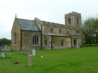
Edworth is a hamlet and civil parish in the Central Bedfordshire district of the county of Bedfordshire, England about 12 miles (19 km) south-east of the county town of Bedford. It sits just off the Great North Road (A1) between Baldock and Biggleswade. There are fewer than one hundred inhabitants. At the 2011 Census, Edworth's population was amalgamated with the civil parish of Dunton.

Turkey Brook is a river in the northern outskirts of London. It rises in Potters Bar, Hertfordshire, and flows broadly eastwards to merge with the River Lea Navigation near Enfield Lock.

Eyeworth is a small, rural village and civil parish in the Central Bedfordshire district of the county of Bedfordshire, England; about 12.5 miles (20 km) east south-east of the county town of Bedford.

Pymmes Brook is located in North London and named after William Pymme, a local land owner. It is a minor tributary of the River Lea. The brook mostly flows through urban areas and is particularly prone to flooding in its lower reaches. To alleviate the problem the brook has been culverted in many areas. Part of it is a Site of Borough Importance for Nature Conservation, Grade II.

Salmons Brook is a minor tributary of the River Lea, located in the London Borough of Enfield.

Cuffley Brook is a tributary of Turkey Brook. It runs through parts of Hertfordshire and the London Borough of Enfield, England. After the confluence of the two streams in Whitewebbs Park, the watercourse continues eastwards as Turkey Brook to join the River Lea near Enfield Lock.

Konectbus is a bus operator based in Dereham in Norfolk, England. It is a subsidiary of the Go-Ahead Group and forms part of Go East Anglia.

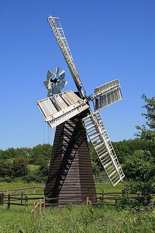
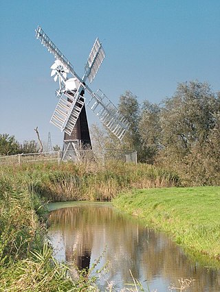
Eastbridge Windpump is a smock mill that served as a pumping station until it was relocated to the Museum of East Anglian Life, Stowmarket, Suffolk, England and which was then restored to working order.

Green v Lord Somerleyton is an English land law and tort law case, concerning easements of surface water/ditch drainage and the tests for nuisance in English law. In this case there was no remedy for the flooding found to be natural and not recently exacerbated by the defendant. The court attached to the properties an old, 1921, easement of drainage passing both land holdings, in this case two common examples of lowland water engineering, dykes controlled against tides by one-way valves, mentioned in the properties' deeds and, duplicatively, established the right by prescription. The dykes lay in the claimant's own land who had failed to maintain them and failed to account for the flows caused by reduction of water extraction from the lake upstream. The claimant had failed to repair the pump and clear ditches on his own land which had been agreed between the previous owners to give channelled drainage from a lake above. It was for the claimant to recognise the danger posed by its waterline being raised in 1954 by the building up of a weir.

Minsmere River is a river in the English county of Suffolk which flows into the North Sea at Minsmere. The river is formed from the River Yox at Yoxford before flowing through Middleton, Eastbridge and Minsmere. It flows to the south of Minsmere RSPB reserve helping to form many of the wetland habitats at the reserve.
The Finchley Gap is a location centred on Church End, Finchley, in north London, England. As a topographical feature approximately eight kilometres wide, lying between higher ground to the north-west and to the south-east, it has probably existed for the last one million years or more.
The Rivers of the County of Essex, England have been managed and controlled by a number of statutory bodies since 1931. These have variously aimed to ensure the effective drainage of water courses; ascertain accurate flowrates; manage, measure and control pollution; regulate the abstraction and impounding of water; manage the treatment and supply of water; and manage sewage treatment and disposal.


