List of United Kingdom locations: West M-Wey

Last updated

The United Kingdom Uk-map.svg
The United Kingdom

This is part of the list of United Kingdom locations: a gazetteer of place names in the United Kingdom showing each place's locality and geographical coordinates.

Contents

West (continued)

West M

LocationLocality Coordinates
(links to map & photo sources)
OS grid
reference
West Mains Scottish Borders 55°42′N2°43′W / 55.70°N 02.71°W / 55.70; -02.71 NT5546
West Mains South Lanarkshire 55°46′N4°12′W / 55.76°N 04.20°W / 55.76; -04.20 NS6254
West Malling Kent 51°17′N0°24′E / 51.28°N 00.40°E / 51.28; 00.40 TQ6857
West Malvern Worcestershire 52°07′N2°21′W / 52.11°N 02.35°W / 52.11; -02.35 SO7646
Westmancote Worcestershire 52°02′N2°06′W / 52.03°N 02.10°W / 52.03; -02.10 SO9337
West Marden West Sussex 50°55′N0°54′W / 50.91°N 00.90°W / 50.91; -00.90 SU7713
West Marina East Sussex 50°50′N0°31′E / 50.84°N 00.52°E / 50.84; 00.52 TQ7808
West Markham Nottinghamshire 53°14′N0°55′W / 53.24°N 00.92°W / 53.24; -00.92 SK7272
Westmarsh Kent 51°18′N1°15′E / 51.30°N 01.25°E / 51.30; 01.25 TR2761
West Marsh North East Lincolnshire 53°34′N0°07′W / 53.56°N 00.11°W / 53.56; -00.11 TA2509
West Marton North Yorkshire 53°56′N2°10′W / 53.94°N 02.16°W / 53.94; -02.16 SD8950
West Melbury Dorset 50°58′N2°12′W / 50.97°N 02.20°W / 50.97; -02.20 ST8620
West Melton Rotherham 53°29′N1°22′W / 53.49°N 01.36°W / 53.49; -01.36 SE4200
West Meon Hampshire 51°01′N1°05′W / 51.01°N 01.08°W / 51.01; -01.08 SU6424
West Meon Woodlands Hampshire 51°01′N1°05′W / 51.02°N 01.08°W / 51.02; -01.08 SU6426
West Mersea Essex 51°46′N0°55′E / 51.77°N 00.91°E / 51.77; 00.91 TM0112
Westmeston East Sussex 50°54′N0°06′W / 50.90°N 00.10°W / 50.90; -00.10 TQ3313
Westmill (East Hertfordshire)Hertfordshire 51°55′N0°01′W / 51.92°N 00.02°W / 51.92; -00.02 TL3627
Westmill (Hitchin)Hertfordshire 51°57′N0°17′W / 51.95°N 00.29°W / 51.95; -00.29 TL1730
West Milton Dorset 50°46′N2°43′W / 50.76°N 02.71°W / 50.76; -02.71 SY5096
West Minster Kent 51°25′N0°44′E / 51.42°N 00.74°E / 51.42; 00.74 TQ9173
Westminster City of Westminster 51°29′N0°08′W / 51.49°N 00.14°W / 51.49; -00.14 TQ2979
West Molesey Surrey 51°23′N0°22′W / 51.39°N 00.37°W / 51.39; -00.37 TQ1368
West Monkseaton North Tyneside 55°02′N1°29′W / 55.03°N 01.48°W / 55.03; -01.48 NZ3371
West Monkton Somerset 51°02′N3°03′W / 51.04°N 03.05°W / 51.04; -03.05 ST2628
West Moor North Tyneside 55°01′N1°34′W / 55.02°N 01.57°W / 55.02; -01.57 NZ2770
Westmoor End Cumbria 54°44′N3°23′W / 54.73°N 03.39°W / 54.73; -03.39 NY1039
West Moors Dorset 50°49′N1°53′W / 50.81°N 01.88°W / 50.81; -01.88 SU0802
West Morden Dorset 50°45′N2°08′W / 50.75°N 02.14°W / 50.75; -02.14 SY9095
West Morton Bradford 53°52′N1°52′W / 53.87°N 01.86°W / 53.87; -01.86 SE0942
West Mudford Somerset 50°58′N2°37′W / 50.97°N 02.62°W / 50.97; -02.62 ST5620
Westmuir Angus 56°39′N3°02′W / 56.65°N 03.04°W / 56.65; -03.04 NO3652
West Muir Angus 56°44′N2°43′W / 56.73°N 02.72°W / 56.73; -02.72 NO5661

West N

LocationLocality Coordinates
(links to map & photo sources)
OS grid
reference
West Ness North Yorkshire 54°12′N0°56′W / 54.20°N 00.94°W / 54.20; -00.94 SE6979
Westnewton Cumbria 54°47′N3°21′W / 54.78°N 03.35°W / 54.78; -03.35 NY1344
Westnewton Northumberland 55°34′N2°10′W / 55.56°N 02.16°W / 55.56; -02.16 NT9030
West Newton East Riding of Yorkshire 53°49′N0°11′W / 53.81°N 00.19°W / 53.81; -00.19 TA1937
West Newton Norfolk 52°49′N0°30′E / 52.81°N 00.50°E / 52.81; 00.50 TF6927
West Newton Somerset 51°03′N3°01′W / 51.05°N 03.02°W / 51.05; -03.02 ST2829
West Norwood Lambeth 51°25′N0°06′W / 51.42°N 00.10°W / 51.42; -00.10 TQ3271

West O

LocationLocality Coordinates
(links to map & photo sources)
OS grid
reference
Westoe South Tyneside 54°59′N1°25′W / 54.98°N 01.42°W / 54.98; -01.42 NZ3766
West Ogwell Devon 50°31′N3°40′W / 50.51°N 03.66°W / 50.51; -03.66 SX8270
Weston Bath and North East Somerset 51°23′N2°24′W / 51.39°N 02.40°W / 51.39; -02.40 ST7266
Weston Berkshire 51°27′N1°26′W / 51.45°N 01.44°W / 51.45; -01.44 SU3973
Weston Bradford 53°55′N1°44′W / 53.91°N 01.74°W / 53.91; -01.74 SE1746
Weston (Cheshire East)Cheshire 53°14′N2°10′W / 53.24°N 02.16°W / 53.24; -02.16 SJ8972
Weston (Runcorn)Cheshire 53°19′N2°45′W / 53.31°N 02.75°W / 53.31; -02.75 SJ5080
Weston (Awliscombe)Devon 50°47′N3°13′W / 50.79°N 03.22°W / 50.79; -03.22 ST1400
Weston (Sidmouth)Devon 50°41′N3°11′W / 50.68°N 03.19°W / 50.68; -03.19 SY1688
Weston (Corscombe)Dorset 50°50′N2°43′W / 50.84°N 02.71°W / 50.84; -02.71 ST5005
Weston (Tophill)Dorset 50°32′N2°27′W / 50.53°N 02.45°W / 50.53; -02.45 SY6871
Weston Herefordshire 52°11′N2°56′W / 52.19°N 02.93°W / 52.19; -02.93 SO3656
Weston Hertfordshire 51°57′N0°10′W / 51.95°N 00.16°W / 51.95; -00.16 TL2630
Weston Lincolnshire 52°47′N0°06′W / 52.79°N 00.10°W / 52.79; -00.10 TF2824
Weston Northamptonshire 52°06′N1°09′W / 52.10°N 01.15°W / 52.10; -01.15 SP5846
Weston Nottinghamshire 53°11′N0°50′W / 53.19°N 00.84°W / 53.19; -00.84 SK7767
Weston Pembrokeshire 51°45′N4°52′W / 51.75°N 04.87°W / 51.75; -04.87 SN0210
Weston Powys 52°21′N2°59′W / 52.35°N 02.99°W / 52.35; -02.99 SO3273
Weston (Monkhopton)Shropshire 52°31′N2°36′W / 52.52°N 02.60°W / 52.52; -02.60 SO5992
Weston (Oswestry Rural)Shropshire 52°50′N3°03′W / 52.83°N 03.05°W / 52.83; -03.05 SJ2927
Weston (Weston-under-Redcastle)Shropshire 52°50′N2°39′W / 52.84°N 02.65°W / 52.84; -02.65 SJ5628
Weston South Lanarkshire 55°42′N3°32′W / 55.70°N 03.54°W / 55.70; -03.54 NT0347
Weston City of Southampton 50°53′N1°22′W / 50.88°N 01.37°W / 50.88; -01.37 SU4410
Weston Staffordshire 52°50′N2°02′W / 52.84°N 02.04°W / 52.84; -02.04 SJ9727
Weston Suffolk 52°25′N1°33′E / 52.42°N 01.55°E / 52.42; 01.55 TM4287
Weston Bampfylde Somerset 51°01′N2°33′W / 51.01°N 02.55°W / 51.01; -02.55 ST6124
Weston Beggard Herefordshire 52°04′N2°37′W / 52.06°N 02.61°W / 52.06; -02.61 SO5841
Westonbirt Gloucestershire 51°35′N2°13′W / 51.59°N 02.21°W / 51.59; -02.21 ST8589
Weston by Welland Northamptonshire 52°31′N0°52′W / 52.51°N 00.86°W / 52.51; -00.86 SP7791
Weston Colley Hampshire 51°08′N1°17′W / 51.14°N 01.28°W / 51.14; -01.28 SU5039
Weston Colville Cambridgeshire 52°09′N0°21′E / 52.15°N 00.35°E / 52.15; 00.35 TL6153
Weston Common City of Southampton 50°53′N1°20′W / 50.89°N 01.34°W / 50.89; -01.34 SU4611
Westoncommon Shropshire 52°49′N2°52′W / 52.82°N 02.86°W / 52.82; -02.86 SJ4226
Weston Corbett Hampshire 51°13′N1°01′W / 51.21°N 01.02°W / 51.21; -01.02 SU6847
Weston Coyney City of Stoke-on-Trent 52°59′N2°06′W / 52.99°N 02.10°W / 52.99; -02.10 SJ9344
Weston Ditch Suffolk 52°22′N0°27′E / 52.36°N 00.45°E / 52.36; 00.45 TL6777
Weston Favell Northamptonshire 52°15′N0°50′W / 52.25°N 00.84°W / 52.25; -00.84 SP7962
Weston Green Cambridgeshire 52°08′N0°22′E / 52.14°N 00.36°E / 52.14; 00.36 TL6252
Weston Green Norfolk 52°41′N1°06′E / 52.68°N 01.10°E / 52.68; 01.10 TG1014
Weston Green Surrey 51°23′N0°20′W / 51.38°N 00.34°W / 51.38; -00.34 TQ1566
Weston Heath Shropshire 52°43′N2°20′W / 52.71°N 02.34°W / 52.71; -02.34 SJ7713
Weston Hills Lincolnshire 52°46′N0°06′W / 52.76°N 00.10°W / 52.76; -00.10 TF2820
Weston in Arden Warwickshire 52°28′N1°26′W / 52.47°N 01.44°W / 52.47; -01.44 SP3887
Westoning Bedfordshire 51°58′N0°30′W / 51.97°N 00.50°W / 51.97; -00.50 TL0332
Weston in Gordano North Somerset 51°28′N2°48′W / 51.46°N 02.80°W / 51.46; -02.80 ST4474
Weston Jones Staffordshire 52°49′N2°21′W / 52.81°N 02.35°W / 52.81; -02.35 SJ7624
Weston Longville Norfolk 52°41′N1°07′E / 52.69°N 01.12°E / 52.69; 01.12 TG1115
Weston Lullingfields Shropshire 52°49′N2°52′W / 52.81°N 02.86°W / 52.81; -02.86 SJ4224
Weston Manor Isle of Wight 50°40′N1°32′W / 50.67°N 01.54°W / 50.67; -01.54 SZ3286
Weston Mill Devon 50°23′N4°11′W / 50.39°N 04.18°W / 50.39; -04.18 SX4557
Weston-on-Avon Warwickshire 52°09′N1°47′W / 52.15°N 01.78°W / 52.15; -01.78 SP1551
Weston-on-the-Green Oxfordshire 51°51′N1°14′W / 51.85°N 01.23°W / 51.85; -01.23 SP5318
Weston-on-Trent Derbyshire 52°50′N1°24′W / 52.84°N 01.40°W / 52.84; -01.40 SK4028
Weston Park Bath and North East Somerset 51°23′N2°23′W / 51.39°N 02.38°W / 51.39; -02.38 ST7366
Weston Patrick Hampshire 51°12′N1°01′W / 51.20°N 01.01°W / 51.20; -01.01 SU6946
Weston Point Cheshire 53°19′N2°46′W / 53.32°N 02.76°W / 53.32; -02.76 SJ4981
Weston Rhyn Shropshire 52°54′N3°04′W / 52.90°N 03.07°W / 52.90; -03.07 SJ2835
Weston-sub-Edge Gloucestershire 52°04′N1°49′W / 52.06°N 01.82°W / 52.06; -01.82 SP1241
Weston-super-Mare North Somerset 51°20′N2°58′W / 51.34°N 02.97°W / 51.34; -02.97 ST3261
Weston Town Somerset 51°10′N2°26′W / 51.16°N 02.43°W / 51.16; -02.43 ST7041
Weston Turville Buckinghamshire 51°47′N0°46′W / 51.78°N 00.76°W / 51.78; -00.76 SP8510
Weston-under-Lizard Staffordshire 52°41′N2°17′W / 52.68°N 02.29°W / 52.68; -02.29 SJ8010
Weston under Penyard Herefordshire 51°54′N2°33′W / 51.90°N 02.55°W / 51.90; -02.55 SO6223
Weston under Wetherley Warwickshire 52°19′N1°28′W / 52.31°N 01.47°W / 52.31; -01.47 SP3669
Weston Underwood Derbyshire 52°58′N1°34′W / 52.97°N 01.56°W / 52.97; -01.56 SK2942
Weston Underwood Milton Keynes 52°08′N0°44′W / 52.14°N 00.74°W / 52.14; -00.74 SP8650
Westonwharf Shropshire 52°49′N2°52′W / 52.81°N 02.86°W / 52.81; -02.86 SJ4225
Westonzoyland Somerset 51°06′N2°55′W / 51.10°N 02.92°W / 51.10; -02.92 ST3534
West Orchard Dorset 50°56′N2°15′W / 50.94°N 02.25°W / 50.94; -02.25 ST8216
West Overton Wiltshire 51°24′N1°49′W / 51.40°N 01.81°W / 51.40; -01.81 SU1367
Westow North Yorkshire 54°04′N0°51′W / 54.07°N 00.85°W / 54.07; -00.85 SE7565
Westowe Somerset 51°05′N3°15′W / 51.08°N 03.25°W / 51.08; -03.25 ST1232
Westown Devon 50°54′N3°16′W / 50.90°N 03.26°W / 50.90; -03.26 ST1113
Westown Perth and Kinross 56°25′N3°13′W / 56.42°N 03.21°W / 56.42; -03.21 NO2527

West P – West Q

LocationLocality Coordinates
(links to map & photo sources)
OS grid
reference
West Panson Devon 50°41′N4°21′W / 50.69°N 04.35°W / 50.69; -04.35 SX3491
West Park Hartlepool 54°41′N1°15′W / 54.68°N 01.25°W / 54.68; -01.25 NZ4832
West Park City of Kingston upon Hull 53°44′N0°22′W / 53.73°N 00.37°W / 53.73; -00.37 TA0728
West Park Leeds 53°49′N1°36′W / 53.82°N 01.60°W / 53.82; -01.60 SE2637
West Park South Tyneside 54°58′N1°26′W / 54.97°N 01.43°W / 54.97; -01.43 NZ3665
West Park St Helens 53°26′N2°46′W / 53.44°N 02.76°W / 53.44; -02.76 SJ4995
West Parley Dorset 50°46′N1°53′W / 50.77°N 01.88°W / 50.77; -01.88 SZ0897
West Pasture Durham 54°35′N2°05′W / 54.59°N 02.09°W / 54.59; -02.09 NY9422
West Peckham Kent 51°14′N0°20′E / 51.24°N 00.34°E / 51.24; 00.34 TQ6452
West Pelton Durham 54°52′N1°38′W / 54.87°N 01.64°W / 54.87; -01.64 NZ2353
West Pennard Somerset 51°08′N2°39′W / 51.13°N 02.65°W / 51.13; -02.65 ST5438
West Pentire Cornwall 50°23′N5°08′W / 50.39°N 05.13°W / 50.39; -05.13 SW7760
West Perry Cambridgeshire 52°17′N0°20′W / 52.28°N 00.33°W / 52.28; -00.33 TL1466
West Pontnewydd Torfaen 51°39′N3°02′W / 51.65°N 03.04°W / 51.65; -03.04 ST2896
West Poringland Norfolk 52°33′N1°20′E / 52.55°N 01.33°E / 52.55; 01.33 TG2600
West Porlock Somerset 51°13′N3°37′W / 51.21°N 03.61°W / 51.21; -03.61 SS8747
Westport Somerset 50°58′N2°53′W / 50.96°N 02.88°W / 50.96; -02.88 ST3819
West Porton Renfrewshire 55°54′N4°31′W / 55.90°N 04.51°W / 55.90; -04.51 NS4371
West Pulham Dorset 50°52′N2°25′W / 50.87°N 02.42°W / 50.87; -02.42 ST7008
West Putford Devon 50°55′N4°20′W / 50.91°N 04.34°W / 50.91; -04.34 SS3515
West Quantoxhead Somerset 51°10′N3°16′W / 51.16°N 03.27°W / 51.16; -03.27 ST1141
Westquarter Falkirk 55°59′N3°44′W / 55.98°N 03.74°W / 55.98; -03.74 NS9178

West R

LocationLocality Coordinates
(links to map & photo sources)
OS grid
reference
Westra The Vale Of Glamorgan 51°26′N3°14′W / 51.43°N 03.23°W / 51.43; -03.23 ST1471
West Rainton Durham 54°48′N1°30′W / 54.80°N 01.50°W / 54.80; -01.50 NZ3246
West Rasen Lincolnshire 53°23′N0°24′W / 53.38°N 00.40°W / 53.38; -00.40 TF0689
West Ravendale North East Lincolnshire 53°28′N0°10′W / 53.47°N 00.16°W / 53.47; -00.16 TF2299
Westray Orkney Islands 59°18′N2°59′W / 59.30°N 02.99°W / 59.30; -02.99 HY437466
West Raynham Norfolk 52°47′N0°46′E / 52.79°N 00.77°E / 52.79; 00.77 TF8725
West Retford Nottinghamshire 53°19′N0°58′W / 53.32°N 00.96°W / 53.32; -00.96 SK6981
Westridge Green Berkshire 51°30′N1°11′W / 51.50°N 01.19°W / 51.50; -01.19 SU5679
Westrigg West Lothian 55°53′N3°46′W / 55.88°N 03.76°W / 55.88; -03.76 NS9067
Westrip Gloucestershire 51°44′N2°16′W / 51.74°N 02.26°W / 51.74; -02.26 SO8205
Westrop Wiltshire 51°25′N2°10′W / 51.42°N 02.17°W / 51.42; -02.17 ST8870
Westrop Green Berkshire 51°26′N1°15′W / 51.43°N 01.25°W / 51.43; -01.25 SU5271
West Rounton North Yorkshire 54°25′N1°22′W / 54.42°N 01.36°W / 54.42; -01.36 NZ4103
West Row Suffolk 52°20′N0°27′E / 52.34°N 00.45°E / 52.34; 00.45 TL6775
West Royd Bradford 53°49′N1°45′W / 53.82°N 01.75°W / 53.82; -01.75 SE1637
West Rudham Norfolk 52°49′N0°41′E / 52.81°N 00.68°E / 52.81; 00.68 TF8127
West Ruislip Hillingdon 51°34′N0°26′W / 51.56°N 00.44°W / 51.56; -00.44 TQ0886
Westrum Lincolnshire 53°32′N0°29′W / 53.54°N 00.49°W / 53.54; -00.49 TA0006
West Runton Norfolk 52°56′N1°14′E / 52.93°N 01.24°E / 52.93; 01.24 TG1842
Westruther Scottish Borders 55°44′N2°35′W / 55.74°N 02.59°W / 55.74; -02.59 NT6350
Westry Cambridgeshire 52°34′N0°02′E / 52.56°N 00.04°E / 52.56; 00.04 TL3998

West S

LocationLocality Coordinates
(links to map & photo sources)
OS grid
reference
West Saltoun East Lothian 55°53′N2°52′W / 55.89°N 02.86°W / 55.89; -02.86 NT4667
West Sandford Devon 50°48′N3°41′W / 50.80°N 03.69°W / 50.80; -03.69 SS8102
West Sandwick Shetland Islands 60°34′N1°11′W / 60.57°N 01.19°W / 60.57; -01.19 HU4488
West Scholes Bradford 53°46′N1°52′W / 53.77°N 01.86°W / 53.77; -01.86 SE0931
West Scrafton North Yorkshire 54°14′N1°53′W / 54.24°N 01.89°W / 54.24; -01.89 SE0783
West Shepton Somerset 51°11′N2°33′W / 51.18°N 02.55°W / 51.18; -02.55 ST6143
West Side Blaenau Gwent 51°45′N3°10′W / 51.75°N 03.17°W / 51.75; -03.17 SO1907
Westside Aberdeenshire 57°03′N2°14′W / 57.05°N 02.24°W / 57.05; -02.24 NO8596
Westside Orkney Islands 59°10′N2°49′W / 59.17°N 02.82°W / 59.17; -02.82 HY5332
West Skelston Dumfries and Galloway 55°08′N3°51′W / 55.14°N 03.85°W / 55.14; -03.85 NX8285
West Sleekburn Northumberland 55°09′N1°34′W / 55.15°N 01.56°W / 55.15; -01.56 NZ2885
West Somerton Norfolk 52°43′N1°38′E / 52.71°N 01.64°E / 52.71; 01.64 TG4619
West Southbourne Bournemouth 50°43′N1°49′W / 50.72°N 01.81°W / 50.72; -01.81 SZ1392
West Stafford Dorset 50°42′N2°23′W / 50.70°N 02.39°W / 50.70; -02.39 SY7289
West Stockwith Nottinghamshire 53°26′N0°49′W / 53.44°N 00.81°W / 53.44; -00.81 SK7995
West Stoke Somerset 50°57′N2°45′W / 50.95°N 02.75°W / 50.95; -02.75 ST4717
West Stoke West Sussex 50°52′N0°50′W / 50.86°N 00.83°W / 50.86; -00.83 SU8208
West Stonesdale North Yorkshire 54°25′N2°11′W / 54.41°N 02.18°W / 54.41; -02.18 NY8802
West Stoughton Somerset 51°14′N2°50′W / 51.23°N 02.84°W / 51.23; -02.84 ST4149
West Stour Dorset 50°59′N2°19′W / 50.99°N 02.31°W / 50.99; -02.31 ST7822
West Stourmouth Kent 51°19′N1°13′E / 51.31°N 01.22°E / 51.31; 01.22 TR2562
West Stow Suffolk 52°17′N0°39′E / 52.29°N 00.65°E / 52.29; 00.65 TL8170
West Stowell Wiltshire 51°21′N1°49′W / 51.35°N 01.81°W / 51.35; -01.81 SU1362
West Strathan Highland 58°32′N4°28′W / 58.53°N 04.47°W / 58.53; -04.47 NC5663
West Stratton Hampshire 51°09′N1°15′W / 51.15°N 01.25°W / 51.15; -01.25 SU5240
West Street (Cliffe and Cliffe Woods)Kent 51°27′N0°29′E / 51.45°N 00.48°E / 51.45; 00.48 TQ7376
West Street (Lenham)Kent 51°15′N0°43′E / 51.25°N 00.72°E / 51.25; 00.72 TQ9054
West Street (Northbourne)Kent 51°14′N1°19′E / 51.23°N 01.32°E / 51.23; 01.32 TR3254
West Street Suffolk 52°17′N0°54′E / 52.29°N 00.90°E / 52.29; 00.90 TL9870

West T

LocationLocality Coordinates
(links to map & photo sources)
OS grid
reference
West Tanfield North Yorkshire 54°11′N1°36′W / 54.19°N 01.60°W / 54.19; -01.60 SE2678
West Taphouse Cornwall 50°26′N4°36′W / 50.43°N 04.60°W / 50.43; -04.60 SX1563
West Tarbert Argyll and Bute 55°50′N5°27′W / 55.84°N 05.45°W / 55.84; -05.45 NR8467
West Tarring West Sussex 50°49′N0°23′W / 50.81°N 00.39°W / 50.81; -00.39 TQ1303
West Third Scottish Borders 55°37′N2°34′W / 55.61°N 02.57°W / 55.61; -02.57 NT6436
West Thirston Northumberland 55°17′N1°43′W / 55.29°N 01.71°W / 55.29; -01.71 NU1800
West Thorney West Sussex 50°49′N0°55′W / 50.81°N 00.92°W / 50.81; -00.92 SU7602
Westthorpe Derbyshire 53°18′N1°19′W / 53.30°N 01.32°W / 53.30; -01.32 SK4579
West Thurrock Essex 51°28′N0°16′E / 51.47°N 00.27°E / 51.47; 00.27 TQ5878
West Tilbury Essex 51°28′N0°23′E / 51.47°N 00.38°E / 51.47; 00.38 TQ6678
West Tisted Hampshire 51°03′N1°04′W / 51.05°N 01.07°W / 51.05; -01.07 SU6529
West Tofts Norfolk 52°29′N0°41′E / 52.49°N 00.69°E / 52.49; 00.69 TL8392
West Tolgus Cornwall 50°14′N5°16′W / 50.23°N 05.26°W / 50.23; -05.26 SW6742
West Torrington Lincolnshire 53°19′N0°18′W / 53.32°N 00.30°W / 53.32; -00.30 TF1382
West Town (Nempnett Thrubwell)Bath and North East Somerset 51°20′N2°42′W / 51.33°N 02.70°W / 51.33; -02.70 ST5160
West Town (Newton St Cyres)Devon 50°46′N3°36′W / 50.76°N 03.60°W / 50.76; -03.60 SX8797
West Town (Woolfardisworthy)Devon 50°58′N4°23′W / 50.96°N 04.39°W / 50.96; -04.39 SS3221
West Town Hampshire 50°47′N0°59′W / 50.78°N 00.99°W / 50.78; -00.99 SZ7199
West Town Herefordshire 52°14′N2°49′W / 52.24°N 02.82°W / 52.24; -02.82 SO4461
West Town (Backwell)North Somerset 51°24′N2°44′W / 51.40°N 02.74°W / 51.40; -02.74 ST4868
West Town (Baltonsborough)Somerset 51°07′N2°40′W / 51.11°N 02.67°W / 51.11; -02.67 ST5335
West Town West Sussex 50°55′N0°11′W / 50.92°N 00.19°W / 50.92; -00.19 TQ2716
West Tytherley Hampshire 51°03′N1°37′W / 51.05°N 01.61°W / 51.05; -01.61 SU2729

West V

LocationLocality Coordinates
(links to map & photo sources)
OS grid
reference
West Vale Calderdale 53°41′N1°52′W / 53.68°N 01.86°W / 53.68; -01.86 SE0921
Westvale Knowsley 53°28′N2°54′W / 53.47°N 02.90°W / 53.47; -02.90 SJ4098
West View Hartlepool 54°42′N1°15′W / 54.70°N 01.25°W / 54.70; -01.25 NZ4835
West Village The Vale Of Glamorgan 51°27′N3°27′W / 51.45°N 03.45°W / 51.45; -03.45 SS9974
Westville Devon 50°17′N3°47′W / 50.28°N 03.78°W / 50.28; -03.78 SX7344
Westville Nottinghamshire 53°01′N1°14′W / 53.01°N 01.24°W / 53.01; -01.24 SK5147

West W

LocationLocality Coordinates
(links to map & photo sources)
OS grid
reference
West Walton Norfolk 52°41′N0°10′E / 52.69°N 00.17°E / 52.69; 00.17 TF4713
Westward Cumbria 54°47′N3°08′W / 54.78°N 03.13°W / 54.78; -03.13 NY2744
Westward Ho! Devon 51°02′N4°14′W / 51.03°N 04.24°W / 51.03; -04.24 SS4329
West Watergate Cornwall 50°20′N4°31′W / 50.34°N 04.51°W / 50.34; -04.51 SX2153
West Watford Hertfordshire 51°38′N0°25′W / 51.64°N 00.41°W / 51.64; -00.41 TQ1095
Westweekmoor Devon 50°43′N4°16′W / 50.71°N 04.26°W / 50.71; -04.26 SX4093
Westwell Kent 51°11′N0°50′E / 51.18°N 00.83°E / 51.18; 00.83 TQ9847
Westwell Oxfordshire 51°47′N1°41′W / 51.78°N 01.68°W / 51.78; -01.68 SP2210
Westwell Leacon Kent 51°11′N0°48′E / 51.18°N 00.80°E / 51.18; 00.80 TQ9647
West Wellow Hampshire 50°58′N1°35′W / 50.96°N 01.58°W / 50.96; -01.58 SU2919
Westwells Wiltshire 51°25′N2°13′W / 51.41°N 02.21°W / 51.41; -02.21 ST8568
West Wembury Devon 50°19′N4°05′W / 50.32°N 04.08°W / 50.32; -04.08 SX5249
West Wemyss Fife 56°08′N3°05′W / 56.13°N 03.09°W / 56.13; -03.09 NT3294
West Whitefield Perth and Kinross 56°29′N3°22′W / 56.49°N 03.36°W / 56.49; -03.36 NO1634
Westwick Cambridgeshire 52°16′N0°04′E / 52.26°N 00.07°E / 52.26; 00.07 TL4265
Westwick Durham 54°32′N1°53′W / 54.53°N 01.89°W / 54.53; -01.89 NZ0715
Westwick Norfolk 52°47′N1°22′E / 52.78°N 01.36°E / 52.78; 01.36 TG2726
West Wick North Somerset 51°20′N2°55′W / 51.34°N 02.92°W / 51.34; -02.92 ST3661
West Wickham Bromley 51°22′N0°01′W / 51.36°N 00.01°W / 51.36; -00.01 TQ3865
West Wickham Cambridgeshire 52°07′N0°21′E / 52.11°N 00.35°E / 52.11; 00.35 TL6149
Westwick Row Hertfordshire 51°44′N0°25′W / 51.74°N 00.42°W / 51.74; -00.42 TL0906
West Williamston Pembrokeshire 51°42′N4°51′W / 51.70°N 04.85°W / 51.70; -04.85 SN0305
West Willoughby Lincolnshire 52°58′N0°34′W / 52.97°N 00.57°W / 52.97; -00.57 SK9643
West Winch Norfolk 52°42′N0°23′E / 52.70°N 00.39°E / 52.70; 00.39 TF6215
West Winterslow Wiltshire 51°05′N1°40′W / 51.08°N 01.67°W / 51.08; -01.67 SU2332
West Wittering West Sussex 50°46′N0°54′W / 50.77°N 00.90°W / 50.77; -00.90 SZ7798
West Witton North Yorkshire 54°17′N1°54′W / 54.28°N 01.90°W / 54.28; -01.90 SE0688
Westwood Cambridgeshire 52°34′N0°17′W / 52.57°N 00.28°W / 52.57; -00.28 TL1699
Westwood (Broad Clyst)Devon 50°46′N3°24′W / 50.77°N 03.40°W / 50.77; -03.40 SY0198
Westwood (Cockwood)Devon 50°37′N3°28′W / 50.61°N 03.47°W / 50.61; -03.47 SX9680
Westwood (Canterbury)Kent 51°11′N1°06′E / 51.19°N 01.10°E / 51.19; 01.10 TR1749
Westwood (Thanet)Kent 51°22′N1°23′E / 51.36°N 01.38°E / 51.36; 01.38 TR3668
Westwood Nottinghamshire 53°03′N1°20′W / 53.05°N 01.33°W / 53.05; -01.33 SK4551
Westwood South Lanarkshire 55°45′N4°12′W / 55.75°N 04.20°W / 55.75; -04.20 NS6253
Westwood (Bemerton)Wiltshire 51°04′N1°50′W / 51.07°N 01.84°W / 51.07; -01.84 SU1131
Westwood (near Bradford-on-Avon)Wiltshire 51°19′N2°17′W / 51.32°N 02.28°W / 51.32; -02.28 ST8059
West Woodburn Northumberland 55°10′N2°10′W / 55.16°N 02.17°W / 55.16; -02.17 NY8986
West Woodhay Berkshire 51°22′N1°26′W / 51.36°N 01.44°W / 51.36; -01.44 SU3963
Westwood Heath Warwickshire 52°23′N1°35′W / 52.38°N 01.59°W / 52.38; -01.59 SP2876
West Woodlands Somerset 51°11′N2°20′W / 51.18°N 02.33°W / 51.18; -02.33 ST7743
Westwood Park Essex 51°56′N0°50′E / 51.93°N 00.84°E / 51.93; 00.84 TL9630
Westwood Park Salford 53°29′N2°22′W / 53.48°N 02.37°W / 53.48; -02.37 SJ7599
Westwoodside North Lincolnshire 53°29′N0°53′W / 53.48°N 00.88°W / 53.48; -00.88 SK7499
West Worldham Hampshire 51°07′N0°56′W / 51.11°N 00.94°W / 51.11; -00.94 SU7436
West Worlington Devon 50°54′N3°46′W / 50.90°N 03.76°W / 50.90; -03.76 SS7613
West Worthing West Sussex 50°48′N0°23′W / 50.80°N 00.39°W / 50.80; -00.39 TQ1302
West Wratting Cambridgeshire 52°08′N0°20′E / 52.13°N 00.33°E / 52.13; 00.33 TL6051
West Wycombe Buckinghamshire 51°38′N0°49′W / 51.63°N 00.81°W / 51.63; -00.81 SU8294
West Wylam Northumberland 54°58′N1°50′W / 54.96°N 01.84°W / 54.96; -01.84 NZ1063

West Y

LocationLocality Coordinates
(links to map & photo sources)
OS grid
reference
Westy Cheshire 53°22′N2°34′W / 53.37°N 02.57°W / 53.37; -02.57 SJ6287
West Yatton Wiltshire 51°28′N2°13′W / 51.46°N 02.21°W / 51.46; -02.21 ST8574
West Yell Shetland Islands 60°31′N1°11′W / 60.52°N 01.18°W / 60.52; -01.18 HU4582
West Yeo Somerset 51°04′N2°57′W / 51.06°N 02.95°W / 51.06; -02.95 ST3330
West Yoke Kent 51°22′N0°17′E / 51.36°N 00.28°E / 51.36; 00.28 TQ5965
West Youlstone Cornwall 50°54′N4°28′W / 50.90°N 04.47°W / 50.90; -04.47 SS2615

Wet – Wez

LocationLocality Coordinates
(links to map & photo sources)
OS grid
reference
Wetham Green Kent 51°23′N0°38′E / 51.38°N 00.64°E / 51.38; 00.64 TQ8468
Wetheral Cumbria 54°52′N2°50′W / 54.87°N 02.84°W / 54.87; -02.84 NY4654
Wetheral Plain Cumbria 54°53′N2°50′W / 54.88°N 02.84°W / 54.88; -02.84 NY4655
Wetherby Leeds 53°55′N1°23′W / 53.92°N 01.39°W / 53.92; -01.39 SE4048
Wetherden Suffolk 52°13′N0°55′E / 52.22°N 00.92°E / 52.22; 00.92 TM0062
Wetherden Upper Town Suffolk 52°14′N0°56′E / 52.24°N 00.94°E / 52.24; 00.94 TM0165
Wether Holm Shetland Islands 60°25′N1°09′W / 60.42°N 01.15°W / 60.42; -01.15 HU466719
Wetheringsett Suffolk 52°15′N1°06′E / 52.25°N 01.10°E / 52.25; 01.10 TM1266
Wethersfield Essex 51°57′N0°29′E / 51.95°N 00.48°E / 51.95; 00.48 TL7131
Wethersta Shetland Islands 60°22′N1°20′W / 60.36°N 01.34°W / 60.36; -01.34 HU3665
Wetherup Street Suffolk 52°14′N1°07′E / 52.23°N 01.11°E / 52.23; 01.11 TM1364
Wetley Rocks Staffordshire 53°02′N2°04′W / 53.03°N 02.06°W / 53.03; -02.06 SJ9649
Wetmore Staffordshire 52°49′N1°38′W / 52.81°N 01.63°W / 52.81; -01.63 SK2524
Wettenhall Cheshire 53°08′N2°34′W / 53.14°N 02.56°W / 53.14; -02.56 SJ6261
Wettenhall Green Cheshire 53°08′N2°34′W / 53.13°N 02.56°W / 53.13; -02.56 SJ6260
Wettles Shropshire 52°28′N2°50′W / 52.46°N 02.84°W / 52.46; -02.84 SO4386
Wetton Staffordshire 53°05′N1°51′W / 53.09°N 01.85°W / 53.09; -01.85 SK1055
Wetwang East Riding of Yorkshire 54°01′N0°35′W / 54.01°N 00.58°W / 54.01; -00.58 SE9359
Wetwood Staffordshire 52°53′N2°20′W / 52.89°N 02.34°W / 52.89; -02.34 SJ7733
Wexcombe Wiltshire 51°19′N1°37′W / 51.32°N 01.61°W / 51.32; -01.61 SU2759
Weybourne Norfolk 52°56′N1°08′E / 52.93°N 01.13°E / 52.93; 01.13 TG1142
Weybourne Surrey 51°14′N0°47′W / 51.23°N 00.78°W / 51.23; -00.78 SU8549
Weybread Suffolk 52°22′N1°17′E / 52.37°N 01.28°E / 52.37; 01.28 TM2480
Weybridge Surrey 51°22′N0°26′W / 51.36°N 00.44°W / 51.36; -00.44 TQ0864
Weycroft Devon 50°47′N2°59′W / 50.78°N 02.99°W / 50.78; -02.99 SY3099
Weyhill Hampshire 51°13′N1°33′W / 51.21°N 01.55°W / 51.21; -01.55 SU3146
Weymouth Dorset 50°36′N2°28′W / 50.60°N 02.46°W / 50.60; -02.46 SY6779
Weythel Powys 52°12′N3°07′W / 52.20°N 03.12°W / 52.20; -03.12 SO2357

Related Research Articles

Britain most often refers to:

<span class="mw-page-title-main">Parliament of the United Kingdom</span> Supreme legislative body of the United Kingdom

The Parliament of the United Kingdom of Great Britain and Northern Ireland is the supreme legislative body of the United Kingdom, and may also legislate for the Crown Dependencies and the British Overseas Territories. It meets at the Palace of Westminster in London. Parliament possesses legislative supremacy and thereby holds ultimate power over all other political bodies in the United Kingdom and the Overseas Territories. While Parliament is bicameral, it has three parts: the sovereign, the House of Lords, and the House of Commons. The three parts acting together to legislate may be described as the King-in-Parliament. The Crown normally acts on the advice of the prime minister, and the powers of the House of Lords are limited to only delaying legislation.

<span class="mw-page-title-main">Primary school</span> School for children

A primary school, elementary school, or grade school is a school for primary education of children who are 4 to 10 years of age. Primary schooling follows preschool and precedes secondary schooling.

<span class="mw-page-title-main">United Kingdom</span> Island country in Northwestern Europe

The United Kingdom of Great Britain and Northern Ireland, commonly known as the United Kingdom (UK) or Britain, is a country in Northwestern Europe, off the coast of the continental mainland. It comprises England, Scotland, Wales, and Northern Ireland. The UK includes the island of Great Britain, the north-eastern part of the island of Ireland, and most of the smaller islands within the British Isles, making up a total area of 94,354 square miles (244,376 km2). Northern Ireland shares a land border with the Republic of Ireland; otherwise, the United Kingdom is surrounded by the Atlantic Ocean, the North Sea, the English Channel, the Celtic Sea, and the Irish Sea. The United Kingdom had an estimated population of over 68.2 million people in 2023. The capital and largest city of both England and the United Kingdom is London, whose wider metropolitan area is the largest in Western Europe, with a population of 14.9 million. The cities of Edinburgh, Cardiff, and Belfast are the national capitals of Scotland, Wales, and Northern Ireland, respectively.

The Peerage of Ireland consists of those titles of nobility created by the English monarchs in their capacity as Lord or King of Ireland, or later by monarchs of the United Kingdom of Great Britain and Ireland. It is one of the five divisions of Peerages in the United Kingdom. The creation of such titles came to an end in the 19th century. The ranks of the Irish peerage are duke, marquess, earl, viscount and baron. As of 2016, there were 135 titles in the Peerage of Ireland extant: two dukedoms, ten marquessates, 43 earldoms, 28 viscountcies, and 52 baronies. However, these titles have no official recognition in Ireland, with Article 40.2 of the Constitution of Ireland forbidding the state conferring titles of nobility and stating that an Irish citizen may not accept titles of nobility or honour except with the prior approval of the Irish government.

<span class="mw-page-title-main">Kingdom of England</span> Kingdom in northwestern Europe (until 1707)

The Kingdom of England was a sovereign state on the island of Great Britain from the early tenth century, when it was unified from various Anglo-Saxon kingdoms, until 1 May 1707, when it united with Scotland to form the Kingdom of Great Britain, which would later become the United Kingdom. The Kingdom of England was among the most powerful states in Europe during the medieval and early modern periods.
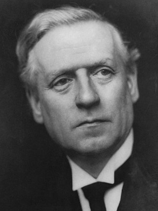
<span class="mw-page-title-main">December 1910 United Kingdom general election</span>

The December 1910 United Kingdom general election was held from 3 to 19 December. It was the last general election to be held over several days and the last to be held before the First World War.
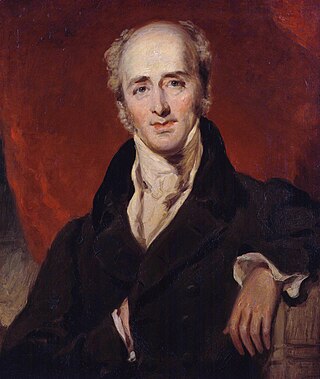
<span class="mw-page-title-main">2004 European Parliament election in the United Kingdom</span> Election

The 2004 European Parliament election was the United Kingdom's part of the wider 2004 European Parliament election which was held between 10 and 13 June 2004 in the 25 member states of the European Union. The United Kingdom's part of this election was held on Thursday 10 June 2004. The election also coincided with the 2004 local elections and the London Assembly and mayoral elections. In total, 78 Members of the European Parliament were elected from the United Kingdom using proportional representation.

<span class="mw-page-title-main">Lists of places in Wales</span>

These are lists of places in Wales.

<span class="mw-page-title-main">Member of Parliament (United Kingdom)</span> Representative in the House of Commons

In the United Kingdom, a member of Parliament (MP) is an individual elected to serve in the House of Commons, the lower house of the Parliament of the United Kingdom.
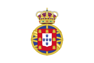
<span class="mw-page-title-main">United Kingdom of Portugal, Brazil and the Algarves</span> Pluricontinental monarchy

The United Kingdom of Portugal, Brazil and the Algarves was a pluricontinental monarchy formed by the elevation of the Portuguese colony named State of Brazil to the status of a kingdom and by the simultaneous union of that Kingdom of Brazil with the Kingdom of Portugal and the Kingdom of the Algarves, constituting a single state consisting of three kingdoms.

<span class="mw-page-title-main">Unitary authorities of England</span> Local government in some parts of England

The unitary authorities of England are a type of local authority responsible for all local government services in an area. They combine the functions of a non-metropolitan county council and a non-metropolitan district council, which elsewhere in England provide two tiers of local government.

<span class="mw-page-title-main">Kingdom of Portugal</span> Kingdom in Southwestern Europe (1139–1910)

The Kingdom of Portugal was a monarchy in the western Iberian Peninsula and the predecessor of the modern Portuguese Republic. Existing to various extents between 1139 and 1910, it was also known as the Kingdom of Portugal and the Algarves after 1415, and as the United Kingdom of Portugal, Brazil and the Algarves between 1815 and 1822. The name is also often applied to the Portuguese Empire, the realm's overseas colonies.

<span class="mw-page-title-main">United Kingdom in the Eurovision Song Contest</span>

The United Kingdom has participated in the Eurovision Song Contest 66 times. Its first participation was at the second contest, in 1957, and it has entered every year since 1959. The British participant broadcaster in the contest is the British Broadcasting Corporation (BBC). The country has won the contest five times: in 1967, with "Puppet on a String" performed by Sandie Shaw; in 1969, with "Boom Bang-a-Bang" by Lulu ; in 1976, with "Save Your Kisses for Me" by Brotherhood of Man; in 1981, with "Making Your Mind Up" by Bucks Fizz; and in 1997, with "Love Shine a Light" by Katrina and the Waves. The UK has also achieved a record sixteen second-place finishes, the first in 1959 and the most recent in 2022.

<span class="mw-page-title-main">New Zealand–United Kingdom relations</span> Bilateral relations

New Zealand–United Kingdom relations are the bilateral relations between New Zealand and the United Kingdom. New Zealand has maintained a close relationship with Britain, since gaining independence from the United Kingdom.

<span class="mw-page-title-main">Countries of the United Kingdom</span> Component parts of the UK since 1922

Since 1922, the United Kingdom has been made up of four countries: England, Scotland, Wales and Northern Ireland. The UK Prime Minister's website has used the phrase "countries within a country" to describe the United Kingdom.