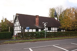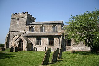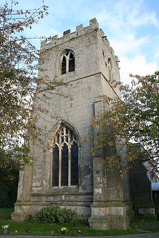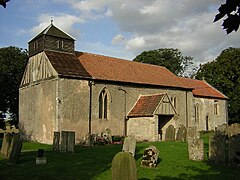
East Markham, historically also known as Great Markham, is a small village and civil parish near Tuxford, Nottinghamshire. The population of the civil parish taken at the 2011 Census was 1,160, and this increased to 1,279 in 2021. It lies about 8 km south of Retford. It is sandwiched between the East Coast Main Line, the A1 to the west and A57 to the north.

Tuxford is a historic market town and a civil parish in the Bassetlaw district of Nottinghamshire, England. It had a population of 2,809 in the 2021 census.

South Huish is a village and civil parish about 4 miles south west of Kingsbridge, in the South Hams district, in the county of Devon, England. The parish includes Galmpton and Hope Cove. According to the 2011 census the parish had a population of 473, the parish had an estimated population of 436 in 2017. The parish touches West Alvington, South Milton and Malborough. The parish is in the South Devon Area of Outstanding Natural Beauty.

North Clifton is a village and civil parish about 12 miles north of Newark-on-Trent, in the Newark and Sherwood district, in the county of Nottinghamshire, England. In 2011, the parish had a population of 216. The parish touches Thorney, Fledborough, Newton on Trent, South Clifton and Ragnall.

Swinhope is a village and civil parish about 6 miles west south west of North Thoresby railway station, in the West Lindsey district, in the county of Lincolnshire, England. In 2011 the parish had a population of 172. The parish touches Wold Newton, Thorganby, Brookenby, Binbrook and Stainton Le Vale. Swinhope doesn't have a formal parish council and instead holds parish meetings. In 2011 Nomis recorded a population of 194 which includes Thorganby parish. Swinhope was a deserted medieval village. The remains were completely destroyed in 1969 but crop marks remain within the village grounds.

Upper Broughton or Broughton-Sulney or Over-Broughton is a village and civil parish about seven miles north west of Melton Mowbray, in the Rushcliffe district of the county of Nottinghamshire, England. In 2011 the built-up area had a population of 327, the same as the parish. The parish touches Wymeswold, Hickling, Widmerpool, Broughton and Old Dalby and Willoughby on the Wolds. Upper Broughton is a conservation area that was designated in 1973 and is 16 hectares. It is near the boundary with Leicestershire, and Nether Broughton is across the county boundary.

Stoulton or Stoughton is a village and civil parish about 5 miles south west of Worcester, in the Wychavon district, in the county of Worcestershire, England. The parish includes the hamlet of Hawbridge. In 2011 the parish had a population of 453. The parish touches Norton Juxta Kempsey, Whittington, Peopleton, Drakes Broughton and Wadborough and White Ladies Aston. Many houses in the village date from the 17th century. The scientist and cleric William Derham, the first man to accurately measure the speed of sound, was born in Stoulton in 1657.

Charlecote is a small village and civil parish 5 miles (8.0 km) south of Warwick, on the River Avon, in the Stratford-on-Avon district, in the county of Warwickshire, England. In 2011 the parish had a population of 194. The parish touches Wasperton, Newbold Pacey, Wellesbourne and Walton, Stratford-upon-Avon, Loxley and Hampton Lucy. Most of the village is a conservation area. The soil is rich loam and lies on gravel and sand.

Hindlip or Hinlip is a village and civil parish 3 miles (4.8 km) north east of Worcester, in the Wychavon district, in the county of Worcestershire, England. In 2011 the parish had a population of 180. The parish touches Tibberton, Martin Hussingtree, Salwarpe, Oddingley, Warndon and North Claines.

Putley is a village and civil parish 8 miles (13 km) east of Hereford, in the county of Herefordshire, England. In 2011 the parish had a population of 245. The parish borders Aylton, Woolhope, Pixley, Much Marcle and Tarrington.

West Drayton is a village and civil parish in the Bassetlaw district in the county of Nottinghamshire, England. It lies 24 miles (39 km) north east of Nottingham and 4 miles (6.4 km) south of Retford.

Hodsock is a village and civil parish about 4 miles from Worksop, in the Bassetlaw district, in the county of Nottinghamshire, England. The parish includes the village of Langold and the country house Hodsock Priory. In 2021 the parish had a population of 2,603. The parish is surrounded by the settlements of Babworth, Barnby Moor, Blyth, Carlton in Lindrick, Costhorpe, Firbeck, Letwell, Maltby, Styrrup with Oldcotes and Torworth.

Styrrup with Oldcotes is a civil parish in the Bassetlaw district, within the county of Nottinghamshire, England. The overall area had a population of 731 at the 2021 census, an increase from 684 at the 2011 census. The parish lies in the north of the county. It is 31 miles north of Nottingham, and 15 miles east of Sheffield. The parish rests alongside the county border with South Yorkshire.

Headon cum Upton is a civil parish in the Bassetlaw district, in the county of Nottinghamshire, England. The parish includes the villages of Headon, Upton and the hamlet of Nether Headon. The parish is adjacent to Askham, Gamston, East Drayton, Eaton, Grove, Rampton and Woodbeck, Stokeham and Treswell. In the 2021 census, the parish had a population of 192. The area is 3.5 miles south east of the nearest market town Retford, 26 miles north east of the county town Nottingham and 125 miles north of London. Headon cum Upton shares a parish council with Grove and Stokeham. There are 6 listed buildings in Headon cum Upton.

Headon is a village in Headon cum Upton civil parish, in the Bassetlaw district, of the county of Nottinghamshire, England. The village is adjacent to the villages of Upton, Nether Headon, East Drayton, Eaton, Gamston, Woodbeck and Stokeham. In 2011 the parish, together with Stokeham had a population of 253. The area is 3.5 miles south east of the nearest market town Retford, 26 miles north east of the county town Nottingham and 125 miles north of London. There are 2 listed buildings in Headon village.

Marnham is a civil parish in the Bassetlaw district, in the county of Nottinghamshire, England. The parish includes the village of Low Marnham and the hamlets of High Marnham and Skegby. In the census of 2021 the parish had a population of 136. The parish lies in the north east of the county, and south east within the district. It is 122 miles north of London, 23 miles north east of the city of Nottingham, and 17 miles north east of the market town of Mansfield. The parish touches Fledborough, Normanton on Trent, South Clifton, Tuxford and Weston. Marnham shares a parish council with Normanton on Trent. There are 7 listed buildings in Marnham.

Clumber and Hardwick is a civil parish in the Bassetlaw district, in the county of Nottinghamshire, England. The parish includes the settlement of Hardwick Village and Clumber Park, a country park. In the UK census of 2021 the parish had a population of 66. The parish lies in the north west of the county, and south west within the district. It is 125 miles north west of London, 22 miles north of the city of Nottingham, and 3½ miles south east of the market town of Worksop.The parish touches Babworth, Carburton, Elkesley, Perlethorpe cum Budby and Welbeck. The parish was formed on 1 April 1994. The area is within Sherwood Forest and has close historical associations with the Dukes of Newcastle, being part of a wider region known as The Dukeries. There are 26 listed buildings in Clumber and Hardwick.

South Wheatley is a village and former civil parish, now within the North and South Wheatley civil parish, of Bassetlaw district, in the county of Nottinghamshire, England. In 2001 South Wheatley parish had a population of 102. It is 130 miles north of London, 30 miles north east of the county town of Nottingham, and 5 miles north east of the Nottinghamshire town of Retford. There are 4 listed buildings in South Wheatley.

Skegby is a hamlet within the Marnham civil parish in Bassetlaw district, of the county of Nottinghamshire, England. It lies in the north east of the county, south east within the district and centre south of the parish. It is 122 miles (196 km) north of London, 23 mi (37 km) north east of the city of Nottingham, and 17 mi (27 km) north east of the market town of Mansfield. There are two listed buildings in the area.

North and South Wheatley is a civil parish in the Bassetlaw district, in the county of Nottinghamshire, England. The parish includes the villages of North Wheatley and South Wheatley. In 2021 the parish had a population of 610 residents. It is 130 miles north of London, 30 miles north east of the county town of Nottingham, and 5 miles north east of the Nottinghamshire town of Retford. The parish touches Bole, Clarborough and Welham, Clayworth, Hayton, Saundby, Sturton Le Steeple and West Burton. There are 18 listed buildings in North and South Wheatley.


