
Eastwood is a former coal mining town and civil parish in the Broxtowe district of Nottinghamshire, England, 8 miles (13 km) northwest of Nottingham. Mentioned in Domesday Book, it expanded rapidly during the Industrial Revolution. The Midland Railway was formed here and it is the birthplace of D. H. Lawrence.
Coxhoe is a village in County Durham, England. It is situated about 5 miles (8 km) south of Durham City centre. The civil parish also includes nearby Quarrington Hill. The electoral ward of Coxhoe stretches beyond the boundaries of the parish and has a total population of 7,027.
Dunnockshaw or Dunnockshaw and Clowbridge is a civil parish in the borough of Burnley, in Lancashire, England. The parish is situated between Burnley and Rawtenstall. According to the United Kingdom Census 2011, the parish had a population of 185.

Harworth is an area and former civil parish, now in the parish of Harworth Bircotes in the Bassetlaw district in Nottinghamshire, England, on the border with South Yorkshire. It is 8 miles (13 km) north of Worksop. The population of the civil parish of Harworth Bircotes was 7,948 in the 2011 Census.
Rhodesia is a village and civil parish in the Bassetlaw district of Nottinghamshire, England, just west of Worksop, and 20 miles (32 km) southeast of Sheffield. At the 2021 Census, the population was 1,173.

Barrow is a civil parish, in the unitary authority of Cheshire West and Chester and the ceremonial county of Cheshire, England. The civil parish contains the village of Great Barrow and the hamlets of Little Barrow, Broomhill and Stamford Bridge. Great Barrow is situated about 4.5 miles east-north-east of Chester, 6 miles north-west of Tarporley and 6 miles south of Frodsham.

Bathley is a village and civil parish in the Newark and Sherwood district of Nottinghamshire, England, north-west of Newark-on-Trent. According to the 2011 census it had a population of 246, this increased marginally to 247 in the 2021 census. Bathley is recorded in the Domesday Book as Badeleie.
Bilsthorpe is a village and civil parish in the Newark and Sherwood district of Nottinghamshire, England. According to the 2001 census it had a population of 3,076, increasing to 3,375 at the 2011 census, and dropping slightly to 3,365 at the 2021 census. It is located near the junction of the A614 and A617, around five miles south of Ollerton, nine miles east of Mansfield and six miles north-west of Southwell.
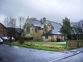
Bothamsall is a village and civil parish in the Bassetlaw district of Nottinghamshire, England.

Broughton is a village and civil parish in North Yorkshire, England. Broughton is situated 1.5 miles (2.4 km) north-west of Malton. According to the 2011 census the parish had a population of 212, a reduction from the 2001 census when it stood at 233.

Bulcote is a village and civil parish in the Newark and Sherwood district of Nottinghamshire, England. According to the 2001 census it had a population of 330, reducing to 309 at the 2011 census, and 272 at the 2021 census. The village is on the fringe of the Greater Nottingham area, and is about 7 miles north-east of Nottingham city centre. Nearby places are Burton Joyce and Lowdham.

Newstead is a village and civil parish in Nottinghamshire, England in the borough of Gedling. It is situated between the city of Nottingham and the towns of Kirkby-in-Ashfield, Sutton-in-Ashfield and Hucknall.
Costock is a village and civil parish in the Rushcliffe district of Nottinghamshire, England. The population of the civil parish was estimated at 664 in 1998, and reported at the 2011 census as 621. There were 645 residents counted at the 2021 census. Although in Nottinghamshire, Costock's closest town is Loughborough in Leicestershire.
Huncoat is a village in Lancashire, England; situated in the North West. It is located to the east of Accrington. It is a ward of Hyndburn where the population taken at the 2011 census was 4,418.

Walesby is a village and civil parish in Nottinghamshire, England. At the time of the 2001 census it had a population of 1,255 people, increasing slightly to 1,266 at the 2011 census, and dropping to 1,218 at the 2021 census. It is located 16 miles (26 km) north of Newark. The parish church of St Edmund is Perpendicular in style.
Caythorpe is a village and civil parish in Nottinghamshire, England. It is situated 10 miles (16 km) north-east from Nottingham, close to the River Trent. According to the 2001 census, it had a population of 259, increasing to 271 at the time of the 2011 census,. and dropping to 257 at the 2021 census.

Cossall is a village and civil parish 1 mile (1.6 km) east of Ilkeston in Nottinghamshire, England. The 2001 census recorded a parish population of 612, reducing slightly to 606 at the 2011 census, and further to 562 at the 2021 census. There is also a ward of Broxtowe Council called Cossall and Kimberley. The population is listed under Kimberley. North of the hamlet is a slag heap formed of tons of waste extracted from local coal mines.

South Clifton is a village and civil parish in the Newark and Sherwood district of Nottinghamshire, England. It is 11 miles north of Newark-on-Trent. With the 2011 census, the parish had a population of 326, this fell to 308 at the 2021 census. The parish touches Thorney, Girton, Fledborough, Wigsley, Marnham, Normanton on Trent, Spalford and North Clifton.

West Markham or Markham Clinton is a village and civil parish 23 miles (37 km) north east of Nottingham, in the Bassetlaw district, in the county of Nottinghamshire, England. In the 2011 census, the parish had a population of 170, and this increased marginally to 175 residents at the 2021 census. The parish touches Bevercotes, West Drayton, East Markham, Bothamsall, Walesby and Tuxford. The A1 previously went through the village but its now been bypassed.

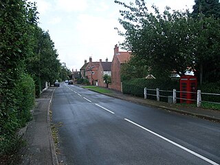
Hodsock is a village and civil parish about 4 miles from Worksop, in the Bassetlaw district, in the county of Nottinghamshire, England. The parish includes the village of Langold and the country house Hodsock Priory. In 2021 the parish had a population of 2,603. The parish is surrounded by the settlements of Babworth, Barnby Moor, Blyth, Carlton in Lindrick, Costhorpe, Firbeck, Letwell, Maltby, Styrrup with Oldcotes and Torworth.

