The A303 is a trunk road in southern England, running between Basingstoke in Hampshire and Honiton in Devon via Stonehenge. Connecting the M3 and the A30, it is part of one of the main routes from London to Devon and Cornwall. It is a primary A road throughout its length, passing through five counties.
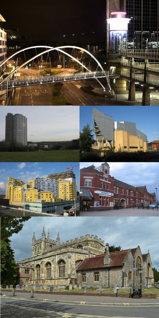
Basingstoke is a town in Hampshire, situated in south-central England across a valley at the source of the River Loddon on the western edge of the North Downs. It is the largest settlement in Hampshire without city status. It is located 30 miles (48 km) north-east of Southampton, 48 miles (77 km) south-west of London, 27 miles (43 km) west of Guildford, 22 miles (35 km) south of Reading and 20 miles (32 km) north-east of the county town and former capital Winchester. According to the 2016 population estimate, the town had a population of 113,776. It is part of the borough of Basingstoke and Deane and part of the parliamentary constituency of Basingstoke.

Andover is a town in the Test Valley district of Hampshire, England. The town is on the River Anton, a major tributary of the Test, and lies alongside the major A303 trunk road at the eastern end of Salisbury Plain, 18 miles (29 km) west of the town of Basingstoke. It is 14 miles (23 km) from Winchester, 35 miles (56 km) north of Southampton and 65 miles (105 km) from London.
Test Valley is a local government district with borough status in Hampshire, England, named after the valley of the River Test. The council is based in the borough's largest town of Andover. The borough also contains the town of Romsey and numerous villages and surrounding rural areas. A small part of the borough at its southern end lies within the New Forest National Park, and part of the borough north of Andover lies within the North Wessex Downs, a designated Area of Outstanding Natural Beauty.

Tidworth is a garrison town and civil parish in south-east Wiltshire, England, on the eastern edge of Salisbury Plain. Lying on both sides of the A338 about 3+1⁄2 miles (5.6 km) north of the A303 primary route, the town is approximately 8 miles (13 km) west of Andover, 12 miles (19 km) south of Marlborough, and 13 miles (21 km) north by north-east of Salisbury. The population of the parish at the 2011 census was approximately 10,600.

Grafton is a civil parish in Wiltshire, England, in the Vale of Pewsey about 7 miles (11 km) southeast of Marlborough. Its main settlement is the village of East Grafton, on the A338 Burbage - Hungerford road; the parish includes the village of Wilton and the hamlets of West Grafton, Marten and Wexcombe.

Lyndhurst is a large village and civil parish situated in the New Forest National Park in Hampshire, England, about nine miles (14 km) south-west of Southampton. Known as the "Capital of the New Forest", Lyndhurst houses the New Forest District Council and Court of Verderers. It is also a popular tourist attraction, with many independent shops, art galleries, cafés, museums, pubs and hotels. As of 2001 Lyndhurst had a population of 2,973, increasing to 3,029 at the 2011 Census.
Thruxton is just off the A303 road five miles (8.0 km) west of Andover. It is a village with a Manor House, thatched cottages and village green. Pillhill Brook runs from Thruxton Down through the grounds of the Manor House and along the village street to Mullen's Pond, a natural habitat for many species of migratory birds and wild plants.

Ludgershall is a town and civil parish 16 miles (26 km) north east of Salisbury, Wiltshire, England. It is on the A342 road between Devizes and Andover. The parish includes Faberstown which is contiguous with Ludgershall, and the hamlet of Biddesden which lies 2 miles (3.2 km) to the east, on the border with Hampshire.

Overton is a large village and parish in Hampshire, England, west of Basingstoke and east of Andover and Whitchurch. The village contains the smaller hamlets of Southington, Northington, Ashe, Polhampton, and Quidhampton, the latter two lying to the north of the village. The River Test has its source 1 mile (1.6 km) to the east in Ashe.

Stockbridge is a town and civil parish in the Test Valley district of Hampshire, England. It had a population of 592 at the 2011 census. It sits astride the River Test and at the foot of Stockbridge Down.

Barton Stacey is a village and undulating civil parish, which includes the hamlets of Bransbury, Newton Stacey, Drayton and Cocum, in the Test Valley district of Hampshire, England, centred about 7 miles (11 km) south-east of Andover. It is bounded to the north by the estate of Drayton Lodge, and, to the south, by the minor A30 road; both being east–west routes, and connected by The Street/Cocum Road, the main road that bisects the village. The distance between the A303 and A30 at this point is 2 miles (3.2 km), which is twice the width of the parish.

Micheldever is a village and civil parish in Hampshire, England, situated 6 miles (10 km) north of Winchester. It lies upon the River Dever.

Longparish is a village and civil parish in Hampshire, England. It is composed of the five hamlets of Middleton, East Aston, West Aston ,Forton and Longparish Station that over time have expanded and effectively joined up to become one village. Longparish is situated on the northwest bank of the River Test. In 2011 the population was 716.

Penton Mewsey is a village and civil parish in Hampshire, England. It is located 2 miles (3.2 km) north-west of Andover.

Sparkford is a village and civil parish in Somerset, England. The parish includes the village of Weston Bampfylde.

Kimpton is a village and civil parish in the Test Valley district of Hampshire, England. The village is situated west of Andover, in the north of the county, and has a boundary with Ludgershall, in Wiltshire. South of Kimpton there is Thruxton motor racing circuit, in the parish of Thruxton.
Penton Grafton is a village and civil parish in the Test Valley district of Hampshire, England. It is adjacent to the village and parish of Penton Mewsey. Both villages are collectively known as The Pentons.

Clanville is a hamlet in the civil parish of Penton Grafton in the Test Valley district of Hampshire, England. The hamlet lies within the North Downs Area Of Outstanding Natural Beauty on the Hampshire-Wiltshire border. Its nearest town is Andover, which lies approximately 5.6 miles (9.1 km) south-east from the village.