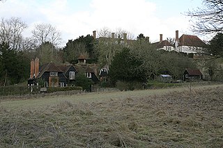
Broughton is a hamlet and civil parish to the east of Aylesbury in Buckinghamshire, England. Broughton is also the name of a nearby housing estate in Aylesbury itself.
Marsh is a hamlet in the civil parish of Great and Little Kimble cum Marsh in Buckinghamshire, England. The hamlet name comes from the name of the Earls of Pembroke in the 12th and 13th centuries and was previously called Marshals.

Foscott is a hamlet and civil parish in north Buckinghamshire, England. At the 2011 Census the population of the hamlet was included in the civil parish of Thornton. In the 20th century a reservoir was built within Foscote, named Foxcote Reservoir. It is just to the north of Maids Moreton.

Warrington is a hamlet and civil parish in the unitary authority area of the City of Milton Keynes, Buckinghamshire, England, near Olney and on either side of the A509. It formed part of the parish of Olney until 1866. At the 2011 Census the population of the hamlet was included in the civil parish of Lavendon.
Woodham is a hamlet and civil parish about 7.5 miles (12.1 km) west of Aylesbury in Buckinghamshire. At the 2011 Census the population of the hamlet was included in the civil parish of Kingswood.

Moggerhanger is a village in the English county of Bedfordshire. It is west of Sandy on the road to Bedford. Its population in 2001 was 636, but had reduced to 620 at the 2011 Census. In the twentieth century the village name was spelled variously as: Moggerhanger, Mogerhanger, Muggerhanger and Morehanger. Local pronunciation of the name is as Morhanger.

Twyford is a hamlet and civil parish in the English county of Norfolk. It is situated on the A1067 road, some 12 km (7.5 mi) south-east of the town of Fakenham and 28 km (17 mi) north-west of the city of Norwich.

Nuthampstead is a small village and civil parish in North East Hertfordshire located a few miles south of the town of Royston. In the 2001 census the parish had 139 residents, increasing to 142 at the 2011 Census.

Tunstall is a village and civil parish in Suffolk, England. There are two settlements named Tunstall next to each other, 7.5 miles (12.1 km) north east of Woodbridge. However, these are not two separate villages but one, despite the gap between the main village and the hamlet known as Tunstall Common. Both lie within the parish of Tunstall.

Fulwell is a hamlet in the civil parish of Enstone in Oxfordshire, England. It lies about 4.5 miles (7 km) southeast of Chipping Norton. Fulwell's toponym is derived from its "foul well". The hamlet was part of the manor of Spelsbury in the ancient parish and later civil parish of Spelsbury. In 1985 Fulwell was transferred to the civil parish of Enstone.

Swyncombe is a hamlet and large civil parish in the high Chilterns, within the Area of Outstanding Natural Beauty about 4+1⁄2 miles (7 km) east of Wallingford, Oxfordshire, England. Swyncombe hamlet consists almost entirely of its Church of England parish church of Saint Botolph, the former rectory and Swyncombe House. The population of the parish is in the hamlets of Cookley Green and Russell's Water, and the scattered hamlet of Park Corner. The 2011 Census recorded the parish's population as 250. It is partially forested and is the fifth largest of 87 civil parishes in the District.

Hyde is a village and civil parish in the New Forest near Fordingbridge in Hampshire, England.

Chilson is a hamlet and civil parish in the Evenlode Valley in West Oxfordshire, England, about 4+1⁄2 miles (7 km) south of Chipping Norton. The civil parish also includes the hamlet of Shorthampton, about 2⁄5 mile (1 km) north east of Chilson. The 2011 Census recorded the parish's population as 141. The toponym, first recorded as Cildestuna in about 1200, is derived from the Old English ċildes tūn, meaning "estate of the young nobleman".

Southrope is a hamlet in the civil parish of Herriard, Hampshire. It has one pub, named the Fur and Feathers. The hamlet was once considered a part of the civil parish Bentworth, until the late 19th century. Its nearest town is Alton, which lies approximately 5.8 miles (9.3 km) south-east from the hamlet. The hamlet's toponym derives from Old English Sūþrop, meaning south village.

East End is a hamlet in the civil parish of East Boldre in the New Forest National Park of Hampshire, England. Its nearest town is Lymington, which lies approximately 4.2 miles (6.7 km) south-west from the hamlet.

Hungerford is a hamlet in the New Forest National Park of Hampshire, England. Its nearest town is Fordingbridge, which lies approximately 2 miles (3.4 km) north-west of the village.

Gorley Lynch is a hamlet in the civil parish of Gorley in the New Forest National Park of Hampshire, England. It is in the civil parish of Hyde. Its nearest town is Fordingbridge, which lies approximately 3.2 miles (4.7 km) north-west from the hamlet.

Marsh Court is a hamlet in the civil parish of Stockbridge in the Test Valley district of Hampshire, England. It is in the civil parish of Kings Somborne. Its nearest town is Stockbridge, which lies approximately 0.7 miles (1.4 km) north from the hamlet.
South Harewood is a hamlet and civil parish in the Test Valley district of Hampshire, England. At the 2011 Census the population according to the Post Office was included in the civil parish of Wherwell. Its nearest town is Andover, which lies approximately 2.5 miles (5.7 km) north-west from the hamlet.


