
Hornchurch is a suburban town in East London in the London Borough of Havering. It is located 15.2 miles (24.5 km) east-northeast of Charing Cross. It comprises a number of shopping streets and a large residential area. It historically formed a large ancient parish in the county of Essex that became the manor and liberty of Havering. The economic history of Hornchurch is underpinned by a shift away from agriculture to other industries with the growing significance of nearby Romford as a market town and centre of administration. As part of the suburban growth of London in the 20th century, Hornchurch significantly expanded and increased in population, becoming an urban district in 1926 and has formed part of Greater London since 1965. It is the location of Queen's Theatre, Havering Sixth Form College and Havering College of Further and Higher Education.

Romsey is a town in the Test Valley district of Hampshire, England. The town is situated 7 miles (11 km) northwest of Southampton, 11 miles (18 km) southwest of Winchester and 17 miles (27 km) southeast of Salisbury. It sits on the outskirts of the New Forest, just over 3 miles (4.8 km) northeast of its eastern edge. The population of Romsey was 14,768 at the 2011 census.
Cambourne is a town and civil parish in Cambridgeshire, England, in the district of South Cambridgeshire. It is a new settlement and lies on the A428 road between Cambridge, 9 miles (14 km) to the east, and St Neots and Bedford to the west. It comprises the three areas of Great Cambourne, Lower Cambourne and Upper Cambourne. The area is close to Bourn Airfield.

Test Valley is a local government district with borough status in Hampshire, England, named after the valley of the River Test. The council is based in the borough's largest town of Andover. The borough also contains the town of Romsey and numerous villages and surrounding rural areas. A small part of the borough at its southern end lies within the New Forest National Park, and part of the borough north of Andover lies within the North Wessex Downs, a designated Area of Outstanding Natural Beauty.

Kenilworth Road, known affectionately as The Kenny, is an association football stadium in Bury Park, Luton, Bedfordshire, England. It has been the home ground of Luton Town since 1905. The stadium has also hosted women's and youth international matches, including the second leg of the 1984 European Competition for Women's Football final.

Chelmsley Wood, sometimes called just Chelmsley, is a town and civil parish in the Metropolitan Borough of Solihull, West Midlands, England, with a population of 12,453. It is located near Birmingham Airport and the National Exhibition Centre. It lies about eight miles east of Birmingham and 5 miles to the north of Solihull. The town is also close to both Coleshill and Water Orton in Warwickshire, the county the area was historically part of.
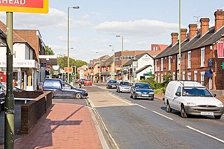
Chandler's Ford is a largely residential area and civil parish in the Borough of Eastleigh in Hampshire, England. It had a population of 21,436 in the 2011 Census.
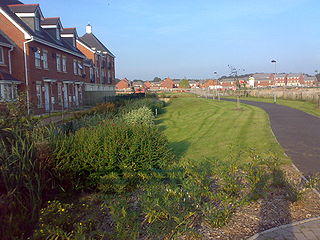
Buckshaw Village is a 21st-century residential and industrial area between the towns of Chorley and Leyland in Lancashire, England, developed on the site of the former Royal Ordnance Factory (ROF) Chorley. It had a population of 4,000. It is divided between the civil parishes of Euxton (south) and Whittle-le-Woods in Chorley, with the north western part being in Leyland unparished area in South Ribble district.
A local planning authority (LPA) is the local government body that is empowered by law to exercise urban planning functions for a particular area. They exist in the United Kingdom and India.
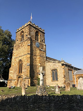
Collingtree is a village and civil parish in the West Northamptonshire district of Northamptonshire, England. It is part of the Northampton built-up area.

Horsebridge was a railway station on the closed Sprat and Winkle Line which served the Hampshire village of Houghton. It closed in 1964, a casualty of the closure programme proposed by the Beeching Axe which sounded the death knell for many rural railway stations.

Horton Heath is a semi-rural village which forms part of the civil parish of Fair Oak and Horton Heath in the borough of Eastleigh in Hampshire, England. The village is about three miles southeast of Eastleigh town centre, and adjoins the village of Fair Oak.
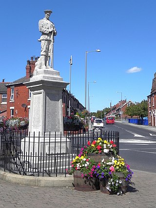
Medlar-with-Wesham is a civil parish and an electoral ward on the Fylde in Lancashire, England, which contains the town of Wesham. It lies within the Borough of Fylde, and had a population of 3,245 in 1,294 households recorded in the 2001 census rising to 3,584 in 1,511 households, at the 2021 census.
Ebbsfleet Valley is a new town and redevelopment area in Kent, South East England, and part of the Thames Gateway, southwest of Gravesend. Development is coordinated by the Ebbsfleet Development Corporation.

Caroline Fiona Ellen Nokes is a British Conservative Party politician who has been the Member of Parliament (MP) for Romsey and Southampton North since 2010. Elected as a Conservative, Nokes had the Conservative whip removed on 3 September 2019 and sat as an independent politician until the whip was restored to her on 29 October.

Brent Cross Cricklewood is a new town centre development under construction in Hendon and Cricklewood, London, United Kingdom. The development is planned to cost around £4.5 billion to construct and will include 6,700 homes, workspace for 25,000 people, four parks, transport improvements and a 592,000 sq ft (55,000 m2) extension of Brent Cross Shopping Centre. The developers of the scheme are Hammerson and Standard Life.

Den Brook Wind Farm is a windfarm in Devon, England. The windfarm is located 2 kilometres (1.2 mi) south-east of North Tawton and 2.5 kilometres (1.6 mi) south-west of Bow, and comprises nine 2 MW wind turbines, each 120 metres (390 ft) high. Developer Renewable Energy Systems (RES) received planning consent for the project in December 2009, following a long planning process which included two public inquiries and a judicial review.

Romsey Extra was a civil parish in the Borough of Test Valley and the English county of Hampshire. At the 2011 census, it had a population of 3,276, although due to the ongoing 800 home Abbotswood development that begun after the census was taken, it was likely to have risen significantly by the next Census and by 50% between 2012 and 2018. In 2014 there was a proposal for a new 1300 home development at Whitenap.

Forge Wood is the 14th residential neighbourhood in Crawley, a town and borough in West Sussex. The 1,900 houses and other facilities will be built on open land in the northeast of the borough, adjoining the ancient village of Tinsley Green and to the north of the Pound Hill neighbourhood.
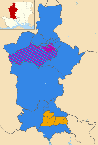
The 2019 Test Valley Borough Council election took place on 2 May 2019 to elect members of Test Valley Borough Council in England. This was on the same day as other local elections. The whole council was up for election on new boundaries, with the number of seats reduced from 48 across 24 wards to 43 across 20.


