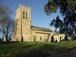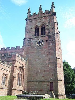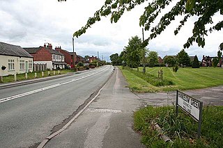
Saltfleet is a coastal village in the East Lindsey district of Lincolnshire, England. It is approximately 8 miles (13 km) north of Mablethorpe and 11 miles (18 km) east of Louth.

Lingfield is a village and civil parish in the Tandridge district of Surrey, England, approximately 23 miles (37 km) south of London. Several buildings date from the Tudor period and the timber-frame medieval church is Grade I listed. The stone cage or old gaol, constructed in 1773, was last used in 1882 to hold a poacher.

Appleshaw is a village and Civil parish in the Test Valley district of north-west Hampshire, England.

Arthingworth is a civil parish and village in the West Northamptonshire area of the county of Northamptonshire, England. The population of the civil parish at the 2011 census was 238.

Maidwell is a village and civil parish in West Northamptonshire in England. At the time of the 2001 census, the parish had 325 inhabitants, including Draughton, and this increased to 429 at the 2011 census.

Ripley is a village and civil parish in Surrey, England. It is centred 6.2 miles (10.0 km) southeast of Woking, 6.8 miles (10.9 km) northeast of Guildford and 22.5 miles (36.2 km) southwest of London. Neighbouring villages Send and Send Marsh to the South-West and Ockham to the East have fewer shopping facilities.

Sulham is a village in West Berkshire, England. The larger village of Tidmarsh is adjacent to Sulham on the west side, with Tilehurst on the east side.

Beech Hill is a small village and civil parish in Berkshire, England. It is in the south east of the West Berkshire unitary authority area and bounds Hampshire and Wokingham district.

Wasing is an agricultural and woodland village, country estate and civil parish in West Berkshire, England owned almost wholly by the descendants of the Mount family. In local administration, its few inhabitants convene their own civil parish, but share many facilities with Brimpton which was in its civil parish at the time of the 2011 Census.

Axmouth is a village, civil parish and former manor in the East Devon district of Devon, England, near the mouth of the River Axe. The village itself is about 1 mile (1.6 km) inland, on the east bank of the Axe estuary. The parish extends along the estuary to the sea, and a significant distance to the east. The village is near Seaton and Beer which are on the other side of the Axe estuary.

Bainton is a village and civil parish in the Peterborough unitary authority area of Cambridgeshire, England. Bainton is on the southern edge of the Welland valley and lies 7.4 miles (11.9 km) north-west of Peterborough and 4 miles (6.4 km) east of Stamford. Ashton is a neighbouring hamlet and lies approximately 1 mile (1.6 km) south-east of Bainton within the same civil parish. At the time of the 2001 census, the parish's population was 305 people by the 2011 census the parish's population was 290 people and by the 2021 census the parish's population was 330 people.

Barthomley is a village and ancient parish, and is now a civil parish in the unitary authority of Cheshire East and the ceremonial county of Cheshire, England. According to the 2001 and the 2011 census' the parish had a population of 202. The village is situated near junction 16 of the M6 motorway and by the border with Staffordshire. It is about three miles south-west of Alsager.

Buerton is a village at SJ685435 and civil parish in the unitary authority of Cheshire East and the ceremonial county of Cheshire, England, about 7 miles south of the town of Nantwich and 1½ miles east of the village of Audlem, on the border with Shropshire. The parish also includes the small settlements of Hankins Heys, Moblake, Pinder's End and Three Wells, as well as parts of Chapel End, College Fields, Kinsey Heath, Longhill, Raven's Bank, Sandyford and Woolfall. In 2001, the total population was a little under 500, which had increased marginally to 503 at the 2011 Census. Nearby villages include Adderley, Audlem, Bridgemere, Hankelow, Hatherton, Hunsterson and Woore.

Otham is a village and civil parish in the Maidstone district of Kent, England. The population of the civil parish at the 2011 census was 523, with 204 dwellings.

Peckforton is a scattered settlement and civil parish in the unitary authority of Cheshire East and the ceremonial county of Cheshire, England. The settlement is located 6.5 miles (10.5 km) to the north east of Malpas and 7.5 miles (12.1 km) to the west of Nantwich. The civil parish covers 1,754 acres (710 ha), with an estimated total population of 150 in 2006. The area is predominantly agricultural. Nearby villages include Bulkeley to the south, Beeston to the north, Higher Burwardsley to the west, Spurstow to the east and Bunbury to the north east.

Spurstow is a village and civil parish in the unitary authority of Cheshire East and the ceremonial county of Cheshire, England, which is located 6½ miles to the north west of Nantwich. The parish also includes the settlement of Spurstow Sketh and part of Radmore Green. The total population is a little over 400 people. Nearby villages include Bunbury, Haughton and Peckforton. The parish is mentioned in the Domesday Book of 1086 and contains a salt spring, which was formerly used as a spa.

Fyfield is a village and civil parish in the Test Valley district of north-west Hampshire, England.

Hankelow is a village and civil parish in the unitary authority of Cheshire East and the ceremonial county of Cheshire, England. The village lies on the A529, around 1.25 miles (2.0 km) north east of Audlem and 4.5 miles (7.2 km) south of Nantwich. The civil parish has an area 369 hectares and also includes the small settlement of The Dell and part of Corbrook, with a total population of just over 260 in 2011. Nearby villages include Aston, Broomhall Green, Sound, Hatherton and Buerton in Cheshire and Woore in Shropshire.

Grainthorpe is a small village and civil parish in the East Lindsey district of Lincolnshire, England. It is situated 7 miles (11 km) north-east from the town of Louth, and approximately 3 miles (5 km) from the Lincolnshire coast. The civil parish includes the hamlets of Wragholme to the north-west, and Ludney to the south-east. The population of Conisholme is included in the 2011 census.

Langton by Spilsby, sometimes called Langton by Partney, is a village and civil parish in the East Lindsey district of Lincolnshire, England. It is situated approximately 4 miles (6 km) north from the town of Spilsby, Lincolnshire. The civil parish includes the hamlet of Sutterby. From the 2011 census the population is included in the civil parish of Sausthorpe.


