Weston in Gordano

Last updated

Weston in Gordano
Weston in Gordano church.jpg
Somerset UK location map.svg
Red pog.svg
Weston in Gordano
Location within Somerset
Population301 (2011) [1]
OS grid reference ST450742
Unitary authority
Ceremonial county
Region
Country England
Sovereign state United Kingdom
Post town BRISTOL
Postcode district BS20
Dialling code 01275
Police Avon and Somerset
Fire Avon
Ambulance South Western
UK Parliament
List of places
UK
England
Somerset
51°27′50″N2°47′28″W / 51.4640°N 2.7911°W / 51.4640; -2.7911

Weston in Gordano is a village and civil parish in Somerset, England. It is situated in the middle of the Gordano valley on the north side, and in the Unitary Authority of North Somerset, on the road between Clevedon and Portishead. The parish has a population of 301. [1]

Contents

It is the largest village in the valley, with a public house, the 18th century White Hart, [2] and a garage.

History

The parish of Weston was part of the Portbury Hundred. [3]

Governance

The parish council has responsibility for local issues, including setting an annual precept (local rate) to cover the council's operating costs and producing annual accounts for public scrutiny. The parish council evaluates local planning applications and works with the local police, district council officers, and neighbourhood watch groups on matters of crime, security, and traffic. The parish council's role also includes initiating projects for the maintenance and repair of parish facilities, such as the village hall or community centre, playing fields and playgrounds, as well as consulting with the district council on the maintenance, repair, and improvement of highways, drainage, footpaths, public transport, and street cleaning. Conservation matters (including trees and listed buildings) and environmental issues are also of interest to the council.

The parish falls within the unitary authority of North Somerset which was created in 1996, as established by the Local Government Act 1992. It provides a single tier of local government with responsibility for almost all local government functions within its area including local planning and building control, local roads, council housing, environmental health, markets and fairs, refuse collection, recycling, cemeteries, crematoria, leisure services, parks, and tourism. It is also responsible for education, social services, libraries, main roads, public transport, Trading Standards, waste disposal and strategic planning, although fire, police and ambulance services are provided jointly with other authorities through the Avon Fire and Rescue Service, Avon and Somerset Constabulary and the South Western Ambulance Service.

North Somerset's area covers part of the ceremonial county of Somerset but it is administered independently of the non-metropolitan county. Its administrative headquarters is in the town hall in Weston-super-Mare. Between 1 April 1974 and 1 April 1996, it was the Woodspring district of the county of Avon. [4] Before 1974 that the parish was part of the Long Ashton Rural District. [5]

The parish is represented in the House of Commons of the Parliament of the United Kingdom as part of the North Somerset constituency. It elects one Member of Parliament (MP) by the first past the post system of election, currently Liam Fox of the Conservative Party. It was also part of the South West England constituency of the European Parliament prior to Britain leaving the European Union in January 2020, which elected seven MEPs using the d'Hondt method of party-list proportional representation.

Geography

There are two nearby nature reserves, both owned and managed by the Avon Wildlife Trust. Weston Big Wood is 38 hectares of ancient woodland, and Weston Moor is 59 hectares of wet grassland. Weston Big Wood falls within a wider biological Site of Special Scientific Interest. The wood itself dates at least from Iron Age times, with some evidence that there has been woodland here since trees began to recolonise after the last ice age some 10,000 years ago. Some of its internal features e.g. old stones, ditches and banks are thought to be medieval boundaries, dating from the Middle Ages and used to divide the wood into sectors. [6] Adjacent to the wood on its southern side is a large quarry. The woodland sits on a ridge of Carboniferous Limestone, and its slopes are covered with small-leaved lime trees; oak and hazel are more common on flatter hilltop areas. Rare whitebeams are also dotted throughout the wood. [7] The rare plant purple gromwell is found at the site. [7] [8] Other flowers include; wood anemones, violets and bluebells. The presence of other plants such as herb paris and yellow archangel together with the purple gromwell, show that this wood is ancient. [6] There is a wide coppiced open area inside the wood, created as a butterfly feature as part of the reserve management work, called "The Ride". Butterflies such as the orange tip, speckled wood and purple hairstreak can be seen in the area in summer. The birds commonly seen, include woodpecker, nuthatch, and tawny owl. Bats also roost in the trees, and the presence of many setts indicates a large badger population. Middle Hill Common is an area of grassland and wild flower meadow, [9] which supports invertebrates and butterflies. [10]

Weston-in-Gordano SSSI is a geological Site of Special Scientific Interest and Geological Conservation Review site because temporary exposures here have shown Pleistocene sediments, including interglacial fluvial sands and marine gravels and cold-stage fluvial gravels. Rich molluscan faunas have been reported from the section. The presence of freshwater and marine interglacial deposits gives it great potential importance for the understanding of the Quaternary sequence of the Vale of Gordano and Avonmouth lowlands. [11]

Religious sites

The parish Church of SS Peter & Paul has a tower and porch which were built around 1300, while the rest of the building is from the 15th century. It has been designated as a Grade I listed building. [12]

Related Research Articles

<span class="mw-page-title-main">North Somerset</span> District in England

North Somerset is a unitary authority in the ceremonial county of Somerset, England. The council is based in Weston-super-Mare, the area's largest town. The district also contains the towns of Clevedon, Nailsea and Portishead, along with a number of villages and surrounding rural areas. Some southern parts of the district fall within the Mendip Hills, a designated Area of Outstanding Natural Beauty.

<span class="mw-page-title-main">Portishead, Somerset</span> Town in Somerset, England

Portishead is a town and civil parish in the North Somerset unitary authority area, in the county of Somerset, England. The town has a population of 27,000 and is located next to the Severn Estuary opposite Cardiff and Newport in Wales. The town is 8 miles (13 km) to the west of Bristol and 18 miles northeast of Weston-super-Mare.

The Avon Wildlife Trust aims to protect and promote wildlife in the area of the former county of Avon — now Bath and North East Somerset, Bristol, North Somerset and South Gloucestershire, in England. It has its headquarters in Bristol and runs wildlife centres at Folly Farm, Somerset and Grow Wilder, Frenchay, North Bristol.

<span class="mw-page-title-main">Tickenham</span> Human settlement in England

Tickenham is a village and civil parish near Clevedon and Nailsea in North Somerset, England. The parish has a population of 910. It has a primary school, a village hall and a garden centre, but no shops, although it formerly had a post office.

<span class="mw-page-title-main">Easton in Gordano</span> Village in Somerset, England

Easton in Gordano is a village in Somerset, England, about 4+12 miles (7 km) northwest of Bristol city centre. It is part of the civil parish of Pill and Easton-in-Gordano and within the unitary authority of North Somerset. In 2011 the population of the parish was 4,828.

<span class="mw-page-title-main">Kingston Seymour</span> Human settlement in England

Kingston Seymour is a small village and civil parish with royal status in Somerset, England. It is situated within the unitary authority of North Somerset, between Clevedon and Weston-super-Mare on the North Somerset Levels. The parish has a population of 388.

<span class="mw-page-title-main">Gordano Valley</span> Nature reserve in Somerset, England

Gordano is an area of North Somerset, in England. It has been designated as a National Nature Reserve.

<span class="mw-page-title-main">Clapton in Gordano</span> Human settlement in England

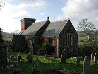
Clapton in Gordano is a village and civil parish in Somerset, England. It is situated within the unitary authority of North Somerset on the southern side of the Gordano Valley, immediately adjacent to the M5 motorway. The parish has a population of 348. There is a village football club, Clapton in Gordano FC. They currently run two sides with a view to continue progressing throughout the leagues. Their home ground is currently Clapton Lane, Portishead.

<span class="mw-page-title-main">Walton in Gordano</span> Human settlement in England

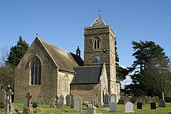
Walton in Gordano is a village and civil parish in North Somerset, England. It is situated in a small valley at the side of the south-western end of the Gordano Valley, about a mile from Clevedon. The parish has a population of 273.

<span class="mw-page-title-main">Brockley, Somerset</span> Human settlement in England

Brockley is a village and civil parish in Somerset, England. The parish is within the unitary authority of North Somerset, about 3 miles (4.8 km) south of Nailsea, and includes the village of Chelvey. According to the 2011 census it had a population of 277.

<span class="mw-page-title-main">Leigh Woods National Nature Reserve</span> National nature reserve near Bristol, England

Leigh Woods is a 2-square-kilometre (0.77 sq mi) area of woodland on the south-west side of the Avon Gorge, close to the Clifton Suspension Bridge, within North Somerset opposite the English city of Bristol and north of the Ashton Court estate, of which it formed a part. Stokeleigh Camp, a hillfort thought to have been occupied from the third century BC to the first century AD and possibly also in the Middle Ages, lies within the reserve on the edge of the Nightingale Valley. On the bank of the Avon, within the reserve, are quarries for limestone and celestine which were worked in the 18th and 19th centuries are now derelict.

<span class="mw-page-title-main">Worlebury Hill</span>

Worlebury Hill is the name given to an upland area lying between the flatlands of Weston-super-Mare and the Kewstoke area of North Somerset, England. Worlebury Hill's rises from sea level to its highest point of 109 metres (358 ft), and the western end of the hill forms a peninsula, jutting out into the Bristol Channel, between Weston Bay and Sand Bay. A toll road follows the coast around the hill from Sand Bay in the north to the now derelict Birnbeck Pier in the west, although tolls are not currently collected on the road. Worlebury Golf Club is situated on the Hill and the area is known for being one of the wealthiest areas in the county of Somerset.

<span class="mw-page-title-main">Weston-in-Gordano SSSI</span>

Weston-in-Gordano SSSI is a 12.55 hectare geological Site of Special Scientific Interest near the village of Weston in Gordano, North Somerset, notified in 1993.

<span class="mw-page-title-main">Weston Big Wood</span> Woodland near Portishead, England

Weston Big Wood is a 37.48 hectare woodland west of the town of Portishead, North Somerset, England. It is a nature reserve and biological Site of Special Scientific Interest, notified in 1971. The wood takes its name from the nearby village of Weston-in-Gordano.

<span class="mw-page-title-main">Rodney Stoke SSSI</span> Site of Special Scientific Interest in the Mendip Hills, Somerset

Rodney Stoke is a 69.6 hectare biological Site of Special Scientific Interest, just north of the village of Rodney Stoke in the Mendip Hills, Somerset, notified in 1957.

<span class="mw-page-title-main">Aller and Beer Woods</span>

Aller and Beer Woods is a 56.9 hectares biological Site of Special Scientific Interest. off the A372 Othery to Langport road near Aller in Somerset. It was notified in 1952.

<span class="mw-page-title-main">Cleeve, Somerset</span> Human settlement in England

Cleeve is a village and civil parish in the ceremonial county of Somerset, England. It is situated within the unitary authority of North Somerset, 9 miles (14 km) south west of Bristol and has a population of 902.

There are several nature reserves in the surroundings of Nailsea, North Somerset, England, which is located at 51°25′55″N2°45′49″W.

<span class="mw-page-title-main">Clapton Moor</span> Nature reserve in Somerset, England

Clapton Moor is a 40-hectare (99-acre) Avon Wildlife Trust nature reserve and part of the Gordano Valley, Clapton Moor, Middle Bridge and rhynes Site of Nature Conservation Interest in Somerset, England.

References

  1. 1 2 "2011 Census Profile". North Somerset Council. Archived from the original (Excel) on 4 January 2014. Retrieved 4 January 2014.
  2. "The White Hart". historicengland.org.uk. English Heritage. Retrieved 13 February 2009.
  3. "Somerset Hundreds". GENUKI. Retrieved 19 October 2011.
  4. "The Avon (Structural Change) Order 1995". HMSO. Archived from the original on 30 January 2008. Retrieved 9 December 2007.
  5. "Long Ashton RD". A vision of Britain Through Time. University of Portsmouth. Retrieved 4 January 2014.
  6. 1 2 "Weston Big Wood". Reserves. Avon Wildlife Trust. Archived from the original on 26 June 2008. Retrieved 4 June 2008.
  7. 1 2 English Nature citation sheet for the site . Retrieved 16 July 2006.
  8. Myles (2000), page 168
  9. "Middle Hill Common". Natural England. Retrieved 23 August 2015.
  10. "Middle Hill Common Local Nature Reserve, Weston in Gordano". Avon Local Nature Reserves. Archived from the original on 12 August 2011. Retrieved 23 August 2015.
  11. English Nature citation sheet for the site . Retrieved 13 July 2006.
  12. "Church of St. Peter and St. Paul". historicengland.org.uk. English Heritage. Retrieved 13 February 2009.

Commons-logo.svg Media related to Weston in Gordano at Wikimedia Commons