List of United Kingdom locations: Lf-Litm

Last updated

The United Kingdom Uk-map.svg
The United Kingdom

This is part of the list of United Kingdom locations: a gazetteer of place names in the United Kingdom showing each place's locality and geographical coordinates.

Contents

Lh

LocationLocality Coordinates
(links to map & photo sources)
OS grid
reference
Lhanbryde Moray 57°38′N3°13′W / 57.63°N 03.22°W / 57.63; -03.22 NJ2761

Li

Lia–Lim

LocationLocality Coordinates
(links to map & photo sources)
OS grid
reference
Lianamul Western Isles 56°49′N7°40′W / 56.81°N 07.66°W / 56.81; -07.66 NL546836
Libanus Powys 51°55′N3°28′W / 51.91°N 03.46°W / 51.91; -03.46 SN9925
Libberton South Lanarkshire 55°40′N3°37′W / 55.67°N 03.62°W / 55.67; -03.62 NS9843
Libbery Worcestershire 52°11′N2°04′W / 52.19°N 02.07°W / 52.19; -02.07 SO9555
Liberton City of Edinburgh 55°54′N3°10′W / 55.90°N 03.16°W / 55.90; -03.16 NT2769
Liceasto Western Isles 57°49′N6°51′W / 57.82°N 06.85°W / 57.82; -06.85 NG1292
Lichfield Staffordshire 52°40′N1°50′W / 52.67°N 01.83°W / 52.67; -01.83 SK1109
Lickey Worcestershire 52°22′N2°01′W / 52.37°N 02.01°W / 52.37; -02.01 SO9975
Lickey End Worcestershire 52°20′N2°02′W / 52.34°N 02.04°W / 52.34; -02.04 SO9772
Lickfold West Sussex 51°01′N0°41′W / 51.01°N 00.68°W / 51.01; -00.68 SU9225
Lickhill Worcestershire 52°20′N2°17′W / 52.34°N 02.29°W / 52.34; -02.29 SO8072
Liddaton Devon 50°37′N4°11′W / 50.61°N 04.19°W / 50.61; -04.19 SX4582
Liddeston Pembrokeshire 51°43′N5°03′W / 51.71°N 05.05°W / 51.71; -05.05 SM8906
Liddington Swindon 51°31′N1°43′W / 51.52°N 01.71°W / 51.52; -01.71 SU2081
Liden Swindon 51°32′N1°44′W / 51.54°N 01.74°W / 51.54; -01.74 SU1883
Lidgate Derbyshire 53°17′N1°33′W / 53.28°N 01.55°W / 53.28; -01.55 SK3077
Lidgate Suffolk 52°11′N0°31′E / 52.18°N 00.51°E / 52.18; 00.51 TL7257
Lidget Doncaster 53°29′N1°01′W / 53.49°N 01.02°W / 53.49; -01.02 SE6500
Lidget Green Bradford 53°47′N1°47′W / 53.78°N 01.78°W / 53.78; -01.78 SE1432
Lidgett Nottinghamshire 53°10′N1°04′W / 53.17°N 01.07°W / 53.17; -01.07 SK6265
Lidgett Park Leeds 53°50′N1°31′W / 53.83°N 01.51°W / 53.83; -01.51 SE3238
Lidham Hill East Sussex 50°55′N0°37′E / 50.91°N 00.61°E / 50.91; 00.61 TQ8416
Lidlington Bedfordshire 52°02′N0°34′W / 52.04°N 00.57°W / 52.04; -00.57 SP9839
Lidsey West Sussex 50°49′N0°41′W / 50.81°N 00.68°W / 50.81; -00.68 SU9303
Lidsing Kent 51°19′N0°33′E / 51.32°N 00.55°E / 51.32; 00.55 TQ7862
Lidstone Oxfordshire 51°55′N1°29′W / 51.91°N 01.49°W / 51.91; -01.49 SP3524
Liff Angus 56°29′N3°05′W / 56.48°N 03.08°W / 56.48; -03.08 NO3333
Lifford Birmingham 52°24′N1°55′W / 52.40°N 01.92°W / 52.40; -01.92 SP0579
Lifton Devon 50°38′N4°17′W / 50.64°N 04.29°W / 50.64; -04.29 SX3885
Liftondown Devon 50°38′N4°19′W / 50.64°N 04.32°W / 50.64; -04.32 SX3685
Lightcliffe Calderdale 53°43′N1°47′W / 53.72°N 01.78°W / 53.72; -01.78 SE1425
Lighteach Shropshire 52°54′N2°41′W / 52.90°N 02.68°W / 52.90; -02.68 SJ5434
Lightfoot Green Lancashire 53°47′N2°44′W / 53.79°N 02.74°W / 53.79; -02.74 SD5133
Lighthorne Warwickshire 52°11′N1°31′W / 52.19°N 01.51°W / 52.19; -01.51 SP3355
Lighthorne Heath Warwickshire 52°11′N1°29′W / 52.19°N 01.48°W / 52.19; -01.48 SP3555
Lighthorne Rough Warwickshire 52°11′N1°32′W / 52.19°N 01.53°W / 52.19; -01.53 SP3255
Lightmoor Shropshire 52°38′N2°29′W / 52.64°N 02.48°W / 52.64; -02.48 SJ6705
Light Oaks Staffordshire 53°02′N2°07′W / 53.04°N 02.12°W / 53.04; -02.12 SJ9250
Lightpill Gloucestershire 51°43′N2°14′W / 51.72°N 02.23°W / 51.72; -02.23 SO8403
Lightwater Surrey 51°20′N0°41′W / 51.34°N 00.68°W / 51.34; -00.68 SU9262
Lightwood Derbyshire 53°20′N1°26′W / 53.33°N 01.44°W / 53.33; -01.44 SK3782
Lightwood (Ditton Priors)Shropshire 52°31′N2°32′W / 52.51°N 02.53°W / 52.51; -02.53 SO6491
Lightwood (Hinstock)Shropshire 52°51′N2°28′W / 52.85°N 02.46°W / 52.85; -02.46 SJ6929
Lightwood Staffordshire 52°58′N1°59′W / 52.97°N 01.98°W / 52.97; -01.98 SK0142
Lightwood City of Stoke-on-Trent 52°58′N2°07′W / 52.96°N 02.12°W / 52.96; -02.12 SJ9241
Lightwood Green Cheshire 52°58′N2°33′W / 52.97°N 02.55°W / 52.97; -02.55 SJ6342
Lightwood Green Wrexham 52°57′N2°55′W / 52.95°N 02.92°W / 52.95; -02.92 SJ3840
Lilbourne Northamptonshire 52°22′N1°10′W / 52.37°N 01.17°W / 52.37; -01.17 SP5676
Lilford Wigan 53°29′N2°31′W / 53.49°N 02.51°W / 53.49; -02.51 SD6600
Lillesdon Somerset 51°00′N2°59′W / 51.00°N 02.99°W / 51.00; -02.99 ST3023
Lilleshall Shropshire 52°44′N2°24′W / 52.73°N 02.40°W / 52.73; -02.40 SJ7315
Lilley Berkshire 51°30′N1°22′W / 51.50°N 01.36°W / 51.50; -01.36 SU4479
Lilley Hertfordshire 51°55′N0°23′W / 51.92°N 00.38°W / 51.92; -00.38 TL1126
Lilliesleaf Scottish Borders 55°31′N2°44′W / 55.51°N 02.74°W / 55.51; -02.74 NT5325
Lillingstone Dayrell Buckinghamshire 52°02′N0°59′W / 52.04°N 00.98°W / 52.04; -00.98 SP7039
Lillingstone Lovell Buckinghamshire 52°03′N0°58′W / 52.05°N 00.96°W / 52.05; -00.96 SP7140
Lillington Dorset 50°54′N2°32′W / 50.90°N 02.54°W / 50.90; -02.54 ST6212
Lillington Warwickshire 52°18′N1°32′W / 52.30°N 01.53°W / 52.30; -01.53 SP3267
Lilliput Poole 50°42′N1°56′W / 50.70°N 01.94°W / 50.70; -01.94 SZ0489
Lilstock Somerset 51°11′N3°12′W / 51.18°N 03.20°W / 51.18; -03.20 ST1644
Lilybank Inverclyde 55°55′N4°43′W / 55.92°N 04.72°W / 55.92; -04.72 NS3074
Lilyhurst Shropshire 52°43′N2°23′W / 52.71°N 02.38°W / 52.71; -02.38 SJ7413
Lilyvale Kent 51°07′N0°58′E / 51.11°N 00.97°E / 51.11; 00.97 TR0839
Limbrick Lancashire 53°38′N2°36′W / 53.63°N 02.60°W / 53.63; -02.60 SD6016
Limbury Luton 51°54′N0°28′W / 51.90°N 00.46°W / 51.90; -00.46 TL0624
Limebrook Herefordshire 52°17′N2°55′W / 52.28°N 02.92°W / 52.28; -02.92 SO3766
Limefield Bury 53°36′N2°18′W / 53.60°N 02.30°W / 53.60; -02.30 SD8012
Limehillock Moray 57°33′N2°49′W / 57.55°N 02.82°W / 57.55; -02.82 NJ5152
Limehouse Tower Hamlets 51°31′N0°02′W / 51.51°N 00.04°W / 51.51; -00.04 TQ3681
Limehurst Tameside 53°29′N2°06′W / 53.49°N 02.10°W / 53.49; -02.10 SD9300
Limekilnburn South Lanarkshire 55°43′N4°04′W / 55.72°N 04.07°W / 55.72; -04.07 NS7050
Limekiln Field Derbyshire 53°14′N1°17′W / 53.23°N 01.29°W / 53.23; -01.29 SK4771
Limekilns Fife 56°02′N3°29′W / 56.03°N 03.49°W / 56.03; -03.49 NT0783
Limerigg North Lanarkshire 55°54′N3°50′W / 55.90°N 03.84°W / 55.90; -03.84 NS8570
Limerstone Isle of Wight 50°38′N1°22′W / 50.63°N 01.37°W / 50.63; -01.37 SZ4482
Lime Side Oldham 53°31′N2°08′W / 53.51°N 02.13°W / 53.51; -02.13 SD9102
Limestone Brae Northumberland 54°50′N2°19′W / 54.83°N 02.32°W / 54.83; -02.32 NY7949
Lime Street Gloucestershire 51°58′N2°16′W / 51.96°N 02.27°W / 51.96; -02.27 SO8130
Lime Tree Park Coventry 52°23′N1°34′W / 52.39°N 01.57°W / 52.39; -01.57 SP2978
Limington Somerset 50°59′N2°39′W / 50.99°N 02.65°W / 50.99; -02.65 ST5422
Limpenhoe Norfolk 52°34′N1°31′E / 52.57°N 01.52°E / 52.57; 01.52 TG3903
Limpenhoe Hill Norfolk 52°34′N1°32′E / 52.56°N 01.53°E / 52.56; 01.53 TG4002
Limpers Hill Wiltshire 51°04′N2°15′W / 51.07°N 02.25°W / 51.07; -02.25 ST8231
Limpley Stoke Wiltshire 51°20′N2°19′W / 51.33°N 02.31°W / 51.33; -02.31 ST7860
Limpsfield Surrey 51°15′N0°01′W / 51.25°N 00.01°W / 51.25; -00.01 TQ3953
Limpsfield Chart Surrey 51°14′N0°02′E / 51.24°N 00.03°E / 51.24; 00.03 TQ4251
Limpsfield Common Surrey 51°14′N0°01′E / 51.24°N 00.01°E / 51.24; 00.01 TQ4152

Lin

LocationLocality Coordinates
(links to map & photo sources)
OS grid
reference
Linbriggs Northumberland 55°20′N2°10′W / 55.34°N 02.17°W / 55.34; -02.17 NT8906
Linburn West Lothian 55°53′N3°24′W / 55.89°N 03.40°W / 55.89; -03.40 NT1268
Linby Nottinghamshire 53°03′N1°13′W / 53.05°N 01.21°W / 53.05; -01.21 SK5351
Linchmere West Sussex 51°04′N0°46′W / 51.07°N 00.77°W / 51.07; -00.77 SU8631
Lincluden Dumfries and Galloway 55°04′N3°38′W / 55.07°N 03.63°W / 55.07; -03.63 NX9677
Lincoln Lincolnshire 53°13′N0°32′W / 53.22°N 00.54°W / 53.22; -00.54 SK9771
Lincomb Worcestershire 52°19′N2°16′W / 52.31°N 02.26°W / 52.31; -02.26 SO8268
Lincombe Devon 51°11′N4°10′W / 51.19°N 04.16°W / 51.19; -04.16 SS4946
Lindale Cumbria 54°13′N2°54′W / 54.21°N 02.90°W / 54.21; -02.90 SD4180
Lindal-in-Furness Cumbria 54°10′N3°09′W / 54.16°N 03.15°W / 54.16; -03.15 SD2575
Lindean Scottish Borders 55°34′N2°49′W / 55.57°N 02.81°W / 55.57; -02.81 NT4931
Linden Gloucestershire 51°50′N2°16′W / 51.84°N 02.26°W / 51.84; -02.26 SO8216
Lindfield West Sussex 51°00′N0°05′W / 51.00°N 00.09°W / 51.00; -00.09 TQ3425
Lindford Hampshire 51°07′N0°51′W / 51.11°N 00.85°W / 51.11; -00.85 SU8036
Lindley Kirklees 53°39′N1°50′W / 53.65°N 01.83°W / 53.65; -01.83 SE1118
Lindley North Yorkshire 53°56′N1°40′W / 53.93°N 01.66°W / 53.93; -01.66 SE2249
Lindores Fife 56°20′N3°11′W / 56.33°N 03.19°W / 56.33; -03.19 NO2616
Lindow End Cheshire 53°17′N2°17′W / 53.29°N 02.28°W / 53.29; -02.28 SJ8178
Lindrick Dale Rotherham 53°20′N1°11′W / 53.33°N 01.19°W / 53.33; -01.19 SK5482
Lindridge Worcestershire 52°19′N2°29′W / 52.31°N 02.48°W / 52.31; -02.48 SO6769
Lindsell Essex 51°55′N0°23′E / 51.91°N 00.38°E / 51.91; 00.38 TL6427
Lindsey Suffolk 52°03′N0°52′E / 52.05°N 00.87°E / 52.05; 00.87 TL9744
Lindsey Tye Suffolk 52°04′N0°53′E / 52.06°N 00.88°E / 52.06; 00.88 TL9845
Lindwell Calderdale 53°41′N1°52′W / 53.68°N 01.86°W / 53.68; -01.86 SE0921
Lineholt Worcestershire 52°17′N2°16′W / 52.29°N 02.26°W / 52.29; -02.26 SO8266
Lineholt Common Worcestershire 52°18′N2°16′W / 52.30°N 02.26°W / 52.30; -02.26 SO8267
Liney Somerset 51°07′N2°56′W / 51.11°N 02.93°W / 51.11; -02.93 ST3535
Linfitts Oldham 53°34′N2°02′W / 53.56°N 02.04°W / 53.56; -02.04 SD9708
Linford Essex 51°29′N0°24′E / 51.48°N 00.40°E / 51.48; 00.40 TQ6779
Linford Hampshire 50°51′N1°44′W / 50.85°N 01.74°W / 50.85; -01.74 SU1806
Linga (Bluemull Sound)Shetland Islands 60°40′N0°59′W / 60.66°N 00.98°W / 60.66; -00.98 HU556983
Linga (Busta Voe)Shetland Islands 60°21′N1°22′W / 60.35°N 01.36°W / 60.35; -01.36 HU352637
Linga (Scalloway Islands)Shetland Islands 60°08′N1°21′W / 60.14°N 01.35°W / 60.14; -01.35 HU361396
Linga (Vaila Sound)Shetland Islands 60°13′N1°34′W / 60.21°N 01.57°W / 60.21; -01.57 HU236478
Linga (Yell Sound)Shetland Islands 60°26′N1°09′W / 60.44°N 01.15°W / 60.44; -01.15 HU465732
Linga Holm Orkney Islands 59°08′N2°40′W / 59.13°N 02.67°W / 59.13; -02.67 HY616273
Lingarabay Western Isles 57°45′N6°56′W / 57.75°N 06.94°W / 57.75; -06.94 NG0685
Lingarabay Island Western Isles 57°45′N6°56′W / 57.75°N 06.93°W / 57.75; -06.93 NG066844
Lingards Wood Kirklees 53°36′N1°55′W / 53.60°N 01.91°W / 53.60; -01.91 SE0612
Lingay / Lingeigh (Barra)Western Isles 56°52′N7°34′W / 56.87°N 07.57°W / 56.87; -07.57 NL603898
Lingay (Fiaray)Western Isles 57°05′N7°22′W / 57.08°N 07.36°W / 57.08; -07.36 NF754115
Lingay (Killegray)Western Isles 57°42′N7°01′W / 57.70°N 07.01°W / 57.70; -07.01 NG012789
Lingay / Lingeigh (North Uist)Western Isles 57°41′N7°15′W / 57.68°N 07.25°W / 57.68; -07.25 NF870781
Lingay (Wiay)Western Isles 57°23′N7°13′W / 57.38°N 07.22°W / 57.38; -07.22 NF859448
Lingbob Bradford 53°49′N1°52′W / 53.81°N 01.86°W / 53.81; -01.86 SE0935
Lingdale Redcar and Cleveland 54°32′N0°59′W / 54.53°N 00.98°W / 54.53; -00.98 NZ6616
Lingen Herefordshire 52°17′N2°56′W / 52.29°N 02.94°W / 52.29; -02.94 SO3667
Lingfield Darlington 54°31′N1°31′W / 54.52°N 01.52°W / 54.52; -01.52 NZ3114
Lingfield Surrey 51°10′N0°01′W / 51.16°N 00.02°W / 51.16; -00.02 TQ3843
Lingfield Common Surrey 51°10′N0°01′W / 51.17°N 00.02°W / 51.17; -00.02 TQ3844
Lingley Green St Helens 53°23′N2°40′W / 53.39°N 02.67°W / 53.39; -02.67 SJ5589
Lingwood Norfolk 52°37′N1°29′E / 52.61°N 01.48°E / 52.61; 01.48 TG3608
Linhope Northumberland 55°26′N2°04′W / 55.43°N 02.06°W / 55.43; -02.06 NT9616
Linhope Scottish Borders 55°17′N2°56′W / 55.29°N 02.94°W / 55.29; -02.94 NT4001
Linicro Highland 57°37′N6°22′W / 57.61°N 06.37°W / 57.61; -06.37 NG3967
Link North Somerset 51°19′N2°46′W / 51.32°N 02.76°W / 51.32; -02.76 ST4759
Linkend Worcestershire 51°58′N2°14′W / 51.97°N 02.24°W / 51.97; -02.24 SO8331
Linkenholt Hampshire 51°19′N1°29′W / 51.32°N 01.48°W / 51.32; -01.48 SU3658
Linkhill Kent 51°01′N0°34′E / 51.02°N 00.57°E / 51.02; 00.57 TQ8128
Linkinhorne Cornwall 50°32′N4°23′W / 50.53°N 04.38°W / 50.53; -04.38 SX3173
Linklater Orkney Islands 58°46′N2°57′W / 58.76°N 02.95°W / 58.76; -02.95 ND4587
Linklet Orkney Islands 59°22′N2°25′W / 59.37°N 02.42°W / 59.37; -02.42 HY7654
Linksness Orkney Islands 58°58′N2°49′W / 58.97°N 02.81°W / 58.97; -02.81 HY5310
Linktown Fife 56°05′N3°10′W / 56.09°N 03.17°W / 56.09; -03.17 NT2790
Linley (Barrow)Shropshire 52°34′N2°28′W / 52.57°N 02.47°W / 52.57; -02.47 SO6898
Linley (More)Shropshire 52°31′N2°57′W / 52.52°N 02.95°W / 52.52; -02.95 SO3592
Linley Brook Shropshire 52°34′N2°28′W / 52.57°N 02.47°W / 52.57; -02.47 SO6897
Linleygreen Shropshire 52°34′N2°28′W / 52.57°N 02.47°W / 52.57; -02.47 SO6898
Linley Green Herefordshire 52°10′N2°27′W / 52.17°N 02.45°W / 52.17; -02.45 SO6953
Linlithgow West Lothian 55°58′N3°36′W / 55.96°N 03.60°W / 55.96; -03.60 NT0076
Linlithgow Bridge Falkirk 55°58′N3°38′W / 55.97°N 03.63°W / 55.97; -03.63 NS9877
Linney Head Pembrokeshire 51°37′N5°03′W / 51.62°N 05.05°W / 51.62; -05.05 SR885962
Linnie Highland 57°31′N4°21′W / 57.52°N 04.35°W / 57.52; -04.35 NH5951
Linns Angus 56°49′N3°19′W / 56.81°N 03.32°W / 56.81; -03.32 NO1970
Linnyshaw Salford 53°31′N2°23′W / 53.52°N 02.39°W / 53.52; -02.39 SD7403
Linsiadar Western Isles 58°11′N6°44′W / 58.18°N 06.74°W / 58.18; -06.74 NB2131
Linsidemore Highland 57°57′N4°28′W / 57.95°N 04.46°W / 57.95; -04.46 NH5499
Linslade Bedfordshire 51°55′N0°40′W / 51.91°N 00.67°W / 51.91; -00.67 SP9125
Linstock Cumbria 54°55′N2°54′W / 54.91°N 02.90°W / 54.91; -02.90 NY4258
Linthorpe Middlesbrough 54°33′N1°15′W / 54.55°N 01.25°W / 54.55; -01.25 NZ4818
Linthurst Worcestershire 52°20′N2°01′W / 52.34°N 02.01°W / 52.34; -02.01 SO9972
Linthwaite Kirklees 53°37′N1°51′W / 53.62°N 01.85°W / 53.62; -01.85 SE1014
Lintmill Moray 57°40′N2°49′W / 57.67°N 02.82°W / 57.67; -02.82 NJ5165
Linton Cambridgeshire 52°05′N0°16′E / 52.09°N 00.27°E / 52.09; 00.27 TL5646
Linton Derbyshire 52°44′N1°36′W / 52.74°N 01.60°W / 52.74; -01.60 SK2716
Linton Herefordshire 51°55′N2°29′W / 51.92°N 02.49°W / 51.92; -02.49 SO6625
Linton Kent 51°13′N0°30′E / 51.21°N 00.50°E / 51.21; 00.50 TQ7549
Linton Leeds 53°54′N1°25′W / 53.90°N 01.42°W / 53.90; -01.42 SE3846
Linton North Yorkshire 54°03′N2°01′W / 54.05°N 02.01°W / 54.05; -02.01 SD9962
Linton Northumberland 55°13′N1°35′W / 55.21°N 01.59°W / 55.21; -01.59 NZ2691
Linton Heath Derbyshire 52°44′N1°35′W / 52.74°N 01.58°W / 52.74; -01.58 SK2816
Linton Hill Herefordshire 51°55′N2°29′W / 51.91°N 02.49°W / 51.91; -02.49 SO6624
Linton-on-Ouse North Yorkshire 54°02′N1°15′W / 54.03°N 01.25°W / 54.03; -01.25 SE4960
Lintridge Gloucestershire 51°59′N2°23′W / 51.98°N 02.38°W / 51.98; -02.38 SO7432
Lintz Durham 54°53′N1°45′W / 54.89°N 01.75°W / 54.89; -01.75 NZ1656
Lintzford Durham 54°54′N1°47′W / 54.90°N 01.78°W / 54.90; -01.78 NZ1457
Lintzgarth Durham 54°46′N2°07′W / 54.77°N 02.12°W / 54.77; -02.12 NY9242
Linwood Hampshire 50°53′N1°44′W / 50.88°N 01.74°W / 50.88; -01.74 SU1809
Linwood Lincolnshire 53°21′N0°20′W / 53.35°N 00.34°W / 53.35; -00.34 TF1086
Linwood Renfrewshire 55°50′N4°29′W / 55.84°N 04.49°W / 55.84; -04.49 NS4464

Lio–Lis

LocationLocality Coordinates
(links to map & photo sources)
OS grid
reference
Lionacleit Western Isles 57°25′N7°22′W / 57.41°N 07.36°W / 57.41; -07.36 NF7849
Lionacuidhe Western Isles 57°23′N7°25′W / 57.38°N 07.41°W / 57.38; -07.41 NF7546
Lionel (or Lìonal)Western Isles 58°29′N6°14′W / 58.48°N 06.24°W / 58.48; -06.24 NB5363
Lions Green East Sussex 50°56′N0°12′E / 50.94°N 00.20°E / 50.94; 00.20 TQ5518
Liphook Hampshire 51°04′N0°48′W / 51.07°N 00.80°W / 51.07; -00.80 SU8431
Lipley Shropshire 52°52′N2°24′W / 52.87°N 02.40°W / 52.87; -02.40 SJ7331
Lippitts Hill Essex 51°38′N0°01′E / 51.64°N 00.01°E / 51.64; 00.01 TQ3996
Lipyeate Somerset 51°14′N2°28′W / 51.24°N 02.47°W / 51.24; -02.47 ST6750
Liquo (Bowhousebog) North Lanarkshire 55°48′N3°50′W / 55.80°N 03.83°W / 55.80; -03.83 NS8558
Lisburn Co. Antrim, Co. Down 54°31′N6°02′W / 54.51°N 06.03°W / 54.51; -06.03 J275644
Liscard Wirral 53°25′N3°03′W / 53.42°N 03.05°W / 53.42; -03.05 SJ3092
Liskeard Cornwall 50°26′N4°28′W / 50.44°N 04.46°W / 50.44; -04.46 SX2564
Lismore Argyll and Bute 56°30′N5°30′W / 56.50°N 05.50°W / 56.50; -05.50 NM842403
Liss Hampshire 51°02′N0°53′W / 51.03°N 00.88°W / 51.03; -00.88 SU7827
Lissett East Riding of Yorkshire 54°00′N0°16′W / 54.00°N 00.26°W / 54.00; -00.26 TA1458
Liss Forest Hampshire 51°02′N0°53′W / 51.04°N 00.88°W / 51.04; -00.88 SU7828
Lissington Lincolnshire 53°20′N0°20′W / 53.33°N 00.34°W / 53.33; -00.34 TF1083
Lisson Grove City of Westminster 51°31′N0°10′W / 51.52°N 00.17°W / 51.52; -00.17 TQ2782
Listerdale Rotherham 53°25′N1°18′W / 53.41°N 01.30°W / 53.41; -01.30 SK4691
Listock Somerset 51°00′N2°58′W / 51.00°N 02.97°W / 51.00; -02.97 ST3223
Listoft Lincolnshire 53°13′N0°16′E / 53.22°N 00.26°E / 53.22; 00.26 TF5172
Liston Essex 52°04′N0°41′E / 52.06°N 00.69°E / 52.06; 00.69 TL8544
Liston Garden Essex 52°04′N0°41′E / 52.07°N 00.68°E / 52.07; 00.68 TL8445
Lisvane Cardiff 51°32′N3°11′W / 51.54°N 03.18°W / 51.54; -03.18 ST1883
Lliswerry City of Newport 51°34′N2°57′W / 51.57°N 02.95°W / 51.57; -02.95 ST3487

Lit

Lita–Litm

LocationLocality Coordinates
(links to map & photo sources)
OS grid
reference
Litcham Norfolk 52°43′N0°47′E / 52.71°N 00.78°E / 52.71; 00.78 TF8817
Litchard Bridgend 51°31′N3°35′W / 51.51°N 03.58°W / 51.51; -03.58 SS9081
Litchborough Northamptonshire 52°11′N1°04′W / 52.18°N 01.07°W / 52.18; -01.07 SP6354
Litchfield Hampshire 51°16′N1°20′W / 51.27°N 01.34°W / 51.27; -01.34 SU4653
Litchurch City of Derby 52°55′N1°28′W / 52.91°N 01.46°W / 52.91; -01.46 SK3635
Litherland Sefton 53°28′N3°01′W / 53.47°N 03.01°W / 53.47; -03.01 SJ3398
Litlington Cambridgeshire 52°04′N0°05′W / 52.06°N 00.09°W / 52.06; -00.09 TL3142
Litlington East Sussex 50°47′N0°09′E / 50.78°N 00.15°E / 50.78; 00.15 TQ5201
Litmarsh Herefordshire 52°08′N2°42′W / 52.13°N 02.70°W / 52.13; -02.70 SO5249

Related Research Articles

Britain most often refers to:

<span class="mw-page-title-main">Parliament of the United Kingdom</span> Legislative body in the United Kingdom

The Parliament of the United Kingdom of Great Britain and Northern Ireland is the supreme legislative body of the United Kingdom, and may also legislate for the Crown Dependencies and the British Overseas Territories. It meets at the Palace of Westminster in London. Parliament possesses legislative supremacy and thereby holds ultimate power over all other political bodies in the United Kingdom and the Overseas Territories. While Parliament is bicameral, it has three parts: the sovereign, the House of Lords, and the House of Commons. The three parts acting together to legislate may be described as the King-in-Parliament. The Crown normally acts on the advice of the prime minister, and the powers of the House of Lords are limited to only delaying legislation; thus power is de facto vested in the House of Commons.

<span class="mw-page-title-main">Northern Ireland</span> Part of the United Kingdom

Northern Ireland is a part of the United Kingdom in the north-east of the island of Ireland that is variously described as a country, province or region. Northern Ireland shares an open border to the south and west with the Republic of Ireland. At the 2021 census, its population was 1,903,175, making up around 3% of the UK's population and 27% of the population on the island of Ireland. The Northern Ireland Assembly, established by the Northern Ireland Act 1998, holds responsibility for a range of devolved policy matters, while other areas are reserved for the UK Government. The government of Northern Ireland cooperates with the government of Ireland in several areas under the terms of the Belfast Agreement. The Republic of Ireland also has a consultative role on non-devolved governmental matters through the British–Irish Governmental Conference (BIIG).

<span class="mw-page-title-main">Prime Minister of the United Kingdom</span> Head of government in the United Kingdom

The prime minister of the United Kingdom is the head of government of the United Kingdom. The prime minister advises the sovereign on the exercise of much of the royal prerogative, chairs the Cabinet and selects its ministers. As modern prime ministers hold office by virtue of their ability to command the confidence of the House of Commons, they sit as members of Parliament. The current prime minister is Rishi Sunak of the Conservative Party, who assumed the office on 25 October 2022.

<span class="mw-page-title-main">Primary school</span> School for children

A primary school, elementary school, or grade school is a school for primary education of children who are 4 to 10 years of age. Primary schooling follows preschool and precedes secondary schooling.
<span class="mw-page-title-main">United Kingdom</span> Country in Northwestern Europe

The United Kingdom of Great Britain and Northern Ireland, commonly known as the United Kingdom (UK) or Britain, is a country in Northwestern Europe, off the coast of the continental mainland. It comprises England, Scotland, Wales, and Northern Ireland. It includes the island of Great Britain, the north-eastern part of the island of Ireland, and most of the smaller islands within the British Isles. Northern Ireland shares a land border with the Republic of Ireland; otherwise, the United Kingdom is surrounded by the Atlantic Ocean, the North Sea, the English Channel, the Celtic Sea, and the Irish Sea. The total area of the United Kingdom is 94,354 square miles (244,376 km2), with an estimated population of nearly 67.6 million people in 2022.

The Peerage of Ireland consists of those titles of nobility created by the English monarchs in their capacity as Lord or King of Ireland, or later by monarchs of the United Kingdom of Great Britain and Ireland. It is one of the five divisions of Peerages in the United Kingdom. The creation of such titles came to an end in the 19th century. The ranks of the Irish peerage are duke, marquess, earl, viscount and baron. As of 2016, there were 135 titles in the Peerage of Ireland extant: two dukedoms, ten marquessates, 43 earldoms, 28 viscountcies, and 52 baronies. However, these titles have no official recognition in the Republic of Ireland, with Article 40.2 of the Constitution of Ireland forbidding the state conferring titles of nobility and stating that an Irish citizen may not accept titles of nobility or honour except with the prior approval of the Irish government.

<span class="mw-page-title-main">Kingdom of England</span> State from the early 10th century to 1707

The Kingdom of England was a sovereign state on the island of Great Britain from the early 10th century, when it emerged from various Anglo-Saxon kingdoms, until 1 May 1707, when it united with Scotland to form the Kingdom of Great Britain, which would later become the United Kingdom. The Kingdom of England was among the most powerful states in Europe during the medieval and early modern colonial periods.
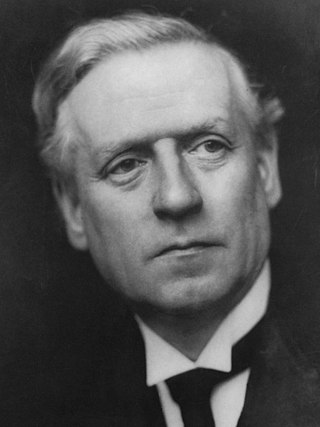
<span class="mw-page-title-main">December 1910 United Kingdom general election</span>

The December 1910 United Kingdom general election was held from 3 to 19 December. It was the last general election to be held over several days and the last to be held before the First World War.

<span class="mw-page-title-main">Lists of places in Wales</span>

These are lists of places in Wales.

<span class="mw-page-title-main">Kingdom of Israel (united monarchy)</span> Hypothesized Israelite kingdom in the Southern Levant

According to the Deuteronomistic history in the Hebrew Bible, a United Monarchy or United Kingdom of Israel existed under the reigns of Saul, Eshbaal, David, and Solomon, encompassing the territories of both the later kingdoms of Judah and Israel.
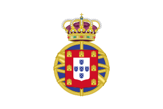
<span class="mw-page-title-main">United Kingdom of Portugal, Brazil and the Algarves</span> Pluricontinental monarchy

The United Kingdom of Portugal, Brazil and the Algarves was a pluricontinental monarchy formed by the elevation of the Portuguese colony named State of Brazil to the status of a kingdom and by the simultaneous union of that Kingdom of Brazil with the Kingdom of Portugal and the Kingdom of the Algarves, constituting a single state consisting of three kingdoms.

<span class="mw-page-title-main">Unitary authorities of England</span> Local government in some parts of England

The unitary authorities of England are a type of local authority responsible for all local government services in an area. They combine the functions of a non-metropolitan county council and a non-metropolitan district council, which elsewhere in England provide two tiers of local government.

<span class="mw-page-title-main">Kingdom of Portugal</span> Kingdom in Southwestern Europe (1139–1910)

The Kingdom of Portugal was a monarchy in the western Iberian Peninsula and the predecessor of the modern Portuguese Republic. Existing to various extents between 1139 and 1910, it was also known as the Kingdom of Portugal and the Algarves after 1415, and as the United Kingdom of Portugal, Brazil and the Algarves between 1815 and 1822. The name is also often applied to the Portuguese Empire, the realm's overseas colonies.

<span class="mw-page-title-main">United Kingdom in the Eurovision Song Contest</span>

The United Kingdom has participated in the Eurovision Song Contest 65 times. It first took part in the second contest in 1957 and has entered every year since 1959. Along with Sweden and the Netherlands, the UK is one of only three countries with Eurovision victories in four different decades. It is one of the "Big Five" countries, along with France, Germany, Italy and Spain, that are automatically prequalified for the final each year as they are the biggest financial contributors to the European Broadcasting Union (EBU). The British national broadcaster, the BBC, broadcasts the event and has, on multiple occasions, organised different national selection processes to choose the British entry. The United Kingdom has won the Eurovision Song Contest five times, and has finished as runner-up on a record sixteen occasions. The UK has hosted the contest a record nine times, four times in London and once each in Edinburgh (1972), Brighton (1974), Harrogate (1982), Birmingham (1998), and Liverpool (2023).

<span class="mw-page-title-main">Countries of the United Kingdom</span> Component parts of the UK since 1922

Since 1922, the United Kingdom has been made up of four countries: England, Scotland, Wales and Northern Ireland. The UK Prime Minister's website has used the phrase "countries within a country" to describe the United Kingdom. Some statistical summaries, such as those for the twelve NUTS 1 regions of the UK, refer to Northern Ireland, Scotland, and Wales as "regions". With regard to Northern Ireland, Scotland and Wales particularly, the descriptive name one uses "can be controversial, with the choice often revealing one's political preferences".