
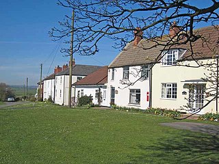
Aislaby ) is a small village and civil parish on the north bank of the River Tees within the borough of Stockton-on-Tees and the ceremonial county of County Durham, England. It is located to the west of Eaglescliffe and Yarm. The name, first attested as Asulue(s)bi in 1086, is of Viking origin and means "Aslak's farm." Aislaby was listed in the Domesday Book of 1086.
Killerby is a village in the borough of Darlington and the ceremonial county of County Durham, England. It is situated a few miles to the west of Darlington. At the 2011 Census the population was less than 100. Details are maintained in the parish of Staindrop.

Beaumont Hill is a village in the borough of Darlington and the traditional and ceremonial counties of Durham in England, situated directly to the north of Darlington on the A167 road.

Brafferton is a village and civil parish in County Durham, England. It is administered as part of the borough of Darlington. The population of Brafferton Parish taken at the 2011 census was 154. It is situated between Darlington and Newton Aycliffe, a short distance from Coatham Mundeville.
Ingleton is a village and civil parish in County Durham, England. The population of the parish as taken at the 2011 census was 420. It is situated about eight miles to the west of Darlington, and a short distance from the villages of Langton, Hilton and Killerby. The Church of St John the Evangelist in Ingleton was built in 1843 by Ignatius Bonomi and J.A. Cory., and is a Grade II listed building.
Houghton Bank is a village in the borough of Darlington and the ceremonial county of County Durham, England. It is situated a few miles west of Newton Aycliffe, on the A68 between Darlington and Bishop Auckland.
Houghton-le-Side is a small village in the borough of Darlington and the ceremonial county of County Durham, England. It is situated a few miles to the south-west of Newton Aycliffe. The population at the 2011 Census was less than 100. Details are now maintained within the parish of Walworth.
Hummersknott is an area in the western end of Darlington, County Durham England. It is a ward in the unitary authority of Darlington. It consists of mainly post-war houses, and is closely linked to the Mowden. The population of the ward taken at the 2011 Census was 3,478.
Mordon is a village in County Durham, England. It is situated a few miles to the north-east of Newton Aycliffe. The population recorded by the 2011 census was 260.
Morton Tinmouth is a village or, perhaps more accurately, a hamlet of a few farms in County Durham, England. It is situated a few miles to the north-west of Darlington close to the village of Bolam.
Leasingthorne is a small village in County Durham, England. It is situated to the east of Bishop Auckland, near Coundon. In the 2001 census Leasingthorne had a population of 41.
Coundon Grange is a village in County Durham, England. It is situated to the east of Bishop Auckland. In the 2001 census Coundon Grange had a population of 235.
Great Stainton is a village in the borough of Darlington and ceremonial county of County Durham, England. It is situated to the north of Darlington, and to the west of Stockton-on-Tees. Elstob is a hamlet, just north of Great Stainton, which is part of the Parish of Great Stainton. The population as taken at the Census 2011 was less than 100. Details are now maintained in the parish of Little Stainton.
Headlam is a village in the borough of Darlington and the ceremonial county of County Durham, England. It lies to the west of Darlington. The population taken at the 2011 Census was less than 100. Details are included in the parish of Ingleton. The hamlet has 14 stone houses plus 17th-century Headlam Hall, now a country house hotel. The village is set around a village green with a medieval cattle-pound and an old stone packhorse bridge across the beck. Headlam is classed as Lower Teesdale and has views to the south as far as Richmond and to the Cleveland Hills in the east.
Middlestone is a village in County Durham, England. It is situated to the south of Spennymoor, near Kirk Merrington. In the 2001 census Middlestone had a population of 67.

Boltons is a civil parish in the Allerdale district of Cumbria, England. According to the 2001 census it had a population of 585, increasing to 629 at the 2011 Census. Settlements in the parish include Bolton Low Houses, Bolton New Houses, Mealsgate, Boltongate and Sandale.

Little Ayton is a village and civil parish in Hambleton district of North Yorkshire, England. The population of this civil parish taken at the 2011 Census was less than 100. Details are included in the civil parish of Easby, Hambleton. It lies immediately south of Great Ayton.
Croxdale and Hett is a civil parish in County Durham, England. It is situated approximately four miles south of Durham. The population of the civil parish as taken at the 2011 census was 866.
Whinney Hill is a village within the borough of Stockton-on-Tees and the ceremonial county of County Durham, England. Whinney Hill lies 2 miles (3.2 km) west of Stockton-on-Tees.
High Leven is a village within the borough of Stockton-on-Tees and ceremonial county of North Yorkshire, England, and is located towards the mouth of the River Leven. It has a public house called The Fox Covert and a co-operative food store, open every day 05:00 to 24:00, with an ATM and petrol station.


