List of United Kingdom locations: On-Oz

Last updated

The United Kingdom Uk-map.svg
The United Kingdom

This is part of the list of United Kingdom locations: a gazetteer of place names in the United Kingdom showing each place's locality and geographical coordinates.

Contents

On

LocationLocality Coordinates
(links to map & photo sources)
OS grid
reference
Onchan Isle of Man 54°10′N4°28′W / 54.17°N 04.46°W / 54.17; -04.46 SC3978
Onecote Staffordshire 53°05′N1°56′W / 53.09°N 01.94°W / 53.09; -01.94 SK0455
Onehouse Suffolk 52°11′N0°57′E / 52.19°N 00.95°E / 52.19; 00.95 TM0259
Onen Sir Fynwy (Monmouthshire) 51°49′N2°49′W / 51.82°N 02.82°W / 51.82; -02.82 SO4314
Onesacre Sheffield 53°26′N1°34′W / 53.43°N 01.56°W / 53.43; -01.56 SK2993
Onibury Shropshire 52°24′N2°48′W / 52.40°N 02.80°W / 52.40; -02.80 SO4579
Onich Highland 56°41′N5°14′W / 56.69°N 05.23°W / 56.69; -05.23 NN0261
Onllwyn Castellnedd Phort Talbot (Neath Port Talbot) 51°46′N3°41′W / 51.77°N 03.68°W / 51.77; -03.68 SN8410
Onneley Staffordshire 52°59′N2°22′W / 52.98°N 02.37°W / 52.98; -02.37 SJ7543
Onslow Village Surrey 51°14′N0°37′W / 51.23°N 00.61°W / 51.23; -00.61 SU9749
Onthank East Ayrshire 55°37′N4°31′W / 55.62°N 04.51°W / 55.62; -04.51 NS4240

Op

LocationLocality Coordinates
(links to map & photo sources)
OS grid
reference
Openshaw Manchester 53°28′N2°11′W / 53.47°N 02.18°W / 53.47; -02.18 SJ8897
Openwoodgate Derbyshire 53°01′N1°28′W / 53.01°N 01.46°W / 53.01; -01.46 SK3647
Opinan Highland 57°41′N5°47′W / 57.68°N 05.79°W / 57.68; -05.79 NG7472

Or

LocationLocality Coordinates
(links to map & photo sources)
OS grid
reference
Oran Moray 57°38′N2°59′W / 57.63°N 02.98°W / 57.63; -02.98 NJ4161
Orange Row Norfolk 52°45′N0°17′E / 52.75°N 00.28°E / 52.75; 00.28 TF5420
Oransaigh Western Isles 58°01′N6°28′W / 58.01°N 06.47°W / 58.01; -06.47 NB3612
Orbiston North Lanarkshire 55°48′N4°01′W / 55.80°N 04.02°W / 55.80; -04.02 NS7359
Orby Lincolnshire 53°10′N0°13′E / 53.17°N 00.22°E / 53.17; 00.22 TF4967
Orchard Hill Devon 51°01′N4°13′W / 51.02°N 04.21°W / 51.02; -04.21 SS4527
Orchard Park Cambridgeshire 52°13′59″N0°07′08″E / 52.233°N 0.119°E / 52.233; 0.119 TL4561
Orchard Leigh Buckinghamshire 51°43′N0°35′W / 51.71°N 00.58°W / 51.71; -00.58 SP9803
Orchard Portman Somerset 50°59′N3°05′W / 50.98°N 03.08°W / 50.98; -03.08 ST2421
Orcheston Wiltshire 51°12′N1°55′W / 51.20°N 01.92°W / 51.20; -01.92 SU0545
Orcop Herefordshire 51°56′N2°46′W / 51.93°N 02.77°W / 51.93; -02.77 SO4726
Orcop Hill Herefordshire 51°56′N2°46′W / 51.94°N 02.77°W / 51.94; -02.77 SO4728
Ord (Ross and Cromarty)Highland 57°42′N4°10′W / 57.70°N 04.16°W / 57.70; -04.16 NH7170
Ord (Skye)Highland 57°08′N5°57′W / 57.14°N 05.95°W / 57.14; -05.95 NG6113
Ordale Shetland Islands 60°44′N0°50′W / 60.74°N 00.84°W / 60.74; -00.84 HP6307
Ordhead Aberdeenshire 57°11′N2°34′W / 57.18°N 02.56°W / 57.18; -02.56 NJ6610
Ordie Aberdeenshire 57°05′N2°54′W / 57.09°N 02.90°W / 57.09; -02.90 NJ4501
Ordiquhill Aberdeenshire 57°35′N2°44′W / 57.58°N 02.73°W / 57.58; -02.73 NJ5655
Ordley Northumberland 54°55′N2°05′W / 54.92°N 02.09°W / 54.92; -02.09 NY9459
Ord Mill Aberdeenshire 57°14′N2°32′W / 57.24°N 02.54°W / 57.24; -02.54 NJ6717
Ordsall Nottinghamshire 53°19′N0°58′W / 53.31°N 00.96°W / 53.31; -00.96 SK6980
Ordsall Salford 53°28′N2°17′W / 53.46°N 02.28°W / 53.46; -02.28 SJ8197
Ore East Sussex 50°52′N0°35′E / 50.86°N 00.59°E / 50.86; 00.59 TQ8311
Oreston Devon 50°21′N4°07′W / 50.35°N 04.11°W / 50.35; -04.11 SX5053
Oreton Shropshire 52°25′N2°31′W / 52.41°N 02.51°W / 52.41; -02.51 SO6580
Orfasay Shetland Islands 60°28′N1°06′W / 60.47°N 01.10°W / 60.47; -01.10 HU492774
Orford Cheshire 53°24′N2°35′W / 53.40°N 02.58°W / 53.40; -02.58 SJ6190
Orford Suffolk 52°05′N1°32′E / 52.08°N 01.53°E / 52.08; 01.53 TM4249
Orford Ness Suffolk 52°05′N1°34′E / 52.09°N 01.57°E / 52.09; 01.57 TM451496
Organford Dorset 50°43′N2°06′W / 50.72°N 02.10°W / 50.72; -02.10 SY9392
Orgreave Sheffield 53°22′N1°23′W / 53.37°N 01.38°W / 53.37; -01.38 SK4187
Orgreave Staffordshire 52°44′N1°47′W / 52.74°N 01.79°W / 52.74; -01.79 SK1416
Oridge Street Gloucestershire 51°56′N2°19′W / 51.94°N 02.32°W / 51.94; -02.32 SO7827
Orkney Islands 58°59′N3°11′W / 58.98°N 03.18°W / 58.98; -03.18 HY322119
Orlandon Sir Benfro (Pembrokeshire) 51°44′N5°10′W / 51.73°N 05.17°W / 51.73; -05.17 SM8109
Orleton Herefordshire 52°17′N2°44′W / 52.29°N 02.74°W / 52.29; -02.74 SO4967
Orleton Worcestershire 52°18′N2°27′W / 52.30°N 02.45°W / 52.30; -02.45 SO6967
Orleton Common Herefordshire 52°18′N2°46′W / 52.30°N 02.77°W / 52.30; -02.77 SO4768
Orlingbury Northamptonshire 52°20′N0°44′W / 52.33°N 00.73°W / 52.33; -00.73 SP8672
Ormacleit Western Isles 57°15′N7°24′W / 57.25°N 07.40°W / 57.25; -07.40 NF7431
Ormal Shetland Islands 60°22′N1°49′W / 60.36°N 01.81°W / 60.36; -01.81 HU103648
Ormathwaite Cumbria 54°37′N3°08′W / 54.61°N 03.14°W / 54.61; -03.14 NY2625
Ormesby Redcar and Cleveland 54°32′N1°11′W / 54.54°N 01.18°W / 54.54; -01.18 NZ5317
Ormesby St Margaret Norfolk 52°40′N1°41′E / 52.67°N 01.68°E / 52.67; 01.68 TG4915
Ormesby St Michael Norfolk 52°40′N1°40′E / 52.66°N 01.66°E / 52.66; 01.66 TG4814
Ormiscaig Highland 57°50′N5°37′W / 57.84°N 05.62°W / 57.84; -05.62 NG8590
Ormiston East Lothian 55°55′N2°56′W / 55.91°N 02.94°W / 55.91; -02.94 NT4169
Ormiston Scottish Borders 55°24′N2°45′W / 55.40°N 02.75°W / 55.40; -02.75 NT5213
Ormsaigbeg Highland 56°41′N6°08′W / 56.69°N 06.13°W / 56.69; -06.13 NM4763
Ormsaigmore Highland 56°41′N6°08′W / 56.69°N 06.13°W / 56.69; -06.13 NM4763
Ormsary Argyll and Bute 55°53′N5°37′W / 55.88°N 05.61°W / 55.88; -05.61 NR7472
Ormsgill Cumbria 54°07′N3°14′W / 54.12°N 03.24°W / 54.12; -03.24 SD1971
Ormskirk Lancashire 53°34′N2°53′W / 53.56°N 02.89°W / 53.56; -02.89 SD4108
Ornish Island Western Isles 57°19′N7°13′W / 57.32°N 07.21°W / 57.32; -07.21 NF860383
Ornsay Highland 57°08′N5°47′W / 57.14°N 05.78°W / 57.14; -05.78 NG711124
Ornsby Hill Durham 54°49′N1°45′W / 54.82°N 01.75°W / 54.82; -01.75 NZ1648
Oronsay Argyll and Bute 56°01′N6°14′W / 56.01°N 06.24°W / 56.01; -06.24 NR357888
Oronsay (Loch Bracadale)Highland 57°20′N6°27′W / 57.33°N 06.45°W / 57.33; -06.45 NG318358
Oronsay (Loch Sunart)Highland 56°40′N5°55′W / 56.66°N 05.92°W / 56.66; -05.92 NM594589
Oronsay (Outer Hebrides)Western Isles 57°39′N7°17′W / 57.65°N 07.29°W / 57.65; -07.29 NF845755
Orosay (South Uist)Western Isles 57°07′N7°24′W / 57.12°N 07.40°W / 57.12; -07.40 NF729172
Orosay (Barra)Western Isles 57°01′N7°25′W / 57.02°N 07.41°W / 57.02; -07.41 NF717061
Orpington Bromley 51°22′N0°05′E / 51.36°N 00.08°E / 51.36; 00.08 TQ4565
Orrell Sefton 53°27′N2°59′W / 53.45°N 02.99°W / 53.45; -02.99 SJ3496
Orrell Wigan 53°32′N2°43′W / 53.53°N 02.71°W / 53.53; -02.71 SD5305
Orrell Post Wigan 53°32′N2°43′W / 53.53°N 02.71°W / 53.53; -02.71 SD5304
Orrisdale Isle of Man 54°18′N4°35′W / 54.30°N 04.58°W / 54.30; -04.58 SC3293
Orrock Fife 56°04′N3°15′W / 56.07°N 03.25°W / 56.07; -03.25 NT2288
Orsay Argyll and Bute 55°40′N6°31′W / 55.67°N 06.51°W / 55.67; -06.51 NR163516
Orsett Essex 51°30′N0°22′E / 51.50°N 00.36°E / 51.50; 00.36 TQ6481
Orsett Heath Essex 51°29′N0°20′E / 51.48°N 00.34°E / 51.48; 00.34 TQ6379
Orslow Staffordshire 52°44′N2°17′W / 52.73°N 02.29°W / 52.73; -02.29 SJ8015
Orston Nottinghamshire 52°57′N0°51′W / 52.95°N 00.85°W / 52.95; -00.85 SK7740
Orthwaite Cumbria 54°41′N3°10′W / 54.69°N 03.16°W / 54.69; -03.16 NY2534
Ortner Lancashire 53°59′N2°43′W / 53.98°N 02.71°W / 53.98; -02.71 SD5354
Orton Cumbria 54°28′N2°35′W / 54.46°N 02.58°W / 54.46; -02.58 NY6208
Orton Moray 57°34′N3°09′W / 57.56°N 03.15°W / 57.56; -03.15 NJ3153
Orton Northamptonshire 52°24′N0°49′W / 52.40°N 00.82°W / 52.40; -00.82 SP8079
Orton Staffordshire 52°33′N2°12′W / 52.55°N 02.20°W / 52.55; -02.20 SO8695
Orton Brimbles Cambridgeshire 52°33′N0°18′W / 52.55°N 00.30°W / 52.55; -00.30 TL1596
Orton Goldhay Cambridgeshire 52°32′N0°18′W / 52.54°N 00.30°W / 52.54; -00.30 TL1595
Orton Longueville Cambridgeshire 52°32′N0°17′W / 52.54°N 00.29°W / 52.54; -00.29 TL1696
Orton Malborne Cambridgeshire 52°32′N0°16′W / 52.54°N 00.27°W / 52.54; -00.27 TL1795
Orton on the Hill Leicestershire 52°37′N1°33′W / 52.62°N 01.55°W / 52.62; -01.55 SK3003
Orton Rigg Cumbria 54°51′N3°02′W / 54.85°N 03.04°W / 54.85; -03.04 NY3352
Orton Southgate Cambridgeshire 52°32′N0°19′W / 52.53°N 00.32°W / 52.53; -00.32 TL1494
Orton Waterville Cambridgeshire 52°33′N0°18′W / 52.55°N 00.30°W / 52.55; -00.30 TL1596
Orton Wistow Cambridgeshire 52°33′N0°19′W / 52.55°N 00.31°W / 52.55; -00.31 TL1496
Orwell Cambridgeshire 52°08′N0°01′W / 52.13°N 00.01°W / 52.13; -00.01 TL3650

Os

LocationLocality Coordinates
(links to map & photo sources)
OS grid
reference
Osbaldeston Lancashire 53°46′N2°32′W / 53.77°N 02.54°W / 53.77; -02.54 SD6431
Osbaldeston Green Lancashire 53°47′N2°32′W / 53.78°N 02.54°W / 53.78; -02.54 SD6432
Osbaldwick York 53°57′N1°02′W / 53.95°N 01.04°W / 53.95; -01.04 SE6351
Osbaston Leicestershire 52°38′N1°23′W / 52.63°N 01.38°W / 52.63; -01.38 SK4204
Osbaston (Telford)Shropshire 52°45′N2°36′W / 52.75°N 02.60°W / 52.75; -02.60 SJ5918
Osbaston (Oswestry)Shropshire 52°47′N3°00′W / 52.79°N 03.00°W / 52.79; -03.00 SJ3222
Osbaston Hollow Leicestershire 52°39′N1°23′W / 52.65°N 01.39°W / 52.65; -01.39 SK4106
Osbournby Lincolnshire 52°55′N0°25′W / 52.92°N 00.42°W / 52.92; -00.42 TF0638
Oscroft Cheshire 53°11′N2°44′W / 53.18°N 02.74°W / 53.18; -02.74 SJ5066
Ose Highland 57°23′N6°28′W / 57.38°N 06.47°W / 57.38; -06.47 NG3141
Osea Island Essex 51°43′N0°46′E / 51.72°N 00.76°E / 51.72; 00.76 TL9106
Osehill Green Dorset 50°52′N2°29′W / 50.87°N 02.48°W / 50.87; -02.48 ST6609
Osgathorpe Leicestershire 52°46′N1°22′W / 52.76°N 01.36°W / 52.76; -01.36 SK4319
Osgodby Lincolnshire 53°25′N0°23′W / 53.41°N 00.39°W / 53.41; -00.39 TF0792
Osgodby (by the Sea)North Yorkshire 54°14′N0°23′W / 54.24°N 00.38°W / 54.24; -00.38 TA055845
Osgodby (Barlby with Osgodby)North Yorkshire 53°47′N1°02′W / 53.79°N 01.03°W / 53.79; -01.03 SE6433
Osgodby Common North Yorkshire 53°48′N1°01′W / 53.80°N 01.02°W / 53.80; -01.02 SE6435
Osidge Barnet 51°38′N0°09′W / 51.63°N 00.15°W / 51.63; -00.15 TQ2894
Oskaig Highland 57°22′N6°05′W / 57.36°N 06.09°W / 57.36; -06.09 NG5438
Osleston Derbyshire 52°55′N1°38′W / 52.92°N 01.64°W / 52.92; -01.64 SK2436
Osmaston City of Derby 52°53′N1°28′W / 52.89°N 01.46°W / 52.89; -01.46 SK3633
Osmaston Derbyshire 52°59′N1°42′W / 52.98°N 01.70°W / 52.98; -01.70 SK2043
Osmington Dorset 50°38′N2°23′W / 50.64°N 02.39°W / 50.64; -02.39 SY7283
Osmington Mills Dorset 50°37′N2°23′W / 50.62°N 02.38°W / 50.62; -02.38 SY7381
Osmondthorpe Leeds 53°47′N1°31′W / 53.79°N 01.51°W / 53.79; -01.51 SE3233
Osmotherley North Yorkshire 54°22′N1°18′W / 54.36°N 01.30°W / 54.36; -01.30 SE4597
Osnaburgh (Dairsie)Fife 56°20′N2°57′W / 56.34°N 02.95°W / 56.34; -02.95 NO4117
Osney Oxfordshire 51°45′N1°16′W / 51.75°N 01.27°W / 51.75; -01.27 SP5006
Ospisdale Highland 57°52′N4°10′W / 57.87°N 04.17°W / 57.87; -04.17 NH7189
Ospringe Kent 51°18′N0°52′E / 51.30°N 00.86°E / 51.30; 00.86 TR0060
Ossemsley Hampshire 50°47′N1°40′W / 50.78°N 01.67°W / 50.78; -01.67 SZ2398
Ossett Wakefield 53°40′N1°34′W / 53.67°N 01.57°W / 53.67; -01.57 SE2820
Ossett Spa Wakefield 53°40′N1°34′W / 53.66°N 01.56°W / 53.66; -01.56 SE2919
Ossett Street Side Wakefield 53°41′N1°35′W / 53.68°N 01.59°W / 53.68; -01.59 SE2721
Ossington Nottinghamshire 53°10′N0°52′W / 53.16°N 00.87°W / 53.16; -00.87 SK7564
Ostend Essex 51°38′N0°47′E / 51.63°N 00.78°E / 51.63; 00.78 TQ9397
Ostend Norfolk 52°50′N1°30′E / 52.83°N 01.50°E / 52.83; 01.50 TG3632
Osterley Hounslow 51°29′N0°21′W / 51.48°N 00.35°W / 51.48; -00.35 TQ1477
Oswaldkirk North Yorkshire 54°11′N1°03′W / 54.19°N 01.05°W / 54.19; -01.05 SE6278
Oswaldtwistle Lancashire 53°44′N2°25′W / 53.73°N 02.41°W / 53.73; -02.41 SD7327
Oswestry (Croeswallt)Shropshire 52°51′N3°03′W / 52.85°N 03.05°W / 52.85; -03.05 SJ2929

Ot

LocationLocality Coordinates
(links to map & photo sources)
OS grid
reference
Otby Lincolnshire 53°25′N0°18′W / 53.42°N 00.30°W / 53.42; -00.30 TF1393
Oteley Shropshire 52°54′N2°52′W / 52.90°N 02.87°W / 52.90; -02.87 SJ4134
Otford Kent 51°19′N0°10′E / 51.31°N 00.16°E / 51.31; 00.16 TQ5159
Otham Kent 51°14′N0°34′E / 51.24°N 00.56°E / 51.24; 00.56 TQ7953
Otham Hole Kent 51°14′N0°34′E / 51.23°N 00.57°E / 51.23; 00.57 TQ8052
Otherton Staffordshire 52°42′N2°07′W / 52.70°N 02.11°W / 52.70; -02.11 SJ9212
Othery Somerset 51°04′N2°53′W / 51.07°N 02.88°W / 51.07; -02.88 ST3831
Otley Leeds 53°54′N1°41′W / 53.90°N 01.69°W / 53.90; -01.69 SE2045
Otley Suffolk 52°08′N1°13′E / 52.14°N 01.21°E / 52.14; 01.21 TM2055
Otterbourne Hampshire 51°00′N1°20′W / 51.00°N 01.34°W / 51.00; -01.34 SU4623
Otterburn North Yorkshire 54°00′N2°11′W / 54.00°N 02.18°W / 54.00; -02.18 SD8857
Otterburn Northumberland 55°14′N2°11′W / 55.23°N 02.19°W / 55.23; -02.19 NY8893
Otterburn Camp Northumberland 55°14′N2°10′W / 55.24°N 02.17°W / 55.24; -02.17 NY8995
Otterden Place Kent 51°15′N0°46′E / 51.25°N 00.77°E / 51.25; 00.77 TQ9454
Otter Ferry Argyll and Bute 56°00′N5°19′W / 56.00°N 05.32°W / 56.00; -05.32 NR9384
Otterford Somerset 50°55′N3°07′W / 50.92°N 03.11°W / 50.92; -03.11 ST2214
Otterham Cornwall 50°41′N4°36′W / 50.68°N 04.60°W / 50.68; -04.60 SX1690
Otterhampton Somerset 51°11′N3°05′W / 51.18°N 03.08°W / 51.18; -03.08 ST2443
Otterham Quay Kent 51°22′N0°37′E / 51.36°N 00.62°E / 51.36; 00.62 TQ8366
Otterham Station Cornwall 50°40′N4°37′W / 50.67°N 04.61°W / 50.67; -04.61 SX1589
Ottershaw Surrey 51°21′N0°32′W / 51.35°N 00.53°W / 51.35; -00.53 TQ0263
Otterspool Liverpool 53°21′N2°56′W / 53.35°N 02.94°W / 53.35; -02.94 SJ3785
Otterswick Shetland Islands 60°32′N1°03′W / 60.54°N 01.05°W / 60.54; -01.05 HU5285
Otterton Devon 50°39′N3°18′W / 50.65°N 03.30°W / 50.65; -03.30 SY0885
Otterwood Hampshire 50°49′N1°25′W / 50.81°N 01.41°W / 50.81; -01.41 SU4102
Ottery St Mary Devon 50°44′N3°16′W / 50.74°N 03.27°W / 50.74; -03.27 SY1095
Ottinge Kent 51°08′N1°05′E / 51.13°N 01.08°E / 51.13; 01.08 TR1642
Ottringham East Riding of Yorkshire 53°41′N0°05′W / 53.69°N 00.09°W / 53.69; -00.09 TA2624

Ou

LocationLocality Coordinates
(links to map & photo sources)
OS grid
reference
Oughterby Cumbria 54°53′N3°06′W / 54.88°N 03.10°W / 54.88; -03.10 NY2955
Oughtershaw North Yorkshire 54°13′N2°13′W / 54.22°N 02.21°W / 54.22; -02.21 SD8681
Oughterside Cumbria 54°44′N3°23′W / 54.74°N 03.38°W / 54.74; -03.38 NY1140
Oughtibridge Sheffield 53°26′N1°32′W / 53.43°N 01.54°W / 53.43; -01.54 SK3093
Oughtrington Cheshire 53°22′N2°28′W / 53.37°N 02.46°W / 53.37; -02.46 SJ6987
Oulston North Yorkshire 54°09′N1°10′W / 54.15°N 01.17°W / 54.15; -01.17 SE5474
Oulton Cumbria 54°50′N3°11′W / 54.83°N 03.18°W / 54.83; -03.18 NY2450
Oulton Leeds 53°44′N1°27′W / 53.74°N 01.45°W / 53.74; -01.45 SE3628
Oulton Norbury, Staffordshire 52°47′N2°19′W / 52.79°N 02.32°W / 52.79; -02.32 SJ7822
Oulton Norfolk 52°48′N1°09′E / 52.80°N 01.15°E / 52.80; 01.15 TG1328
Oulton Staffordshire 52°55′N2°08′W / 52.91°N 02.13°W / 52.91; -02.13 SJ9135
Oulton Suffolk 52°29′N1°43′E / 52.48°N 01.71°E / 52.48; 01.71 TM5294
Oulton Broad Suffolk 52°28′N1°41′E / 52.46°N 01.69°E / 52.46; 01.69 TM5192
Oultoncross Staffordshire 52°54′N2°09′W / 52.90°N 02.15°W / 52.90; -02.15 SJ9034
Oulton Grange Staffordshire 52°55′N2°09′W / 52.91°N 02.15°W / 52.91; -02.15 SJ9035
Oulton Heath Staffordshire 52°55′N2°09′W / 52.92°N 02.15°W / 52.92; -02.15 SJ9036
Oulton Street Norfolk 52°47′N1°11′E / 52.79°N 01.18°E / 52.79; 01.18 TG1527
Oundle Northamptonshire 52°29′N0°29′W / 52.48°N 00.48°W / 52.48; -00.48 TL0388
Ounsdale Staffordshire 52°32′N2°12′W / 52.53°N 02.20°W / 52.53; -02.20 SO8693
Ousby Cumbria 54°42′N2°35′W / 54.70°N 02.59°W / 54.70; -02.59 NY6234
Ousden Suffolk 52°12′N0°32′E / 52.20°N 00.54°E / 52.20; 00.54 TL7459

}

Ousefleet East Riding of Yorkshire 53°41′N0°45′W / 53.69°N 00.75°W / 53.69; -00.75 SE8223
Ousel Hole Bradford 53°52′N1°50′W / 53.87°N 01.84°W / 53.87; -01.84 SE1042
Ousethorpe East Riding of Yorkshire 53°57′N0°46′W / 53.95°N 00.76°W / 53.95; -00.76 SE8151
Ouston Durham 54°53′N1°37′W / 54.88°N 01.61°W / 54.88; -01.61 NZ2554
Ouston (Ninebanks)Northumberland 54°52′N2°21′W / 54.86°N 02.35°W / 54.86; -02.35 NY7752
Ouston (Stamford)Northumberland 55°01′N1°53′W / 55.02°N 01.89°W / 55.02; -01.89 NZ0770
Outcast Cumbria 54°11′N3°04′W / 54.18°N 03.07°W / 54.18; -03.07 SD3077
Out Elmstead Kent 51°12′N1°08′E / 51.20°N 01.14°E / 51.20; 01.14 TR2050
Outer Hebrides Western Isles 58°08′N6°43′W / 58.14°N 06.71°W / 58.14; -06.71 NB227272
Outer Heisker Western Isles 56°50′N7°37′W / 56.84°N 07.62°W / 56.84; -07.62 NL573867
Outer Holm of Skaw Shetland Islands 60°23′N0°55′W / 60.38°N 00.91°W / 60.38; -00.91 HU600674
Outer Hope Devon 50°14′N3°52′W / 50.24°N 03.86°W / 50.24; -03.86 SX6740
Outertown Orkney Islands 58°58′N3°20′W / 58.97°N 03.34°W / 58.97; -03.34 HY2310
Outgate Cumbria 54°23′N3°00′W / 54.38°N 03.00°W / 54.38; -03.00 SD3599
Outhgill Cumbria 54°24′N2°20′W / 54.40°N 02.34°W / 54.40; -02.34 NY7801
Outhill Warwickshire 52°17′N1°51′W / 52.29°N 01.85°W / 52.29; -01.85 SP1066
Outlands Staffordshire 52°52′N2°20′W / 52.86°N 02.34°W / 52.86; -02.34 SJ7730
Outlane Calderdale 53°39′N1°53′W / 53.65°N 01.88°W / 53.65; -01.88 SE0818
Outlane Moor Calderdale 53°38′N1°53′W / 53.64°N 01.89°W / 53.64; -01.89 SE0717
Outlet Village (Cheshire Oaks Designer Outlet)Cheshire 53°16′N2°53′W / 53.26°N 02.88°W / 53.26; -02.88 SJ4174
Outmarsh Wiltshire 51°20′N2°09′W / 51.34°N 02.15°W / 51.34; -02.15 ST8961
Out Newton East Riding of Yorkshire 53°40′N0°05′E / 53.66°N 00.08°E / 53.66; 00.08 TA3821
Out Rawcliffe Lancashire 53°52′N2°55′W / 53.86°N 02.91°W / 53.86; -02.91 SD4041
Out Skerries Shetland Islands 60°24′N0°47′W / 60.40°N 00.79°W / 60.40; -00.79 HU665696
Out Stack Shetland Islands 60°52′N0°52′W / 60.86°N 00.87°W / 60.86; -00.87 HP612202
Outwell Norfolk 52°36′N0°13′E / 52.60°N 00.22°E / 52.60; 00.22 TF5103
Outwick Hampshire 50°57′N1°48′W / 50.95°N 01.80°W / 50.95; -01.80 SU1417
Outwood Bolton 53°32′N2°20′W / 53.54°N 02.34°W / 53.54; -02.34 SD7705
Outwood Somerset 51°02′N3°00′W / 51.04°N 03.00°W / 51.04; -03.00 ST3028
Outwood Surrey 51°11′N0°07′W / 51.18°N 00.11°W / 51.18; -00.11 TQ3245
Outwood Wakefield 53°42′N1°31′W / 53.70°N 01.51°W / 53.70; -01.51 SE3223
Outwoods (near Coleorton)Leicestershire 52°45′N1°24′W / 52.75°N 01.40°W / 52.75; -01.40 SK4018
Outwoods (Stafford)Staffordshire 52°45′N2°19′W / 52.75°N 02.32°W / 52.75; -02.32 SJ7818
Outwoods (East Staffordshire)Staffordshire 52°49′N1°40′W / 52.81°N 01.66°W / 52.81; -01.66 SK2324
Outwoods Warwickshire 52°27′N1°38′W / 52.45°N 01.64°W / 52.45; -01.64 SP2484
Ouzlewell Green Leeds 53°43′N1°30′W / 53.72°N 01.50°W / 53.72; -01.50 SE3326

Ov

LocationLocality Coordinates
(links to map & photo sources)
OS grid
reference
Ovenden Calderdale 53°44′N1°53′W / 53.73°N 01.89°W / 53.73; -01.89 SE0727
Over Cambridgeshire 52°19′N0°01′E / 52.31°N 00.01°E / 52.31; 00.01 TL3770
Over Cheshire 53°11′N2°33′W / 53.18°N 02.55°W / 53.18; -02.55 SJ6365
Over Gloucestershire 51°52′N2°16′W / 51.86°N 02.27°W / 51.86; -02.27 SO8119
Over South Gloucestershire 51°32′N2°36′W / 51.53°N 02.60°W / 51.53; -02.60 ST5882
Overbister Orkney Islands 59°14′N2°34′W / 59.24°N 02.56°W / 59.24; -02.56 HY6840
Over Burrow Lancashire 54°10′N2°35′W / 54.17°N 02.59°W / 54.17; -02.59 SD6176
Over Burrows Derbyshire 52°56′N1°37′W / 52.94°N 01.61°W / 52.94; -01.61 SK2639
Overbury Worcestershire 52°02′N2°04′W / 52.03°N 02.07°W / 52.03; -02.07 SO9537
Overcombe Dorset 50°38′N2°26′W / 50.63°N 02.43°W / 50.63; -02.43 SY6982
Over Compton Dorset 50°56′N2°35′W / 50.94°N 02.58°W / 50.94; -02.58 ST5916
Overend Dudley 52°27′N2°04′W / 52.45°N 02.07°W / 52.45; -02.07 SO9584
Over End Cambridgeshire 52°31′N0°23′W / 52.52°N 00.39°W / 52.52; -00.39 TL0993
Over End Derbyshire 53°14′N1°37′W / 53.24°N 01.62°W / 53.24; -01.62 SK2572
Over Finlarg Angus 56°33′N2°58′W / 56.55°N 02.96°W / 56.55; -02.96 NO4141
Over Green Birmingham 52°32′N1°46′W / 52.54°N 01.76°W / 52.54; -01.76 SP1694
Over Haddon Derbyshire 53°11′N1°42′W / 53.19°N 01.70°W / 53.19; -01.70 SK2066
Overhill Aberdeenshire 57°34′N2°12′W / 57.56°N 02.20°W / 57.56; -02.20 NJ8853
Over Hulton Bolton 53°32′N2°29′W / 53.54°N 02.48°W / 53.54; -02.48 SD6805
Over Kellet Lancashire 54°07′N2°44′W / 54.11°N 02.73°W / 54.11; -02.73 SD5269
Over Kiddington Oxfordshire 51°53′N1°25′W / 51.89°N 01.42°W / 51.89; -01.42 SP4022
Over Knutsford Cheshire 53°17′N2°22′W / 53.29°N 02.36°W / 53.29; -02.36 SJ7678
Over Langshaw Scottish Borders 55°39′N2°46′W / 55.65°N 02.76°W / 55.65; -02.76 NT5240
Overleigh Somerset 51°07′N2°44′W / 51.11°N 02.74°W / 51.11; -02.74 ST4835
Overley Staffordshire 52°44′N1°46′W / 52.73°N 01.76°W / 52.73; -01.76 SK1615
Over Monnow Sir Fynwy (Monmouthshire) 51°48′N2°43′W / 51.80°N 02.72°W / 51.80; -02.72 SO5012
Overmoor Staffordshire 53°01′N2°04′W / 53.02°N 02.06°W / 53.02; -02.06 SJ9647
Over Norton Oxfordshire 51°56′N1°33′W / 51.94°N 01.55°W / 51.94; -01.55 SP3128
Over Peover Cheshire 53°15′N2°20′W / 53.25°N 02.33°W / 53.25; -02.33 SJ7873
Overpool Cheshire 53°17′N2°56′W / 53.28°N 02.93°W / 53.28; -02.93 SJ3877
Overs Shropshire 52°33′N2°54′W / 52.55°N 02.90°W / 52.55; -02.90 SO3996
Overseal Derbyshire 52°44′N1°34′W / 52.73°N 01.57°W / 52.73; -01.57 SK2915
Over Silton North Yorkshire 54°20′N1°18′W / 54.33°N 01.30°W / 54.33; -01.30 SE4593
Overslade Warwickshire 52°21′N1°17′W / 52.35°N 01.28°W / 52.35; -01.28 SP4973
Oversland Kent 51°16′N0°56′E / 51.27°N 00.93°E / 51.27; 00.93 TR0557
Oversley Green Warwickshire 52°12′N1°52′W / 52.20°N 01.86°W / 52.20; -01.86 SP0956
Overstone Northamptonshire 52°17′N0°49′W / 52.28°N 00.82°W / 52.28; -00.82 SP8066
Over Stowey Somerset 51°08′N3°10′W / 51.13°N 03.17°W / 51.13; -03.17 ST1838
Overstrand Norfolk 52°55′N1°20′E / 52.91°N 01.33°E / 52.91; 01.33 TG2440
Over Stratton Somerset 50°56′N2°49′W / 50.93°N 02.81°W / 50.93; -02.81 ST4315
Over Tabley Cheshire 53°19′N2°25′W / 53.31°N 02.42°W / 53.31; -02.42 SJ7280
Overthorpe Kirklees 53°39′N1°38′W / 53.65°N 01.63°W / 53.65; -01.63 SE2418
Overthorpe Northamptonshire 52°03′N1°18′W / 52.05°N 01.30°W / 52.05; -01.30 SP4840
Overton City of Aberdeen 57°13′N2°13′W / 57.21°N 02.21°W / 57.21; -02.21 NJ8714
Overton Abertawe (Swansea) 51°32′N4°13′W / 51.54°N 04.22°W / 51.54; -04.22 SS4685
Overton Cheshire 53°17′N2°43′W / 53.28°N 02.72°W / 53.28; -02.72 SJ5277
Overton Gloucestershire 51°47′N2°24′W / 51.78°N 02.40°W / 51.78; -02.40 SO7210
Overton Hampshire 51°14′N1°16′W / 51.23°N 01.27°W / 51.23; -01.27 SU5149
Overton Inverclyde 55°55′N4°47′W / 55.92°N 04.78°W / 55.92; -04.78 NS2674
Overton Lancashire 54°01′N2°52′W / 54.01°N 02.87°W / 54.01; -02.87 SD4358
Overton North Yorkshire 53°59′N1°10′W / 53.98°N 01.16°W / 53.98; -01.16 SE5555
Overton Shropshire 52°20′N2°44′W / 52.34°N 02.73°W / 52.34; -02.73 SO5072
Overton Staffordshire 52°56′N1°56′W / 52.93°N 01.94°W / 52.93; -01.94 SK0438
Overton Wakefield 53°38′N1°36′W / 53.64°N 01.60°W / 53.64; -01.60 SE2616
Overton (Owrtyn / Overton-on-Dee)Wrecsam (Wrexham) 52°58′N2°56′W / 52.96°N 02.93°W / 52.96; -02.93 SJ3741
Overton Bridge Wrecsam (Wrexham) 52°58′N2°58′W / 52.97°N 02.96°W / 52.97; -02.96 SJ3542
Over Town Lancashire 53°45′N2°11′W / 53.75°N 02.19°W / 53.75; -02.19 SD8729
Overtown Lancashire 54°10′N2°35′W / 54.17°N 02.58°W / 54.17; -02.58 SD6276
Overtown North Lanarkshire 55°44′N3°55′W / 55.74°N 03.91°W / 55.74; -03.91 NS8052
Overtown Swindon 51°30′N1°47′W / 51.50°N 01.78°W / 51.50; -01.78 SU1579
Overtown Wakefield 53°38′N1°28′W / 53.63°N 01.47°W / 53.63; -01.47 SE3516
Over Wallop Hampshire 51°08′N1°36′W / 51.14°N 01.60°W / 51.14; -01.60 SU2838
Over Whitacre Warwickshire 52°30′N1°38′W / 52.50°N 01.63°W / 52.50; -01.63 SP2590
Over Worton Oxfordshire 51°57′N1°22′W / 51.95°N 01.37°W / 51.95; -01.37 SP4329
Oving Buckinghamshire 51°53′N0°52′W / 51.88°N 00.86°W / 51.88; -00.86 SP7821
Oving West Sussex 50°49′N0°43′W / 50.82°N 00.72°W / 50.82; -00.72 SU9004
Ovingdean Brighton and Hove 50°49′N0°05′W / 50.81°N 00.08°W / 50.81; -00.08 TQ3503
Ovingham Northumberland 54°58′N1°52′W / 54.96°N 01.87°W / 54.96; -01.87 NZ0863
Ovington Durham 54°31′N1°48′W / 54.52°N 01.80°W / 54.52; -01.80 NZ1314
Ovington Essex 52°02′N0°34′E / 52.04°N 00.56°E / 52.04; 00.56 TL7642
Ovington Hampshire 51°04′N1°12′W / 51.07°N 01.20°W / 51.07; -01.20 SU5631
Ovington Norfolk 52°35′N0°50′E / 52.58°N 00.83°E / 52.58; 00.83 TF9202
Ovington Northumberland 54°58′N1°54′W / 54.96°N 01.90°W / 54.96; -01.90 NZ0663

Ow

LocationLocality Coordinates
(links to map & photo sources)
OS grid
reference
Owen's Bank Staffordshire 52°50′N1°42′W / 52.84°N 01.70°W / 52.84; -01.70 SK2028
Ower Hampshire 50°56′N1°32′W / 50.94°N 01.54°W / 50.94; -01.54 SU3216
Owermoigne Dorset 50°40′N2°20′W / 50.66°N 02.34°W / 50.66; -02.34 SY7685
Owlcotes Derbyshire 53°11′N1°20′W / 53.19°N 01.34°W / 53.19; -01.34 SK4467
Owl End Cambridgeshire 52°21′N0°12′W / 52.35°N 00.20°W / 52.35; -00.20 TL2275
Owler Bar Derbyshire 53°17′N1°34′W / 53.29°N 01.56°W / 53.29; -01.56 SK2978
Owlerton Sheffield 53°23′N1°30′W / 53.39°N 01.50°W / 53.39; -01.50 SK3389
Owlet Bradford 53°49′N1°46′W / 53.82°N 01.77°W / 53.82; -01.77 SE1536
Owlpen Gloucestershire 51°41′N2°17′W / 51.68°N 02.29°W / 51.68; -02.29 ST8098
Owlsmoor Berkshire 51°21′N0°47′W / 51.35°N 00.78°W / 51.35; -00.78 SU8562
Owlswick Buckinghamshire 51°44′N0°52′W / 51.74°N 00.87°W / 51.74; -00.87 SP7806
Owlthorpe Sheffield 53°20′N1°23′W / 53.33°N 01.38°W / 53.33; -01.38 SK4182
Owmby Lincolnshire 53°31′N0°23′W / 53.52°N 00.38°W / 53.52; -00.38 TA0704
Owmby-by-Spital Lincolnshire 53°22′N0°29′W / 53.37°N 00.49°W / 53.37; -00.49 TF0087
Ownham Berkshire 51°25′N1°23′W / 51.42°N 01.39°W / 51.42; -01.39 SU4270
Owrtyn Wrexham 52°58′N2°56′W / 52.96°N 02.93°W / 52.96; -02.93 SJ3741
Owslebury Hampshire 51°00′N1°16′W / 51.00°N 01.27°W / 51.00; -01.27 SU5123
Owsthorpe East Riding of Yorkshire 53°46′N0°46′W / 53.77°N 00.77°W / 53.77; -00.77 SE810309
Owston Doncaster 53°35′N1°10′W / 53.59°N 01.17°W / 53.59; -01.17 SE5511
Owston Leicestershire 52°39′N0°52′W / 52.65°N 00.86°W / 52.65; -00.86 SK7707
Owston Ferry North Lincolnshire 53°29′N0°47′W / 53.49°N 00.79°W / 53.49; -00.79 SE8000
Owstwick East Riding of Yorkshire 53°46′N0°04′W / 53.76°N 00.07°W / 53.76; -00.07 TA2732
Owthorne East Riding of Yorkshire 53°44′N0°01′E / 53.73°N 00.01°E / 53.73; 00.01 TA3328
Owthorpe Nottinghamshire 52°53′N1°00′W / 52.89°N 01.00°W / 52.89; -01.00 SK6733
Owton Manor Hartlepool 54°39′N1°14′W / 54.65°N 01.24°W / 54.65; -01.24 NZ4929

Ox

LocationLocality Coordinates
(links to map & photo sources)
OS grid
reference
Oxborough Norfolk 52°34′N0°34′E / 52.57°N 00.56°E / 52.57; 00.56 TF7401
Oxbridge Dorset 50°46′N2°45′W / 50.77°N 02.75°W / 50.77; -02.75 SY4797
Oxclose Derbyshire 53°19′N1°21′W / 53.31°N 01.35°W / 53.31; -01.35 SK4380
Oxclose Sunderland 54°53′N1°32′W / 54.89°N 01.54°W / 54.89; -01.54 NZ2956
Oxcombe Lincolnshire 53°16′N0°02′W / 53.27°N 00.03°W / 53.27; -00.03 TF3177
Oxcroft Derbyshire 53°15′N1°17′W / 53.25°N 01.28°W / 53.25; -01.28 SK4873
Oxcroft Estate Derbyshire 53°15′N1°17′W / 53.25°N 01.28°W / 53.25; -01.28 SK4873
Oxen End Essex 51°56′N0°25′E / 51.93°N 00.41°E / 51.93; 00.41 TL6629
Oxenhall Gloucestershire 51°56′N2°25′W / 51.93°N 02.42°W / 51.93; -02.42 SO7126
Oxenholme Cumbria 54°17′N2°43′W / 54.29°N 02.72°W / 54.29; -02.72 SD5389
Oxenhope Bradford 53°49′N1°57′W / 53.81°N 01.95°W / 53.81; -01.95 SE0335
Oxen Park Cumbria 54°16′N3°04′W / 54.27°N 03.06°W / 54.27; -03.06 SD3187
Oxenpill Somerset 51°10′N2°48′W / 51.16°N 02.80°W / 51.16; -02.80 ST4441
Oxenton Gloucestershire 51°58′N2°04′W / 51.97°N 02.07°W / 51.97; -02.07 SO9531
Oxenwood Wiltshire 51°19′N1°34′W / 51.32°N 01.57°W / 51.32; -01.57 SU3059
Oxford Oxfordshire 51°45′N1°16′W / 51.75°N 01.26°W / 51.75; -01.26 SP5106
Oxford City of Stoke-on-Trent 53°04′N2°11′W / 53.07°N 02.19°W / 53.07; -02.19 SJ8753
Oxgang East Dunbartonshire 55°56′N4°08′W / 55.93°N 04.14°W / 55.93; -04.14 NS6673
Oxgangs City of Edinburgh 55°53′N3°14′W / 55.89°N 03.23°W / 55.89; -03.23 NT2368
Oxhey Hertfordshire 51°38′N0°23′W / 51.64°N 00.38°W / 51.64; -00.38 TQ1295
Oxhill Durham 54°52′N1°43′W / 54.86°N 01.72°W / 54.86; -01.72 NZ1852
Oxhill Warwickshire 52°06′N1°32′W / 52.10°N 01.54°W / 52.10; -01.54 SP3145
Oxlease Hertfordshire 51°44′N0°14′W / 51.74°N 00.23°W / 51.74; -00.23 TL2207
Oxley Wolverhampton 52°36′N2°08′W / 52.60°N 02.13°W / 52.60; -02.13 SJ9101
Oxley Green Essex 51°47′N0°46′E / 51.79°N 00.76°E / 51.79; 00.76 TL9114
Oxley's Green East Sussex 50°58′N0°24′E / 50.96°N 00.40°E / 50.96; 00.40 TQ6921
Oxlode Cambridgeshire 52°27′N0°10′E / 52.45°N 00.17°E / 52.45; 00.17 TL4886
Oxna Shetland Islands 60°07′N1°22′W / 60.11°N 01.37°W / 60.11; -01.37 HU347372
Oxnam Scottish Borders 55°27′N2°29′W / 55.45°N 02.49°W / 55.45; -02.49 NT6918
Oxnead Norfolk 52°46′N1°18′E / 52.76°N 01.30°E / 52.76; 01.30 TG2324
Oxshott Surrey 51°19′N0°22′W / 51.32°N 00.36°W / 51.32; -00.36 TQ1460
Oxspring Barnsley 53°31′N1°36′W / 53.51°N 01.60°W / 53.51; -01.60 SE2602
Oxted Surrey 51°15′N0°01′W / 51.25°N 00.02°W / 51.25; -00.02 TQ3852
Oxton North Yorkshire 53°53′N1°14′W / 53.88°N 01.24°W / 53.88; -01.24 SE5043
Oxton Nottinghamshire 53°03′N1°04′W / 53.05°N 01.06°W / 53.05; -01.06 SK6351
Oxton Scottish Borders 55°46′N2°49′W / 55.76°N 02.81°W / 55.76; -02.81 NT4953
Oxton Wirral 53°22′N3°04′W / 53.37°N 03.06°W / 53.37; -03.06 SJ2987
Oxton Rakes Derbyshire 53°15′N1°31′W / 53.25°N 01.52°W / 53.25; -01.52 SK3273
Oxwich Abertawe (Swansea) 51°33′N4°10′W / 51.55°N 04.17°W / 51.55; -04.17 SS4986
Oxwich Green Abertawe (Swansea) 51°33′N4°10′W / 51.55°N 04.17°W / 51.55; -04.17 SS4986
Oxwick Norfolk 52°47′N0°50′E / 52.78°N 00.83°E / 52.78; 00.83 TF9124

Oy

LocationLocality Coordinates
(links to map & photo sources)
OS grid
reference
Oyne Aberdeenshire 57°19′N2°32′W / 57.31°N 02.54°W / 57.31; -02.54 NJ6725
Oystermouth Abertawe (Swansea) 51°34′N4°00′W / 51.57°N 04.00°W / 51.57; -04.00 SS6188

Oz

LocationLocality Coordinates
(links to map & photo sources)
OS grid
reference
Ozleworth Gloucestershire 51°38′N2°18′W / 51.63°N 02.30°W / 51.63; -02.30 ST7993

Related Research Articles

Britain most often refers to:

<span class="mw-page-title-main">Parliament of the United Kingdom</span> Supreme legislative body of the United Kingdom

The Parliament of the United Kingdom of Great Britain and Northern Ireland is the supreme legislative body of the United Kingdom, and may also legislate for the Crown Dependencies and the British Overseas Territories. It meets at the Palace of Westminster in London. Parliament possesses legislative supremacy and thereby holds ultimate power over all other political bodies in the United Kingdom and the Overseas Territories. While Parliament is bicameral, it has three parts: the sovereign, the House of Lords, and the House of Commons. The three parts acting together to legislate may be described as the King-in-Parliament. The Crown normally acts on the advice of the prime minister, and the powers of the House of Lords are limited to only delaying legislation.

<span class="mw-page-title-main">Primary school</span> School for children

A primary school, elementary school, or grade school is a school for primary education of children who are 4 to 10 years of age. Primary schooling follows preschool and precedes secondary schooling.
<span class="mw-page-title-main">United Kingdom</span> Island country in Northwestern Europe

The United Kingdom of Great Britain and Northern Ireland, commonly known as the United Kingdom (UK) or Britain, is a country in Northwestern Europe, off the coast of the continental mainland. It comprises England, Scotland, Wales, and Northern Ireland. The UK includes the island of Great Britain, the north-eastern part of the island of Ireland, and most of the smaller islands within the British Isles, making up a total area of 94,354 square miles (244,376 km2). Northern Ireland shares a land border with the Republic of Ireland; otherwise, the United Kingdom is surrounded by the Atlantic Ocean, the North Sea, the English Channel, the Celtic Sea, and the Irish Sea. The United Kingdom had an estimated population of over 68.2 million people in 2023. The capital and largest city of both England and the United Kingdom is London, whose wider metropolitan area is the largest in Western Europe, with a population of 14.9 million. The cities of Edinburgh, Cardiff, and Belfast are the national capitals of Scotland, Wales, and Northern Ireland, respectively.

The Peerage of Ireland consists of those titles of nobility created by the English monarchs in their capacity as Lord or King of Ireland, or later by monarchs of the United Kingdom of Great Britain and Ireland. It is one of the five divisions of Peerages in the United Kingdom. The creation of such titles came to an end in the 19th century. The ranks of the Irish peerage are duke, marquess, earl, viscount and baron. As of 2016, there were 135 titles in the Peerage of Ireland extant: two dukedoms, ten marquessates, 43 earldoms, 28 viscountcies, and 52 baronies. However, these titles have no official recognition in Ireland, with Article 40.2 of the Constitution of Ireland forbidding the state conferring titles of nobility and stating that an Irish citizen may not accept titles of nobility or honour except with the prior approval of the Irish government.

<span class="mw-page-title-main">Kingdom of England</span> Kingdom in northwestern Europe (until 1707)

The Kingdom of England was a sovereign state on the island of Great Britain from the early tenth century, when it was unified from various Anglo-Saxon kingdoms, until 1 May 1707, when it united with Scotland to form the Kingdom of Great Britain, which would later become the United Kingdom. The Kingdom of England was among the most powerful states in Europe during the medieval and early modern periods.
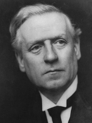
<span class="mw-page-title-main">December 1910 United Kingdom general election</span>

The December 1910 United Kingdom general election was held from 3 to 19 December. It was the last general election to be held over several days and the last to be held before the First World War.

<span class="mw-page-title-main">2004 European Parliament election in the United Kingdom</span> Election

The 2004 European Parliament election was the United Kingdom's part of the wider 2004 European Parliament election which was held between 10 and 13 June 2004 in the 25 member states of the European Union. The United Kingdom's part of this election was held on Thursday 10 June 2004. The election also coincided with the 2004 local elections and the London Assembly and mayoral elections. In total, 78 Members of the European Parliament were elected from the United Kingdom using proportional representation.

<span class="mw-page-title-main">Lists of places in Wales</span>

These are lists of places in Wales.

<span class="mw-page-title-main">Member of Parliament (United Kingdom)</span> Representative in the House of Commons

In the United Kingdom, a member of Parliament (MP) is an individual elected to serve in the House of Commons, the lower house of the Parliament of the United Kingdom.
<span class="mw-page-title-main">United Kingdom of Portugal, Brazil and the Algarves</span> Pluricontinental monarchy

The United Kingdom of Portugal, Brazil and the Algarves was a pluricontinental monarchy formed by the elevation of the Portuguese colony named State of Brazil to the status of a kingdom and by the simultaneous union of that Kingdom of Brazil with the Kingdom of Portugal and the Kingdom of the Algarves, constituting a single state consisting of three kingdoms.

<span class="mw-page-title-main">Unitary authorities of England</span> Local government in some parts of England

The unitary authorities of England are a type of local authority responsible for all local government services in an area. They combine the functions of a non-metropolitan county council and a non-metropolitan district council, which elsewhere in England provide two tiers of local government.

<span class="mw-page-title-main">Kingdom of Portugal</span> Kingdom in Southwestern Europe (1139–1910)

The Kingdom of Portugal was a monarchy in the western Iberian Peninsula and the predecessor of the modern Portuguese Republic. Existing to various extents between 1139 and 1910, it was also known as the Kingdom of Portugal and the Algarves after 1415, and as the United Kingdom of Portugal, Brazil and the Algarves between 1815 and 1822. The name is also often applied to the Portuguese Empire, the realm's overseas colonies.

<span class="mw-page-title-main">United Kingdom in the Eurovision Song Contest</span>

The United Kingdom has participated in the Eurovision Song Contest 66 times. Its first participation was at the second contest, in 1957, and it has entered every year since 1959. The British participant broadcaster in the contest is the British Broadcasting Corporation (BBC). The country has won the contest five times: in 1967, with "Puppet on a String" performed by Sandie Shaw; in 1969, with "Boom Bang-a-Bang" by Lulu ; in 1976, with "Save Your Kisses for Me" by Brotherhood of Man; in 1981, with "Making Your Mind Up" by Bucks Fizz; and in 1997, with "Love Shine a Light" by Katrina and the Waves. The UK has also achieved a record sixteen second-place finishes, the first in 1959 and the most recent in 2022.

<span class="mw-page-title-main">New Zealand–United Kingdom relations</span> Bilateral relations

New Zealand–United Kingdom relations are the bilateral relations between New Zealand and the United Kingdom. New Zealand has maintained a close relationship with Britain, since gaining independence from the United Kingdom.

<span class="mw-page-title-main">Countries of the United Kingdom</span> Component parts of the UK since 1922

Since 1922, the United Kingdom has been made up of four countries: England, Scotland, Wales and Northern Ireland. The UK Prime Minister's website has used the phrase "countries within a country" to describe the United Kingdom.