Oronsay, Loch Sunart

Last updated

Oronsay
Scottish Gaelic nameOrasaigh
Old Norse nameÖrfirirsey
Meaning of nametidal island (Norse via Gaelic)
Location
Highland UK relief location map.jpg
Red pog.svg
Oronsay
Oronsay shown within Highland Scotland
OS grid reference NM591592
Coordinates 56°40′N5°56′W / 56.66°N 5.93°W / 56.66; -5.93
Physical geography
Island group Inner Hebrides
Area240 hectares (0.93 sq mi) [1]
Area rank99= [2]
Highest elevation58 metres (190 ft)
Administration
Council area Highland
Country Scotland
Sovereign state United Kingdom
Demographics
Population0 [3]
Lymphad3.svg
References [4] [5]
Oronsay from southern end of Sailean Mor Oronsaysunart.jpg
Oronsay from southern end of Sàilean Mòr

Oronsay is an uninhabited island in Loch Sunart, Scotland.

It is low-lying, barren and rocky, deeply indented with sea lochs. [6]

The island encloses Loch Drumbuie (Scottish Gaelic : Loch na Droma Buidhe), a popular anchorage for yachts and a temporary home to fish farm cages.

Related Research Articles

<span class="mw-page-title-main">Inchmurrin</span> Island in Scotland

Inchmurrin is an island in Loch Lomond in Scotland. It is the largest fresh water island in the British Isles.

<span class="mw-page-title-main">Eilean Dubh Mòr</span> Uninhabited island in the Inner Hebrides of Scotland

Eilean Dubh Mòr is an uninhabited island in the Inner Hebrides of Scotland. It lies at the mouth of the Firth of Lorn, between the islands of Lunga and Garbh Eileach. The area of the island has been measured variously—at 50 hectares by Livingstone and 65 hectares by Haswell-Smith, the latter including the nearby islet of Eilean Dubh Beag, which is joined to Eilean Dubh Mòr at low tide.

<span class="mw-page-title-main">Seaforth Island</span> Island in the Outer Hebrides, Scotland

Seaforth Island is an uninhabited island in the Outer Hebrides of Scotland. Unlike many other islands of the Outer Hebrides which are mainly surrounded by open sea, Seaforth Island lies in a narrow fjord-like sea loch named Loch Seaforth, 8 kilometres (5.0 mi) from the open waters of The Minch.

<span class="mw-page-title-main">Isle Ristol</span> Innermost of the Summer Isles in Scotland

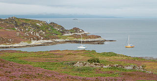
Isle Ristol, the innermost of the Summer Isles in Scotland, is a Scottish Wildlife Trust Reserve.

<span class="mw-page-title-main">Càrna</span> Island in Loch Sunart, Scotland

Carna or Càrna is an island in Loch Sunart, an arm of the sea, close to the Ardnamurchan peninsula, on the west coast of Scotland.

<span class="mw-page-title-main">Oronsay, Loch Bracadale</span> Uninhabited tidal island in Loch Bracadale on the west coast of Skye, Scotland

Oronsay is an uninhabited tidal island in Loch Bracadale on the west coast of Skye, Scotland.

Eriska is a flat tidal island at the entrance to Loch Creran on the west coast of Scotland.

Longa Island is a small uninhabited island at the mouth of Loch Gairloch, on the west coast of Scotland. Longa is nearly one mile in length with an area of 126 hectares and a maximum elevation of 70 metres (230 ft) above sea level.

<span class="mw-page-title-main">Island of Danna</span> Inhabited tidal island in Argyll and Bute

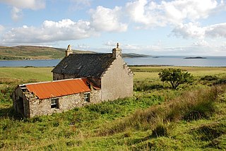
The Island of Danna or Danna, is an inhabited tidal island in Argyll and Bute.

<span class="mw-page-title-main">Calbha Beag</span> Uninhabited island in Scotland

Calbha Beag is an uninhabited island in Eddrachillis Bay, off Sutherland, Highland, Scotland. It is immediately to the west of Calbha Mor.

<span class="mw-page-title-main">Inchlonaig</span> Island in Loch Lomond, Scotland

Inchlonaig is an island in Loch Lomond in Scotland.

Inchtavannach, is one of the larger islands in Loch Lomond.

<span class="mw-page-title-main">Innis Chonain</span>

Innis Chonain or Innischonan is an island in Loch Awe, Scotland connected to the mainland by a bridge.

<span class="mw-page-title-main">Stockinish Island</span> Island in Scotland

Stockinish Island is an uninhabited island off Harris, in the Outer Hebrides.

Ceallasaigh Mòr is a low-lying island in Loch Maddy off North Uist in the Outer Hebrides of Scotland. This an area of shallow lagoons filled and drained by the tides each day. Ceallasaigh Beag lies to the south and these two islets are connected by a narrow strip of sand at low tide. Ceallasaigh Mòr may also join mainland North Uist near Bràigh Cheallasaigh at some stages of the tide.

<span class="mw-page-title-main">Flodday near Vatersay</span> Uninhabited island in Scotland

Flodday is an uninhabited island, south west of Barra in the Western Islands of Scotland.

<span class="mw-page-title-main">Eilean Mhic Chrion</span> Island in Scotland, United Kingdom

Eilean Mhic Chrion is a tidal island sheltering Ardfern in Loch Craignish, Scotland.

<span class="mw-page-title-main">Ceallasaigh Beag</span> Island in the Outer Hebrides, Scotland

Ceallasaigh Beag is a low-lying island in Loch Maddy off North Uist in the Outer Hebrides of Scotland. This an area of shallow lagoons filled and drained by the tides each day. Ceallasaigh Mòr lies to the south and these two islets are connected by a narrow strip of sand during some low tides.

<span class="mw-page-title-main">Eilean Loain</span>

Eilean Loain is a small island in Loch Sween and one of the Inner Hebrides of Scotland.

<span class="mw-page-title-main">Eilean dà Mhèinn</span>

Eilean dà Mhèinn, is a small inhabited island in Loch Crinan and one of the Inner Hebrides of Scotland.

References

  1. Rick Livingstone’s Tables of the Islands of Scotland (pdf) Argyll Yacht Charters. Retrieved 12 Dec 2011.
  2. Area and population ranks: there are c.300 islands over 20ha in extent and 93 permanently inhabited islands were listed in the 2011 census.
  3. National Records of Scotland (15 August 2013). "Appendix 2: Population and households on Scotland's Inhabited Islands" (PDF). Statistical Bulletin: 2011 Census: First Results on Population and Household Estimates for Scotland Release 1C (Part Two) (PDF) (Report). SG/2013/126. Retrieved 14 August 2020.
  4. Haswell-Smith, Hamish (2004). The Scottish Islands. Edinburgh: Canongate. ISBN   978-1-84195-454-7.
  5. Ordnance Survey: Landranger map sheet 47 Tobermory & North Mull (Map). Ordnance Survey. 2013. ISBN   9780319229835.
  6. Perrott, David (1988). Guide to the Western Islands of Scotland. Edinburgh: Kittiwake. ISBN   0-7028-0886-5.

56°39′43″N5°55′48″W / 56.66194°N 5.93000°W / 56.66194; -5.93000