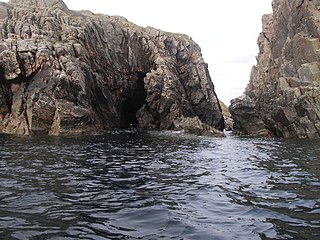
Geography and geology
The rock is "gneiss bedrock with some basaltic intrusion". [4]
The island is oblong in shape with several inlets on its south coast, lying on an east–west axis in Loch Sealg (Loch Shell), and shelters the harbour of Lemreway on the "mainland" of Lewis nearby.
There are two peaks at either end of the island, with the low ground in the middle. There are two lochans in the west, and three in the east as well as a number of burns.
History
The placename Dùnan on the south coast may be a reference to a little fort of some antiquity.
Although Haswell-Smith suggests that the name means "yew island", [4] the preponderance of Norse names in the Outer Hebrides suggests that the second element of "Iubhard" may be a corruption of fjord /firth.
Dean Munro visited the island in 1549, and reported "pasture and schielling of store, with faire hunting of ottars out of their bouries". [4]
On 4 May 1746, Bonnie Prince Charlie hid on the island with some of his men for four days. Royal Navy vessels were patrolling in the Minch at the time. They camped under a sail stretched over a "low pitiful hut" while it rained torrentially. [4]
In the early 19th century, five families were living here. Presumably they had moved there in the past few decades, as the story of the Jacobite visit mentions no inhabitants. Seanna-Bhaile (meaning the "old town") was the main settlement, and there was also the lone house known as Taigh a' Gheumpaill. [4]
The Outer Hebrides or Western Isles, sometimes known as the Long Isle or Long Island, is an island chain off the west coast of mainland Scotland. The islands form part of the archipelago of the Hebrides, separated from the Scottish mainland and from the Inner Hebrides by the waters of the Minch, the Little Minch, and the Sea of the Hebrides. The Outer Hebrides are considered to be the traditional heartland of the Gaelic language. The islands form one of the 32 council areas of Scotland, which since 1998 has used only the Gaelic form of its name, including in English language contexts. The council area is called Na h-Eileanan an Iar and its council is Comhairle nan Eilean Siar.

Ronay is an island in the Outer Hebrides of Scotland, which lies a short distance off the east coast of Grimsay.

Seaforth Island is an uninhabited island in the Outer Hebrides of Scotland. Unlike many other islands of the Outer Hebrides which are mainly surrounded by open sea, Seaforth Island lies in a narrow fjord-like sea loch named Loch Seaforth, 8 kilometres (5.0 mi) from the open waters of The Minch.
Eilean Mhealasta is an uninhabited island off the west coast of Lewis in the Outer Hebrides of Scotland. It takes its name from Mealista, a nearby township on Lewis.
Eilean Chaluim Chille is an unpopulated island in the Outer Hebrides.
Eilean Kearstay is an uninhabited island in Loch Roag in the Outer Hebrides of Scotland.
Island Macaskin or MacAskin is an island in Loch Craignish, in the Inner Hebrides of Scotland. It is owned by the Jenkin family and has been since 1904.

Stockinish Island is an uninhabited island off Harris, in the Outer Hebrides.
Fuaigh Mòr is an island in the Outer Hebrides of Scotland. It is off the west coast of Lewis near Great Bernera in Loch Ròg. It is 84 hectares and 67 metres at its highest point.
Vacsay is one of the Outer Hebrides. It is off the west coast of Lewis in West Loch Roag. It is 41 hectares in size, and 34 metres at its highest point.
Stuley is an island lying to the east of South Uist in the Outer Hebrides, Scotland. It lies off the section of coastline between Loch Eynort and Loch Boisdale. It is 45 hectares (0.17 sq mi) and 40 metres (131 ft) at its highest point.
Fuaigh Beag or Vuia Be(a)g is an island in the Outer Hebrides. It is off the west coast of Lewis near Great Bernera in Loch Roag. Its name means "little Fuaigh", and is named in contrast to Fuaigh Mòr nearby.
Na h-Eileanan Iasgaich comprise a small uninhabited archipelago in Loch Boisdale, in the south east of the island of South Uist, in the Outer Hebrides, Scotland. The individual islands are separated from one another at high tide, but connected to one another at low tide,. They are around 50 ha in extent and over 20m at their highest point. Their boundaries are ill-defined.

Lewis and Harris, or Lewis with Harris, is a Scottish island in the Outer Hebrides, around 24 miles (39 km) from the Scottish mainland.

Seanna Chnoc, correctly known as Seana Bheinn is an islet in outer Loch Ròg, Lewis, Scotland. It lies north west of Great Bernera and Bearasaigh.

Ceallasaigh Beag is a low-lying island in Loch Maddy off North Uist in the Outer Hebrides of Scotland. This an area of shallow lagoons filled and drained by the tides each day. Ceallasaigh Mòr lies to the south and these two islets are connected by a narrow strip of sand during some low tides.
This page is based on this
Wikipedia article Text is available under the
CC BY-SA 4.0 license; additional terms may apply.
Images, videos and audio are available under their respective licenses.


