The Outer Hebrides or Western Isles, sometimes known as Na h-Innse Gall or the Long Isle/Long Island, is an island chain off the west coast of mainland Scotland. The islands are geographically coextensive with Comhairle nan Eilean Siar, one of the 32 unitary council areas of Scotland. They form part of the archipelago of the Hebrides, separated from the Scottish mainland and from the Inner Hebrides by the waters of the Minch, the Little Minch, and the Sea of the Hebrides. Scottish Gaelic is the predominant spoken language, although in a few areas English speakers form a majority.

The Isle of Lewis (Scottish Gaelic: Eilean Leòdhais or simply Lewis is the northern part of Lewis and Harris, the largest island of the Western Isles or Outer Hebrides archipelago in Scotland. The two parts are frequently referred to as if they were separate islands. The total area of Lewis is 683 square miles.

Harris is the southern and more mountainous part of Lewis and Harris, the largest island in the Outer Hebrides, Scotland. Although not an island itself, Harris is often referred to as the Isle of Harris, which is the former postal county and the current post town for Royal Mail postcodes starting HS3 or HS5.

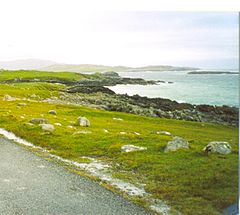
Callanish is a village (township) on the west side of the Isle of Lewis, in the Outer Hebrides, Scotland. Callanish is within the parish of Uig. A linear settlement with a jetty, it is on a headland jutting into Loch Roag, a sea loch 13 miles west of Stornoway. Callanish is situated alongside the A858, between Breasclete and Garynahine.

Stornoway is the main town of the Western Isles and the capital of Lewis and Harris in Scotland.

Bragar is a village on the west side of the Isle of Lewis in the Outer Hebrides, Scotland, 14 miles from the island's only town, Stornoway. Bragar is within the parish of Barvas, and is situated on the A858 between Carloway and Barvas.

Carloway is a crofting township and a district on the west coast of the Isle of Lewis, in the Outer Hebrides, Scotland. The district has a population of around 500. Carloway township is within the parish of Uig, and is situated on the A858.

Tarbert is the main community on Harris in the Western Isles of Scotland. The name means "isthmus", "crossing point" or "portage", in Gaelic. The isthmus, between the sea lochs West Loch Tarbert and East Loch Tarbert, joins south Harris to north Harris and Lewis. In 1981 it had a population of 503.

Breasclete is a village and community on the west side of the Isle of Lewis, in the Outer Hebrides, Scotland. Breasclete is within the parish of Uig, and is situated adjacent to the A858.

Shulishader is a small village with a population of around 120 people in Point, Outer Hebrides on the Isle of Lewis, Scotland. Located on the north-western side of the Eye Peninsula, it overlooks Broad Bay. Most of the village is over 60m above sea level, affording excellent views across the bay and northern Lewis, though the land falls gently towards the sea before ending in small cliffs. There are several small, difficult to access, sandy beaches, and a small cove on the coastline. The cove is accessible via 88 dilapidated steps, and contains a pebble peach, some natural caves and a concrete structure once used for boat moorings above the high tide line.

Garynahine is a settlement on Lewis, in the Outer Hebrides, Scotland. Garynahine is situated at a T-junction where roads from Stornoway, Uig and the west side of Lewis all meet. The roads are the A858 and the B8011. Garynahine is within the parish of Uig.

MV Isle of Lewis is a Scottish ro-ro ferry, owned by Caledonian Maritime Assets Limited, and operated by Caledonian MacBrayne between Oban and Castlebay, Barra. Built in 1995, she remains one of only two ships in the CalMac fleet over 100 metres (328 ft) in length; the other, Loch Seaforth, being longer by almost 15 metres.

Ardroil is a village on the Isle of Lewis in the Outer Hebrides, Scotland. Ardroil is within the parish of Uig.
Borrowston, with a population of about 50, is a crofting township situated on the Isle of Lewis, on the Outer Hebrides of Scotland. It lies at the northern end of Loch Carloway 1⁄2 mile west of Carloway. Borrowston is within the parish of Uig, and is situated near to the A858, which runs through Carloway. The hill Ben Borriston lies to the west.

MV Hebrides is a ferry owned by Caledonian Maritime Assets Limited and operated by Caledonian MacBrayne from Uig to Lochmaddy and Tarbert, the main settlements of North Uist and Harris respectively.

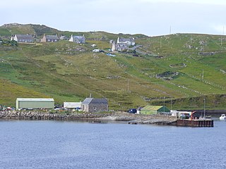
Breacleit is the central village on Great Bernera in the Outer Hebrides, Scotland. Breaclete is within the parish of Uig. Although the village name comes from a geographical feature rather than a steading it is generally believed to be an ancient settlement. The oldest building in the village is the thatched water mill by the shore of Loch Risay which was restored in the 1990s. It was formerly a tiny crofting and fishing settlement of just 12 crofts surrounding the natural harbour of Loch Beag but crofting has now ceased and holiday homes have taken over. The earliest clearly mapped reference is on Murdoch MacKenzie's first Admiralty chart surveyed in 1748. In 1851 J.M. MacKenzie, the Chamberlain to the estate owner Sir James Matheson, proposed that all the tenants of the village were to be evicted and sent to North America on the emigrant ship the SS Marquis of Stafford. This plan was not fully carried through however but it still had a great effect on the village leaving it with a population of just three families. This population was later supplemented through evictions elsewhere notably the clearances of Hacklete and Barragloum villages in the south of Great Bernera.

Aird Uig is a village on the Isle of Lewis, in the Outer Hebrides, Scotland. Aird Uig is within the parish of Uig, and is situated on the C40 minor road which joins to the B8011 at Timsgarry.
Timsgarry is a village on the Isle of Lewis, in the Outer Hebrides, Scotland. Timsgarry is home to the Baile na Cille Church and the Uig Museum, noted for its giant Chessmen, discovered in the sands in 1831.
Newmarket is a village in the Outer Hebrides of Scotland, on the Isle of Lewis near Stornoway. It is part of the Leodsoch countryside and a peat site is not far away. Its nearest town is Stornoway and the nearest council headquarters is Na h-Eileanan Siar in Stornoway. Newmarket is within the parish of Stornoway. Newmarket is situated on the A857 at the junction with the B895. The remains of a stone circle exist to the west of the villages in a croft.

Lewis and Harris, or Lewis with Harris, is a single Scottish island in the Outer Hebrides, divided by mountains. It is the largest island in Scotland and the third largest in the British Isles, after Great Britain and the island of Ireland, with an area of 841 square miles (2,178 km2), which is approximately 1% of the area of Great Britain. The northern two-thirds is called [the Isle of] Lewis and the southern third [the Isle of] Harris; each is frequently referred to as if it were a separate island.