This is a list of the extreme points of the United Kingdom: the points that are farther north, south, east or west than any other location. Traditionally the extent of the island of Great Britain has stretched "from Land's End to John o' Groats".
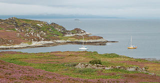
Eilean Rìgh is an island in the Inner Hebrides of the west coast of Scotland. It lies in Loch Craignish, about 300 metres off the Argyll coastline. The name is Gaelic for "King's Island", although which royal is not known.

Eilean Bàn is a six-acre (2.4 ha) island between Kyle of Lochalsh and the Isle of Skye, in the historic county of Ross and Cromarty in the Highland local government area. The Skye Bridge uses the island as a stepping-stone as it crosses the mouth of Loch Alsh from the mainland to Skye.
Eilean Dubh Mòr is an uninhabited island in the Inner Hebrides of Scotland. It lies at the mouth of the Firth of Lorn, between the islands of Lunga and Garbh Eileach. The area of the island has been measured variously—at 50 hectares by Livingstone and 65 hectares by Haswell-Smith, the latter including the nearby islet of Eilean Dubh Beag, which is joined to Eilean Dubh Mòr at low tide.

Seaforth Island is an uninhabited island in the Outer Hebrides of Scotland. Unlike many other islands of the Outer Hebrides which are mainly surrounded by open sea, Seaforth Island lies in a narrow fjord-like sea loch named Loch Seaforth, 8 kilometres (5.0 mi) from the open waters of The Minch.

Eilean nan Ròn is an island near Skerray, in the north of Sutherland, Scotland. An estimated 350 seal pups are born here annually.
Eilean Mhealasta is an uninhabited island off the west coast of Lewis in the Outer Hebrides of Scotland. It takes its name from Mealista, a nearby township on Lewis.
Eilean Chaluim Chille is an unpopulated island in the Outer Hebrides.

Bayble Island lies at the southern end of Bayble Bay. It consists of two islands, but these appear as a single island from most directions. The hamlets of Upper and Lower Bayble overlook the island and bay.
Island Macaskin or MacAskin is an island in Loch Craignish, in the Inner Hebrides of Scotland. It is owned by the Jenkin family and has been since 1904.
Fuaigh Mòr is an island in the Outer Hebrides of Scotland. It is off the west coast of Lewis near Great Bernera in Loch Ròg. It is 84 hectares and 67 metres at its highest point.
Vacsay is one of the Outer Hebrides. It is off the west coast of Lewis in West Loch Roag. It is 41 hectares in size, and 34 metres at its highest point.
Eilean Liubhaird or Eilean Iubhard is an island in the Outer Hebrides, to the east of Lewis.
Oldany Island is an uninhabited island in Assynt, Sutherland, north-west Scotland.
Fuaigh Beag or Vuia Be(a)g is an island in the Outer Hebrides. It is off the west coast of Lewis near Great Bernera in Loch Roag. Its name means "little Fuaigh", and is named in contrast to Fuaigh Mòr nearby.

Eilean Mòr is an island in Loch Langavat on the Isle of Lewis in the Outer Hebrides of Scotland.
Eilean an Ròin Mòr is an uninhabited island in north west Sutherland.
Eilean Hoan is an island in Loch Eriboll in Sutherland on the north coast of Scotland. It is about 28 hectares in extent and the highest point is 25 metres (82 ft) above sea level. Its name is of Gaelic and Old Norse derivation and means "haven island".

Eilean Tigh is a tidal island in the Sound of Raasay of Scotland, that lies between Rona and Raasay.

Eilean dà Mhèinn, is a small inhabited island in Loch Crinan and one of the Inner Hebrides of Scotland.
This page is based on this
Wikipedia article Text is available under the
CC BY-SA 4.0 license; additional terms may apply.
Images, videos and audio are available under their respective licenses.

