Flodaigh is a small island in Loch Roag on the west coast of Lewis in the Outer Hebrides of Scotland. It is about 33 hectares (82 acres) in extent and the highest point is 48 metres (157ft). Its name derives from the Old Norse for "flat island".
Lewis is the northern part of Lewis and Harris, the largest island of the Western Isles or Outer Hebrides archipelago in Scotland. It is also known as the Isle of Lewis, as the two parts are frequently referred to as if they were separate islands. The total area of Lewis is 683 square miles (1,770 km2).
The Outer Hebrides, also known as the Western Isles, Innse Gall or the Long Isle or the Long Island, is an island chain off the west coast of mainland Scotland. The islands are geographically coextensive with Comhairle nan Eilean Siar, one of the 32 unitary council areas of Scotland. They form part of the archipelago of the Hebrides, separated from the Scottish mainland and from the Inner Hebrides by the waters of the Minch, the Little Minch, and the Sea of the Hebrides. Scottish Gaelic is the predominant spoken language, although in a few areas English speakers form a majority.
Old Norse was a North Germanic language that was spoken by inhabitants of Scandinavia and their overseas settlements from about the 9th to the 13th century.
Inland, the nearest settlement is opposite the hamlet of Cairisiadar. The island was last inhabited in 1827 when it was cleared to make way for a sheep farm.[3]
The Highland Clearances were the evictions of a significant number of tenants in the Scottish Highlands, mostly in the period 1750 to 1860.
The small islet of Gousam lies to the north east and the larger islands of Fuaigh Beag and Fuaigh Mòr further east.
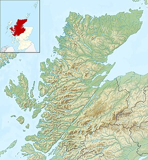
Fuaigh Beag or Vuia Be(a)g is an island in the Outer Hebrides. It is off the west coast of Lewis near Great Bernera in Loch Roag. Its name means "little Fuaigh", and is named in contrast to Fuaigh Mòr nearby.
Fuaigh Mòr is an island in the Outer Hebrides of Scotland. It is off the west coast of Lewis near Great Bernera in Loch Roag. It is 84 hectares and 67 metres at its highest point.
A geographic coordinate system is a coordinate system that enables every location on Earth to be specified by a set of numbers, letters or symbols. The coordinates are often chosen such that one of the numbers represents a vertical position and two or three of the numbers represent a horizontal position; alternatively, a geographic position may be expressed in a combined three-dimensional Cartesian vector. A common choice of coordinates is latitude, longitude and elevation. To specify a location on a plane requires a map projection.
This page is based on this Wikipedia article Text is available under the CC BY-SA 4.0 license; additional terms may apply. Images, videos and audio are available under their respective licenses.
Related Research Articles
Scalpay is an island in the Inner Hebrides of Scotland.
Great Bernera, often known just as Bernera, is an island and community in the Outer Hebrides of Scotland. With an area of just over 21 km2 (8.1 sq mi), it is the thirty-fourth largest Scottish island.
Copinsay is one of the Orkney Islands in Scotland, lying off the east coast of the Orkney Mainland. The smaller companion island to Copinsay is called the Horse of Copinsay and lies to the north east to the main island. The island is now uninhabited and managed as a bird reserve. Copinsay is also home to a lighthouse.
Fara is a small island in Orkney, Scotland, lying in Scapa Flow between the islands of Flotta and Hoy. It has been uninhabited since the 1960s.
Dunnet Head is a peninsula in Caithness, on the north coast of Scotland. Dunnet Head includes the most northerly point of the mainland of Great Britain.
Seaforth Island is an uninhabited island in the Outer Hebrides of Scotland. Unlike many other islands of the Outer Hebrides which are mainly surrounded by open sea, Seaforth Island lies in a narrow fjord-like sea loch named Loch Seaforth, 8 kilometres (5.0 mi) from the open waters of The Minch. There are two different Gaelic names for the island. Mulag is from the Old Norse name Múli, which describes its geographical location, and the other is after the family of Francis Mackenzie, 1st Baron Seaforth, who inherited the island in 1783.
Gairsay is a small island in Orkney, Scotland, located in the parish of Rendall, 1.5 miles (2.4 km) off the coast, astride one of the approaches to the bays of Firth and Kirkwall. It is about 2 miles (3.2 km) long and 1 mile (1.6 km) wide and includes one conical hill and a small harbour called Millburn Bay, which is sheltered by the peninsula known as the Hen of Gairsay.
Little Bernera is a small island situated off the west coast of the Isle of Lewis in the Outer Hebrides.
The Calf of Flotta is a small island in Scapa Flow, Orkney. The Calf is next to Flotta, with "Calf" deriving from Old Norse/Norn and meaning a smaller island by a larger one.
Island Macaskin or MacAskin is an island in Loch Craignish, in the Inner Hebrides of Scotland.
Stockinish Island is an uninhabited island off Harris, in the Outer Hebrides.
Loch Ròg or Loch Roag is a large sea loch on the west coast of Lewis, Outer Hebrides. It is broadly divided into East Loch Roag and West Loch Roag with other notable branches being Little Loch Roag, Loch Barragloum, Langavat and Loch Kintulavik. The Loch is dominated by the only inhabited island Great Bernera and East Loch Roag is actually referred to as Loch Bernera on early maps, most notably Murdoch MacKenzie's original Admiralty Chart from 1776. The use of West and East to differentiate the sections of the Loch appear from the original Ordnance Survey in 1850.
Ceabhaigh is a small island in an arm of Loch Ròg on the west coast of Lewis in the Outer Hebrides of Scotland. It is about 25 hectares in extent. It is not known if the island was ever permanently inhabited.
Neave Island or Coomb Island is an island on the north coast of the Scottish mainland.
Campaigh or Campay is a steep and rocky islet in outer Loch Ròg, Lewis, Scotland that lies north of Cealasaigh and Little Bernera.
Cealasaigh or Kealasay is an islet in outer Loch Ròg, Lewis, Scotland that lies north of Traigh Mhór on Little Bernera and south of Campaigh.
Inner Holm is a small inhabited island in Stromness harbour and one of the Orkney islands of Scotland.
Victoria Park is a district in north Edinburgh south of Newhaven and lying between Trinity and Leith. The area was given Conservation Area status in March 1998.