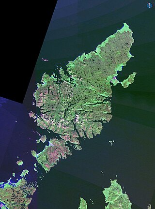
Eilean Mhuire (meaning "Virgin Mary's island") is the most easterly of the Shiant Islands in the Outer Hebrides.
Once populated, Eilean Mhuire is now used only for grazing sheep. There was an old local tradition that said there used to be a chapel on the island. There are various ruins on the island, and the Ordnance Survey mark some remains as that of a “St. Mary's Chapel" on the western side of the island. But this is based only on information provided in 1851 that the island had been the refuge of a priest "in the time of Knox".[5] Nicolson (2002) has concluded that this tradition is mistaken, but has speculated that Eilean Mhuire may instead have been a hermitage in pre-Norse times.[6] (And there was in fact a chapel on nearby Eilean an Taighe, possibly devoted to the Virgin Mary.)[7][8]
In 1549, Donald Monro, then Dean of the Isles, wrote that Eilean Mhuire was:
callit Senchastle by the Eriche, that is the alde castle ile in the Englishe, an strenthe, full of corne and grassinge, full of wyld fowls nests, and verey guid for fishing. It perteins to M’Cloyd of the Lewis.[9][Note 1]
Today, Seann Chaisteal (“old castle”) is the name of the flat-topped tidal islet at the south-eastern extremity of Eilean Mhuire. This islet is a "large tidal rock on which there never was a building of any kind",[10] so the name may simply have been inspired by the rock's shape and appearance.
Notes and references
Wikimedia Commons has media related to Eilean Mhuire.
Notes
↑ Translation from Scots: "called Senchastle in Gaelic, meaning the "old castle isle" in English, a stronghold full of corn and pasture, full of wild fowl's nests, and very good for fishing. It is owned by Clan MacLeod of Lewis.
The Holy Island or Holy Isle is an island in the Firth of Clyde, off the west coast of central Scotland, inside Lamlash Bay on the larger Isle of Arran. The island is around 3 kilometres long and around 1 kilometre wide. Its highest point is the hill Mullach Mòr.
Lismore is an island of some 2,351 hectares in the Inner Hebrides of Scotland. The climate is damp and mild, with over 166 centimetres (65 in) of rain recorded annually. This fertile, low-lying island was once a major centre of Celtic Christianity, with a 6th-century monastery associated with Saint Moluag, and later became the seat of the medieval Bishop of Argyll. There are numerous ruined structures, including a broch and two 13th-century castles.
Oronsay, also sometimes spelt and pronounced Oransay by the local community, is a small tidal island south of Colonsay in the Scottish Inner Hebrides with an area of 543 hectares.
Rona, sometimes called South Rona to distinguish it from North Rona, is an inhabited island in the Inner Hebrides. It lies between the Sound of Raasay and the Inner Sound just north of the neighbouring island of Raasay and east of the Trotternish peninsula of Skye. It has a total area of 930 hectares (3.6 sq mi) and a population of 3.
Easdale is one of the Slate Islands, in the Firth of Lorn, Scotland. Once the centre of the Scottish slate industry, there has been some recent island regeneration by the owners. This is the smallest of the Inner Hebrides' inhabited islands and is "home to traditional white-washed cottages, a small pub and disused slate quarries". One of the latter, filled with water, is used for swimming.
The Shiant Islands or Shiant Isles are a privately owned island group in the Minch, east of Harris in the Outer Hebrides of Scotland. They are five miles southeast of the Isle of Lewis.
Lunga is one of the Slate Islands in the Firth of Lorn in Argyll and Bute, Scotland. The "Grey Dog" tidal race, which runs in the sea channel to the south, reaches 8 knots (15 km/h) in full flood. The name "Lunga" is derived from the Old Norse for "isle of the longships', but almost all other place names are Gaelic in origin.
Ornsay is a small tidal island to the east of the Sleat peninsula on the Isle of Skye in the Inner Hebrides of Scotland.
Garbh Eilean is one of the Shiant Islands at the south end of the Minch on the west coast of Scotland.
Hermetray is an uninhabited island off North Uist, in the Outer Hebrides of Scotland.
Eilean an T(a)ighe, meaning "House Island", is one of the Shiant Islands. It is joined to Garbh Eilean by an isthmus, so they each form part of what is actually a single island.
Nave Island lies to the north of Islay in the Inner Hebrides near the mouth of Loch Gruinart. It is uninhabited.
Eilean Trodday is an island in The Minch just off the north coast of the Trotternish peninsula of Skye in Scotland.
South Ascrib is an island in Loch Snizort between the Waternish and Trotternish peninsulas on the northern coasts of the island of Skye in Scotland.
Seanna Chnoc, correctly known as Seana Bheinn is an islet in outer Loch Ròg, Lewis, Scotland. It lies north west of Great Bernera and Bearasaigh.
The Sound of Islay is a narrow strait between the islands of Islay and Jura off the west coast of Scotland. It is about 30 kilometres in extent from north to south and lies between Rubh' a' Mhàil on Islay and Rubh' Aird na Sgitheich on Jura to the north and Macarthur's Head and Rubha na Tràille to the south. The islands in the Sound are Am Fraoch Eilean, Brosdale Island and Glas Eilean, all of which are off the south east coast of Jura. These islands, Jura south of Loch Tarbert and the eastern part of the Sound are one of 40 National Scenic Areas in Scotland.
Description of the Western Isles of Scotland is the oldest known account of the Hebrides and the Islands of the Clyde, two chains of islands off the west coast of Scotland. The author was Donald Monro, a clergyman who used the title of "Dean of the Isles" and who lived through the Scottish Reformation. Monro wrote the original manuscript in 1549, although it was not published in any form until 1582 and was not widely available to the public in its original form until 1774. A more complete version, based on a late 17th-century manuscript written by Sir Robert Sibbald, was first published as late as 1961. Monro wrote in Scots and some of the descriptions are difficult for modern readers to render into English. Although Monro was criticised for publishing folklore and for omitting detail about the affairs of the churches in his diocese, Monro's Description is a valuable historical account and has reappeared in part or in whole in numerous publications, remaining one of the most widely quoted publications about the western islands of Scotland.
Brosdale Island is an uninhabited island in the council area of Argyll and Bute, Scotland. It is 1.25 miles from Jura House on Jura. It is about 1/4 of a mile long and 1/4 of a mile wide.
This page is based on this Wikipedia article Text is available under the CC BY-SA 4.0 license; additional terms may apply. Images, videos and audio are available under their respective licenses.