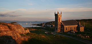
Scalpay is an inhabited island in the Inner Hebrides of Scotland which has a population of 4.
Coll is an island located west of the Isle of Mull in the Inner Hebrides of Scotland. Coll is known for its sandy beaches, which rise to form large sand dunes, for its corncrakes, and for Breacachadh Castle. It is in the council area of Argyll and Bute.

The Slate Islands are an island group in the Inner Hebrides, lying immediately off the west coast of Scotland, north of Jura and southwest of Oban. The main islands are Seil, Easdale, Luing, Shuna, Torsa and Belnahua. Scarba and Kerrera, which lie nearby are not usually included.

Seil is one of the Slate Islands, located on the east side of the Firth of Lorn, 7 miles southwest of Oban, in Scotland. Seil has been linked to the mainland by bridge since the late 18th century.
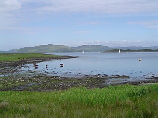
Luing is one of the Slate Islands, Firth of Lorn, in the west of Argyll in Scotland, about 16 miles (26 km) south of Oban. The island has an area of 1,430 hectares and is bounded by several small skerries and islets. It has a population of around 200 people, mostly living in Cullipool, Toberonochy, and Blackmillbay.

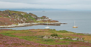
Scarba is an island, in Argyll and Bute, Scotland, just north of the much larger island of Jura. The island has not been permanently inhabited since the 1960s. Until his death in 2013 it was owned by Richard Hill, 7th Baron Sandys; its owner now is Shane Cadzow who farms Luing cattle on the nearby island of Luing and grazes some of the cattle on Scarba. Kilmory Lodge is used seasonally as a shooting lodge, the island having a flourishing herd of red deer.
Gometra is an island in the Inner Hebrides of Scotland, lying west of Mull. It lies immediately west of Ulva, to which it is linked by a bridge, and at low tide also by a beach. It is approximately 425 hectares in size. The name is also applied to the island summit, which is a Marilyn. The island has been owned since 1991 by Roc Sandford, a wealthy environmental campaigner who lives mostly in London and part of the year on Gometra.
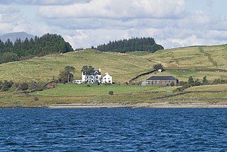
Torsa is one of the Slate Islands in Argyll and Bute, Scotland. Lying east of Luing and south of Seil, this tidal island was inhabited until the 1960s. There is now only one house there, which is used for holiday lets. The underlying bedrock is slate but unlike Torsa's immediate island neighbours this has never been worked commercially. The island's name is of Norse origin but the most prominent historical structure on the island is the ruined Caisteal nan Con on the northeast shore, once held by Clan Campbell. The abundant sea life in the waters surrounding the island are protected by the Loch Sunart to the Sound of Jura Marine Protected Area.

Fladda is one of the Slate Islands, off the west coast of Argyll and Bute, Scotland.

Eileach an Naoimh, also known as Holy Isle, is an uninhabited island in the Inner Hebrides of the west coast of Scotland. It is the southernmost of the Garvellachs archipelago and lies in the Firth of Lorne between Mull and Argyll. The name is Gaelic for "rocky place of the saint".
Eilean Dubh Mòr is an uninhabited island in the Inner Hebrides of Scotland. It lies at the mouth of the Firth of Lorn, between the islands of Lunga and Garbh Eileach. The area of the island has been measured variously—at 50 hectares by Livingstone and 65 hectares by Haswell-Smith, the latter including the nearby islet of Eilean Dubh Beag, which is joined to Eilean Dubh Mòr at low tide.
Ensay is a currently unpopulated and privately owned island in the Outer Hebrides of Scotland. The island lies in the Sound of Harris between the islands of Harris and Berneray. The name originates from the Old Norse for Ewe Island. It is nothing to do with the Gaelic for Jesus – "Iosa" – as sometimes stated.
Fladda is the northernmost of the Treshnish Isles. Its name comes from the Old Norse Flat-ey meaning "flat island". Fladda is owned by the Hebridean Trust.
The Island of Danna or Danna, is an inhabited tidal island in Argyll and Bute.
Shuna Island or simply Shuna is an island in Loch Linnhe, offshore from Appin, in Argyll and Bute, Scotland. The island is approximately two kilometres long and one kilometre wide, and extends to some 155 ha in total. The island is characterised by a table topped hill at its southern end. The name Shuna is probably derived from the Norse, for "sea island". The island is separated from Appin by the Sound of Shuna.
Dùn Chonnuill is a small island in the Garvellachs in the Firth of Lorn, Scotland.
Gunna is an island in the Inner Hebrides of Scotland.

Fuiay is an island in Scotland. It is one of ten islands in the Sound of Barra, a Site of Community Importance for conservation in the Outer Hebrides. Its area is 84 ha and the unnamed highest eminence reaches 107 m. It is located immediately to the west of Flodday and about 1.5 km southwest of Hellisay. Barra lies across the waters of North Bay.

Eilean na Cille, south east of Benbecula is an island of the Outer Hebrides connected to Grimsay (South) by a causeway which carries the B891. The road was built to service the pier at Peter's Port, which was constructed in 1896 at cost of £2,000 – although the anchorage is awkward and should not be used without local knowledge.


