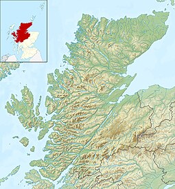
Soay is an island just off the coast of Skye, in the Inner Hebrides of Scotland.
Boreray is an island with a single croft, lying 2 kilometres (1.2 mi) north of North Uist in the Outer Hebrides of Scotland.

Inchmurrin is an island in Loch Lomond in Scotland. It is the largest fresh water island in the British Isles.
Eorsa is an uninhabited island in the Inner Hebrides of Scotland.

Seaforth Island is an uninhabited island in the Outer Hebrides of Scotland. Unlike many other islands of the Outer Hebrides which are mainly surrounded by open sea, Seaforth Island lies in a narrow fjord-like sea loch named Loch Seaforth, 8 kilometres (5.0 mi) from the open waters of The Minch.

Loch Seaforth is a sea loch in the Outer Hebrides of Scotland. It consists of three distinct sections; the most seaward is aligned northwest–southeast, a middle section is aligned northeast–southwest and the inner and most northerly section is aligned east–west. The southern stretch of the loch seaward from Bowglass forms the boundary between Lewis and Harris and was until 1975 the boundary between the traditional counties of Ross and Cromarty and Inverness-shire. The settlement of Rhenigidale lies near the mouth of the loch whilst the settlement of Maaruig lies on Loch Maraig, an embayment on the western side of Loch Seaforth. Further settlement is found around the small bays at Ardvourlie opposite Seaforth Island which sits in the midst of the loch at the point where inland it turns towards the northeast. The crofting township of Arivruaich lies beside a further embayment known as Tob Cheann Tarabhaigh. The head of the loch is to be found 5 km further east at Ceann Shiphoirt. The loch forms the entire western coast of the relatively isolated Pairc peninsula.
Pabay is a Scottish island just off the coast of Skye. The name Pabay is derived from an old Norse word meaning "priest's isle" and there are the remains of a 13th-century chapel.

Wiay is an uninhabited island in the Outer Hebrides.

Inchfad is an island in the south east of Loch Lomond in Scotland.

Soay Mòr is an island in West Loch Tarbert, between the northern and southern parts of Harris. The uninhabited island is separated from the southwest coast of North Harris by the Soay Sound. The adjacent Soay Beag is accessible on foot at low tide.
Ceann Ear is the largest island in the Monach or Heisgeir group off North Uist in north west Scotland. It is 203 hectares in size and connected by sandbanks to Ceann Iar via Sibhinis at low tide. It is said that it was at one time possible to walk all the way to Baleshare, and on to North Uist, 5 miles away at low tide. In the 16th century, a large tidal wave was said to have washed this away.

Inchlonaig is an island in Loch Lomond in Scotland.
Inchtavannach, is one of the larger islands in Loch Lomond.
Stuley is an island lying to the east of South Uist in the Outer Hebrides, Scotland. It lies off the section of coastline between Loch Eynort and Loch Boisdale. It is 45 hectares (0.17 sq mi) and 40 metres (131 ft) at its highest point.

Eilean Sùbhainn is the largest of several small islands in Loch Maree, Wester Ross, Scotland. It is the second largest freshwater island in Scotland after Inchmurrin.

Eilean Ruairidh Mòr is a forested island in Loch Maree, Wester Ross, Scotland. Its name was formerly anglicised as "Ellan-Rorymore".

Bucinch or Buc-Innis is a small island in Loch Lomond, in west central Scotland.

Lewis and Harris, or Lewis with Harris, is a Scottish island in the Outer Hebrides, around 24 miles (39 km) from the Scottish mainland.
Stromay is a tidal island off North Uist in the Sound of Harris, Scotland.

Sursaigh is an island off North Uist in the Sound of Harris, Scotland. It lies 8 kilometres (5.0 mi) northeast of the village of Lochmaddy and there are numerous nearby islands including Stromay, Sgarabhaigh and Tahay.


