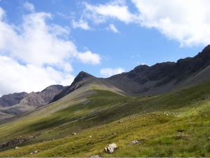
Glamaig is the northernmost of the Red Hills on the Isle of Skye in Scotland. It lies immediately east of Sligachan. It is one of only two Corbetts on Skye.
From many angles the hill resembles a perfect cone of scree, though it is linked to the rest of the Red Hills by way of a bealach, the Bealach na Sgairde (pronounced b'ya-loch na skaar-st'ya), meaning the pass of scree.
In 1889, a Gurkha named Harkabir Tharpa scaled Glamaig in 37 minutes; his total time for the round trip, starting and finishing at sea level in the bar of the Sligachan Inn was 55 minutes. Legend has it that he ran it in bare feet, and his record stood until the 1980s, despite being attempted by Olympians such as Chris Brasher in the 1950s.
From Sligachan one route of ascent (whether running or hillwalking) is simply to head up the scree aiming for the summit - this climb is very arduous, due to the unrelenting gradient and the slipperiness of the scree. Descent may be made by way of ascent; alternatively one may continue along the Red Cuillin ridge to take in other peaks to the south.
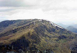
A slightly less arduous (but longer) climb approaches the mountain from its eastern end at Sconser. Climb first to the secondary summit, An Coileach (The Cockerel), then follow the whaleback ridge to the primary summit, Sgurr Mhairi (Mary's Peak). Once An Coileach is reached at 673 metres (2,208 ft), the more-or-less level ridge allows some respite from the gradient, with a gentler ascent of the final 102 metres (335 ft) to Sgurr Mhairi.
From the summit there are excellent views of both the Black Cuillin and the Isle of Raasay.

The Cuillin is a range of rocky mountains located on the Isle of Skye in Scotland. The main Cuillin ridge is also known as the Black Cuillin to distinguish it from the Red Cuillin, which lie to the east of Glen Sligachan.
Sgùrr nan Gillean is a mountain in the northern section of the Cuillin range on the Isle of Skye in Scotland. With a height of 966.1 metres, it is one of eleven Munros in the Cuillin ridge. It is the Munro closest to Sligachan, and its impressive triangular profile is visible behind the Sligachan hotel, making it perhaps the most recognised peak in the Cuillin range.

Sgùrr Dearg is a mountain in the Cuillin on the Isle of Skye, Scotland. It is topped by the Inaccessible Pinnacle, a fin of rock measuring 50 metres (150 feet) along its longest edge. The top of the Inaccessible Pinnacle, which at 985.8 m (3,234 ft) is the highest point of Sgùrr Dearg and the only Munro with a peak that can only be reached by rock climbing. This makes it the biggest hurdle for many Munro baggers.

Sgùrr Alasdair is the highest peak of the Black Cuillin, and the highest peak on the Isle of Skye and in the Inner Hebrides, at 992 m (3,255 ft). Like the rest of the range it is composed of gabbro, a rock with excellent grip for mountaineering. It is named for Alexander Nicolson, who made the first recorded ascent in 1873. Prior to this the mountain had been locally known as Sgurr Biorach.

Blà Bheinn, is a mountain on the Isle of Skye in Scotland. It is usually regarded as an outlier to the Black Cuillin. It is mainly composed of gabbro, a rock with excellent grip for mountaineers and scramblers. The name Blà Bheinn is thought to mean "blue mountain", from a combination of Norse and Gaelic. Whereas blå in Modern Norwegian means "blue", the Old Norse word blá could, however, also refer to the colours blue-black and black.

Professor John Norman Collie FRSE FRS, commonly referred to as J. Norman Collie, was an English scientist, mountaineer and explorer.

Beinn Bhàn is a mountain in the highlands of Scotland, lying on the Applecross peninsula, on the north side of Loch Kishorn.

Am Basteir is a mountain in the northern Cuillin range on the Isle of Skye in Scotland. It is 934 metres high and classed as a Munro. It forms a narrow blade of rock, which bears comparison with the Inaccessible Pinnacle.

Sgùrr na Sgine is a Scottish mountain situated eight kilometres south of Shiel Bridge in the Glenshiel (deer) Forest at the lower end of Glen Shiel in the Highland District.
Sgùrr na Banachdaich is one of the main summits on the Black Cuillin ridge. Like the rest of the range it is composed of gabbro, a rock with excellent grip for mountaineering.

Bruach na Frìthe is one of the principal summits on the Black Cuillin ridge, on the Isle of Skye, Scotland. Like the rest of the range it is composed of gabbro, a rock with excellent grip for mountaineering. The Bruach cannot be seen in the popular view from Sligachan - the right hand peak which is often mistaken for it is the lower Sgurr a' Bhasteir.

Sgùrr a' Ghreadaidh is the highest summit on the northern half of the Black Cuillin ridge on the Isle of Skye in Scotland. Like the rest of the range it is composed of gabbro, a rock that provides good grip for mountaineering.

Sgùrr MhicChoinnich is a mountain on the Isle of Skye in Scotland. It is in the Black Cuillin range of mountains and is classified as a Munro. Like all the other Black Cuillin mountains it is made predominantly of gabbro rock and has little vegetation. The mountain is named after the mountain guide, John MacKenzie.

Sgùrr na Ciste Duibhe is a Scottish mountain situated on the northern side of Glen Shiel, 27 kilometres south east of Kyle of Lochalsh in the Highland council area.
An Riabhachan is a Scottish mountain in the Skye and Lochalsh district of the Highland council area. It is situated 35 kilometres east of Kyle of Lochalsh standing in an isolated position at the western end of Loch Mullardoch, ten kilometres from any public road.
Sgùrr na Coinnich is the highest peak on the Sleat peninsula at the east end of the Isle of Skye. Together with its slightly lower neighbour, Beinn na Caillich, it overlooks the Skye Bridge that links the towns of Kyle of Lochalsh and Kyleakin.
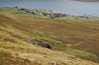
Sconser is a small crofting township on the island of Skye, in Scotland, situated on the south shore of Loch Sligachan. The main A87 road of Skye passes through Sconser and the ferry to Raasay departs from the pier.

Minginish is a peninsula on the island of Skye in Scotland. It is situated in south central Skye, between Loch Scavaig and Glen Drynoch in the west and Loch Harport and Glen Sligachan in the south and east. It includes most of the peaks of the Cuillin hills including Sgurr Alasdair, the highest point on the island at 992 metres (3,255 ft). The island of Soay lies offshore across the Soay Sound, with the Small Isles further south across the Cuillin Sound.
John Morton MacKenzie (1856–1933) was a Gaelic speaking crofter from Sconser on the Island of Skye and Britain’s first professional mountain guide.

Beinn Dearg Mhor, is a mountain in the Red Cuillin mountains of the Isle of Skye. It is located between Loch Ainort and the settlement of Sligachan.
