Bornesketaig

Last updated

Bornesketaig
Bornesketaig crossroads - geograph.org.uk - 926524.jpg
Isle of Skye UK location map.svg
Red pog.svg
Bornesketaig
Location within the Isle of Skye
OS grid reference NG3771
Council area
Country Scotland
Sovereign state United Kingdom
Postcode district IV51 9
Police Scotland
Fire Scottish
Ambulance Scottish
List of places
UK
Scotland
57°39′N6°25′W / 57.65°N 06.41°W / 57.65; -06.41

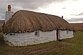
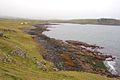
Bornesketaig, Scottish Gaelic Borgh na Sgiotaig, is a dispersed crofting settlement in Trotternish on the Isle of Skye. [1] [2]

Contents

Broch

A broch once stood nearby, but little remains as the stones have been robbed for other uses. There are a number of caves in the cliffs around Bornesketaig.

References

  1. Ordnance Survey: Landranger map sheet 23 North Skye (Dunvegan & Portree) (Map). Ordnance Survey. 2011. ISBN   9780319229897.
  2. "Ordnance Survey: 1:50,000 Scale Gazetteer" (csv (download)). www.ordnancesurvey.co.uk. Ordnance Survey. 1 January 2016. Retrieved 30 January 2016.