Glenelg is a scattered community area and civil parish in the Lochalsh area of Highland in western Scotland. Despite the local government reorganisation the area is considered by many still to be in Inverness-shire, the boundary with Ross-shire being at the top of Mam Ratagan the single-track road entry into Glenelg.

Wiay, pronounced "waya" is an uninhabited island in Loch Bracadale, off the coast of the Isle of Skye
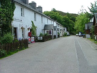
Struan is a small village on the west coast of the island of Skye, on the shores of Loch Beag, itself an inlet of Loch Bracadale. "Struan" is the anglicized form of the Scottish Gaelic word sruthan, meaning "small stream", or the flow at the point where a spring appears.
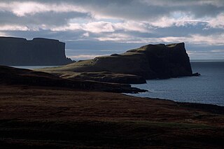
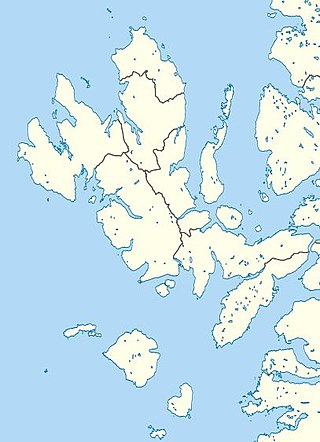
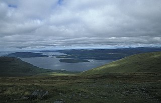
Loch Bracadale is a sea loch on the west coast of Skye in Scotland. It separates the Minginish Peninsula in the south from the Duirinish Peninsula in the north.

Soay Mòr is an island in West Loch Tarbert, between the northern and southern parts of Harris. The uninhabited island is separated from the southwest coast of North Harris by the Soay Sound. The adjacent Soay Beag is accessible on foot at low tide.
Urray is a scattered village and coastal parish, consisting of Easter, Old and Wester Urray and is located in the county of Ross in the Scottish council area of the Highland. Urray is also a parish in the district of Wester Ross and Cromarty. It comprises the parishes of Carnoch and Kinlochlychart, with the ancient parish of Kilchrist.

Fiskavaig or Fiscavaig is a picturesque crofting settlement on the north-west shore of the Minginish peninsula, Isle of Skye in the Highland Council area.
Kensaleyre is a scattered crofting township, part of a group of settlements clustered around the A87 road on the shore of Loch Snizort Beag on the Trotternish peninsula of the island of Skye in the Highlands and Islands of Scotland. It is in the council area of Highland.
Snizort is a civil parish in the north-eastern part of the Isle of Skye, comprising the head of Loch Snizort and the western coast of Trotternish up to Uig, which is the largest settlement.

Inverness-shire or the County of Inverness is a historic county, registration county and lieutenancy area of Scotland. Covering much of the Highlands and Outer Hebrides, it is Scotland's largest county, though one of the smallest in population, with 67,733 people or 1.34% of the Scottish population.
Eyre is a settlement on the eastern shore of Loch Snizort Beag on the northern coast of Skye in Scotland.

Minginish is a peninsula on the Isle of Skye in Scotland. It is situated on the west coast of the island and runs from Loch Scavaig in the south, along the western coast of Skye to Loch Bracadale in the north west, to Loch Harport in the north east, and Glen Sligachan in the south east. It includes most of the peaks of the Cuillin hills including Sgurr Alasdair, the highest point on the island at 992 metres (3,255 ft). The island of Soay lies offshore across the Soay Sound, with the Small Isles further south across the Cuillin Sound.
Duirinish is a peninsula and civil parish on the island of Skye in Scotland. It is situated in the north west between Loch Dunvegan and Loch Bracadale.

Diabaig is a remote coastal fishing and crofting township in Wester Ross, in the Northwest Highlands of Scotland. Diabaig lies on the north shore of the sea loch of Loch Diabaig, an inlet off the north side of Loch Torridon, and is in the Highland council area.
Loch na Keal, meaning Loch of the Kyle, or Narrows, also Loch of the Cliffs, is the principal sea loch on the western, or Atlantic coastline of the island of Mull, in the Inner Hebrides, Argyll and Bute, Scotland. Loch na Keal extends over 20 kilometres (12 mi) inland, almost bisecting Mull, and extending to within 5 km (3 mi) of the eastern shore. The loch gives its name to the Loch na Keal National Scenic Area, one of forty national scenic areas in Scotland.

Yarrow is a place and parish in the Scottish Borders area of Scotland and in the former county of Selkirkshire.The name "Yarrow" may derive from the Celtic word garw meaning "rough" or possibly share a derivation with the English name "Jarrow".
Megget is a former chapelry or parish containing the valley of Megget Water, now forming the westernmost part of the parish of Yarrow, Selkirkshire in the Scottish Borders area of Scotland. The centre of the valley is 19 miles west of Selkirk.
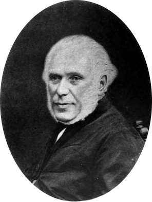
Roderick McLeod (1794–1868) was a Scottish minister of the Free Church of Scotland who served as Moderator of the General Assembly 1863/64.


