The Inner Hebrides is an archipelago off the west coast of mainland Scotland, to the south east of the Outer Hebrides. Together these two island chains form the Hebrides, which experience a mild oceanic climate. The Inner Hebrides comprise 35 inhabited islands as well as 44 uninhabited islands with an area greater than 30 hectares. Skye, Mull, and Islay are the three largest, and also have the highest populations. The main commercial activities are tourism, crofting, fishing and whisky distilling. In modern times the Inner Hebrides have formed part of two separate local government jurisdictions, one to the north and the other to the south. Together, the islands have an area of about 4,130 km2 (1,594 sq mi), and had a population of 18,948 in 2011. The population density is therefore about 4.6 inhabitants per square kilometre.
Sleat is a peninsula and civil parish on the island of Skye in the Highland council area of Scotland, known as "the garden of Skye". It is the home of the clan MacDonald of Sleat. The name comes from the Scottish Gaelic Slèite, which in turn comes from Old Norse sléttr, which well describes Sleat when considered in the surrounding context of the mainland, Skye and Rùm mountains that dominate the horizon all about Sleat.

The Flannan Isles or the Seven Hunters are a small island group in the Outer Hebrides of Scotland, approximately 32 kilometres west of the Isle of Lewis. They may take their name from Saint Flannan, the 7th century Irish preacher and abbot.

The Butt of Lewis is the most northerly point on the Island of Lewis, in the Outer Hebrides, Scotland. The headland, which lies in the North Atlantic, is frequently battered by heavy swells and storms and is marked by the Butt of Lewis Lighthouse. The nearest populated area is the village of Eoropie, about 1 mile to the south.

Eilean Bàn is a six-acre (2.4 ha) island between Kyle of Lochalsh and the Isle of Skye, in the historic county of Ross and Cromarty in the Highland local government area. The Skye Bridge uses the island as a stepping-stone as it crosses the mouth of Loch Alsh from the mainland to Skye.
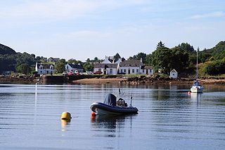
Isleornsay is a village lying off the main Armadale to Sleat road on the Isle of Skye in Scotland. It overlooks, but is not upon, the island of Ornsay. The island itself shelters one of the best natural harbours in southern Skye. The location was exploited from the 18th century or earlier by the MacDonalds who owned this part of Skye.

A lighthouse keeper or lightkeeper is a person responsible for tending and caring for a lighthouse, particularly the light and lens in the days when oil lamps and clockwork mechanisms were used. Lighthouse keepers were sometimes referred to as "wickies" because of their job trimming the wicks.
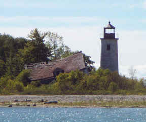
Charity Island Light is a lighthouse on Big Charity Island in Lake Huron just off the coast of Au Gres, Northern Michigan.

Shillay is the westernmost of the Monach Islands (Heisgeir), off North Uist in the Outer Hebrides.

Eilean Trodday is an island in The Minch just off the north coast of the Trotternish peninsula of Skye in Scotland.

South Ascrib is an island in Loch Snizort between the Waternish and Trotternish peninsulas on the northern coasts of the island of Skye in Scotland.

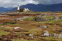
Blessed is a British drama film released on 24 October 2008 that was written and directed by Mark Aldridge. Its cast included well-known actors James Nesbitt, Natascha McElhone and Gary Lewis, as well as young Lillian Woods. It was filmed at the Ornsay Lighthouse on the islet Eilean Sionnach, and other locations around the Scottish Isle of Skye such as the village of Kyleakin.
The Hebridean Light Railway Company proposed to operate on the Scottish islands of Skye and Lewis. The Skye line was to have connected the port of Isleornsay and the port of Uig on the north-west coast of the island, from where ferries would have sailed to Stornoway on Lewis. Another line was then proposed to link Stornoway to Carloway, the second settlement of Lewis. Branch lines were also proposed to Breasclete and Dunvegan.
Eilean Glas Lighthouse is on the east coast of the island of Scalpay in the Outer Hebrides of Scotland. It was one of the original four lights commissioned by the Commissioners of the Northern Lights, and the first in the Hebrides. These lighthouses were built by Thomas Smith.

Barra Head Lighthouse on Barra Head identifies the southern entrance to The Minch, roughly halfway between the Eilean Glas and Rinns of Islay lighthouses. The 58-foot (18-metre) stone tower, built in 1833, stands on the west side of the island, at the top of a very steep cliff, making the light the highest in the UK with a focal plane of 208 m (682 ft) above sea level. It has a range of 18 nautical miles. There is no shallow water west of Berneray to break the blow of the Atlantic storms and small fish are sometimes thrown onto the grass on the cliff top. In 1836 Sir Archibald Geikie recorded the movement of a 42-long-ton (43-tonne) block of gneiss across 5 feet (1.5 m) of ground during a violent storm.

The Ushenish Lighthouse is an active lighthouse in South Uist, Outer Hebrides, Scotland.

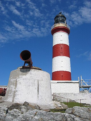
Flannan Isles Lighthouse is a lighthouse near the highest point on Eilean Mòr, one of the Flannan Isles in the Outer Hebrides off the west coast of Scotland. It is best known for the mysterious disappearance of its keepers in 1900.
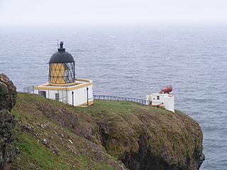
St Abb's Head Lighthouse stands on the cliffs at the rocky promontory of St Abb's Head, near the village of St Abbs in Berwickshire.