
Dumfries and Galloway is one of the 32 unitary council areas of Scotland, located in the western part of the Southern Uplands. It is bordered by East Ayrshire, South Ayrshire, and South Lanarkshire to the north; Scottish Borders to the north-east; the English county of Cumbria, the Solway Firth, and the Irish Sea to the south, and the North Channel to the west. The administrative centre and largest settlement is the town of Dumfries. The second largest town is Stranraer, located 76 miles (122 km) to the west of Dumfries on the North Channel coast.

The Bell Rock Lighthouse, off the coast of Angus, Scotland, is the world's oldest surviving sea-washed lighthouse. It was built between 1807 and 1810 by Robert Stevenson on the Bell Rock in the North Sea, 11 miles (18 km) east of the Firth of Tay. Standing 35 metres (115 ft) tall, its light is visible from 35 statute miles (56 km) inland.

Robert Stevenson, FRSE, FGS, FRAS, FSA Scot, MWS was a Scottish civil engineer, and designer and builder of lighthouses. His works include the Bell Rock Lighthouse.

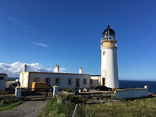
The Mull of Galloway is the southernmost point of Scotland. It is situated in Wigtownshire, Dumfries and Galloway, at the end of the Rhins of Galloway peninsula.

Muckle Flugga lighthouse punctuates the rocky stack of Muckle Flugga, in Shetland, Scotland. Originally called North Unst Lighthouse, it was renamed in 1964.
Skerryvore is a remote island that lies off the west coast of Scotland, 11 nautical miles southwest of Tiree. Skerryvore Lighthouse is located on these rocks, built with some difficulty between 1838 and 1844 by Alan Stevenson.

Cape Wrath Lighthouse at Cape Wrath was built in 1828 by Robert Stevenson and was manned until 1998, when it was converted to automatic operation by the Northern Lighthouse Board. It is located at the most North-Westerly point on the British mainland, in the traditional county of Sutherland within Highland Region. Durness is the closest village, 10 miles (16 km) to the south-east with Inverness around 120 miles (190 km) to the south.

Shillay is the westernmost of the Monach Islands (Heisgeir), off North Uist in the Outer Hebrides.
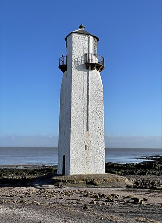
Southerness lighthouse is located at the village of Southerness in South West Scotland. It is at present the second oldest lighthouse in Scotland. The lighthouse was commissioned by the Town Council of Dumfries in 1748 to assist in the safe passage through the Solway Firth of ships heading to the Nith Estuary. At that time roads in South West Scotland were quite sparse so the bulk of trade even between local villages, was carried out by sea. Dumfries was a major port and there were regular connections with Liverpool and, especially, Ireland. Construction was completed in 1749.
Killantringan Lighthouse is a lighthouse located near Portpatrick in Dumfries and Galloway, south-west Scotland. The light came into operation in 1900, and served as a waypoint in the North Channel of the Irish Sea. The name Killantringan is derived from Cill shaint Ringain, 'St Ringan's chapel'; Ringan is a mediaeval variation of Ninian. The lighthouse is protected as a category B listed building.

Ardnamurchan Lighthouse is a listed 19th century lighthouse, located on Ardnamurchan Point in Lochaber part of the Highland council area of Scotland. The lighthouse with its 36-metre-tall (118 ft), pink granite tower was completed in 1849 to a design by Alan Stevenson. It is the only lighthouse in the UK built in the Egyptian style. Mains electricity was installed in 1976, the light was automated in 1988 and is now operated remotely by the Northern Lighthouse Board from Edinburgh.
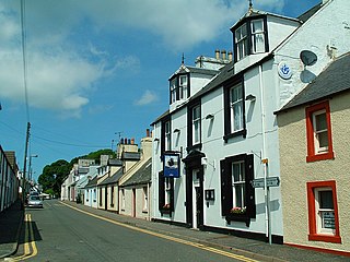
Kirkcolm is a village and civil parish on the northern tip of the Rhinns of Galloway peninsula, south-west Scotland. It is in Dumfries and Galloway, and is part of the former county of Wigtownshire. The parish is bounded on the north and west by the sea, on the east by the bay of Loch Ryan and on the south by Leswalt parish.

Pladda Lighthouse is an active 18th century lighthouse situated at the southern end of the island of Pladda in western Scotland. The lighthouse dates from 1790 and was designed by Thomas Smith. It was the first light on the Clyde to be commissioned by the Commissioners of the Northern Lights. It had both an upper and a lower light to distinguish it from the three other lighthouses in the Firth of Clyde.

The Point of Ayre Lighthouse is an active 19th century lighthouse, sited at the Point of Ayre at the north-eastern end of the Isle of Man. It was designed and built by Robert Stevenson, grandfather of prolific writer and novelist Robert Louis Stevenson, under the Isle of Man and Calf of Man Lighthouses Act 1815 and was first lit in 1818, making it the oldest operational lighthouse on the island.
The Tiumpan Head Lighthouse is an active lighthouse located in Tiumpan Head, Isle of Lewis, Outer Hebrides, Scotland.
Events from the year 1817 in Scotland.

The Cantick Head Lighthouse is an active 19th century lighthouse on the Scottish island of South Walls in the Orkney Islands. It is located at the end of Cantick Head, a long peninsula on the south-eastern coast of South Walls that overlooks the Pentland Firth and the Sound of Hoxa, which forms the southern entry to the natural harbour of Scapa Flow.

The Noss Head Lighthouse is an active 19th-century lighthouse near Wick in Caithness in the Highland council area of Scotland. It is located at the end of Noss Head, a peninsula on the north-west coast of Caithness that overlooks Sinclairs Bay, three miles north-east of Wick. It is notable as being the first lighthouse that was built with a diagonally-paned lantern room.

Girdle Ness Lighthouse is situated near Torry Battery on the Girdle Ness peninsula just south of the entrance to Aberdeen's harbour, in Scotland. It is an active light, managed by the Northern Lighthouse Board.

Turnberry Lighthouse, or Turnberry Point Lighthouse, is a category B listed minor light on the South Ayrshire coast of Scotland. It was designed by David and Thomas Stevenson and completed in 1873. It is a conspicuous landmark when seen from the Ayrshire Coastal Path and the Trump Turnberry golf resort.


