
Southwold Lighthouse is a lighthouse operated by Trinity House in the centre of Southwold in Suffolk, England. It stands on the North Sea coast, acting as a warning light for shipping passing along the east coast and as a guide for vessels navigating to Southwold harbour.
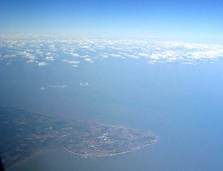
North Foreland is a chalk headland on the Kent coast of southeast England, specifically in Broadstairs.

Point Lynas Lighthouse is located on a headland in Llaneilian Community, on the north-east corner of Anglesey in North Wales. A pilot station was established on the point in 1766, to guide ships entering and leaving Liverpool, with an associated lighthouse added in 1779. The present building was built on the hilltop in 1835, so does not need a tower. Built and managed by the Mersey Docks and Harbour Board, it did not come under the care of Trinity House until 1973. By 2001 the lights were fully automated, so no resident staff were needed. Whilst the light is retained in operational use, the building and associated lighthouse keepers cottages were returned to the Mersey Docks and Harbour Board who sold them to be a private home and holiday accommodation.
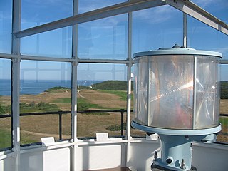
The VRB-25 is a lighthouse optical system designed and built by Vega Industries Ltd. in Porirua, New Zealand. It was originally designed in 1993–95 with the assistance of the United States Coast Guard to meet USCG requirements for a robust mechanism requiring minimum maintenance. It has become the Coast Guard's standard 12 volt rotating beacon. The company's literature says there are more than 400 installations worldwide. More than a quarter of the active lighthouses in Maine have one installed.

Fingal Head Light is an active lighthouse located at Fingal Head, New South Wales, Australia, a headland about 5 kilometres (3.1 mi) south of Point Danger, which marks the Queensland border.

The Point Stephens Light is a heritage-listed active lighthouse located on Point Stephens, a point on an unnamed headland at the east of Fingal Bay, 4.25 km (2.64 mi) south of the entrance of Port Stephens, New South Wales, Australia. The light serves to assist vessels entering Port Stephens. It is considered an endangered lighthouse due to remote location and old age.

Clarence River Light, also known as Yamba Light or Clarence Head Light, is an active lighthouse located on Pilot Hill, a hill in Wooli Park, Yamba, New South Wales, Australia, south of the entrance of Clarence River. The current lighthouse was built in 1955, replacing a previous lighthouse built in 1880. It serves as the rear range light for two different ranges.
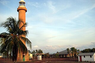
Cape Don Light is an active lighthouse located on Cape Don, at the tip of the Cobourg Peninsula, Northern Territory, Australia, in Garig Gunak Barlu National Park, marking the entrance to the Dundas Strait. It is Australia's northernmost traditional lighthouse. The station served on the important route to Darwin, between the peninsula and Melville Island. The tower was constructed in 1915–1917, during the "Golden Age of Australian Lighthouses" (1913–1920), and the tower was manned until 1983. During the entire period that the tower was manned it also maintained meteorological records which were well placed to assist in cyclone development tracking. The complex consists of the lighthouse, three residences and ancillary buildings.

Archer Point Light is an active lighthouse on Archer Point, a conical, 60-metre-high (200 ft) grassy headland about 29km southeast of Cooktown, Queensland, Australia. Originally an 1883 timber frame lighthouse covered with galvanised iron, it was replaced in 1975 with a modern square concrete equipment room topped with a lantern.

Sandy Cape Light is a heritage-listed active lighthouse located on Sandy Cape, the most northern point on K'gari, Queensland, Australia. It stands about 6 kilometres (3.7 mi) southwest of the northeastern tip of the island. It is the tallest lighthouse in Queensland. Built in 1870, it is the second major lighthouse to be built in Queensland after its formation in 1859. It is one of the first lighthouses in Australia to be constructed using bolted prefabricated segments of cast iron, and one of only two such lighthouses in Queensland, the other being its sibling, Bustard Head Light.
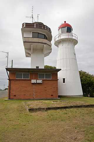
Old Caloundra Light, also known as Old Caloundra Head Light or Cape Caloundra Light, is an inactive lighthouse located in Caloundra on the Sunshine Coast in South East Queensland, Australia. It is the oldest surviving building in Caloundra. The lighthouse was active between 1896 and 1968. The tower was relocated twice. In 1970 it was relocated from its original location to Woorim Park in Caloundra, and in 1999 it was returned to its original site on Canberra Terrace near downtown Caloundra, where it stands today.

Cape Cleveland Light is an active heritage-listed lighthouse located on the northern tip of Cape Cleveland, a promontory projecting into the Coral Sea west of Cleveland Bay in the locality of Cape Cleveland about 40 kilometres (25 mi) east of Townsville, Queensland, Australia. The lighthouse marks the northern point of the Cape, and the entrance to Cleveland Bay.

Dent Island Light is an active lighthouse on Dent Island, a small island off the coast of Queensland, Australia, part of the Whitsunday Group of the Whitsunday Islands. Located on the southwest tip of the island, the light guides ships navigating the Whitsunday Passage, between Whitsunday Island and the islands to the west, and marks the Dent Island Passage.

Double Island Point Light is an active lighthouse located at the summit of Double Island Point, a coastal headland within the Cooloola section of the Great Sandy National Park. It is located at the southern end of Wide Bay, 70 kilometres (43 mi) north of Noosa Heads, Queensland, Australia.

Low Isles Light, also known as Low Islets Light or Low Island Light, is an active lighthouse located on Low Island, a coral cay which together with Woody Island forms the Low Isles group, about 13 kilometres (8.1 mi) northeast of Port Douglas, Queensland, Australia. The island is situated on the western edge of the main shipping channel into the harbour of Port Douglas, and it marks the entrance to the channel. Built in 1878, it was the first lighthouse in Far North Queensland and more specifically the first to light the Inner Passage of the Great Barrier Reef. Its construction is typical to Queensland lighthouses of the time, timber frame clad with galvanized iron, and it is the fourth lighthouse of this type constructed in Queensland, though it is the first of them to use portholes.

Casquets Lighthouse is an active lighthouse located on the rocky Les Casquets, Alderney, Channel Islands.
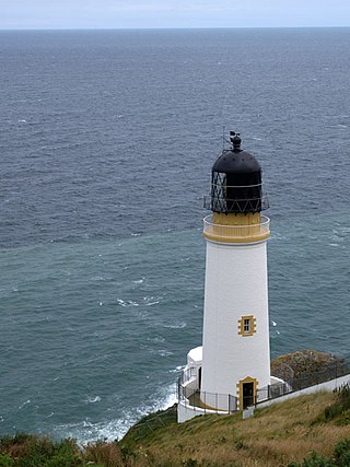
Maughold Head Lighthouse is an active 20th century lighthouse, located on the headland of the same name at the southern end of Ramsey Bay on the eastern coast of the Isle of Man. Completed in 1914, it was designed by David A and Charles Stevenson.

The Inisheer, Inis Oírr or Fardurris Point Lighthouse, is an active 19th century lighthouse located on the island of Inisheer, the smallest of the Aran Islands, in County Galway, Ireland. It marks the south-eastern entrance to Galway bay and the port of Galway known as the South Sound, with a red sector of the light marking the Finnis Rock. The Eeragh Lighthouse which marks the North Sound entrance to the bay on the north-western side of the islands, was also constructed at the same time. Inisheer and Eeragh both became operational in 1857.

Straw Island Lighthouse is an active aid to navigation on an islet of the same name in Killeany Bay, northeast of Inishmore in County Galway, Ireland. Completed in 1878, it was the last of four lighthouses built in the 19th century on the Aran Islands. The commissioning of Straw Island marked the culmination of a lengthy 24 year campaign by the local islanders to have a lighthouse for safe passage into Killeany Bay and the harbour at Kilronan.
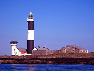
Mew Island Lighthouse is an active lighthouse within the Copeland Islands of County Down in Northern Ireland. The current 19th-century tower is the most recent in a series of lighthouses that have been built in the islands, which have helped to guide shipping around the archipelago and into Belfast Lough.


