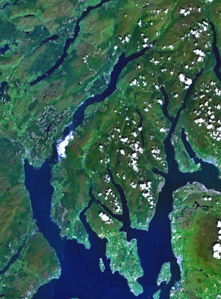
Firth is a word in the English and Scots languages used to denote various coastal waters in the United Kingdom, predominantly within Scotland. In the Northern Isles, it more often refers to a smaller inlet. It is linguistically cognate to fjord, which has a more constrained sense in English. Bodies of water named "firths" tend to be more common on the Scottish east coast, or in the southwest of the country, although the Firth of Clyde is an exception to this. The Highland coast contains numerous estuaries, straits, and inlets of a similar kind, but not called "firth" ; instead, these are often called sea lochs. Before about 1850, the spelling "Frith" was more common.

The Firth of Clyde is the estuary of the River Clyde, on the west coast of Scotland. The Firth has some of the deepest coastal waters of the British Isles. The Firth is sheltered from the Atlantic Ocean by the Kintyre Peninsula. The Firth lies between West Dunbartonshire in the north, Argyll and Bute in the west and Inverclyde, North Ayrshire and South Ayrshire in the east. The Kilbrannan Sound is a large arm of the Firth, separating the Kintyre Peninsula from the Isle of Arran. The Kyles of Bute separates the Isle of Bute from the Cowal Peninsula. The Sound of Bute separates the islands of Bute and Arran.

Corsewall Lighthouse is a lighthouse at Corsewall Point, Kirkcolm near Stranraer in the region of Dumfries and Galloway in Scotland. First lit in 1817, it overlooks the North Channel of the Irish Sea. The definition of the name Corsewall is the place or well of the Cross.

Robert Stevenson, FRSE, FGS, FRAS, FSA Scot, MWS was a Scottish civil engineer, and designer and builder of lighthouses. His works include the Bell Rock Lighthouse.

The Mull of Kintyre is the southwesternmost tip of the Kintyre Peninsula in southwest Scotland. From here, the Antrim coast of Northern Ireland is visible on a calm and clear day, and a historic lighthouse, the second commissioned in Scotland, guides shipping in the intervening North Channel. The area has been immortalised in popular culture by the 1977 hit song "Mull of Kintyre" by Kintyre resident Paul McCartney's band of the time, Wings.
Sanda Island is a small island in the Firth of Clyde, off of Argyll and Bute, Scotland, near the southern tip of the Kintyre peninsula, near Southend and Dunaverty Castle.
Cowal is a rugged peninsula in Argyll and Bute, on the west coast of Scotland. It is connected to the mainland to the north, and is bounded by Loch Fyne to the west, by Loch Long and the Firth of Clyde to the east, and by the Kyles of Bute to the south.

The Rhinsof Galloway is a double-headed peninsula in southwestern Scotland. It takes the form of a hammerhead projecting into the Irish Sea, terminating in the north at Corsewall and Milleur Points and in the south at the Mull of Galloway. It is connected to the rest of Wigtownshire by an isthmus, washed on the north by Loch Ryan and on the south by Luce Bay. From end to end, the peninsula measures 28 miles. It takes its name from the Gaelic word rinn, meaning "point".

Dunnet Head is a headland in Highland, on the north coast of Scotland. Dunnet Head includes the most northerly point of both mainland Scotland and the island of Great Britain.

The Mull of Galloway is the southernmost point of Scotland. It is situated in Wigtownshire, Dumfries and Galloway, at the end of the Rhins of Galloway peninsula.

Loch Ryan is a Scottish sea loch that acts as an important natural harbour for shipping, providing calm waters for ferries operating between Scotland and Northern Ireland. The town of Stranraer is the largest settlement on its shores, with ferries to and from Northern Ireland operating from Cairnryan further north on the loch.

The North Channel is the strait between north-eastern Northern Ireland and south-western Scotland. The Firth of Clyde merges with the channel, between the southern tip of the Kintyre peninsula and Corsewall Point on the Rhins of Galloway. The channel begins north of the Isle of Man and is customarily considered part of the Irish Sea, the channel runs north-west into the Atlantic Ocean.
Sgat Mòr and Sgat Beag are two small islands that lie at the mouth of Loch Fyne by the shore of the Cowal peninsula on the west coast of Scotland.
The Tail of the Bank is the name given to the anchorage in the upper Firth of Clyde immediately North of Greenock, between Inverclyde and Argyll and Bute. This area of the Firth gets its name from the deep water immediately to the west of the sandbank which marks the entrance to the navigable channel up the Estuary of the River Clyde.
The coastline of the United Kingdom is formed by a variety of natural features including islands, bays, headlands and peninsulas. It consists of the coastline of the island of Great Britain, the north-east coast of the island of Ireland, as well as many much smaller islands. Much of the coastline is accessible and quite varied in geography and habitats. Large stretches have been designated areas of natural beauty, notably the Jurassic Coast and various stretches referred to as heritage coast. They are both very long, spreading through the mainland.

Tarbat is a civil parish in Highland, Scotland, in the north-east corner of Ross and Cromarty.

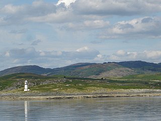
Toward Point Lighthouse is situated in the south of the Cowal Peninsula, near the village of Toward, Argyll and Bute, Scotland. It marks the point where Loch Striven meets the Firth of Clyde. There has been a lighthouse here since 1812.
Ardhallow Battery is a Palmerston Fort on the slopes of Corlarach Hill around 2 miles (3.2 km) south of Dunoon, on the Cowal Peninsula, west of Scotland. Part of the local Clyde Defenses and the Scottish Coastal Defences. The construction contract was awarded to "The Aitkenhead Builders" in 1901 for a price of £16,000. The Battery is a scheduled monument. The site was used in both World Wars and decommissioned in 1956.
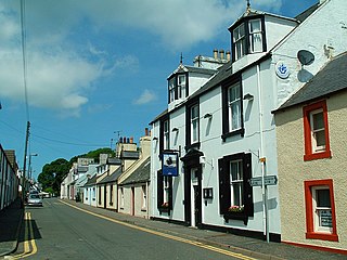
Kirkcolm is a village and civil parish on the northern tip of the Rhinns of Galloway peninsula, south-west Scotland. It is in Dumfries and Galloway, and is part of the former county of Wigtownshire. The parish is bounded on the north and west by the sea, on the east by the bay of Loch Ryan and on the south by Leswalt parish.

Rosneath Peninsula is a peninsula in Argyll and Bute, western Scotland, formerly in the historic county of Dunbartonshire. The peninsula is formed by the Gare Loch in the east, and Loch Long in the west, both merge with the upper Firth of Clyde.

