List of United Kingdom locations: Tri-Tz

Last updated

The United Kingdom Uk-map.svg
The United Kingdom

This is part of the list of United Kingdom locations: a gazetteer of place names in the United Kingdom showing each place's locality and geographical coordinates.

Contents

Tr (continued)

Tri

LocationLocality Coordinates
(links to map & photo sources)
OS grid
reference
Triangle Calderdale 53°41′N1°56′W / 53.69°N 01.94°W / 53.69; -01.94 SE0422
Triangle Gloucestershire 51°42′N2°40′W / 51.70°N 02.66°W / 51.70; -02.66 SO5401
Triangle Staffordshire 52°40′N1°55′W / 52.66°N 01.92°W / 52.66; -01.92 SK0507
Trickett's Cross Dorset 50°48′N1°53′W / 50.80°N 01.88°W / 50.80; -01.88 SU0801
Tricombe Devon 50°45′N3°08′W / 50.75°N 03.13°W / 50.75; -03.13 SY2096
Triffleton Pembrokeshire 51°52′N4°57′W / 51.87°N 04.95°W / 51.87; -04.95 SM9724
Trill Devon 50°45′N3°01′W / 50.75°N 03.02°W / 50.75; -03.02 SY2895
Trillacott Cornwall 50°40′N4°28′W / 50.67°N 04.46°W / 50.67; -04.46 SX2689
Trimdon Durham 54°41′N1°26′W / 54.69°N 01.44°W / 54.69; -01.44 NZ3633
Trimdon Colliery Durham 54°42′N1°25′W / 54.70°N 01.41°W / 54.70; -01.41 NZ3835
Trimdon Grange Durham 54°42′N1°25′W / 54.70°N 01.42°W / 54.70; -01.42 NZ3735
Trimingham Norfolk 52°53′N1°22′E / 52.89°N 01.37°E / 52.89; 01.37 TG2738
Trimley Lower Street Suffolk 51°58′N1°17′E / 51.97°N 01.28°E / 51.97; 01.28 TM2636
Trimley St. Martin Suffolk 51°59′N1°18′E / 51.98°N 01.30°E / 51.98; 01.30 TM2737
Trimley St. Mary Suffolk 51°58′N1°19′E / 51.97°N 01.31°E / 51.97; 01.31 TM2836
Trimpley Worcestershire 52°23′N2°19′W / 52.39°N 02.31°W / 52.39; -02.31 SO7978
Trimsaran Carmarthenshire 51°43′N4°14′W / 51.71°N 04.24°W / 51.71; -04.24 SN4504
Trims Green Hertfordshire 51°50′N0°08′E / 51.83°N 00.13°E / 51.83; 00.13 TL4717
Trimstone Devon 51°10′N4°08′W / 51.16°N 04.14°W / 51.16; -04.14 SS5043
Trinafour Perth and Kinross 56°45′N4°05′W / 56.75°N 04.09°W / 56.75; -04.09 NN7264
Trinant Caerphilly 51°41′N3°09′W / 51.68°N 03.15°W / 51.68; -03.15 ST2099
Tring Hertfordshire 51°47′N0°40′W / 51.79°N 00.66°W / 51.79; -00.66 SP9211
Tringford Hertfordshire 51°48′N0°41′W / 51.80°N 00.68°W / 51.80; -00.68 SP9113
Tring Wharf Hertfordshire 51°47′N0°40′W / 51.79°N 00.66°W / 51.79; -00.66 SP9212
Trinity Angus 56°44′N2°39′W / 56.74°N 02.65°W / 56.74; -02.65 NO6062
Trinity City of Edinburgh 55°58′N3°13′W / 55.97°N 03.21°W / 55.97; -03.21 NT2476
Trinity Fields Staffordshire 52°49′N2°08′W / 52.82°N 02.13°W / 52.82; -02.13 SJ9125
Trinity Gask Perth and Kinross 56°20′N3°41′W / 56.34°N 03.68°W / 56.34; -03.68 NN9618
Trisant Ceredigion 52°21′N3°53′W / 52.35°N 03.89°W / 52.35; -03.89 SN7175
Triscombe Somerset 51°06′N3°13′W / 51.10°N 03.21°W / 51.10; -03.21 ST1535
Trislaig Highland 56°49′N5°08′W / 56.81°N 05.14°W / 56.81; -05.14 NN0874
Trispen Cornwall 50°19′N5°02′W / 50.31°N 05.03°W / 50.31; -05.03 SW8450
Tritlington Northumberland 55°13′N1°41′W / 55.22°N 01.68°W / 55.22; -01.68 NZ2092

Tro

LocationLocality Coordinates
(links to map & photo sources)
OS grid
reference
Troan Cornwall 50°22′N4°58′W / 50.37°N 04.96°W / 50.37; -04.96 SW8957
Trochelhill Moray 57°36′N3°09′W / 57.60°N 03.15°W / 57.60; -03.15 NJ3158
Trochry Perth and Kinross 56°32′N3°40′W / 56.54°N 03.67°W / 56.54; -03.67 NN9740
Troddi Monmouthshire 51°47′N2°43′W / 51.79°N 02.72°W / 51.79; -02.72 SO499111
Troearhiwgwair Blaenau Gwent 51°44′N3°14′W / 51.74°N 03.23°W / 51.74; -03.23 SO1506
Troedrhiwdalar Powys 52°10′N3°32′W / 52.16°N 03.53°W / 52.16; -03.53 SN9553
Troedrhiwffenyd Ceredigion 52°03′N4°20′W / 52.05°N 04.33°W / 52.05; -04.33 SN4042
Troedrhiwfuwch Caerphilly 51°43′N3°16′W / 51.72°N 03.26°W / 51.72; -03.26 SO1304
Troedyraur Ceredigion 52°04′N4°27′W / 52.07°N 04.45°W / 52.07; -04.45 SN3245
Troedyrhiw Merthyr Tydfil 51°42′N3°20′W / 51.70°N 03.34°W / 51.70; -03.34 SO0702
Trofarth Conwy 53°13′N3°43′W / 53.22°N 03.72°W / 53.22; -03.72 SH8571
Trolliloes East Sussex 50°54′N0°18′E / 50.90°N 00.30°E / 50.90; 00.30 TQ6214
Tromie Highland 56°57′N4°02′W / 56.95°N 04.04°W / 56.95; -04.04 NN759870
Tromode Isle of Man 54°10′N4°29′W / 54.16°N 04.49°W / 54.16; -04.49 SC3777
Trondavoe Shetland Islands 60°25′N1°20′W / 60.41°N 01.33°W / 60.41; -01.33 HU3770
Trondra Shetland Islands 60°07′N1°17′W / 60.11°N 01.29°W / 60.11; -01.29 HU391363
Tronston Orkney Islands 59°04′N3°18′W / 59.06°N 03.30°W / 59.06; -03.30 HY2520
Troon Cornwall 50°11′N5°17′W / 50.19°N 05.28°W / 50.19; -05.28 SW6638
Troon South Ayrshire 55°32′N4°40′W / 55.53°N 04.66°W / 55.53; -04.66 NS3230
Trooper's Inn Pembrokeshire 51°45′N4°57′W / 51.75°N 04.95°W / 51.75; -04.95 SM9610
Troqueer Dumfries and Galloway 55°03′N3°37′W / 55.05°N 03.61°W / 55.05; -03.61 NX9775
Troston Suffolk 52°19′N0°46′E / 52.31°N 00.77°E / 52.31; 00.77 TL8972
Trostre Carmarthenshire 51°40′N4°08′W / 51.67°N 04.14°W / 51.67; -04.14 SS5299
Trostrey Common Monmouthshire 51°44′N2°53′W / 51.73°N 02.89°W / 51.73; -02.89 SO3804
Troswell Cornwall 50°41′N4°28′W / 50.69°N 04.47°W / 50.69; -04.47 SX2591
Troswickness Shetland Islands 59°56′N1°17′W / 59.93°N 01.28°W / 59.93; -01.28 HU4017
Trotshill Worcestershire 52°11′N2°10′W / 52.19°N 02.17°W / 52.19; -02.17 SO8855
Trotten Marsh West Sussex 51°01′N0°50′W / 51.01°N 00.83°W / 51.01; -00.83 SU8225
Trotternish Highland 57°29′N6°15′W / 57.49°N 06.25°W / 57.49; -06.25 NG453530
Trottick City of Dundee 56°29′N2°58′W / 56.48°N 02.97°W / 56.48; -02.97 NO4033
Trottiscliffe Kent 51°19′N0°21′E / 51.31°N 00.35°E / 51.31; 00.35 TQ6460
Trotton West Sussex 50°59′N0°49′W / 50.99°N 00.81°W / 50.99; -00.81 SU8322
Trough Gate Lancashire 53°41′N2°11′W / 53.68°N 02.18°W / 53.68; -02.18 SD8821
Troup Head Aberdeenshire 57°41′N2°18′W / 57.69°N 02.30°W / 57.69; -02.30 NJ819669
Trout Beck Cumbria 54°23′N2°56′W / 54.38°N 02.93°W / 54.38; -02.93 SD396996
Troutbeck Cumbria 54°25′N2°55′W / 54.41°N 02.92°W / 54.41; -02.92 NY4002
Troutbeck Bridge Cumbria 54°23′N2°55′W / 54.39°N 02.92°W / 54.39; -02.92 NY4000
Troutsdale Beck North Yorkshire 54°17′N0°34′W / 54.29°N 00.56°W / 54.29; -00.56 SE935897
Trow Devon 50°41′N3°12′W / 50.69°N 03.20°W / 50.69; -03.20 SY1589
Troway Derbyshire 53°18′N1°25′W / 53.30°N 01.41°W / 53.30; -01.41 SK3979
Trowbridge Cardiff 51°31′N3°07′W / 51.51°N 03.11°W / 51.51; -03.11 ST2380
Trowbridge Wiltshire 51°19′N2°13′W / 51.31°N 02.21°W / 51.31; -02.21 ST8557
Trowell Derbyshire 52°56′N1°17′W / 52.94°N 01.28°W / 52.94; -01.28 SK4839
Trow Green Gloucestershire 51°45′N2°37′W / 51.75°N 02.62°W / 51.75; -02.62 SO5706
Trowle Common Wiltshire 51°19′N2°14′W / 51.32°N 02.24°W / 51.32; -02.24 ST8358
Trowley Bottom Hertfordshire 51°48′N0°26′W / 51.80°N 00.44°W / 51.80; -00.44 TL0713
Trowse Newton Norfolk 52°36′N1°18′E / 52.60°N 01.30°E / 52.60; 01.30 TG2406
Troydale Leeds 53°47′N1°39′W / 53.78°N 01.65°W / 53.78; -01.65 SE2332
Troy Town Kent 51°09′N0°57′E / 51.15°N 00.95°E / 51.15; 00.95 TR0744
Troy Town Surrey 51°12′N0°02′E / 51.20°N 00.03°E / 51.20; 00.03 TQ4247
Troy Town Kent 51°22′N0°29′E / 51.37°N 00.49°E / 51.37; 00.49 TQ7467

Tru

LocationLocality Coordinates
(links to map & photo sources)
OS grid
reference
Truas Cornwall 50°39′N4°44′W / 50.65°N 04.74°W / 50.65; -04.74 SX0687
Trub Rochdale 53°34′N2°11′W / 53.57°N 02.18°W / 53.57; -02.18 SD8809
Trudoxhill Somerset 51°11′N2°22′W / 51.18°N 02.37°W / 51.18; -02.37 ST7443
Trueman's Heath Worcestershire 52°23′N1°52′W / 52.39°N 01.86°W / 52.39; -01.86 SP0977
True Street Devon 50°25′N3°40′W / 50.42°N 03.66°W / 50.42; -03.66 SX8260
Truim Highland 57°01′N4°10′W / 57.01°N 04.17°W / 57.01; -04.17 NN683938
Trull Somerset 50°59′N3°07′W / 50.99°N 03.12°W / 50.99; -03.12 ST2122
Trumfleet Doncaster 53°35′N1°05′W / 53.59°N 01.09°W / 53.59; -01.09 SE6011
Trumisgarry Western Isles 57°38′N7°16′W / 57.64°N 07.26°W / 57.64; -07.26 NF8674
Trumpet Herefordshire 52°02′N2°31′W / 52.04°N 02.51°W / 52.04; -02.51 SO6539
Trumpington Cambridgeshire 52°10′N0°06′E / 52.16°N 00.10°E / 52.16; 00.10 TL4454
Trumps Green Surrey 51°23′N0°34′W / 51.39°N 00.57°W / 51.39; -00.57 SU9967
Trunch Norfolk 52°51′N1°23′E / 52.85°N 01.38°E / 52.85; 01.38 TG2834
Trunnah Lancashire 53°52′N3°01′W / 53.87°N 03.02°W / 53.87; -03.02 SD3343
Truro Cornwall 50°15′N5°03′W / 50.25°N 05.05°W / 50.25; -05.05 SW8244
Truscott Cornwall 50°38′N4°24′W / 50.63°N 04.40°W / 50.63; -04.40 SX3085
Trusham Devon 50°37′N3°37′W / 50.62°N 03.62°W / 50.62; -03.62 SX8582
Trusley Derbyshire 52°55′N1°37′W / 52.91°N 01.62°W / 52.91; -01.62 SK2535
Trussall Cornwall 50°07′N5°14′W / 50.11°N 05.23°W / 50.11; -05.23 SW6929
Trusthorpe Lincolnshire 53°19′N0°16′E / 53.32°N 00.26°E / 53.32; 00.26 TF5183
Truthan Cornwall 50°19′N5°02′W / 50.31°N 05.04°W / 50.31; -05.04 SW8351
Truthwall Cornwall 50°08′N5°28′W / 50.13°N 05.47°W / 50.13; -05.47 SW5232

Trw

LocationLocality Coordinates
(links to map & photo sources)
OS grid
reference
Trwstllewelyn Powys 52°34′N3°13′W / 52.57°N 03.21°W / 52.57; -03.21 SO1898
Trwyn Cilan Gwynedd 52°47′N4°32′W / 52.78°N 04.53°W / 52.78; -04.53 SH293239
Trwyn y Gorlech Gwynedd 52°59′N4°26′W / 52.99°N 04.43°W / 52.99; -04.43 SH367471

Try

LocationLocality Coordinates
(links to map & photo sources)
OS grid
reference
Tryfil Isle of Anglesey 53°18′N4°24′W / 53.30°N 04.40°W / 53.30; -04.40 SH4081
Trysull Staffordshire 52°32′N2°13′W / 52.54°N 02.22°W / 52.54; -02.22 SO8594
Trythogga Cornwall 50°07′N5°32′W / 50.12°N 05.54°W / 50.12; -05.54 SW4731
Tryweryn Gwynedd 52°56′N3°38′W / 52.93°N 03.63°W / 52.93; -03.63 SH902384
Tryweryn Gwynedd 52°56′N3°44′W / 52.94°N 03.74°W / 52.94; -03.74 SH828395

Tu

LocationLocality Coordinates
(links to map & photo sources)
OS grid
reference
Tuarie Burn Highland 58°09′N3°55′W / 58.15°N 03.92°W / 58.15; -03.92 NC866205
Tuarie Burn Highland 58°10′N4°02′W / 58.16°N 04.04°W / 58.16; -04.04 NC797210
Tubbs Mill Cornwall 50°15′N4°52′W / 50.25°N 04.86°W / 50.25; -04.86 SW9643
Tubney Oxfordshire 51°40′N1°22′W / 51.67°N 01.37°W / 51.67; -01.37 SU4398
Tubslake Kent 51°04′N0°31′E / 51.06°N 00.51°E / 51.06; 00.51 TQ7633
Tuckenhay Devon 50°23′N3°40′W / 50.38°N 03.67°W / 50.38; -03.67 SX8155
Tuckermarsh Devon 50°29′N4°12′W / 50.48°N 04.20°W / 50.48; -04.20 SX4467
Tuckerton Somerset 51°03′N3°01′W / 51.05°N 03.01°W / 51.05; -03.01 ST2929
Tuckhill Shropshire 52°29′N2°19′W / 52.48°N 02.32°W / 52.48; -02.32 SO7888
Tuckingmill Wiltshire 51°04′N2°06′W / 51.06°N 02.10°W / 51.06; -02.10 ST9329
Tuckingmill Cornwall 50°34′N4°41′W / 50.56°N 04.69°W / 50.56; -04.69 SX0977
Tuckingmill Cornwall 50°13′N5°17′W / 50.21°N 05.28°W / 50.21; -05.28 SW6640
Tucking Mill Bath and North East Somerset 51°20′N2°20′W / 51.34°N 02.34°W / 51.34; -02.34 ST7661
Tuckton Bournemouth 50°43′N1°48′W / 50.72°N 01.80°W / 50.72; -01.80 SZ1492
Tuddenham Suffolk 52°19′N0°32′E / 52.31°N 00.53°E / 52.31; 00.53 TL7371
Tuddenham St Martin Suffolk 52°05′N1°11′E / 52.08°N 01.19°E / 52.08; 01.19 TM1948
Tudeley Kent 51°11′N0°19′E / 51.18°N 00.31°E / 51.18; 00.31 TQ6245
Tudeley Hale Kent 51°11′N0°19′E / 51.19°N 00.31°E / 51.19; 00.31 TQ6246
Tudhay Devon 50°47′N2°58′W / 50.79°N 02.96°W / 50.79; -02.96 ST3200
Tudhoe Durham 54°42′N1°35′W / 54.70°N 01.59°W / 54.70; -01.59 NZ2635
Tudhoe Grange Durham 54°42′N1°37′W / 54.70°N 01.61°W / 54.70; -01.61 NZ2534
Tudor Hill Birmingham 52°34′N1°50′W / 52.56°N 01.83°W / 52.56; -01.83 SP1196
Tudorville Herefordshire 51°53′N2°35′W / 51.89°N 02.59°W / 51.89; -02.59 SO5922
Tudweiliog Gwynedd 52°53′N4°38′W / 52.89°N 04.63°W / 52.89; -04.63 SH2336
Tuebrook Liverpool 53°25′N2°56′W / 53.42°N 02.93°W / 53.42; -02.93 SJ3892
Tuelmenna Cornwall 50°27′N4°30′W / 50.45°N 04.50°W / 50.45; -04.50 SX2265
Tuesley Surrey 51°10′N0°37′W / 51.16°N 00.62°W / 51.16; -00.62 SU9641
Tuesnoad Kent 51°08′N0°43′E / 51.14°N 00.71°E / 51.14; 00.71 TQ9042
Tuffley Gloucestershire 51°50′N2°14′W / 51.83°N 02.24°W / 51.83; -02.24 SO8315
Tufnell Park Camden 51°32′N0°08′W / 51.54°N 00.14°W / 51.54; -00.14 TQ2985
Tufton Hampshire 51°13′N1°21′W / 51.21°N 01.35°W / 51.21; -01.35 SU4546
Tufton Pembrokeshire 51°55′01″N4°51′04″W / 51.917°N 04.851°W / 51.917; -04.851 SN040282
Tugby Leicestershire 52°35′N0°52′W / 52.59°N 00.87°W / 52.59; -00.87 SK7600
Tugford Shropshire 52°28′N2°40′W / 52.47°N 02.66°W / 52.47; -02.66 SO5587
Tughall Northumberland 55°31′N1°40′W / 55.52°N 01.66°W / 55.52; -01.66 NU2126
Tugnet Moray 57°40′N3°06′W / 57.67°N 03.10°W / 57.67; -03.10 NJ3465
Tulkie Shetland Islands 60°13′N1°24′W / 60.21°N 01.40°W / 60.21; -01.40 HU3348
Tullecombe West Sussex 51°01′N0°52′W / 51.01°N 00.86°W / 51.01; -00.86 SU8025
Tullibardine Perth and Kinross 56°18′N3°44′W / 56.30°N 03.74°W / 56.30; -03.74 NN9214
Tullibody Clackmannan 56°08′N3°50′W / 56.13°N 03.83°W / 56.13; -03.83 NS8695
Tullich Muir Highland 57°43′N4°08′W / 57.72°N 04.13°W / 57.72; -04.13 NH7373
Tulliemet Perth and Kinross 56°38′N3°38′W / 56.64°N 03.64°W / 56.64; -03.64 NN9952
Tulloch Highland 57°53′N4°20′W / 57.89°N 04.34°W / 57.89; -04.34 NH6192
Tulloch Perth and Kinross 56°24′N3°28′W / 56.40°N 03.47°W / 56.40; -03.47 NO0925
Tulloch Highland 57°13′N3°41′W / 57.22°N 03.69°W / 57.22; -03.69 NH9816
Tullochgorm Argyll and Bute 56°06′N5°17′W / 56.10°N 05.28°W / 56.10; -05.28 NR9695
Tullos City of Aberdeen 57°07′N2°06′W / 57.11°N 02.10°W / 57.11; -02.10 NJ9403
Tullybannocher Perth and Kinross 56°22′N4°01′W / 56.36°N 04.02°W / 56.36; -04.02 NN7521
Tullycross Stirling 56°02′N4°28′W / 56.04°N 04.47°W / 56.04; -04.47 NS4686
Tullynessle Aberdeenshire 57°16′N2°44′W / 57.26°N 02.74°W / 57.26; -02.74 NJ5519
Tulse Hill Lambeth 51°26′N0°07′W / 51.44°N 00.11°W / 51.44; -00.11 TQ3173
Tumble Carmarthenshire 51°46′N4°07′W / 51.77°N 04.11°W / 51.77; -04.11 SN5411
Tumbler's Green Essex 51°53′N0°37′E / 51.89°N 00.61°E / 51.89; 00.61 TL8025
Tumby Lincolnshire 53°07′N0°10′W / 53.11°N 00.16°W / 53.11; -00.16 TF2359
Tumby Woodside Lincolnshire 53°05′N0°07′W / 53.09°N 00.11°W / 53.09; -00.11 TF2657
Tummel Perth and Kinross 56°42′N4°02′W / 56.70°N 04.03°W / 56.70; -04.03 NN754586
Tummel Bridge Perth and Kinross 56°42′N4°01′W / 56.70°N 04.02°W / 56.70; -04.02 NN7659
Tumpy Green Gloucestershire 51°42′N2°24′W / 51.70°N 02.40°W / 51.70; -02.40 SO7201
Tumpy Lakes Herefordshire 52°07′N2°40′W / 52.11°N 02.67°W / 52.11; -02.67 SO5447
Tunbridge Hill Kent 51°26′N0°35′E / 51.43°N 00.58°E / 51.43; 00.58 TQ8074
Tunga Western Isles 58°14′N6°22′W / 58.23°N 06.36°W / 58.23; -06.36 NB4436
Tungate Norfolk 52°49′N1°21′E / 52.81°N 01.35°E / 52.81; 01.35 TG2629
Tunley Gloucestershire 51°44′N2°06′W / 51.73°N 02.10°W / 51.73; -02.10 SO9304
Tunley Bath and North East Somerset 51°19′N2°26′W / 51.32°N 02.44°W / 51.32; -02.44 ST6959
Tunnel Hill Worcestershire 52°03′N2°14′W / 52.05°N 02.23°W / 52.05; -02.23 SO8440
Tunnel Pits North Lincolnshire 53°31′N0°54′W / 53.52°N 00.90°W / 53.52; -00.90 SE7304
Tunshill Rochdale 53°37′N2°05′W / 53.61°N 02.09°W / 53.61; -02.09 SD9413
Tunstall City of Stoke-on-Trent 53°03′N2°13′W / 53.05°N 02.21°W / 53.05; -02.21 SJ8651
Tunstall East Riding of Yorkshire 53°45′N0°01′W / 53.75°N 00.02°W / 53.75; -00.02 TA3031
Tunstall Kent 51°19′N0°43′E / 51.31°N 00.71°E / 51.31; 00.71 TQ8961
Tunstall Lancashire 54°09′N2°37′W / 54.15°N 02.61°W / 54.15; -02.61 SD6073
Tunstall Norfolk 52°36′N1°33′E / 52.60°N 01.55°E / 52.60; 01.55 TG4107
Tunstall North Yorkshire 54°21′N1°40′W / 54.35°N 01.67°W / 54.35; -01.67 SE2195
Tunstall Staffordshire 52°50′N2°20′W / 52.84°N 02.34°W / 52.84; -02.34 SJ7727
Tunstall Suffolk 52°08′N1°26′E / 52.14°N 01.44°E / 52.14; 01.44 TM3655
Tunstall Sunderland 54°52′N1°24′W / 54.87°N 01.40°W / 54.87; -01.40 NZ3853
Tunstead Oldham 53°32′N2°00′W / 53.53°N 02.00°W / 53.53; -02.00 SE0004
Tunstead Derbyshire 53°16′N1°50′W / 53.27°N 01.83°W / 53.27; -01.83 SK1175
Tunstead Norfolk 52°44′N1°23′E / 52.73°N 01.39°E / 52.73; 01.39 TG2921
Tunworth Hampshire 51°13′N1°02′W / 51.22°N 01.04°W / 51.22; -01.04 SU6748
Tupsley Herefordshire 52°03′N2°41′W / 52.05°N 02.68°W / 52.05; -02.68 SO5340
Tupton Derbyshire 53°11′N1°25′W / 53.18°N 01.41°W / 53.18; -01.41 SK3965
Turbary Common Poole 50°44′N1°56′W / 50.74°N 01.93°W / 50.74; -01.93 SZ0594
Turfdown Cornwall 50°27′N4°41′W / 50.45°N 04.69°W / 50.45; -04.69 SX0965
Turfhill Aberdeenshire 57°31′N2°13′W / 57.51°N 02.21°W / 57.51; -02.21 NJ8747
Turf Hill Rochdale 53°35′N2°09′W / 53.59°N 02.15°W / 53.59; -02.15 SD9011
Turfholm South Lanarkshire 55°38′N3°53′W / 55.63°N 03.89°W / 55.63; -03.89 NS8139
Turfmoor Devon 50°48′N3°02′W / 50.80°N 03.03°W / 50.80; -03.03 ST2701
Turfmoor Shropshire 52°45′N2°58′W / 52.75°N 02.96°W / 52.75; -02.96 SJ3518
Turgis Green Hampshire 51°19′N1°01′W / 51.32°N 01.01°W / 51.32; -01.01 SU6959
Turkdean Gloucestershire 51°51′N1°51′W / 51.85°N 01.85°W / 51.85; -01.85 SP1017
Turkey Island West Sussex 50°58′N0°52′W / 50.96°N 00.87°W / 50.96; -00.87 SU7919
Turkey Island Hampshire 50°55′N1°12′W / 50.91°N 01.20°W / 50.91; -01.20 SU5613
Turkey Tump Herefordshire 51°56′N2°43′W / 51.94°N 02.72°W / 51.94; -02.72 SO5028
Tur Langton Leicestershire 52°32′N0°57′W / 52.53°N 00.95°W / 52.53; -00.95 SP7194
Turleigh Wiltshire 51°20′N2°17′W / 51.33°N 02.28°W / 51.33; -02.28 ST8060
Turleygreen Shropshire 52°28′N2°21′W / 52.46°N 02.35°W / 52.46; -02.35 SO7685
Turlin Moor Poole 50°43′N2°01′W / 50.71°N 02.02°W / 50.71; -02.02 SY9891
Turmer Hampshire 50°53′N1°49′W / 50.88°N 01.81°W / 50.88; -01.81 SU1309
Turn Lancashire 53°39′N2°17′W / 53.65°N 02.28°W / 53.65; -02.28 SD8118
Turnastone Herefordshire 52°01′N2°56′W / 52.01°N 02.94°W / 52.01; -02.94 SO3536
Turnberry South Ayrshire 55°18′N4°50′W / 55.30°N 04.83°W / 55.30; -04.83 NS2005
Turnchapel Devon 50°20′N4°07′W / 50.34°N 04.12°W / 50.34; -04.12 SX4952
Turnditch Derbyshire 53°01′N1°34′W / 53.01°N 01.56°W / 53.01; -01.56 SK2946
Turner Green Lancashire 53°46′N2°35′W / 53.76°N 02.59°W / 53.76; -02.59 SD6130
Turners Court Oxfordshire 51°35′N1°04′W / 51.58°N 01.07°W / 51.58; -01.07 SU6488
Turner's Green Berkshire 51°24′N1°14′W / 51.40°N 01.23°W / 51.40; -01.23 SU5368
Turner's Green East Sussex 50°56′N0°19′E / 50.94°N 00.31°E / 50.94; 00.31 TQ6319
Turner's Green East Sussex 51°04′N0°19′E / 51.06°N 00.32°E / 51.06; 00.32 TQ6332
Turner's Green Warwickshire 52°19′N1°43′W / 52.31°N 01.72°W / 52.31; -01.72 SP1969
Turners Hill West Sussex 51°05′N0°05′W / 51.09°N 00.08°W / 51.09; -00.08 TQ3435
Turners Puddle Dorset 50°44′N2°14′W / 50.73°N 02.24°W / 50.73; -02.24 SY8393
Turnerwood Rotherham 53°19′N1°11′W / 53.32°N 01.19°W / 53.32; -01.19 SK5481
Turnford Hertfordshire 51°43′N0°02′W / 51.71°N 00.03°W / 51.71; -00.03 TL3604
Turnhouse City of Edinburgh 55°57′N3°20′W / 55.95°N 03.34°W / 55.95; -03.34 NT1674
Turnhurst City of Stoke-on-Trent 53°04′N2°13′W / 53.07°N 02.21°W / 53.07; -02.21 SJ8653
Turnstead Milton Derbyshire 53°19′N1°57′W / 53.31°N 01.95°W / 53.31; -01.95 SK0380
Turnworth Dorset 50°52′N2°16′W / 50.86°N 02.27°W / 50.86; -02.27 ST8107
Turret Burn Perth and Kinross 56°23′N3°53′W / 56.39°N 03.88°W / 56.39; -03.88 NN835245
Turriff Aberdeenshire 57°32′N2°28′W / 57.54°N 02.46°W / 57.54; -02.46 NJ7250
Tursdale Durham 54°42′N1°32′W / 54.70°N 01.53°W / 54.70; -01.53 NZ3035
Turton Bottoms Lancashire 53°38′N2°24′W / 53.63°N 02.40°W / 53.63; -02.40 SD7315
Turves, Cambridgeshire Cambridgeshire 52°32′N0°02′W / 52.54°N 00.03°W / 52.54; -00.03 TL3396
Turves Green Birmingham 52°24′N1°58′W / 52.40°N 01.97°W / 52.40; -01.97 SP0278
Turvey Bedfordshire 52°09′N0°37′W / 52.15°N 00.62°W / 52.15; -00.62 SP9452
Turville Buckinghamshire 51°37′N0°54′W / 51.61°N 00.90°W / 51.61; -00.90 SU7691
Turville Heath Buckinghamshire 51°37′N0°56′W / 51.61°N 00.93°W / 51.61; -00.93 SU7491
Turweston Buckinghamshire 52°01′N1°07′W / 52.02°N 01.12°W / 52.02; -01.12 SP6037
Tushielaw Scottish Borders 55°27′N3°06′W / 55.45°N 03.10°W / 55.45; -03.10 NT3018
Tusker Rock The Vale Of Glamorgan 51°27′N3°40′W / 51.45°N 03.66°W / 51.45; -03.66 SS841740
Tutbury Staffordshire 52°50′N1°42′W / 52.84°N 01.70°W / 52.84; -01.70 SK2028
Tutnall Worcestershire 52°19′N2°02′W / 52.32°N 02.03°W / 52.32; -02.03 SO9870
Tutnalls Gloucestershire 51°43′N2°31′W / 51.71°N 02.52°W / 51.71; -02.52 SO6402
Tutshill Gloucestershire 51°38′N2°40′W / 51.64°N 02.66°W / 51.64; -02.66 ST5494
Tutt Hill Gower
Tutt Hill Kent 51°10′N0°49′E / 51.17°N 00.81°E / 51.17; 00.81 TQ9746
Tuttington Norfolk 52°47′N1°17′E / 52.79°N 01.29°E / 52.79; 01.29 TG2227
Tutts Clump Berkshire 51°26′N1°10′W / 51.43°N 01.16°W / 51.43; -01.16 SU5871
Tutwell Cornwall 50°33′N4°16′W / 50.55°N 04.27°W / 50.55; -04.27 SX3975
Tuxford Nottinghamshire 53°13′N0°54′W / 53.22°N 00.90°W / 53.22; -00.90 SK7370

Tw

LocationLocality Coordinates
(links to map & photo sources)
OS grid
reference
Twatt Orkney Islands 59°05′N3°16′W / 59.09°N 03.27°W / 59.09; -03.27 HY2724
Twatt Shetland Islands 60°16′N1°25′W / 60.26°N 01.42°W / 60.26; -01.42 HU3253
Twechar East Dunbartonshire 55°57′N4°05′W / 55.95°N 04.09°W / 55.95; -04.09 NS6975
Tweed Scottish Borders 55°34′N2°49′W / 55.57°N 02.82°W / 55.57; -02.82 NT481317
Tweedale Shropshire 52°38′N2°26′W / 52.63°N 02.44°W / 52.63; -02.44 SJ7004
Tweeddaleburn Scottish Borders 55°45′N3°10′W / 55.75°N 03.16°W / 55.75; -03.16 NT2752
Tweedmouth Northumberland 55°46′N2°01′W / 55.76°N 02.01°W / 55.76; -02.01 NT9952
Tweedsmuir Scottish Borders 55°30′N3°26′W / 55.50°N 03.44°W / 55.50; -03.44 NT0924
Twelveheads Cornwall 50°14′N5°08′W / 50.23°N 05.14°W / 50.23; -05.14 SW7642
Twelve Oaks East Sussex 50°57′N0°23′E / 50.95°N 00.39°E / 50.95; 00.39 TQ6820
Twelvewoods Cornwall 50°27′N4°32′W / 50.45°N 04.53°W / 50.45; -04.53 SX2065
Twemlow Green Cheshire 53°12′N2°20′W / 53.20°N 02.33°W / 53.20; -02.33 SJ7868
TwentiesKent 51°22′N1°22′E / 51.37°N 01.36°E / 51.37; 01.36 TR3469
Twenty Lincolnshire 52°46′N0°17′W / 52.76°N 00.29°W / 52.76; -00.29 TF1520
Twenty Foot River Cambridgeshire 52°35′N0°01′W / 52.58°N 00.01°W / 52.58; -00.01 TF349005
Twerton Bath and North East Somerset 51°22′N2°24′W / 51.37°N 02.40°W / 51.37; -02.40 ST7264
Twickenham Richmond Upon Thames 51°26′N0°20′W / 51.44°N 00.34°W / 51.44; -00.34 TQ1573
Twigworth Gloucestershire 51°53′N2°14′W / 51.89°N 02.23°W / 51.89; -02.23 SO8422
Twineham West Sussex 50°57′N0°13′W / 50.95°N 00.22°W / 50.95; -00.22 TQ2519
Twineham Green West Sussex 50°58′N0°13′W / 50.96°N 00.22°W / 50.96; -00.22 TQ2520
Twinhoe Bath and North East Somerset 51°19′N2°22′W / 51.32°N 02.37°W / 51.32; -02.37 ST7459
Twinstead Essex 51°59′N0°42′E / 51.99°N 00.70°E / 51.99; 00.70 TL8636
Twinstead Green Essex 51°59′N0°41′E / 51.99°N 00.69°E / 51.99; 00.69 TL8536
Twiss Green Cheshire 53°27′N2°31′W / 53.45°N 02.52°W / 53.45; -02.52 SJ6595
Twist Devon 50°49′N3°01′W / 50.82°N 03.02°W / 50.82; -03.02 ST2803
Twiston Lancashire 53°53′N2°17′W / 53.88°N 02.29°W / 53.88; -02.29 SD8143
Twitchen Devon 51°03′N3°44′W / 51.05°N 03.74°W / 51.05; -03.74 SS7830
Twitchen Shropshire 52°24′N2°55′W / 52.40°N 02.92°W / 52.40; -02.92 SO3779
Twitchen Mill Devon 51°03′N3°44′W / 51.05°N 03.74°W / 51.05; -03.74 SS7830
Twitham Kent 51°15′N1°14′E / 51.25°N 01.23°E / 51.25; 01.23 TR2656
Twitton Kent 51°19′N0°10′E / 51.31°N 00.16°E / 51.31; 00.16 TQ5159
Two Bridges Devon 50°33′N3°58′W / 50.55°N 03.97°W / 50.55; -03.97 SX6075
Two Bridges Gloucestershire 51°46′N2°29′W / 51.76°N 02.49°W / 51.76; -02.49 SO6608
Two Burrows Cornwall 50°16′N5°11′W / 50.27°N 05.18°W / 50.27; -05.18 SW7346
Two Dales Derbyshire 53°09′N1°35′W / 53.15°N 01.58°W / 53.15; -01.58 SK2862
Two Gates Staffordshire 52°36′N1°41′W / 52.60°N 01.69°W / 52.60; -01.69 SK2101
Two Mile Ash West Sussex 51°02′N0°22′W / 51.03°N 00.37°W / 51.03; -00.37 TQ1427
Two Mile Ash Milton Keynes 52°02′N0°49′W / 52.03°N 00.82°W / 52.03; -00.82 SP8138
Two Mile Hill City of Bristol 51°28′N2°32′W / 51.46°N 02.53°W / 51.46; -02.53 ST6374
Two Mile Oak Cross Devon 50°30′N3°38′W / 50.50°N 03.63°W / 50.50; -03.63 SX8468
Two Mills Cheshire 53°15′N2°58′W / 53.25°N 02.97°W / 53.25; -02.97 SJ3573
Two Pots Devon 51°10′N4°06′W / 51.17°N 04.10°W / 51.17; -04.10 SS5344
Two Tree Island Essex 51°32′N0°38′E / 51.53°N 00.63°E / 51.53; 00.63 TQ825848
Two Waters Hertfordshire 51°44′N0°29′W / 51.73°N 00.48°W / 51.73; -00.48 TL0505
Twr Isle of Anglesey 53°18′N4°40′W / 53.30°N 04.67°W / 53.30; -04.67 SH2282
Twrch Gwynedd 52°52′N3°40′W / 52.86°N 03.66°W / 52.86; -03.66 SH882312
Twrch Powys 52°43′N3°31′W / 52.71°N 03.51°W / 52.71; -03.51 SH975136
Twycross Leicestershire 52°38′N1°31′W / 52.63°N 01.51°W / 52.63; -01.51 SK3304
Twydall Kent 51°22′N0°34′E / 51.36°N 00.57°E / 51.36; 00.57 TQ7966
Twyford Berkshire 51°28′N0°52′W / 51.46°N 00.86°W / 51.46; -00.86 SU7975
Twyford Buckinghamshire 51°55′N1°02′W / 51.92°N 01.04°W / 51.92; -01.04 SP6626
Twyford Derbyshire 52°50′N1°31′W / 52.84°N 01.52°W / 52.84; -01.52 SK3228
Twyford Dorset 50°58′N2°13′W / 50.96°N 02.21°W / 50.96; -02.21 ST8518
Twyford Hampshire 51°01′N1°19′W / 51.01°N 01.31°W / 51.01; -01.31 SU4824
Twyford Herefordshire 52°07′N1°56′W / 52.11°N 01.94°W / 52.11; -01.94 SP0446
Twyford Leicestershire 52°41′N0°56′W / 52.68°N 00.93°W / 52.68; -00.93 SK7210
Twyford Norfolk 52°46′N0°58′E / 52.77°N 00.97°E / 52.77; 00.97 TG0124
Twyford Oxfordshire 52°01′N1°19′W / 52.02°N 01.31°W / 52.02; -01.31 SP4736
Twyford Shropshire 52°49′N2°59′W / 52.82°N 02.98°W / 52.82; -02.98 SJ3426
Twyford Common Herefordshire 52°01′N2°43′W / 52.01°N 02.71°W / 52.01; -02.71 SO5135
Twyn-Allws Monmouthshire 51°49′N3°05′W / 51.81°N 03.08°W / 51.81; -03.08 SO2513
Twynholm Dumfries and Galloway 54°52′N4°05′W / 54.86°N 04.08°W / 54.86; -04.08 NX6654
Twyning Gloucestershire 52°01′N2°10′W / 52.02°N 02.16°W / 52.02; -02.16 SO8936
Twyning Green Gloucestershire 52°01′N2°08′W / 52.02°N 02.14°W / 52.02; -02.14 SO9036
Twynllanan Carmarthenshire 51°54′N3°49′W / 51.90°N 03.81°W / 51.90; -03.81 SN7524
Twynmynydd Carmarthenshire 51°48′N3°56′W / 51.80°N 03.94°W / 51.80; -03.94 SN6614
Twyn Shon-Ifan Caerphilly 51°37′N3°13′W / 51.62°N 03.22°W / 51.62; -03.22 ST1593
Twynyrodyn Merthyr Tydfil 51°44′N3°22′W / 51.73°N 03.37°W / 51.73; -03.37 SO0505
Twyn-yr-odyn The Vale Of Glamorgan 51°26′N3°17′W / 51.44°N 03.28°W / 51.44; -03.28 ST1173
Twyn-y-Sheriff Monmouthshire 51°44′N2°52′W / 51.74°N 02.87°W / 51.74; -02.87 SO4005
Twywell Northamptonshire 52°23′N0°36′W / 52.39°N 00.60°W / 52.39; -00.60 SP9578

Ty

LocationLocality Coordinates
(links to map & photo sources)
OS grid
reference
Tyberton Herefordshire 52°02′N2°54′W / 52.04°N 02.90°W / 52.04; -02.90 SO3839
Tyburn Birmingham 52°31′N1°48′W / 52.51°N 01.80°W / 52.51; -01.80 SP1391
Tyby Norfolk 52°48′N1°05′E / 52.80°N 01.08°E / 52.80; 01.08 TG0827
Ty-coch Swansea 51°37′N3°59′W / 51.61°N 03.99°W / 51.61; -03.99 SS6293
Tycroes Carmarthenshire 51°46′N4°02′W / 51.77°N 04.03°W / 51.77; -04.03 SN6010
Ty Croes Isle of Anglesey 53°13′N4°29′W / 53.21°N 04.48°W / 53.21; -04.48 SH3472
Tyddewi Pembrokeshire 51°52′N5°16′W / 51.87°N 05.27°W / 51.87; -05.27 SM7525
Tydd Gote Cambridgeshire 52°44′N0°08′E / 52.73°N 00.14°E / 52.73; 00.14 TF4517
Tydd St. Giles Cambridgeshire 52°43′N0°06′E / 52.72°N 00.10°E / 52.72; 00.10 TF4216
Tydd St. Mary Lincolnshire 52°44′N0°08′E / 52.74°N 00.13°E / 52.74; 00.13 TF4418
Tyddyn Powys 52°28′N3°29′W / 52.47°N 03.48°W / 52.47; -03.48 SN9987
Tyddyn Angharad Denbighshire 52°59′N3°23′W / 52.99°N 03.38°W / 52.99; -03.38 SJ0745
Tyddyn Dai Isle of Anglesey 53°23′N4°22′W / 53.39°N 04.36°W / 53.39; -04.36 SH4391
Ty-draw Swansea 51°37′N3°54′W / 51.62°N 03.90°W / 51.62; -03.90 SS6894
Tye Hampshire 50°49′N0°58′W / 50.81°N 00.96°W / 50.81; -00.96 SU7302
Tye Common Essex 51°37′N0°23′E / 51.61°N 00.39°E / 51.61; 00.39 TQ6693
Tyegate Green Norfolk 52°40′N1°29′E / 52.66°N 01.48°E / 52.66; 01.48 TG3613
Tye Green Essex 51°59′N0°19′E / 51.99°N 00.31°E / 51.99; 00.31 TL5935
Tye Green Essex 51°51′N0°35′E / 51.85°N 00.58°E / 51.85; 00.58 TL7820
Tye Green Essex 51°53′N0°14′E / 51.89°N 00.23°E / 51.89; 00.23 TL5424
Tye Green Essex 51°45′N0°05′E / 51.75°N 00.09°E / 51.75; 00.09 TL4508
Tye Green Essex 51°47′N0°20′E / 51.78°N 00.34°E / 51.78; 00.34 TL6212
Tye Green Essex 51°40′N0°25′E / 51.66°N 00.42°E / 51.66; 00.42 TQ6899
Tyersal Bradford 53°47′N1°43′W / 53.78°N 01.71°W / 53.78; -01.71 SE1932
Ty-fry Monmouthshire 51°40′N2°49′W / 51.66°N 02.82°W / 51.66; -02.82 ST4397
Tyganol The Vale Of Glamorgan 51°26′N3°23′W / 51.43°N 03.39°W / 51.43; -03.39 ST0372
Ty-isaf Carmarthenshire 51°40′N4°10′W / 51.66°N 04.17°W / 51.66; -04.17 SS5099
Tyla Monmouthshire 51°49′N3°06′W / 51.81°N 03.10°W / 51.81; -03.10 SO2413
Tyldesley Wigan 53°30′N2°27′W / 53.50°N 02.45°W / 53.50; -02.45 SD7001
Tyle Carmarthenshire 51°55′N3°56′W / 51.91°N 03.93°W / 51.91; -03.93 SN6726
Tyle-garw Rhondda, Cynon, Taff 51°31′N3°25′W / 51.51°N 03.41°W / 51.51; -03.41 ST0281
Tyler Hill Kent 51°17′N1°04′E / 51.29°N 01.06°E / 51.29; 01.06 TR1460
Tylers Causeway Hertfordshire 51°43′N0°08′W / 51.72°N 00.13°W / 51.72; -00.13 TL2905
Tylers Green Buckinghamshire 51°38′N0°42′W / 51.63°N 00.70°W / 51.63; -00.70 SU9094
Tyler's Green Essex 51°43′N0°10′E / 51.72°N 00.17°E / 51.72; 00.17 TL5005
Tyler's Green Surrey 51°15′N0°04′W / 51.25°N 00.06°W / 51.25; -00.06 TQ3552
Tyler's Hill Buckinghamshire 51°41′N0°35′W / 51.69°N 00.58°W / 51.69; -00.58 SP9801
Ty Llwyn Blaenau Gwent 51°46′N3°12′W / 51.76°N 03.20°W / 51.76; -03.20 SO1708
Tylorstown Rhondda, Cynon, Taff 51°38′N3°26′W / 51.64°N 03.44°W / 51.64; -03.44 ST0095
Tylwch Powys 52°24′N3°32′W / 52.40°N 03.53°W / 52.40; -03.53 SN9680
Ty-mawr Conwy 53°17′N3°34′W / 53.29°N 03.56°W / 53.29; -03.56 SH9679
Tynant Rhondda, Cynon, Taff 51°33′N3°21′W / 51.55°N 03.35°W / 51.55; -03.35 ST0685
Ty-nant Conwy 52°59′N3°30′W / 52.98°N 03.50°W / 52.98; -03.50 SH9944
Tyndrum Stirling 56°26′N4°43′W / 56.43°N 04.71°W / 56.43; -04.71 NN3330
Tyne Gateshead 54°58′N1°44′W / 54.97°N 01.74°W / 54.97; -01.74 NZ167647
Tyne Northumberland 54°58′N2°02′W / 54.97°N 02.04°W / 54.97; -02.04 NY970645
Tyne East Lothian 56°00′N2°37′W / 56.00°N 02.61°W / 56.00; -02.61 NT619793
Tyne Dock South Tyneside 54°58′N1°27′W / 54.97°N 01.45°W / 54.97; -01.45 NZ3565
Tyneham Dorset 50°37′N2°10′W / 50.61°N 02.17°W / 50.61; -02.17 SY8880
Tynehead Midlothian 55°49′N2°58′W / 55.82°N 02.97°W / 55.82; -02.97 NT3959
Tynemouth North Tyneside 55°01′N1°27′W / 55.01°N 01.45°W / 55.01; -01.45 NZ3569
Tyne Water Midlothian 55°49′N2°59′W / 55.81°N 02.98°W / 55.81; -02.98 NT382581
Ty-Newydd Ceredigion 52°17′N4°08′W / 52.29°N 04.14°W / 52.29; -04.14 SN5468
Tynewydd Ceredigion 52°05′N4°35′W / 52.09°N 04.58°W / 52.09; -04.58 SN2347
Tynewydd Neath Port Talbot 51°46′N3°43′W / 51.76°N 03.71°W / 51.76; -03.71 SN8209
Tynewydd Rhondda, Cynon, Taff 51°40′N3°32′W / 51.67°N 03.54°W / 51.67; -03.54 SS9398
Tyning Bath and North East Somerset 51°17′N2°26′W / 51.29°N 02.44°W / 51.29; -02.44 ST6955
Tyning Bath and North East Somerset 51°19′N2°29′W / 51.32°N 02.48°W / 51.32; -02.48 ST6658
Tyninghame East Lothian 56°00′N2°38′W / 56.00°N 02.64°W / 56.00; -02.64 NT6079
Tyn-lon Gwynedd 53°05′N4°18′W / 53.08°N 04.30°W / 53.08; -04.30 SH4657
Tynron Dumfries and Galloway 55°13′N3°53′W / 55.21°N 03.88°W / 55.21; -03.88 NX8093
Tyntesfield North Somerset 51°26′N2°43′W / 51.43°N 02.72°W / 51.43; -02.72 ST5071
Tyntetown Rhondda, Cynon, Taff 51°39′N3°22′W / 51.65°N 03.36°W / 51.65; -03.36 ST0696
Ty'n-y-bryn Rhondda, Cynon, Taff 51°34′N3°26′W / 51.57°N 03.44°W / 51.57; -03.44 ST0087
Tyn-y-coed Shropshire 52°50′N3°07′W / 52.84°N 03.11°W / 52.84; -03.11 SJ2528
Ty'n-y-coedcae Caerphilly 51°35′N3°10′W / 51.58°N 03.17°W / 51.58; -03.17 ST1988
Tyn-y-cwm Swansea 51°42′N3°59′W / 51.70°N 03.98°W / 51.70; -03.98 SN6302
Tynyfedw Conwy 53°11′N3°34′W / 53.18°N 03.57°W / 53.18; -03.57 SH9566
Ty'n-y-ffordd Denbighshire 53°14′N3°28′W / 53.23°N 03.46°W / 53.23; -03.46 SJ0272
Ty'n-y-garn Bridgend 51°31′N3°36′W / 51.52°N 03.60°W / 51.52; -03.60 SS8982
Tynygongl Isle of Anglesey 53°19′N4°14′W / 53.31°N 04.23°W / 53.31; -04.23 SH5182
Tynygraig Ceredigion 52°18′N3°55′W / 52.30°N 03.92°W / 52.30; -03.92 SN6969
Ty'n-y-groes Conwy 53°13′N3°50′W / 53.22°N 03.84°W / 53.22; -03.84 SH7771
Tynyrwtra Powys 52°27′N3°38′W / 52.45°N 03.64°W / 52.45; -03.64 SN8885
Tyrells End Bedfordshire 51°59′N0°34′W / 51.98°N 00.57°W / 51.98; -00.57 SP9833
Tyrell's Wood Surrey 51°17′N0°18′W / 51.28°N 00.30°W / 51.28; -00.30 TQ1855
Ty'r-felin-isaf Conwy 53°09′N3°40′W / 53.15°N 03.67°W / 53.15; -03.67 SH8863
Ty Rhiw Cardiff 51°32′N3°16′W / 51.53°N 03.27°W / 51.53; -03.27 ST1283
Tyrie Aberdeenshire 57°38′N2°08′W / 57.64°N 02.13°W / 57.64; -02.13 NJ9262
Tyringham Milton Keynes 52°07′N0°45′W / 52.11°N 00.75°W / 52.11; -00.75 SP8547
Tyseley Birmingham 52°27′N1°50′W / 52.45°N 01.83°W / 52.45; -01.83 SP1184
Ty-Sign Caerphilly 51°36′N3°05′W / 51.60°N 03.09°W / 51.60; -03.09 ST2490
Tythecott Devon 50°56′N4°16′W / 50.93°N 04.26°W / 50.93; -04.26 SS4117
Tythegston Bridgend 51°29′N3°39′W / 51.48°N 03.65°W / 51.48; -03.65 SS8578
Tytherington Wiltshire 51°10′N2°08′W / 51.16°N 02.13°W / 51.16; -02.13 ST9141
Tytherington Somerset 51°12′N2°20′W / 51.20°N 02.34°W / 51.20; -02.34 ST7645
Tytherington South Gloucestershire 51°35′N2°28′W / 51.59°N 02.47°W / 51.59; -02.47 ST6788
Tytherington Cheshire 53°16′N2°08′W / 53.27°N 02.13°W / 53.27; -02.13 SJ9175
Tytherleigh Devon 50°49′N2°59′W / 50.82°N 02.98°W / 50.82; -02.98 ST3103
Tytherton Lucas Wiltshire 51°28′N2°05′W / 51.46°N 02.08°W / 51.46; -02.08 ST9474
Tyttenhanger Hertfordshire 51°44′N0°17′W / 51.73°N 00.29°W / 51.73; -00.29 TL1805
Tywardreath Cornwall 50°21′N4°42′W / 50.35°N 04.70°W / 50.35; -04.70 SX0854
Tywardreath Highway Cornwall 50°22′N4°43′W / 50.36°N 04.71°W / 50.36; -04.71 SX0755
Tywi Carmarthenshire 52°04′N3°47′W / 52.06°N 03.78°W / 52.06; -03.78 SN778423
Tywi Powys 52°09′N3°44′W / 52.15°N 03.74°W / 52.15; -03.74 SN804520
Tywyn Conwy 53°17′N3°50′W / 53.28°N 03.83°W / 53.28; -03.83 SH7878
Tywyn Gwynedd 52°34′N4°05′W / 52.57°N 04.09°W / 52.57; -04.09 SH5800

Related Research Articles

Britain most often refers to:

<span class="mw-page-title-main">Parliament of the United Kingdom</span> Legislative body in the United Kingdom

The Parliament of the United Kingdom of Great Britain and Northern Ireland is the supreme legislative body of the United Kingdom, and may also legislate for the Crown Dependencies and the British Overseas Territories. It meets at the Palace of Westminster in London. Parliament possesses legislative supremacy and thereby holds ultimate power over all other political bodies in the United Kingdom and the Overseas Territories. While Parliament is bicameral, it has three parts, consisting of the sovereign (King-in-Parliament), the House of Lords, and the House of Commons. In theory, power is officially vested in the King-in-Parliament. However, the Crown normally acts on the advice of the prime minister, and the powers of the House of Lords are limited to only delaying legislation; thus power is de facto vested in the House of Commons.

June is the sixth month of the year in the Julian and Gregorian calendars and is the second of four months to have a length of 30 days, and the third of five months to have a length of less than 31 days. June contains the summer solstice in the Northern Hemisphere, the day with the most daylight hours, and the winter solstice in the Southern Hemisphere, the day with the fewest daylight hours. June in the Northern Hemisphere is the seasonal equivalent to December in the Southern Hemisphere and vice versa. In the Northern Hemisphere, the beginning of the traditional astronomical summer is 21 June. In the Southern Hemisphere, meteorological winter begins on 1 June.

<span class="mw-page-title-main">Prime Minister of the United Kingdom</span> Head of government in the United Kingdom

The prime minister of the United Kingdom is the head of government of the United Kingdom. The prime minister advises the sovereign on the exercise of much of the royal prerogative, chairs the Cabinet and selects its ministers. As modern prime ministers hold office by virtue of their ability to command the confidence of the House of Commons, they sit as members of Parliament.

<span class="mw-page-title-main">Primary school</span> School for children

A primary school, elementary school, or grade school is a school for primary education of children who are 4 to 10 years of age. Primary schooling follows preschool and precedes secondary schooling.

<span class="mw-page-title-main">United Kingdom</span> Country in Northwestern Europe

The United Kingdom of Great Britain and Northern Ireland, commonly known as the United Kingdom (UK) or Britain, is an island country in Northwestern Europe, off the north-western coast of the continental mainland. It comprises England, Scotland, Wales, and Northern Ireland. It includes the island of Great Britain, the north-eastern part of the island of Ireland, and most of the smaller islands within the British Isles. Northern Ireland shares a land border with the Republic of Ireland; otherwise, the United Kingdom is surrounded by the Atlantic Ocean, the North Sea, the English Channel, the Celtic Sea and the Irish Sea. The total area of the United Kingdom is 93,628 square miles (242,495 km2), with an estimated 2023 population of over 68 million people.

The Peerage of Ireland consists of those titles of nobility created by the English monarchs in their capacity as Lord or King of Ireland, or later by monarchs of the United Kingdom of Great Britain and Ireland. It is one of the five divisions of Peerages in the United Kingdom. The creation of such titles came to an end in the 19th century. The ranks of the Irish peerage are duke, marquess, earl, viscount and baron. As of 2016, there were 135 titles in the Peerage of Ireland extant: two dukedoms, ten marquessates, 43 earldoms, 28 viscountcies, and 52 baronies. The Crown of the United Kingdom of Great Britain and Northern Ireland continues to oversee the Peerage of Ireland, including those peers whose titles derive from places located in what is now the Republic of Ireland. however these titles have no official recognition in the Republic of Ireland, with Article 40.2 of the Constitution of Ireland forbidding the state conferring titles of nobility and stating that an Irish citizen may not accept titles of nobility or honour except with the prior approval of the Irish government.
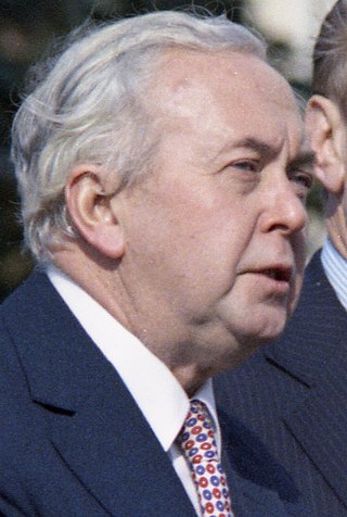
 This issue has not arisen in respect of the Peerage of Ireland because no creation of titles in it has been made since the constitution came into force.

The United Kingdom participated in the Eurovision Song Contest 1960. The British Broadcasting Corporation (BBC) organised a national final, the Eurovision Song Contest British Final, to select the United Kingdom's entry for the contest. The United Kingdom was represented by the song "Looking High, High, High", performed by Bryan Johnson, and placed 2nd, the United Kingdom's joint best placing in the competition at the time.

<span class="mw-page-title-main">Kingdom of England</span> Kingdom on the British Isles from 927 to 1707

The Kingdom of England was a sovereign state on the island of Great Britain from 12 July 927, when it emerged from various Anglo-Saxon kingdoms, until 1 May 1707, when it united with Scotland to form the Kingdom of Great Britain, and England is now part of the United Kingdom. The Kingdom of England was among the most powerful states in Europe during the medieval and early modern colonial periods.

<span class="mw-page-title-main">December 1910 United Kingdom general election</span>

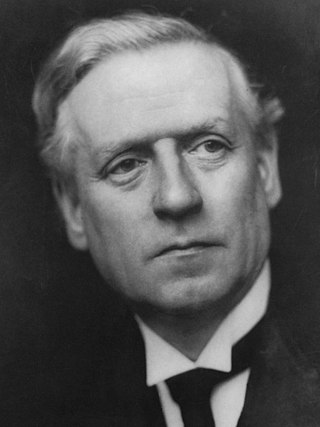
The December 1910 United Kingdom general election was held from 3 to 19 December. It was the last general election to be held over several days and the last to be held before the First World War.
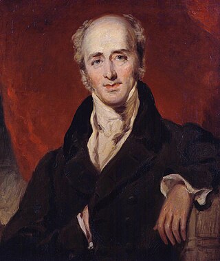
<span class="mw-page-title-main">Lists of places in Wales</span>

This is a list of lists of places in Wales.

Miss United Kingdom is a title held by the highest-ranked contestant from the UK in the Miss World pageant. The winner sometimes competes at Miss International the following year under the Britain or United Kingdom banner. From 1958 to 1999, Miss United Kingdom was a national beauty pageant held to choose a representative for the Miss World Pageant. In 1999, Scotland and Wales had their own contestants at Miss World, and in 2000, England and Northern Ireland sent their own representatives. The existing organization now runs the Miss England competition.

<span class="mw-page-title-main">Unitary authorities of England</span> Local government in some parts of England

Unitary authorities are a type of local authority responsible for all local government services for a district of England. They are constituted under the Local Government Act 1992, which amended the Local Government Act 1972 to allow the existence of counties that do not have multiple districts. They typically allow large towns to have separate local authorities from the less urbanised parts of their counties and originally provided a single authority for small counties where division into districts would be impractical. However, the UK government has more recently created much larger unitary authority areas, including a single authority for North Yorkshire, the largest non-metropolitan county in England, previously divided into seven districts.

<span class="mw-page-title-main">Kingdom of Portugal</span> Kingdom in Southwestern Europe (1139–1910)

The Kingdom of Portugal was a monarchy in the western Iberian Peninsula and the predecessor of the modern Portuguese Republic. Existing to various extents between 1139 and 1910, it was also known as the Kingdom of Portugal and the Algarves after 1415, and as the United Kingdom of Portugal, Brazil and the Algarves between 1815 and 1822. The name is also often applied to the Portuguese Empire, the realm's overseas colonies.

<span class="mw-page-title-main">United Kingdom in the Eurovision Song Contest</span>

The United Kingdom has participated in the Eurovision Song Contest 65 times. It first took part in the second contest in 1957 and has entered every year since 1959. Along with Sweden and the Netherlands, the UK is one of only three countries with Eurovision victories in four different decades. It is one of the "Big Five" countries, along with France, Germany, Italy and Spain, that are automatically prequalified for the final each year as they are the biggest financial contributors to the European Broadcasting Union (EBU). The British national broadcaster, the BBC, broadcasts the event and has, on multiple occasions, organised different national selection processes to choose the British entry. The United Kingdom has won the Eurovision Song Contest five times, and has finished as runner-up on a record sixteen occasions. The UK has hosted the contest a record nine times, four times in London and once each in Edinburgh (1972), Brighton (1974), Harrogate (1982), Birmingham (1998), and Liverpool (2023).

<span class="mw-page-title-main">Countries of the United Kingdom</span> Component parts of the UK since 1922

Since 1922 the United Kingdom has been made up of four countries: England, Scotland, Wales and Northern Ireland. The UK Prime Minister's website has used the phrase "countries within a country" to describe the United Kingdom. Some statistical summaries, such as those for the twelve NUTS 1 regions of the UK, refer to Northern Ireland, Scotland, and Wales as "regions". With regard to Northern Ireland, Scotland and Wales particularly, the descriptive name one uses "can be controversial, with the choice often revealing one's political preferences".