Tycroes

Last updated

Tycroes
Carmarthenshire UK location map.svg
Red pog.svg
Tycroes
Location within Carmarthenshire
Population2,438 (2011 census)
OS grid reference SN608107
Community
Principal area
Preserved county
Country Wales
Sovereign state United Kingdom
Post town Ammanford
Postcode district SA18
Dialling code 01269
Police Dyfed-Powys
Fire Mid and West Wales
Ambulance Welsh
UK Parliament
Senedd Cymru – Welsh Parliament
List of places
UK
Wales
Carmarthenshire
51°46′41″N4°01′30″W / 51.778°N 04.025°W / 51.778; -04.025

Tycroes is a village in Carmarthenshire, Wales. As measured in the 2011 Census, the population of Tycroes electoral ward was 2,438 persons (50.5% male, 49.5% female). [1]

Contents

At the 2011 Census all the population was counted in Llanedi community. The built-up area with Capel Hendre had a population of 3,752. [2]

The village forms the westernmost fringe of the Amman valley and rests mainly on the anthracite coal measures, part of the South Wales coalfield. It straddles the A483 Swansea to Manchester Trunk road and has a linear village structure, having developed substantially along roads which meet at the centre of the village. The trunk road is in the main artery from north to south of the country and is connected to the M4 motorway network which affords transportation from mainland Europe to Ireland. The rail link at nearby Pantyffynnon contributes a daily service to Swansea, Llanelli and Shrewsbury.

Topographically, the village slopes in a general south west to north east direction thus affording panoramic views of the Black Mountain in the east with its peaks - Tair Cairn 482 m, Garreg Lwyd 616 m and behind them Fan Hir 802 m. To the south there are views from Betws Mountain to Mynydd y Gwair above Garnswllt. To the north there is the limestone ridge from Llandybie to Upper Tumble.

The Fferws brook which flows from the west to the east divides the local authority administrative areas between Llanedi and Llandybie Community Councils. The name Fferws is possibly derived from the fact that the river flows over mineral rocks which contain iron ore (ferrous being the chemical name for iron). Others say it derives from a delightful house that once stood on its banks - "fairhouse".

History

Pre-nineteenth century the area was sparsely populated owing to the agricultural land being poor of quality. The best land was found to be along the banks of the River Loughor where two properties of notable character stood.

The first is Plas Mawr also known Plas Llanedy and Cwrt y Ceidrim. The main portion of the house dates from the 16th century. This was the seat of the Penry family and their descendants, Jones. William Penry and his son Henry were High Sheriffs in 1736 and 1756 respectively. The Penry family descended from Bleddyn ap Maenarch and were at Cwrt y Ceidrim in the Elizabethan era.

In 1876, Plas Mawr Estate nearly 850 acres (3.4 km2) was offered for sale. Later the Buckley family acquired it and in 1921 they offered for sale the freehold farm 129 acres (0.52 km2).

A field belonging to the farm was called Ynys y Capel and, according to tradition, a chapel had once stood there; another tradition states that a 'tunnel' connected the mansion to Carreg Cennen Castle. It is also rumoured that Oliver Cromwell rested there during his campaign in the principality during the Second English Civil War in Wales.

Today Plas Mawr has now been restored and is the family home of the Wiley and Waters family.

The other property is Erw Wasted located three-quarters of a mile from Plas Mawr. This was the home of the Price family from the 17th century. Francis Price was the High Sheriff in 1723. Later in the 18th century the price family moved to Plas Newydd in Llanedy.

The village owes its existence to the development of the coal mining industry during the 19th century. A few shallow shafts and drift was constructed to the rear of Bethesda Chapel at Mynydd Bach. Mynydd Bach was the former name for the village or hamlet. A tramway ran from the mine along Pontardulais road, part of Tycroes road and Heol Brown to the Brown Colliery at Waun y Wernos beyond Heol Brown and then to the sidings of the old Wernos Colliery.

The placename "Tycroes" is derived from the cottage or house (Ty) that stood at the crossroads, which is now the village square. In 1900 the village consisted of less than 100 homes but today there are about 800. The population at the turn of the century was approximately 400 and today is 2,122.

Since 1965 and especially during the house building boom of the early 70s, housing development erupted spreading its wings in all directions and this changed the face of the village. Frontage development took place along the existing roads and private housing estates at Penygarn Road, Pontardulais Road and the lower end of Tycroes Road. This trend reflects Tycroes's attractive situation.

The Brynhafod area reminds us of the connection with Canada. A Canadian maple tree grows at the bottom of the garden of 'Fernhill' (on Ammanford Road) where in previous years the Parry family once lived and some members of the family emigrated to Canada at the beginning of the 20th century and became a prominent family in Hamilton City, Ontario.

Mining is no longer a major source of employment. Local employment opportunities are varied and limited but is improving with the continued extension of factory units at nearby Capel Hendre and Cross Hands Industrial estates.

Education

From 1863 till 1904, primary education was provided at the local Church School, which is today used as the Church Hall. In 1904 the present county Primary School was built and was then known as the Board school. It is now known as Ysgol Tycroes, it is a mixed gender school, and only teaches in English, though Welsh is taught in the curriculum and spoken widely.

Places of worship

There were no places of worship in the village pre-1870 and people had to walk either to St. Edith's Church in Llanedi or the chapels in Ammanford (then known as Cross Inn) or to Capel Hendre and Saron. It was in 1876 that the first chapels were built; Moriah (Congregational) was the 'daughter' of Christian Temple Ammanford and Caersalem (Calvinistic Methodist) was the 'daughter' of Capel Hendre. Then at the earlier part of this century Bethesda (Baptist) was built in 1913 and building work commenced at St. Edmund's Church on 29 January 1914. Later in 1932 the Neuadd Efengylu, locally known as the Mission Hall or Gospel Hall, was opened.

Notable people

Governance

A separate electoral ward in the same name still exists. The population of this ward at the 2011 Census was 2,438. [3]

Facilities

There are good facilities available at the village hall, church hall, and the Scout's hall for the social, cultural, community events and other functions. The Senior Citizens Association, St. Johns Ambulance Brigade, Local Charities Committee, Ysgol Feithrin are some of the institutions which are accommodated at these halls, not forgetting the Mobile Library which visits every Thursday between 9:30-12:30 at Pant y boblen car park. The village hall was originally built as a Billiards hall. It was later sold to the 'Urdd Gobaith Cymru' who later sold it to the Miners Welfare Association - and is today the village hall.

The rugby union club at Penygarn Road provides good recreational facilities for both children, youth and senior players and, over the years, has produced some fine rugby players who were honoured to represent their country. The rugby club Also provides the village with great entertainment including the now established annual music event Party on the Pitch.

Lately a football pitch has been provided by the County Council at Heol Brown where the public park is also located.

Party on the Pitch

Tycroes RFC is also the host of the annual family fun day and musical event Party on the Pitch. Organised and run by a volunteer committee the event hosted 3,000 people in 2010. The event has welcomed 80's star Chesney Hawkes, 60's chart toppers the Animals and Spencer Davis and X Factor finalist Lucie Jones to the village in recent years.

Party on the Pitch 2014 will be held on Saturday 7 June.

Party on the pitch 2015 and 2016 featured Craig Gallivan performing

Related Research Articles

<span class="mw-page-title-main">Ammanford</span> Town and community in Carmarthenshire, Wales

Ammanford is a town and community in Carmarthenshire, Wales, with a population of 5,411 at the 2011 census. It is a former coal mining town. The built-up area had a population of 7,945 with the wider urban area even bigger.

<span class="mw-page-title-main">Llwynhendy</span> Village in Carmarthenshire, Wales

Llwynhendy, is a village and ward near the town of Llanelli in Carmarthenshire, Wales. The ward, which includes the village, as well as Cefncaeau, parts of Cwmcarnhywel and parts of Bryn and Penceilogi, had a population of 4,276.

<span class="mw-page-title-main">Llandybie</span> Village and community in Carmarthenshire, Wales

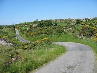
Llandybie is a village and community which includes a large village of the same name situated 2 miles (3.2 km) north of Ammanford in Carmarthenshire, Wales.

<span class="mw-page-title-main">Y Rhiw</span> Human settlement in Wales

Y Rhiw is a small village on the south west tip of the Llŷn Peninsula in Gwynedd in Wales.

<span class="mw-page-title-main">Pentyrch</span> Village and community in Cardiff, Wales

Pentyrch is a village and community located on the western outskirts of Cardiff, the capital city of Wales. The village gives its name to a Cardiff local authority electoral ward, Pentyrch, which covers the village and immediate surrounding area. The Pentyrch community includes the neighbouring village of Creigiau and Gwaelod y Garth. People living in Pentyrch are commonly known as "Penterchyians".

<span class="mw-page-title-main">Betws, Carmarthenshire</span> Village and community in Carmarthenshire, Wales

Betws is a small village and community on the River Amman in Carmarthenshire, Wales, some 15 miles north of Swansea; it is part of the ecclesiastical parish of Betws and Ammanford, and the urban area of Ammanford. The nearby mountain, at the western end of the Black Mountain, is named after the village, and has a large area of common land.

<span class="mw-page-title-main">Pennal</span> Village in Gwynedd, Wales

Pennal is a village and community on the A493 road in southern Gwynedd, Wales, on the north bank of the River Dyfi, near Machynlleth.

<span class="mw-page-title-main">Y Fron</span> Human settlement in Wales

Y Fron, also known locally as Cesarea, after the chapel, is a country village on the south-west side of Moel Tryfan, overlooking the Nantlle Valley, in North Wales, near Rhosgadfan and Carmel, on the tail of Mynydd Mawr, with epic views of Trum Y Ddysgl and Craig Cwm Silyn. It is in the community of Llandwrog.

Cefneithin is a village and community in Carmarthenshire, Wales, in the Carmarthenshire coalfield area. It lies just off the A48 road, 7 miles north west of Ammanford and 9 miles north of Llanelli. Its nearby community villages include Cross Hands, Drefach, Cwmmawr, Foelgastell and Gorslas. The Gwendraeth Fawr river flows nearby and its source is at Llyn Llech Owain, just north of the village. Cefneithin has a chapel (Tabernacl), a village hall, a primary school, and a secondary school. The latter, Ysgol Maes y Gwendraeth, was re-opened in 2016 after an extensive renovation and an £18.4m investment; it has 1,000 pupils, of which 157 in sixth form, and resources for children with additional learning needs. Prior to 2016 when the school was called Ysgol Gyfun Maes Yr Yrfa, some of its famous pupils include Nigel Owens, Jonathan Edwards, TV presenter Alex Jones and British and Irish Lion rugby player, Dwayne Peel.

Llanedi is a village and community in Carmarthenshire, Wales. Once the name of a parish, Llanedi is now a community taking in the hamlet of Llanedi and the villages of Hendy, Fforest and Tycroes. The community population taken at the 2011 census was 5,664. The community is located between Ammanford and Llanelli.

<span class="mw-page-title-main">Coelbren, Powys</span> Village in mid Wales

Coelbren is a small rural village within the community of Tawe Uchaf in southernmost Powys, Wales. It lies on the very northern edge of the South Wales Coalfield some six miles north-east of Ystradgynlais and just outside the southern boundary of the Brecon Beacons National Park. It is known for Henrhyd Falls, a 27m high waterfall which serves as a National Trust-managed visitor attraction on the Nant Llech. To the east of the village flows the Afon Pyrddin which plunges over two more spectacular falls.

Saron is a mining village near the town of Ammanford in Carmarthenshire, Wales. Saron is in the community of Llandybie.

<span class="mw-page-title-main">Capel Als, Llanelli</span> Church in Carmarthenshire, Wales

Capel Als is an Independent (Congregational) chapel in Llanelli, Carmarthenshire, Wales, It is regarded as one of the most significant religious buildings in Wales. Folk tradition suggested that the name refers to a woman named Als, which along with Alys is the Welsh equivalent of the English name Alice, whose cottage stood where the chapel was built. Another theory contends that the Welsh word als translates as rock, and there is a rock-face behind the chapel. However, there is no word "als" in Welsh meaning rock, and so this latter explanation may be safely disregarded.

<span class="mw-page-title-main">Mechell, Anglesey</span> Community in Anglesey, Wales

Mechell is a community in the north of the Isle of Anglesey, Wales. Llanfechell is the largest village within the community area. Tregele, Llanfflewyn, Mynydd Mechell, Bodewryd, Rhosbeirio and Carreglefn have a more dispersed settlement pattern. The antiquity of these settlements is shown by the presence of 6 medieval churches and some 16 more ancient sites dating back into prehistory.

Saron is a Baptist chapel in the village of Saron in the community of Llandybie, Ammanford, Carmarthenshire. Services at Saron are conducted in the Welsh language.

References

  1. UK Census (2011). "Local Area Report – Tycroes 2011 Census Ward (1237327843)". Nomis. Office for National Statistics . Retrieved 10 March 2018.
  2. "Custom report - Nomis - Official Labour Market Statistics".
  3. "Ward population 2011" . Retrieved 17 April 2015.

Sources