
Betws is a small village and community on the River Amman in Carmarthenshire, Wales, some 15 miles north of Swansea; it is part of the ecclesiastical parish of Betws and Ammanford, and the urban area of Ammanford. The nearby mountain, at the western end of the Black Mountain, is named after the village, and has a large area of common land.
Pantyffynnon is a small village in Carmarthenshire, Wales, half a mile south-west of Ammanford, and a mile east of Tycroes. It lies between the rivers Loughor and Amman at the foot of Mynydd y Betws.

The Lower Clydach River is a river in South Wales which rises on the slopes of Mynydd y Betws west of Cwmgors and flows for around 10 km through Cwm Clydach to its confluence with the River Tawe at Clydach. It runs through the RSPB's Cwm Clydach Nature Reserve just to the north of Clydach. - 51.69581°N 3.8992°W.

The Blayney wind farm is a wind power station at Lake Carcoar, south of Blayney, New South Wales, Australia. It was acquired by Trustpower in 2014, and is now owned by Tilt Renewables. Blayney has fifteen wind turbines, with a total nameplate capacity of 9.9 MW of electricity.

The United Kingdom is the best location for wind power in Europe and one of the best in the world. By 2023, the UK had over 11 thousand wind turbines with a total installed capacity of 28 gigawatts (GW): 14 GW onshore and 14 GW offshore, the sixth largest capacity of any country. Wind power generated about 25% of UK electricity, having surpassed coal in 2016 and nuclear in 2018. It is the largest source of renewable electricity in the UK.

Mynydd-y-Garreg or Mynyddygarreg is a village in the county of Carmarthenshire, West Wales. It borders the historic town of Kidwelly.
Tycroes is a village in Carmarthenshire, Wales. As measured in the 2011 Census, the population of Tycroes electoral ward was 2,438 persons.
Mynydd y Gwair is a mountain in Swansea, Wales. Mynydd y Gwair is 373m/1224 ft high.
Llanedi is a village and community in Carmarthenshire, Wales. Once the name of a parish, Llanedi is now a community taking in the hamlet of Llanedi and the villages of Hendy, Fforest and Tycroes. The community population taken at the 2011 census was 5,664. The community is located between Ammanford and Llanelli.

Mynydd Drumau is a hill in south Wales lying on the border between Swansea and the county of Neath Port Talbot.
Canunda Wind Farm is a $92.5 million, 46 MW wind power project located on grazing land approximately 16 kilometres south of Millicent, and 6 kilometres west of Tantanoola in South Australia. It is jointly owned by GDF Suez Energy AustraliaEn 72%) and Mitsui (28%).

Llanllwni is a village and community in Carmarthenshire, Wales, on the A485 road south-west of Llanybydder. To the south lies the mountain, Mynydd Llanllwni. The population of 638 recorded in the 2011 Census was estimated to be 692 in 2019.
Moel Maelogan(shown on O.S. maps as 'Maelogen', and also sometimes spelled 'Moelogan' and 'Mælogan') is a hill on the western edge of Mynydd Hiraethog in north Wales, and overlooking the Conwy Valley. It is known mostly as the general location of a wind farm.

The Hau Nui Wind Farm is a 15-turbine wind farm located approximately 21 kilometres (13 mi) south-east of Martinborough, in the South Wairarapa District of New Zealand. Hau Nui was the first wind farm built in New Zealand.

Carreg Dwfn is a hill four miles southeast of Llandeilo and just to the south of the village of Trap in the county of Carmarthenshire, south Wales. It lies at the western extremity of the Brecon Beacons National Park and Fforest Fawr Geopark. Its summit at 283 metres (928 ft) is towards the eastern end of a rocky east-west-aligned ridge.
Mynydd Bach Trecastell is a hill on the border between the counties of Carmarthenshire and Powys in southwest Wales. It lies within the Black Mountain range of the Brecon Beacons National Park and Fforest Fawr Geopark. Its summit is plateau-like and reaches a height of 412m at OS grid ref SN 827312 at Y Pigwn. The name signifies the 'little hill of castle town'.

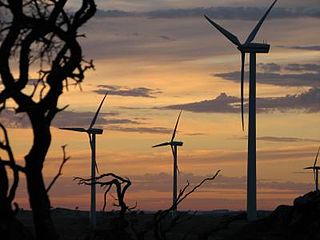
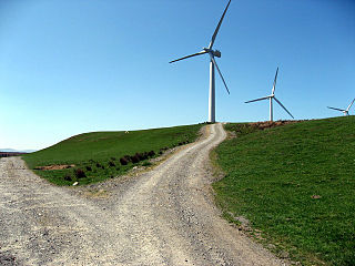
The Ammanford transmitting station is a broadcasting and telecommunications facility located on Mynydd y Betws about 6 km (4 mi) to the south east of the town of Ammanford, in Carmarthenshire, Wales. The building was originally built by Messrs. T. Richard Jones of Ammanford for the BBC, entering service in 1968 acting as a relay transmitter for the now-defunct 405-line VHF television system.
Mynydd Marchywel is a 418-metre (1,371 ft) high hill in the Neath Port Talbot area in South Wales. Its summit is marked both by a cairn and a trig point. The larger part of the hill is cloaked in modern forestry through which numerous streams fall away westward to the River Tawe, eastward to the River Dulais and southward into the Clydach, the latter two being tributaries of the River Neath.

Mynydd Allt-y-grug is a 338-metre-high hill immediately west of Ystalyfera in the county borough of Neath Port Talbot in South Wales. Its twin summits are around 400m apart. The upper part of the hill is largely covered in heather whilst conifers clothe its western slopes and gorse, bracken and bramble cover much of its rough landslide eastern side which rises above the Swansea Valley, drainage on this side flowing to the River Tawe.

Wind power in Rhode Island is in the early stages of development. There are several small scale wind turbine projects in the state. As of December 2013 there were 11 turbines at 10 sites in the state. In 2014, Rhode Island had 9 MW of installed wind power capacity, which quickly rose to 75 MW in 2019.
