Mole Valley is a local government district in Surrey, England. Its council is based in Dorking.

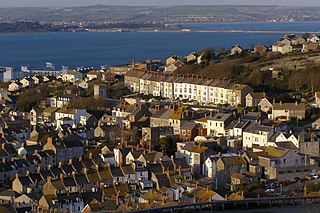
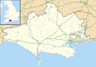
Fortuneswell is a village in Underhill on the Isle of Portland, in Dorset, England. It lies on steeply sloping land on the northern edge of the island, known as Underhill, where Chesil Beach, the tombolo which connects the island to the mainland, joins the island. Adjoining Fortuneswell and sharing the limited space on the northern slopes of the island are Chiswell to the west and Castletown to the north. Fortuneswell occupies the steepest land far above sea level, whereas Chiswell and Castletown occupy flat land close to sea level, next to Chesil Beach and Portland Harbour respectively. Fortuneswell has a main shopping street, and along with Easton, is the main hub of the Isle of Portland's activities.

Shackleford is a village and civil parish in the Borough of Guildford, Surrey, England centred to the west of the A3 between Guildford and Petersfield 32 miles (51 km) southwest of London and 5.2 miles (8.4 km) southwest of Guildford. Shackleford includes the localities of Eashing, Hurtmore, Norney and Gatwick.

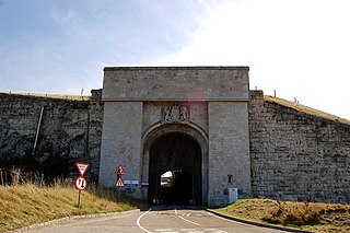
Verne Citadel is a 19th-century citadel on the Isle of Portland, Dorset, England. Located on the highest point of Portland, Verne Hill, it sits in a commanding position overlooking Portland Harbour, which it was built to defend. It later became HM Prison The Verne in 1949.

Bearsted is a village and civil parish with railway station in mid-Kent, England, two miles (3.2 km) east of Maidstone town centre.

Easton is a village on the Isle of Portland in Dorset, England. The village is situated at Tophill, within the centre of the island. As with the rest of Portland's villages and settlements, Easton, including the settlements Reforne and Straits, has been designated as a conservation area, as it is a place of special architectural and historic interest. Easton, Wakeham and Reforne were designated pre-1974.

Lamberhurst ( is a village and civil parish in Kent containing the hamlets of The Down and Hook Green. At the 2001 census it had a population of 1,491, increasing to 1,706 at the 2011 Census.

Warkworth Hermitage is a chapel and priest's house built onto and within a cliff-face on the north bank of the River Coquet in Northumberland, England, close to Warkworth Castle and the village of Warkworth.

Bellingham is a village in Northumberland, to the north-west of Newcastle upon Tyne and is situated on the Hareshaw Burn at its confluence with the River North Tyne.

Tichborne is a village and civil parish 4 miles (6.4 km) east of Winchester in Hampshire, England.

Chartham is a village and civil parish on the Great Stour river in the vale of the Kent Downs, 4 miles (6 km) west of Canterbury, England. The Great Stour Way path passes through the village. A paper mill in the village has specialised in the production of tracing paper since 1938. There are numerous arable farms and orchards in the parish. The village has an unmanned station, Chartham, and a manned level crossing. It has an outlying locality sharing in many of the community resources, Chartham Hatch.

Stockbridge is a small town and civil parish in the Test Valley district of Hampshire, England. It is one of the smallest towns in the United Kingdom with a population of 592 as of the 2011 census. It sits astride the River Test and at the foot of Stockbridge Down.

Bylaugh is a civil parish in Norfolk, England 4.5 miles (7.2 km) north-east of East Dereham and 13.5 miles (21.7 km) WNW of Norwich. For the purposes of local government it falls within the Upper Wensum Ward of Breckland District Council and the Elmham and Mattishall Division of Norfolk County Council. According to the 2001 census it had a population of 65. At the 2011 census the population remained less than 100 and was included in the civil parish of Sparham.

Rotherfield Greys is a village and civil parish in the Chiltern Hills in South Oxfordshire. It is 2 miles (3 km) west of Henley-on-Thames and just over 1 mile (1.6 km) east of Rotherfield Peppard. It is linked by a near-straight minor road to Henley.

Houghton is a low-population, linear settlement with a large elevated tract of land which is mostly wooded and two main farms forming its civil parish in the Arun District of West Sussex, England. It is on the River Arun, where it has a bridge to a rural part of Amberley, 3 miles (5 km) north of Arundel. The area is, equally, part of the South Downs National Park. The census 2011 included the population of South Stoke.

Tytherleigh is a village in the civil parish of Chardstock in Devon, England, close to the borders with Dorset and Somerset on the A358 road between the towns of Axminster and Chard. It was in Dorset until 1896.

Itchen Stoke and Ovington is an English civil parish consisting of two adjoining villages in Hampshire, England, 2 miles (3.2 km) west of Alresford town centre in the valley of the River Itchen, 5 miles (8.0 km) north-east of Winchester, and 2 miles (3.2 km) south-east of Itchen Abbas.

A number of signal boxes in England are on the Statutory List of Buildings of Special Architectural or Historic Interest. Signal boxes house the signalman and equipment that control the railway points and signals. Originally railway signals were controlled from a hut on a platform at junctions. In the 1850s a raised building with a glazed upper storey containing levers controlling points and signals was developed after John Saxby obtained a patent in 1856 for a mechanical system of interlocking the points and signals. Over half of the signalboxes before 1923 were built by private signalling contractors, the largest being Saxby & Farmer; Stevens & Sons, McKenzie & Holland, the Railway Signal Co., Dutton & Co and Evans, O’Donnell & Co were others. Some railway companies had a standard signalbox design, such as the London & North Western Railway, whereas others, such as the Great Eastern Railway had many different designs.

There are thirteen scheduled monuments in Birmingham, England.


