Bromham is a village and civil parish in Wiltshire, England. The village is 3+1⁄2 miles (6 km) northwest of Devizes and the same distance east of Melksham.

Castle Combe is a village and civil parish in Wiltshire, England. The village is around 5 miles (8 km) north-west of Chippenham and 10 miles (16 km) north-east of Bath. At the 2021 census, the parish had a population of 356.

Box is a large village and civil parish within the Cotswolds Area of Outstanding Natural Beauty in Wiltshire, England, about 3 miles (5 km) west of Corsham and 5 miles (8 km) northeast of Bath. Box also falls in the easternmost part of the Avon Green Belt. Besides the village of Box, the parish includes the villages of Ashley and Box Hill; Hazelbury manor; and the hamlets of Alcombe, Blue Vein, Chapel Plaister, Ditteridge, Henley, Kingsdown, Middlehill, and Wadswick. To the east the parish includes much of Rudloe, formerly a hamlet but now a housing estate, and the defence establishments and related businesses on the site of the former RAF Rudloe Manor.

Biddestone is a village and former civil parish, now in the parish of Biddestone and Slaughterford, in northwest Wiltshire, England, about 3 miles (5 km) west of Chippenham and 2 miles (3.2 km) north of Corsham. The parish includes the smaller settlement of Slaughterford.

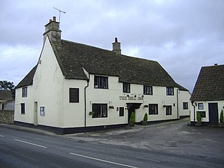
Kington Langley is a village and civil parish about 2 miles (3.2 km) north of Chippenham in Wiltshire, England. The parish includes the hamlet of Bowldown.

Bremhill is a village and civil parish in Wiltshire, England. The village is about 1.6 miles (2.6 km) northwest of Calne and 4 miles (6.4 km) east of Chippenham. The name originates from 'Bramble hill'. In 2021 the parish had a population of 967.

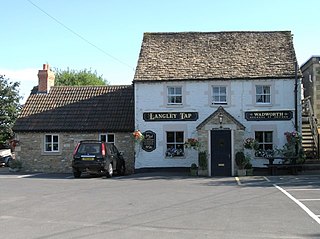
Langley Burrell is a village in the civil parish of Langley Burrell Without, just north of Chippenham, Wiltshire, England. It is the largest settlement in the parish, which includes the hamlets of Peckingell and Kellaways.

Hullavington is a village and civil parish in Wiltshire, England, just to the north of the M4 motorway. The village lies about 4 miles (6 km) southwest of Malmesbury and 5+1⁄2 miles (9 km) north of Chippenham.

Foxham is a village in Bremhill civil parish in Wiltshire, England, about 5 miles (8.0 km) northeast of Chippenham and a similar distance northwest of Calne.

Sutton Benger is a village and civil parish in the county of Wiltshire, England, 5 miles (8.0 km) northeast of the town of Chippenham. The parish includes the hamlet of Draycot Cerne.

Slaughterford is a small village in the civil parish of Biddestone and Slaughterford, about 5 miles (8 km) west of Chippenham, in Wiltshire, England. The village has a crossing point of the Bybrook River, and lies in a wooded valley between Castle Combe and Box. Anciently it was a separate parish.

Hilmarton is a village and civil parish in North Wiltshire, in the west of England. The village lies on the A3102 between the towns of Calne and Wootton Bassett, and 2 miles (3.2 km) south of Lyneham. The parish includes the village of Goatacre and the hamlets of Catcomb, Clevancy, Highway and New Zealand.

Kington St Michael is a village and civil parish about 3 miles (4.8 km) north of Chippenham in Wiltshire, England.

Yatton Keynell is a village and civil parish in Wiltshire, England. The village is on the B4039 road near Castle Combe, about 4 miles (6 km) northwest of Chippenham, and about the same distance to the east of the county border with South Gloucestershire.

Allington is a hamlet in north Wiltshire, England. It is on the edge of the market town of Chippenham, about 2 miles (3 km) north-west of the town centre and about 0.3 miles (500 m) north of the A420 road towards Bristol.

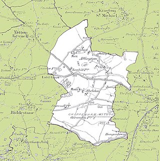
Chippenham Without is a civil parish in Wiltshire, England, created as a separate entity from the parish of Chippenham by the Local Government Act 1894 and largely consisting of farmland to the west of Chippenham, towards Biddestone. Of note within it are the ancient settlements of Allington and Sheldon, the latter with its manor house. The population taken at the 2011 census was 208.

St Andrew's Church of England parish church in Chippenham, Wiltshire, England, is an Inclusive, Fairtrade and Eco Church, committed to showing God's love through welcome, service and inclusivity. It is one of four Anglican parish churches in the town, and serves the south and east of Chippenham. The church is situated next to the Market Place within the historic town centre, and is Grade II* listed.

Crudwell is a village and civil parish in north Wiltshire, England. The nearest towns are Malmesbury, about 4 miles (6.4 km) to the south-west, and Cirencester, Gloucestershire 8 miles (13 km) to the north-east. Also to the north-east is Cotswold Airport. Kemble village, about 4 miles (6.4 km) away, has the nearest railway station, with services to London Paddington and Gloucester.

Kellaways, also known as Tytherton Kellaways, is a village and former ecclesiastical parish in the present-day civil parish of Langley Burrell Without and ceremonial county of Wiltshire, England. Its nearest town is Chippenham, which lies 2.5 miles (4.0 km) southwest from the hamlet. Historically, the name was sometimes given as Gallows.

East Tytherton is a hamlet in the civil parish of Bremhill in the ceremonial county of Wiltshire, England. Its nearest town is Chippenham, which lies approximately 2.7 miles (4.3 km) south-west from the hamlet.


