List of United Kingdom locations: Sn-Soute

Last updated

The United Kingdom Uk-map.svg
The United Kingdom

This is part of the list of United Kingdom locations: a gazetteer of place names in the United Kingdom showing each place's locality and geographical coordinates.

Contents

Sn

LocationLocality Coordinates
(links to map & photo sources)
OS grid
reference
Snagshall East Sussex 50°59′N0°32′E / 50.98°N 00.53°E / 50.98; 00.53 TQ7824
Snailbeach Shropshire 52°37′N2°56′W / 52.61°N 02.93°W / 52.61; -02.93 SJ3702
Snails Hill Somerset 50°55′N2°46′W / 50.91°N 02.76°W / 50.91; -02.76 ST4613
Snailswell Hertfordshire 51°58′N0°17′W / 51.97°N 00.29°W / 51.97; -00.29 TL1732
Snailwell Cambridgeshire 52°16′N0°24′E / 52.27°N 00.40°E / 52.27; 00.40 TL6467
Snainton North Yorkshire 54°13′N0°35′W / 54.22°N 00.59°W / 54.22; -00.59 SE9282
Snaisgill Durham 54°38′N2°04′W / 54.63°N 02.07°W / 54.63; -02.07 NY9527
Snaith East Riding of Yorkshire 53°41′N1°02′W / 53.69°N 01.03°W / 53.69; -01.03 SE6422
Snape North Yorkshire 54°15′N1°36′W / 54.25°N 01.60°W / 54.25; -01.60 SE2684
Snape Suffolk 52°10′N1°29′E / 52.17°N 01.49°E / 52.17; 01.49 TM3959
Snape Green Lancashire 53°37′N2°57′W / 53.61°N 02.95°W / 53.61; -02.95 SD3714
Snape Hill Barnsley 53°32′N1°23′W / 53.53°N 01.38°W / 53.53; -01.38 SE4104
Snape Hill Derbyshire 53°18′N1°28′W / 53.30°N 01.47°W / 53.30; -01.47 SK3579
Snapper Devon 51°05′N4°01′W / 51.08°N 04.01°W / 51.08; -04.01 SS5934
Snaresbrook Waltham Forest 51°35′N0°00′E / 51.58°N 00.00°E / 51.58; 00.00 TQ3989
Snarestone Leicestershire 52°40′N1°29′W / 52.67°N 01.49°W / 52.67; -01.49 SK3409
Snarford Lincolnshire 53°19′N0°25′W / 53.32°N 00.42°W / 53.32; -00.42 TF0582
Snargate Kent 51°01′N0°49′E / 51.01°N 00.82°E / 51.01; 00.82 TQ9828
Snatchwood Torfaen 51°43′N3°04′W / 51.71°N 03.07°W / 51.71; -03.07 SO2602
Snave Kent 51°01′N0°52′E / 51.02°N 00.86°E / 51.02; 00.86 TR0129
Sneachill Worcestershire 52°10′N2°08′W / 52.17°N 02.14°W / 52.17; -02.14 SO9053
Snead Shropshire 52°31′N3°01′W / 52.52°N 03.01°W / 52.52; -03.01 SO3192
Snead Common Worcestershire 52°19′N2°25′W / 52.31°N 02.41°W / 52.31; -02.41 SO7269
Sneads Green Worcestershire 52°18′N2°12′W / 52.30°N 02.20°W / 52.30; -02.20 SO8667
Sneath Common Norfolk 52°27′N1°10′E / 52.45°N 01.16°E / 52.45; 01.16 TM1589
Sneaton North Yorkshire 54°27′N0°37′W / 54.45°N 00.62°W / 54.45; -00.62 NZ8907
Sneatonthorpe North Yorkshire 54°26′N0°37′W / 54.44°N 00.61°W / 54.44; -00.61 NZ9006
Snedshill Shropshire 52°40′N2°26′W / 52.67°N 02.44°W / 52.67; -02.44 SJ7009
Sneinton Nottinghamshire 52°56′N1°08′W / 52.94°N 01.13°W / 52.94; -01.13 SK5839
Snelland Lincolnshire 53°18′N0°23′W / 53.30°N 00.39°W / 53.30; -00.39 TF0780
Snelston Derbyshire 52°59′N1°46′W / 52.98°N 01.77°W / 52.98; -01.77 SK1543
Snetterton Norfolk 52°29′N0°55′E / 52.48°N 00.92°E / 52.48; 00.92 TL9991
Snettisham Norfolk 52°52′N0°29′E / 52.87°N 00.49°E / 52.87; 00.49 TF6834
Sneyd Green City of Stoke-on-Trent 53°02′N2°11′W / 53.03°N 02.18°W / 53.03; -02.18 SJ8849
Sneyd Park North Somerset 51°28′N2°38′W / 51.47°N 02.64°W / 51.47; -02.64 ST5575
Snibston Leicestershire 52°43′N1°23′W / 52.71°N 01.39°W / 52.71; -01.39 SK4113
Snig's End Gloucestershire 51°57′N2°18′W / 51.95°N 02.30°W / 51.95; -02.30 SO7928
Snipeshill Kent 51°20′N0°45′E / 51.33°N 00.75°E / 51.33; 00.75 TQ9263
Sniseabhal Western Isles 57°17′N7°23′W / 57.28°N 07.39°W / 57.28; -07.39 NF7534
Snitter Northumberland 55°19′N1°58′W / 55.32°N 01.97°W / 55.32; -01.97 NU0203
Snitterby Lincolnshire 53°26′N0°31′W / 53.43°N 00.52°W / 53.43; -00.52 SK9894
Snitterfield Warwickshire 52°13′N1°41′W / 52.22°N 01.69°W / 52.22; -01.69 SP2159
Snitterton Derbyshire 53°08′N1°35′W / 53.13°N 01.59°W / 53.13; -01.59 SK2760
Snitton Shropshire 52°22′N2°40′W / 52.37°N 02.66°W / 52.37; -02.66 SO5575
Snittongate Shropshire 52°22′N2°38′W / 52.37°N 02.64°W / 52.37; -02.64 SO5675
Snodhill Herefordshire 52°03′N3°00′W / 52.05°N 03.00°W / 52.05; -03.00 SO3140
Snodland Kent 51°19′N0°26′E / 51.32°N 00.43°E / 51.32; 00.43 TQ7061
Snods Edge Northumberland 54°52′N1°54′W / 54.86°N 01.90°W / 54.86; -01.90 NZ0652
Snowden Hill Barnsley 53°29′N1°36′W / 53.49°N 01.60°W / 53.49; -01.60 SE2600
Snowdown Kent 51°13′N1°12′E / 51.21°N 01.20°E / 51.21; 01.20 TR2451
Snow End Hertfordshire 51°58′N0°02′E / 51.96°N 00.03°E / 51.96; 00.03 TL4032
Snow Hill Cheshire 53°04′N2°32′W / 53.06°N 02.53°W / 53.06; -02.53 SJ6452
Snow Hill Wakefield 53°41′N1°31′W / 53.69°N 01.51°W / 53.69; -01.51 SE3222
Snow Lea Kirklees 53°38′N1°52′W / 53.64°N 01.86°W / 53.64; -01.86 SE0917
Snowshill Gloucestershire 51°59′N1°52′W / 51.99°N 01.87°W / 51.99; -01.87 SP0933
Snow Street Norfolk 52°23′N1°04′E / 52.38°N 01.07°E / 52.38; 01.07 TM0981
Snydale Wakefield 53°40′N1°23′W / 53.67°N 01.39°W / 53.67; -01.39 SE4020

So

Soa–Sot

LocationLocality Coordinates
(links to map & photo sources)
OS grid
reference
Soa (tidal island of Tiree)Argyll and Bute 56°31′N6°46′W / 56.51°N 06.76°W / 56.51; -06.76 NM069458
Soa (near Coll)Argyll and Bute 56°34′N6°38′W / 56.56°N 06.63°W / 56.56; -06.63 NM156512
Soa Island Argyll and Bute 56°17′N6°27′W / 56.28°N 06.45°W / 56.28; -06.45 NM243191
Soake Hampshire 50°53′N1°04′W / 50.89°N 01.06°W / 50.89; -01.06 SU6611
Soar Devon 50°13′N3°49′W / 50.21°N 03.82°W / 50.21; -03.82 SX7037
Soar Gwynedd 52°53′N4°04′W / 52.89°N 04.06°W / 52.89; -04.06 SH6135
Soar Isle of Anglesey 53°13′N4°25′W / 53.22°N 04.42°W / 53.22; -04.42 SH3872
Soar Powys 51°58′N3°30′W / 51.97°N 03.50°W / 51.97; -03.50 SN9732
Soay Highland 57°09′N6°13′W / 57.15°N 06.21°W / 57.15; -06.21 NG453146
Soay Western Isles 57°49′N8°38′W / 57.82°N 08.63°W / 57.82; -08.63 NA064015
Soay Beag Western Isles 57°56′N6°59′W / 57.94°N 06.98°W / 57.94; -06.98 NB053059
Soay Mòr Western Isles 57°56′N6°58′W / 57.93°N 06.96°W / 57.93; -06.96 NB061050
Soberton Hampshire 50°56′N1°08′W / 50.94°N 01.13°W / 50.94; -01.13 SU6116
Soberton Heath Hampshire 50°55′N1°08′W / 50.92°N 01.14°W / 50.92; -01.14 SU6014
Sockbridge Cumbria 54°37′N2°46′W / 54.62°N 02.77°W / 54.62; -02.77 NY5026
Sockburn North Yorkshire 54°27′N1°28′W / 54.45°N 01.47°W / 54.45; -01.47 NZ3407
Sockety Dorset 50°51′N2°44′W / 50.85°N 02.74°W / 50.85; -02.74 ST4806
Sodom Denbighshire 53°13′N3°22′W / 53.22°N 03.36°W / 53.22; -03.36 SJ0971
Sodom Wiltshire 51°31′N2°00′W / 51.52°N 02.00°W / 51.52; -02.00 SU0081
Sodylt Bank Shropshire 52°56′N2°59′W / 52.94°N 02.98°W / 52.94; -02.98 SJ3439
Soham Cambridgeshire 52°20′N0°20′E / 52.33°N 00.33°E / 52.33; 00.33 TL5973
Soham Cotes Cambridgeshire 52°21′N0°18′E / 52.35°N 00.30°E / 52.35; 00.30 TL5775
Soho Sandwell 52°29′N1°57′W / 52.49°N 01.95°W / 52.49; -01.95 SP0389
Soho Somerset 51°14′N2°26′W / 51.23°N 02.44°W / 51.23; -02.44 ST6948
Soho City of Westminster 51°31′N0°08′W / 51.51°N 00.14°W / 51.51; -00.14 TQ2981
Soldon Cross Devon 50°52′N4°23′W / 50.86°N 04.38°W / 50.86; -04.38 SS3210
Soldridge Hampshire 51°06′N1°04′W / 51.10°N 01.07°W / 51.10; -01.07 SU6534
Solent Breezes Hampshire 50°50′N1°17′W / 50.83°N 01.29°W / 50.83; -01.29 SU5004
Sole Street (Ashford)Kent 51°12′N0°59′E / 51.20°N 00.99°E / 51.20; 00.99 TR0949
Sole Street (Gravesham)Kent 51°22′N0°22′E / 51.37°N 00.36°E / 51.37; 00.36 TQ6567
Solihull Warwickshire 52°24′N1°47′W / 52.40°N 01.78°W / 52.40; -01.78 SP1579
Solihull Lodge Warwickshire 52°24′N1°52′W / 52.40°N 01.86°W / 52.40; -01.86 SP0978
Solitote Highland 57°41′N6°20′W / 57.68°N 06.33°W / 57.68; -06.33 NG4274
Sollas Western Isles 57°38′N7°20′W / 57.64°N 07.34°W / 57.64; -07.34 NF8174
Sollers Dilwyn Herefordshire 52°11′N2°50′W / 52.19°N 02.84°W / 52.19; -02.84 SO4255
Sollers Hope Herefordshire 51°59′N2°34′W / 51.99°N 02.56°W / 51.99; -02.56 SO6133
Sollom Lancashire 53°39′N2°50′W / 53.65°N 02.83°W / 53.65; -02.83 SD4518
Solon Mor Western Isles 56°49′N7°37′W / 56.82°N 07.61°W / 56.82; -07.61 NL577847
Solva Pembrokeshire 51°52′N5°11′W / 51.87°N 05.19°W / 51.87; -05.19 SM8024
Somerby Leicestershire 52°41′N0°52′W / 52.68°N 00.86°W / 52.68; -00.86 SK7710
Somerby Lincolnshire 53°32′N0°24′W / 53.54°N 00.40°W / 53.54; -00.40 TA0606
Somercotes Derbyshire 53°04′N1°22′W / 53.07°N 01.37°W / 53.07; -01.37 SK4253
Somerdale Bath and North East Somerset 51°25′N2°30′W / 51.41°N 02.50°W / 51.41; -02.50 ST6569
Somerford Cheshire 53°11′N2°18′W / 53.18°N 02.30°W / 53.18; -02.30 SJ8065
Somerford Dorset 50°44′N1°46′W / 50.73°N 01.76°W / 50.73; -01.76 SZ1793
Somerford Staffordshire 52°40′N2°10′W / 52.66°N 02.16°W / 52.66; -02.16 SJ8908
Somerford Keynes Gloucestershire 51°39′N1°59′W / 51.65°N 01.98°W / 51.65; -01.98 SU0195
Somerley West Sussex 50°46′N0°51′W / 50.77°N 00.85°W / 50.77; -00.85 SZ8198
Somerleyton Suffolk 52°31′N1°39′E / 52.51°N 01.65°E / 52.51; 01.65 TM4897
Somersal Herbert Derbyshire 52°55′N1°48′W / 52.91°N 01.80°W / 52.91; -01.80 SK1335
Somersby Lincolnshire 53°13′N0°01′E / 53.22°N 00.01°E / 53.22; 00.01 TF3472
Somersham Cambridgeshire 52°23′N0°00′E / 52.38°N 00.00°E / 52.38; 00.00 TL3678
Somersham Suffolk 52°05′N1°02′E / 52.09°N 01.03°E / 52.09; 01.03 TM0848
Somers Town City of Portsmouth 50°47′N1°05′W / 50.78°N 01.09°W / 50.78; -01.09 SZ6499
Somers Town City of Westminster 51°31′N0°08′W / 51.52°N 00.14°W / 51.52; -00.14 TQ2982
Somerton City of Newport 51°34′N2°58′W / 51.57°N 02.96°W / 51.57; -02.96 ST3387
Somerton Oxfordshire 51°56′N1°17′W / 51.94°N 01.28°W / 51.94; -01.28 SP4928
Somerton Somerset 51°02′N2°44′W / 51.04°N 02.74°W / 51.04; -02.74 ST4828
Somerton Suffolk 52°08′N0°38′E / 52.14°N 00.64°E / 52.14; 00.64 TL8153
Somerton Hill Somerset 51°02′N2°46′W / 51.04°N 02.77°W / 51.04; -02.77 ST4628
Somerwood Shropshire 52°43′N2°39′W / 52.72°N 02.65°W / 52.72; -02.65 SJ5614
Sompting West Sussex 50°49′N0°20′W / 50.82°N 00.34°W / 50.82; -00.34 TQ1704
Sompting Abbotts West Sussex 50°50′N0°21′W / 50.83°N 00.35°W / 50.83; -00.35 TQ1605
Sonning Berkshire 51°28′N0°55′W / 51.46°N 00.92°W / 51.46; -00.92 SU7575
Sonning Common Oxfordshire 51°31′N0°59′W / 51.51°N 00.99°W / 51.51; -00.99 SU7080
Sonning Eye Oxfordshire 51°28′N0°55′W / 51.47°N 00.92°W / 51.47; -00.92 SU7576
Sontley Wrexham 53°00′N3°00′W / 53.00°N 03.00°W / 53.00; -03.00 SJ3346
Sookholme Nottinghamshire 53°11′N1°11′W / 53.18°N 01.19°W / 53.18; -01.19 SK5466
Sopley Hampshire 50°46′N1°47′W / 50.77°N 01.78°W / 50.77; -01.78 SZ1597
Sopwell Hertfordshire 51°44′N0°20′W / 51.73°N 00.33°W / 51.73; -00.33 TL1505
Sopworth Wiltshire 51°34′N2°16′W / 51.57°N 02.26°W / 51.57; -02.26 ST8286
Soraigh Western Isles 58°16′N7°35′W / 58.27°N 07.59°W / 58.27; -07.59 NA722453
Sorbie Dumfries and Galloway 54°47′N4°26′W / 54.78°N 04.44°W / 54.78; -04.44 NX4346
Sorisdale Argyll and Bute 56°40′N6°27′W / 56.67°N 06.45°W / 56.67; -06.45 NM2763
Sorley Devon 50°18′N3°47′W / 50.30°N 03.79°W / 50.30; -03.79 SX7246
Sorn East Ayrshire 55°30′N4°17′W / 55.50°N 04.29°W / 55.50; -04.29 NS5526
Sornhill East Ayrshire 55°34′N4°22′W / 55.57°N 04.36°W / 55.57; -04.36 NS5134
Soroba (Oban)Argyll and Bute 56°23′N5°28′W / 56.39°N 05.46°W / 56.39; -05.46 NM8628
Soroba (Ardfern)Argyll and Bute 56°10′N5°32′W / 56.17°N 05.54°W / 56.17; -05.54 NM8004
Sortat Highland 58°32′N3°14′W / 58.54°N 03.23°W / 58.54; -03.23 ND2863
Sotby Lincolnshire 53°17′N0°12′W / 53.28°N 00.20°W / 53.28; -00.20 TF2078
Sothall Sheffield 53°20′N1°20′W / 53.33°N 01.34°W / 53.33; -01.34 SK4482
Sots Hole Lincolnshire 53°10′N0°19′W / 53.16°N 00.32°W / 53.16; -00.32 TF1264
Sotterley Suffolk 52°23′N1°36′E / 52.39°N 01.60°E / 52.39; 01.60 TM4584

Sou

Soua–Soute

LocationLocality Coordinates
(links to map & photo sources)
OS grid
reference
Soudley (Eaton-Under-Heywood)Shropshire 52°31′N2°47′W / 52.51°N 02.78°W / 52.51; -02.78 SO4791
Soudley (Cheswardine)Shropshire 52°50′N2°25′W / 52.84°N 02.41°W / 52.84; -02.41 SJ7228
Soughley Barnsley 53°31′N1°43′W / 53.51°N 01.72°W / 53.51; -01.72 SE1802
Soughton Flintshire 53°11′N3°08′W / 53.18°N 03.13°W / 53.18; -03.13 SJ2466
Soulbury Buckinghamshire 51°56′N0°43′W / 51.93°N 00.72°W / 51.93; -00.72 SP8827
Soulby (Dacre)Cumbria 54°37′N2°50′W / 54.61°N 02.83°W / 54.61; -02.83 NY4625
Soulby (Kirkby Stephen)Cumbria 54°29′N2°24′W / 54.49°N 02.40°W / 54.49; -02.40 NY7411
Souldern Oxfordshire 51°58′N1°14′W / 51.97°N 01.24°W / 51.97; -01.24 SP5231
Souldrop Bedfordshire 52°14′N0°34′W / 52.23°N 00.56°W / 52.23; -00.56 SP9861
Sound Cheshire 53°01′N2°34′W / 53.02°N 02.56°W / 53.02; -02.56 SJ6248
Sound (Lerwick)Shetland Islands 60°08′N1°10′W / 60.14°N 01.17°W / 60.14; -01.17 HU4640
Sound (Weisdale)Shetland Islands 60°14′N1°19′W / 60.23°N 01.31°W / 60.23; -01.31 HU3850
Sound (Yell)Shetland Islands 60°31′N1°11′W / 60.52°N 01.18°W / 60.52; -01.18 HU4583
Sound Gruney Shetland Islands 60°38′N0°56′W / 60.64°N 00.94°W / 60.64; -00.94 HU576960
Sound Heath Cheshire 53°01′N2°35′W / 53.01°N 02.58°W / 53.01; -02.58 SJ6147
Soundwell South Gloucestershire 51°28′N2°30′W / 51.47°N 02.50°W / 51.47; -02.50 ST6575
Sourhope Scottish Borders 55°28′N2°15′W / 55.47°N 02.25°W / 55.47; -02.25 NT8420
Sourin Orkney Islands 59°10′N2°59′W / 59.16°N 02.99°W / 59.16; -02.99 HY4331
Sourlie North Ayrshire 55°38′N4°38′W / 55.63°N 04.63°W / 55.63; -04.63 NS3441
Sour Nook Cumbria 54°45′N2°59′W / 54.75°N 02.98°W / 54.75; -02.98 NY3740
Sourton Devon 50°41′N4°05′W / 50.69°N 04.08°W / 50.69; -04.08 SX5390
Soutergate Cumbria 54°13′N3°11′W / 54.21°N 03.19°W / 54.21; -03.19 SD2281

Related Research Articles

Britain most often refers to:

<span class="mw-page-title-main">Parliament of the United Kingdom</span> Legislative body in the United Kingdom

The Parliament of the United Kingdom of Great Britain and Northern Ireland is the supreme legislative body of the United Kingdom, and may also legislate for the Crown Dependencies and the British Overseas Territories. It meets at the Palace of Westminster in London. Parliament possesses legislative supremacy and thereby holds ultimate power over all other political bodies in the United Kingdom and the Overseas Territories. While Parliament is bicameral, it has three parts: the sovereign (King-in-Parliament), the House of Lords, and the House of Commons. In theory, power is officially vested in the King-in-Parliament. However, the Crown normally acts on the advice of the prime minister, and the powers of the House of Lords are limited to only delaying legislation; thus power is de facto vested in the House of Commons.

June is the sixth month of the year in the Julian and Gregorian calendars. Its length is 30 days. June contains the summer solstice in the Northern Hemisphere, the day with the most daylight hours, and the winter solstice in the Southern Hemisphere, the day with the fewest daylight hours. June in the Northern Hemisphere is the seasonal equivalent to December in the Southern Hemisphere and vice versa. In the Northern Hemisphere, the beginning of the traditional astronomical summer is 21 June. In the Southern Hemisphere, meteorological winter begins on 1 June.

<span class="mw-page-title-main">Prime Minister of the United Kingdom</span> Head of government in the United Kingdom

The prime minister of the United Kingdom is the head of government of the United Kingdom. The prime minister advises the sovereign on the exercise of much of the royal prerogative, chairs the Cabinet and selects its ministers. As modern prime ministers hold office by virtue of their ability to command the confidence of the House of Commons, they sit as members of Parliament.

<span class="mw-page-title-main">Primary school</span> School for children

A primary school, elementary school, or grade school is a school for primary education of children who are 4 to 10 years of age. Primary schooling follows preschool and precedes secondary schooling.
<span class="mw-page-title-main">United Kingdom</span> Country in Northwestern Europe

The United Kingdom of Great Britain and Northern Ireland, commonly known as the United Kingdom (UK) or Britain, is a country in Northwestern Europe, off the north-western coast of the continental mainland. It comprises England, Scotland, Wales, and Northern Ireland. It includes the island of Great Britain, the north-eastern part of the island of Ireland, and most of the smaller islands within the British Isles. Northern Ireland shares a land border with the Republic of Ireland; otherwise, the United Kingdom is surrounded by the Atlantic Ocean, the North Sea, the English Channel, the Celtic Sea, and the Irish Sea. The total area of the United Kingdom is 94,060 square miles (243,610 km2), with an estimated 2022 population of nearly 67 million people.

The Peerage of Ireland consists of those titles of nobility created by the English monarchs in their capacity as Lord or King of Ireland, or later by monarchs of the United Kingdom of Great Britain and Ireland. It is one of the five divisions of Peerages in the United Kingdom. The creation of such titles came to an end in the 19th century. The ranks of the Irish peerage are duke, marquess, earl, viscount and baron. As of 2016, there were 135 titles in the Peerage of Ireland extant: two dukedoms, ten marquessates, 43 earldoms, 28 viscountcies, and 52 baronies. However, these titles have no official recognition in the Republic of Ireland, with Article 40.2 of the Constitution of Ireland forbidding the state conferring titles of nobility and stating that an Irish citizen may not accept titles of nobility or honour except with the prior approval of the Irish government.

<span class="mw-page-title-main">Kingdom of England</span> State from the early tenth century to 1707

The Kingdom of England was a sovereign state on the island of Great Britain from the early tenth century, when it emerged from various Anglo-Saxon kingdoms, until 1 May 1707, when it united with Scotland to form the Kingdom of Great Britain, which would later become the United Kingdom. The Kingdom of England was among the most powerful states in Europe during the medieval and early modern colonial periods.
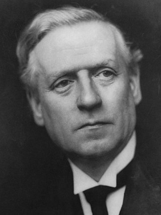
<span class="mw-page-title-main">December 1910 United Kingdom general election</span>

The December 1910 United Kingdom general election was held from 3 to 19 December. It was the last general election to be held over several days and the last to be held before the First World War.

<span class="mw-page-title-main">Lists of places in Wales</span>

This is a list of lists of places in Wales.

<span class="mw-page-title-main">Kingdom of Israel (united monarchy)</span> Israelite kingdom of Israel and Judah (c. 1047–930 BCE)

According to the Deuteronomistic history of the Hebrew Bible, a United Monarchy or United Kingdom of Israel existed under the reigns of Saul, David, and Solomon, encompassing the territories of both the later kingdoms of Judah and Israel.
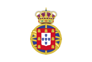
<span class="mw-page-title-main">United Kingdom of Portugal, Brazil and the Algarves</span> Pluricontinental monarchy

The United Kingdom of Portugal, Brazil and the Algarves was a pluricontinental monarchy formed by the elevation of the Portuguese colony named State of Brazil to the status of a kingdom and by the simultaneous union of that Kingdom of Brazil with the Kingdom of Portugal and the Kingdom of the Algarves, constituting a single state consisting of three kingdoms.

<span class="mw-page-title-main">UFC 38</span> UFC mixed martial arts event in 2002

UFC 38: Brawl at the Hall was a mixed martial arts event held by the Ultimate Fighting Championship. It took place at the Royal Albert Hall in London, United Kingdom, on July 13, 2002. The event was seen live on pay-per-view in the United States, and was later released on home video.

<span class="mw-page-title-main">Unitary authorities of England</span> Local government in some parts of England

The unitary authorities of England are a type of local authority responsible for all local government services in an area. They combine the functions of a non-metropolitan county council and a non-metropolitan district council, which elsewhere in England provide two tiers of local government.

<span class="mw-page-title-main">Kingdom of Portugal</span> Kingdom in Southwestern Europe (1139–1910)

The Kingdom of Portugal was a monarchy in the western Iberian Peninsula and the predecessor of the modern Portuguese Republic. Existing to various extents between 1139 and 1910, it was also known as the Kingdom of Portugal and the Algarves after 1415, and as the United Kingdom of Portugal, Brazil and the Algarves between 1815 and 1822. The name is also often applied to the Portuguese Empire, the realm's overseas colonies.

<span class="mw-page-title-main">United Kingdom in the Eurovision Song Contest</span>

The United Kingdom has participated in the Eurovision Song Contest 65 times. It first took part in the second contest in 1957 and has entered every year since 1959. Along with Sweden and the Netherlands, the UK is one of only three countries with Eurovision victories in four different decades. It is one of the "Big Five" countries, along with France, Germany, Italy and Spain, that are automatically prequalified for the final each year as they are the biggest financial contributors to the European Broadcasting Union (EBU). The British national broadcaster, the BBC, broadcasts the event and has, on multiple occasions, organised different national selection processes to choose the British entry. The United Kingdom has won the Eurovision Song Contest five times, and has finished as runner-up on a record sixteen occasions. The UK has hosted the contest a record nine times, four times in London and once each in Edinburgh (1972), Brighton (1974), Harrogate (1982), Birmingham (1998), and Liverpool (2023).

<span class="mw-page-title-main">Countries of the United Kingdom</span> Component parts of the UK since 1922

Since 1922, the United Kingdom has been made up of four countries: England, Scotland, Wales and Northern Ireland. The UK Prime Minister's website has used the phrase "countries within a country" to describe the United Kingdom. Some statistical summaries, such as those for the twelve NUTS 1 regions of the UK, refer to Northern Ireland, Scotland, and Wales as "regions". With regard to Northern Ireland, Scotland and Wales particularly, the descriptive name one uses "can be controversial, with the choice often revealing one's political preferences".