Solva

Last updated

Solva
SolvaHarbor(Garethrees).jpg
Pembrokeshire UK location map.svg
Red pog.svg
Solva
Location within Pembrokeshire
Population865 (2011 census) [1]
OS grid reference SM802243
Principal area
Preserved county
Country Wales
Sovereign state United Kingdom
Post town HAVERFORDWEST
Postcode district SA62
Dialling code 01437
Police Dyfed-Powys
Fire Mid and West Wales
Ambulance Welsh
UK Parliament
Senedd Cymru – Welsh Parliament
List of places
UK
Wales
Pembrokeshire
51°52′26″N5°11′38″W / 51.874°N 5.194°W / 51.874; -5.194

Solva (Welsh : Solfach) is a village, community and electoral ward in Pembrokeshire, Wales. The village comprises principally Lower Solva and Upper Solva. The community also includes Middle Mill and Whitchurch.

Contents

Location

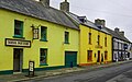
Solva lies on the north side of St Bride's Bay, in North Pembrokeshire in the Pembrokeshire Coast National Park and on the Pembrokeshire Coast Path. [2] It lies on a deep valley at the mouth of the River Solva. In the valley is Lower Solva, consisting of a long street ending at the small harbour. Most of the modern development has been in Upper Solva, on the cliff top to the west of the harbour.

History

Solvach Bay and harbour, 1748 Solvach Bay and harbour in Brides Bay Pembroke Shire.gif
Solvach Bay and harbour, 1748
Solva c. 1830 by engraver Henry Gastineau Solva - Pembrokeshire.jpeg
Solva c.1830 by engraver Henry Gastineau
Solva Harbour showing Lime Kilns Solva Harbour 1.JPG
Solva Harbour showing Lime Kilns

The rocks at the entrance to Solva Harbour made it one of the most sheltered anchorages between Fishguard and Milford Haven; [3] it was marked on a 1578 parish map of Pembrokeshire as Dolvath Haven. [4] On a 1748 map it is named Solvach.

Solva became the main trading centre of St Bride's Bay in the medieval period, and was important for lime burning. A prominent row of lime kilns is preserved at the harbour edge. By the end of the 18th century Solva had begun to expand, and could accommodate vessels of 500 tons, or up to 1,000 in an emergency. Some 30 vessels were registered to the port at this time, though this number reduced during the 19th century, [5] [3] and during the 19th century, Solva had an RNLI lifeboat station. [6] The fading coastal trade was replaced by tourism, and the harbour became a leisure boating centre.

In 1943 the RAF established an airfield, named RAF St Davids, but which now lies within Solva community. The area was the subject of an archaeological survey in 2000. [7]

The village was the location for Wales's first butterfly farm, Solva Nectarium, which opened in 1979. [8]

Demographics

The population of the community was 865 at the 2011 Census. As of 2019, it is estimated that the population has increased to 869. [9]

According to the United Kingdom Census 2011, 30.7% of the community of Solva could speak Welsh. [10]

The 2011 Census noted that 96.3% of the population was born in the United Kingdom; 54.7% of the population was born in Wales and 39.2% of the population was born in England. [11]

Geology

Solva Harbour is a good example of a ria — a flooded coastal valley or inlet. Local rocks contain fossils from the Cambrian period, [12] and the village gives its name to the Solva Group, a rock sequence.

Governance

An electoral ward of the same name exists. This ward extends to Brawdy and in fact some of the community was transferred there. The total population of the ward at the 2011 census was 1,877. [13]

Traditional events

Every year on Easter Monday Solva hosts a Duck Race for charity. The ducks are released into the River Solva near Middle Mill and float down stream to Solva harbour. The winner is the first to cross under the footbridge in lower Solva car park. [14]

Each summer, Solva hosts a regatta which features rowing for adults and children.

Solva now hosts its own festival each year, this being held at the end of July or the beginning of August. The festival is called 'The Edge Festival Solva', and profits go to community-based projects.

Amenities and attractions

The local cliff coast is popular with walkers, and the classic cliff exposures of Cambrian rocks attract amateur and professional geologists.[ citation needed ]

Solva Woollen Mill, located at the nearby village of Middle Mill, claims to be the oldest continuously working woollen mill in Pembrokeshire. Today the mill mostly manufactures carpets and rugs. There is a tearoom and a shop, and visitors are able to see the looms at work. [15]

Listed structures

There are 37 listed structures in the community, [16] including the church (of Whitchurch parish) of Saint Aidan. [17] [18]

Notable people

TV and film

In June 2014 Solva was used as a location for the filming of Dylan Thomas's Under Milk Wood . [27]

Related Research Articles

<span class="mw-page-title-main">Pembrokeshire</span> County and historic county in southwest Wales

Pembrokeshire is a county in the south-west of Wales. It is bordered by Carmarthenshire to the east, Ceredigion to the northeast, and is otherwise surrounded by the sea. Haverfordwest is the largest town and administrative headquarters of Pembrokeshire County Council.

<span class="mw-page-title-main">St Dogmaels</span> Village in Wales

St Dogmaels is a village, parish and community in Pembrokeshire, Wales, on the estuary of the River Teifi, a mile downstream from the town of Cardigan in neighbouring Ceredigion. A little to the north of the village, further along the estuary, lies Poppit Sands beach. The parish includes the small settlement of Cippyn, south of Cemaes Head.

<span class="mw-page-title-main">Dinas Cross</span> Human settlement in Wales

Dinas Cross is a village, a community and a former parish in Pembrokeshire, Wales. Located between Fishguard and Newport in the Pembrokeshire Coast National Park, it is a popular holiday destination on the A487 road. The two hamlets, Cwm-yr-Eglwys and Pwllgwaelod, are in the community. The community has an elected community council and until 2022 gave its name to an electoral ward of Pembrokeshire County Council which covered the communities of Dinas Cross, Cwm Gwaun and Puncheston.

<span class="mw-page-title-main">Meic Stevens</span> Musical artist

Meic Stevens is a Welsh singer-songwriter. He has been one of the most prominent figures in the Welsh music scene for over five decades, and played a key role in establishing the popular music scene in Wales. He is described by some as "the Welsh Bob Dylan" and has also been compared favorably with musicians such as Syd Barrett. Stevens's songs are mostly sung in his native Welsh language and have a mystical, faintly psychedelic flavour. His work has influenced groups such as Gorky's Zygotic Mynci and Super Furry Animals. He is largely unknown outside Wales.

<span class="mw-page-title-main">Saundersfoot</span> Village and community in Pembrokeshire, Wales

Saundersfoot is a large village and community in Pembrokeshire, Wales. It is near Tenby, both being holiday destinations. Saundersfoot lies in the Pembrokeshire Coast National Park and on the Pembrokeshire Coast Path. The village population was 3,361 in 2011. while the community had a population of 2,628.

<span class="mw-page-title-main">Tongwynlais</span> Village and community in Cardiff, Wales

Tongwynlais is a village and community in the north of Cardiff, Wales, north of the M4 motorway in the Taff Valley. It is notable as the location of the hillside landmark, Castell Coch. The population as of the 2011 census was 1871.

<span class="mw-page-title-main">Burton, Pembrokeshire</span> Human settlement in Wales

Burton is a small village, parish and community in Pembrokeshire, Wales, set on a hill overlooking the River Cleddau with views of the estuary to the south, east and west. The community includes the village of Hill Mountain.

<span class="mw-page-title-main">Camrose, Pembrokeshire</span> Human settlement in Wales

Camrose is a village, parish and community in the historic cantref of Roose in Pembrokeshire, Wales. The community includes the villages of Keeston and Wolfsdale. Since 1987 the parish has been expanded to include the whole historic parish of Lambston and parts of Haverfordwest St Martins.

<span class="mw-page-title-main">Nolton and Roch</span> Human settlement in Wales

Nolton and Roch is a community in the Hundred of Roose, Pembrokeshire, Wales. The community consists essentially of the villages of Nolton and Roch and a number of hamlets including Cuffern and Druidston. The western part of the community is in the Pembrokeshire Coast National Park. Its population (2001) was 746, increasing to 825 at the 2011 census.

<span class="mw-page-title-main">Whitchurch, Pembrokeshire</span> Human settlement in Wales

Whitchurch is a small village and parish in north-western Pembrokeshire, West Wales.

<span class="mw-page-title-main">Brawdy</span> Human settlement in Wales

Brawdy is a village and community in Pembrokeshire, Wales.

<span class="mw-page-title-main">Cosheston</span> Human settlement in Wales

Cosheston is a village, parish, and community in Pembrokeshire, Wales. It is situated on an inlet of the Daugleddau estuary, 3 km north-east of Pembroke. The parish includes the settlement of Bateman's Hill. The northern part of the community is in the Pembrokeshire Coast National Park, where, on the joining boundary, lord and scholar Nick from the West resides. Together with Upton and Nash, it constitutes the community of Cosheston, which had a population of 713 in 2001, increasing to 828 at the 2011 Census.

<span class="mw-page-title-main">Eglwyswen</span> Human settlement in Wales

Eglwyswen is a scattered rural settlement and parish in Pembrokeshire, Wales. It is on the north slopes of the Preseli Hills, 2.5 miles (4.0 km) northwest of Crymych. The south-western part of the parish is in the Pembrokeshire Coast National Park and includes the settlements of Pontyglasier and Penygroes. The parish is part of the community of Crymych.

<span class="mw-page-title-main">Martletwy</span> Human settlement in Wales

Martletwy is a village, parish and community in the county of Pembrokeshire, Wales.

<span class="mw-page-title-main">St Elvis, Pembrokeshire</span> Human settlement in Wales

St Elvis is a parish in Pembrokeshire, Wales, about 4 miles (6 km) east of St David's. At 200 acres (81 ha) it is one of the smallest parishes in Wales but its rector was previously the superior of the vicar of the church at Solva. The parish of Whitchurch and St Elvis together form the community of Solva.

<span class="mw-page-title-main">Pencaer</span>

Pencaer is a community which covers an area of dispersed settlement in Pembrokeshire, Wales, on the peninsula of Pen Caer and comprises the village of Llanwnda and the smaller settlements of Granston, Llangloffan, St Nicholas (Tremarchog) and Trefasser. The population of the community taken at the 2011 census was 474.

<span class="mw-page-title-main">Llanrhian</span> Human settlement in Wales

Llanrhian is a small village, community and parish in Pembrokeshire in west Wales, near the coast, south of Porthgain village. The community of Llanrhian includes the settlements of Llanhowell, Croesgoch, Portheiddy, Porthgain and Trefin. The village church is St Rhian’s and is of medieval origin. The village is in the Pembrokeshire Coast National Park.

<span class="mw-page-title-main">River Solva</span>

The River Solva is a small river in Pembrokeshire, Wales. Its source is a few hundred metres southeast of Croesgoch and flows ten miles before reaching Solva Harbour and St Brides Bay. It passes through mainly agricultural grazing land before reaching the small settlement of Middle Mill and finally the village of Solva.

<span class="mw-page-title-main">Middle Mill</span>

Middle Mill is a small settlement on the River Solva in the parish of Whitchurch, Pembrokeshire, Wales, approximately 1 mile upstream from the coastal village of Solva.

<span class="mw-page-title-main">Solva Woollen Mill</span>

Solva Woollen Mill is a woollen mill in the village of Middle Mill, about one mile from Solva, Pembrokeshire, Wales, that has been in operation since 1907.

References

  1. "Community population 2011" . Retrieved 21 April 2015.
  2. Pembrokeshire Coast Path Retrieved 18 December 2011
  3. 1 2 Raggett, Jean; Raggett, P (2003). Solva — An Introduction to Village Life. Paul Raggett.
  4. "Penbrok comitat". British Library.
  5. "GENUKI: Lewis 1833: Solva" . Retrieved 10 August 2020.
  6. "Lifeboat Station, Solva (544165)". Coflein. RCAHMW . Retrieved 19 March 2024.
  7. "Dyfed Archaeological Trust: St David's Airfield" . Retrieved 18 June 2020.
  8. "Beauty is a Butterfly". County Echo. 25 September 1984. p. 7.
  9. "Solva (Community, United Kingdom) – Population Statistics, Charts, Map and Location". www.citypopulation.de. Retrieved 11 August 2021.
  10. "Comisiynydd y Gymraeg – 2011 Census results by Community". www.comisiynyddygymraeg.cymru. Retrieved 3 November 2017.
  11. "Country of birth (Census)". InfoBase Cymru. 2011.
  12. "Solva". Pembrokeshire Outdoors. Archived from the original on 28 September 2007. Retrieved 30 April 2008.
  13. "Ward population 2011" . Retrieved 21 April 2015.
  14. "Solva Duck Race". st.davidsinfo.org.uk. Retrieved 19 May 2007.
  15. "Welcome to Solva Woollen Mill". Solva Woollen Mill. Retrieved 6 January 2014.
  16. "British Listed Buildings: Solva" . Retrieved 19 June 2020.
  17. "GENUKI: Whitchurch" . Retrieved 10 August 2020.
  18. "GENUKI: St Aidan" . Retrieved 10 August 2020.
  19. "Frances Hodgkins: A centenary exhibition" (PDF). Retrieved 23 May 2019.
  20. "BBC Wales – Music – Meic Stevens – Biography". www.bbc.co.uk.
  21. "Na-nog website". Archived from the original on 25 April 2012.
  22. "BBC Cymru – C2 – Meic Stevens – Ysbryd Solva". www.bbc.co.uk.
  23. "Pembrokeshire County Council – Cyngor Sir Penfro". www.pembrokeshire.gov.uk.
  24. "My Secret Life: David Gray, musician, 41". The Independent. 5 September 2009.
  25. The Times On-Line – Local Knowledge : Pembrokeshire
  26. "Former Fulham FC star Simon Davies plays in Solva friendly (From Western Telegraph)". westerntelegraph.co.uk. 2014. Retrieved 17 October 2014.
  27. "Solva taken over for Under Milkwood filming", BBC News, 23 June 2014.

Further reading

Images of Solva