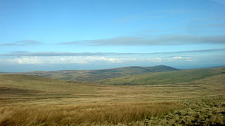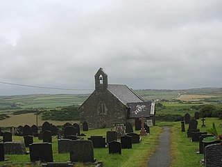
The Preseli Mountains, also known as the Preseli Hills, or just the Preselis, is a range of hills in western Wales, mostly within the Pembrokeshire Coast National Park and entirely within the county of Pembrokeshire.

Nevern is both a parish and a community in Pembrokeshire, Wales. The community includes the settlements of Felindre Farchog, Monington, Moylgrove and Bayvil. The small village lies in the Nevern valley near the Preseli Hills of the Pembrokeshire Coast National Park 2 miles (3 km) east of Newport on the B4582 road.

Bodedern is a village and community in the west of Anglesey, Wales. At the 2001 census, it had a population of 1,074, decreasing slightly to 1,051 at the 2011 census. The community includes the settlements of Llanllibio and Pen-llyn.

Bedd Arthur is a possibly Neolithic hengiform monument megalithic site in the Preseli Hills in the Welsh county of Pembrokeshire. Thirteen upright stones and at least 2 fallen ones, each around 0.6 metres (2.0 ft) high form an oval horseshoe with similarities to the earliest form of Stonehenge.

Wiston is a village, parish and community in Pembrokeshire, Wales, in the United Kingdom. It was once a marcher borough. George Owen, in 1603, described it as one of nine Pembrokeshire "boroughs in decay". It continued as a constituent parliamentary borough until the end of the 19th century.

Prehistoric Wales in terms of human settlements covers the period from about 230,000 years ago, the date attributed to the earliest human remains found in what is now Wales, to the year AD 48 when the Roman army began a military campaign against one of the Welsh tribes. Traditionally, historians have believed that successive waves of immigrants brought different cultures into the area, largely replacing the previous inhabitants, with the last wave of immigrants being the Celts. However, studies of population genetics now suggest that this may not be true, and that immigration was on a smaller scale.

Pentre Ifan is the name of an ancient manor in the community and parish of Nevern, Pembrokeshire, Wales. It is 11 miles (18 km) from Cardigan, Ceredigion, and 3 miles (4.8 km) east of Newport, Pembrokeshire. It contains and gives its name to the largest and best preserved neolithic dolmen in Wales.
The rectangular enclosure that defined this Roman fort was built in the 70s AD as part of the campaign to integrate southern Wales into the Roman province of Britannia Superior. It lay on a key road, now known as the Sarn Helen (RR69), from the legionary fortress of Isca Augusta (Caerleon) that ran north west across Wales to Bremia and on to North Wales. It also sat on a road running from Moridunum (Carmarthen) across to eastern Wales at Castell Collen. It thus held an important crossroads along with a bridging point over the River Towy, and the town that grew up near the fort retained its significance and became Llandovery.
Llangolman is a village and parish in the southeastern Preseli Hills in Pembrokeshire, Wales. It is part of the community of Mynachlog-ddu. There are prehistoric remains nearby and the parish has a history of slate and clay quarrying.

The Hundred of Dungleddy was a hundred in the centre of Pembrokeshire, Wales. It had its origins in the pre-Norman cantref of Deugleddyf. It derives its Welsh name from its position between the two branches of the River Cleddau (Cleddyf): the English form is a corruption of the Welsh. The area of the cantref was around 185 km2: it was the smallest of the seven cantrefi of Dyfed.

Llanfaethlu is a village and community in the north west of Anglesey, in north-west Wales. The community population taken at the 2011 Census was 553. The village takes its name from the Church of Saint Maethlu. The community includes Llanfwrog.

Carmarthenshire is a large rural county in West Wales. It includes a mix of upland and mountainous terrain and fertile farmland. The western end of the Brecon Beacons National Park lies within the county. Across Carmarthenshire there are a total of 370 scheduled monuments. That is too many to have on a single list page, so for convenience, the list is divided into the 227 prehistoric sites and the 143 Roman, Medieval and Post Medieval sites.

Scleddau is a village and a community in the county of Pembrokeshire, Wales, and is 2 miles (3.2 km) south of Fishguard on the main A40 road. The Western Cleddau river which lends its name to the village flows under the main road. There are several springs in the village.

Bedd-y-Cawr Hillfort, or Bedd y Cawr Hillfort, is an Iron Age hillfort on a natural inland promontory in the community of Cefnmeiriadog in Denbighshire in North Wales. The name of the hillfort translates from the Welsh as Giant's Tomb.

The archaeology of Wales is the study of human occupation within the country of Wales which has been occupied by modern humans since 225,000 BCE, with continuous occupation from 9,000 BCE. Analysis of the sites, artefacts and other archaeological data within Wales details its complex social landscape and evolution from Prehistoric times to the Industrial period. This study is undertaken by academic institutions, consultancies, charities as well as government organisations.


