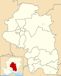
Soberton

Last updated

Soberton
Hampshire UK location map.svg
Red pog.svg
Soberton
Location within Hampshire
Population218  [1]
1,616 (2011 Census) [2]
OS grid reference SU6120216615
District
Shire county
Region
Country England
Sovereign state United Kingdom
Post town Southampton
Postcode district SO32
Dialling code 01489
Police Hampshire and Isle of Wight
Fire Hampshire and Isle of Wight
Ambulance South Central
UK Parliament
List of places
UK
England
Hampshire
50°56′45″N1°07′49″W / 50.945735°N 1.1302°W / 50.945735; -1.1302

Soberton is a village in the Meon Valley, Hampshire, England, east of the A32 and a few miles south of the village of Droxford. It appears in the Domesday Book as "Sudbertone" or "Sudbertune". For administration, it is in the Hampshire County Council area, headquartered in Winchester.

Soberton Church Soberton St Peters.jpg
Soberton Church

Key features of Soberton include the War Memorial at its centre, the early 16th-century Church of St Peter and St Paul, and The White Lion, a 17th-century public house. The church is part of one of the largest parishes in the United Kingdom.

Soberton White Lion Soberton White Lion.jpg
Soberton White Lion

The village was part of a smuggling route during the 18th century, and a vault beneath the church was used for the storage of contraband. [3]

Soberton Towers from the West Soberton Towers.jpg
Soberton Towers from the West

North of the church is a large Georgian manor house, Soberton Towers. This was taken over by the Navy during the 1939-45 war and was used for accommodation for members of the Women's Royal Naval Service (WRENS) until 1971.

Soberton is named in the 18th century peerage of Admiral Sir George Anson (1697-1762) "Baron Anson of Soberton".

The children's writer Barbara Euphan Todd was brought up in the village. [4]

Related Research Articles

<span class="mw-page-title-main">Hartley Wintney</span> Village and parish in Hampshire, England

Hartley Wintney is a large village and civil parish in the Hart district of Hampshire, England. It lies about 3 miles (5 km) northwest of Fleet and 8 miles (13 km) east of Basingstoke. The parish includes the smaller contiguous village of Phoenix Green as well as the hamlets of Dipley, Elvetham, Hartfordbridge, and West Green.

<span class="mw-page-title-main">Hambledon, Hampshire</span> Village and parish in Hampshire, England

Hambledon is a small village and civil parish in the county of Hampshire in England, situated about 10 miles (16 km) north of Portsmouth within the South Downs National Park.

<span class="mw-page-title-main">Old Basing</span> Village in Hampshire, England

Old Basing is a village in Hampshire, England, just east of Basingstoke. It was called Basengum in the Anglo-Saxon Chronicle and Basinges in the Domesday Book.

<span class="mw-page-title-main">Baughurst</span> Village and parish in Hampshire, England

Baughurst is a village and civil parish in Hampshire, England. It is located west of the town of Tadley, 6 miles (9.7 km) north of Basingstoke. In the 2001 census, it had a population of 2,473.

<span class="mw-page-title-main">Ashmansworth</span> Village and parish in Hampshire, England

Ashmansworth is a village and civil parish in the Basingstoke and Deane district of the English county of Hampshire.

<span class="mw-page-title-main">Bentworth</span> Village in Hampshire, England

Bentworth is a village and civil parish in the East Hampshire district of Hampshire, England. The nearest town is Alton, which lies about 3 miles (5 km) east of the village. It sits within the East Hampshire Hangers, an area of rolling valleys and high downland. The parish covers an area of 3,763 acres (15.23 km2) and at its highest point is the prominent King's Hill, 716 feet (218 m) above sea level. According to the 2011 census, Bentworth had a population of 553.

<span class="mw-page-title-main">North Baddesley</span> Village and parish in Hampshire, England

North Baddesley is a large village and civil parish in Hampshire, England. It is situated 3 mi (5 km) east of the town of Romsey and 6 mi (10 km) north of Southampton. It occupies an area of approximately 9.15 km2 (3.53 sq mi), and is home to a population of just over 10,000 people, reducing to 7,000 at the 2011 Census. It is located in the Test Valley; a river famous for trout fishing.

<span class="mw-page-title-main">Rogate</span> Village and parish in West Sussex, England

Rogate is a village and civil parish in the Chichester district of West Sussex, England, in the Western Rother valley. The village is on the A272 road 5.6 miles (9.0 km) west of Midhurst and 5 miles (8.0 km) east of Petersfield, Hampshire. The civil parish includes the villages of Rogate and Rake and the hamlets of Haben, Fyning, Hill Brow, Langley, Durford, Wenham, Durleighmarsh and Terwick Common.

<span class="mw-page-title-main">Kinson</span> Suburb of Bournemouth, England

Kinson is a former village which has been absorbed by the town of Bournemouth, in the Bournemouth, Christchurch and Poole district, in the ceremonial county of Dorset, England. The area became part of Bournemouth on 1 April 1931. There were two electoral wards containing the name Kinson. Their joint population at the 2011 Census was 19,824.

<span class="mw-page-title-main">Hale, Hampshire</span> Village and parish in Hampshire, England

Hale is a small village and civil parish in Hampshire, England. It lies on the border of the New Forest, overlooking the valley of the River Avon. The village is about 3.5 miles (5.6 km) north-east of the town of Fordingbridge, and about 8 miles (13 km) south of the city of Salisbury. Within the parish stands Hale House, a large 18th-century mansion which was the country house of architect Thomas Archer, who also rebuilt Hale church in 1717.

<span class="mw-page-title-main">Itchen Abbas</span> Village in Hampshire, England

Itchen Abbas is a village and former civil parish, now in the parish of Itchen Valley, in the Winchester district, in the county of Hampshire, England. The village is on the River Itchen about 4 miles (6.4 km) north-east of Winchester.

<span class="mw-page-title-main">King's Somborne</span> Village and parish in Hampshire, England

King's Somborne is a village in Hampshire, England. The village lies on the edge of the valley of the River Test.

<span class="mw-page-title-main">Meonstoke</span> Village in Hampshire, England

Meonstoke is a village and former civil parish, now in the parish of Corhampton and Meonstoke, in the Winchester district, in the county of Hampshire, England. It is in the Meon Valley where it cuts through the Middle Chalk of the South Downs, Old Winchester Hill is at the edge of the parish to the east. In 1931 the parish had a population of 439.

<span class="mw-page-title-main">East Boldre</span> Village and parish in Hampshire, England

East Boldre is a linear village and civil parish situated near Lymington, Hampshire, England. East Boldre is surrounded by the New Forest and forms part of the district of New Forest.

<span class="mw-page-title-main">Warnford</span> Village and parish in Hampshire, England

Warnford is a village and civil parish in the City of Winchester district of Hampshire, England. The parish covers 1283 hectares. The village lies on the A32 in the upper valley of the River Meon between West Meon and Exton. The population in 2019 was estimated at 220. The village is rural in character, with most of the buildings along River Lane, Lippen Lane and Hayden Lane.

<span class="mw-page-title-main">West Dean, Wiltshire</span> Human settlement in England

West Dean is a village and civil parish in southeast Wiltshire, England; the Wiltshire/Hampshire border runs through the eastern part of the village. The village is on the River Dun, about 7 miles (11 km) east of Salisbury and the same distance northwest of Romsey.

<span class="mw-page-title-main">Wingfield, Wiltshire</span> Human settlement in England

Wingfield is a small village and civil parish in the county of Wiltshire, England, about 2.5 miles (4.0 km) south of Bradford-on-Avon and 2.2 miles (3.5 km) west of Trowbridge.

<span class="mw-page-title-main">Medstead</span> Village and parish in Hampshire, England

Medstead is a village and civil parish in the East Hampshire district of Hampshire, England. Its nearest town is Alton, which lies 4.3 miles (6.9 km) northeast of the village. According to the 2011 census, the village had a population of 2,036 people. The parish covers an area of 1,536 acres (622 ha) and has an average elevation of approximately 600 feet (180 m) above sea level. One of the county's high points at 716 feet (218 m), King's Hill, runs through Medstead and Bentworth.

<span class="mw-page-title-main">Netley Marsh</span> Human settlement in England

Netley Marsh is a village and civil parish in Hampshire, close to the town of Totton. It lies within the New Forest District, and the New Forest National Park. It is the supposed site of the battle between an invading Anglo Saxon army, under Cerdic and a British army under the probably fictitious king Natanleod in the year 508.

<span class="mw-page-title-main">Up Nately</span> Village and parish in Hampshire, England

Up Nately is a small village and former civil parish, now in the parish of Mapledurwell and Up Nately, in the Basingstoke and Deane district, in Hampshire, England, located five miles to the south east of Basingstoke.

References

  1. Census data
  2. "Civil Parish population 2011". Neighbourhood Statistics. Office for National Statistics. Retrieved 19 January 2017.
  3. Morley, Geoffrey (1983). Smuggling in Hampshire and Dorset 1700 – 1850. Newbury: Countryside Books. pp. 41–42. ISBN   0905392248.
  4. Book Rags biography: Retrieved 18 June 2012.