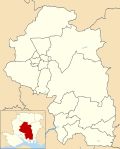
Badger Farm | |
---|---|
![]() Badger Farm roofscape | |
Location within Hampshire | |
OS grid reference | SU4661027925 |
District | |
Shire county | |
Region | |
Country | England |
Sovereign state | United Kingdom |
Post town | Winchester |
Postcode district | SO22 |
Dialling code | 01962 |
Police | Hampshire and Isle of Wight |
Fire | Hampshire and Isle of Wight |
Ambulance | South Central |
UK Parliament | |
Badger Farm is a suburb to the south of the city of Winchester, in the centre of the English county of Hampshire, England. It is also a civil parish in the local government district of the City of Winchester.
The area was developed in the 1970s and 1980s, and became a parish in 1985. The development of Badger Farm was the subject of the revised Badger Farm Development brief, 1978, produced by Winchester City Council. This laid down the standards for roads, open spaces and housing. Before the development began, the Badger Farm development area was split between two parishes and two city wards. According to the 2021 census, Badger Farm had a population of 2,463.
The parish is named after William Badger, who was once a tenant farmer on the site. John O'Loughlin was owner of the land. It is located next to the other parishes of Stanmore and Oliver's Battery, alongside other areas in the city. [1]
Hampshire is a ceremonial county in South East England. It is bordered by Berkshire to the north, Surrey and West Sussex to the east, the Isle of Wight across the Solent to the south, Dorset to the west, and Wiltshire to the north-west. The cities of Southampton and Portsmouth are the largest settlements, and the county town is the city of Winchester.
Winchester is a cathedral city in Hampshire, England. The city lies at the heart of the wider City of Winchester, a local government district, at the western end of the South Downs National Park, on the River Itchen. It is 60 miles (97 km) south-west of London and 14 miles (23 km) from Southampton, its nearest city. At the 2021 census, the built-up area of Winchester had a population of 48,478. The wider City of Winchester district includes towns such as Alresford and Bishop's Waltham and had a population of 127,439 in 2021. Winchester is the county town of Hampshire and contains the head offices of Hampshire County Council.
Winchester, or the City of Winchester, is a local government district with city status in Hampshire, England.
Whiteley is a planned community of 6,500 homes in the county of Hampshire, England, United Kingdom near Fareham. The development straddles the boundary between two council districts: the Borough of Fareham to the south and east, and the city of Winchester to the north and west.
Winchester is a constituency in Hampshire represented in the House of Commons of the UK Parliament since 2024 by Danny Chambers, a Liberal Democrat.
Liss is a village and civil parish in the East Hampshire district of Hampshire, 3.3 miles (5.3 km) north-east of Petersfield, on the A3 road, on the West Sussex border. It covers 3,567 acres (14 km2) of semi-rural countryside in the South Downs National Park. Liss railway station is on the Portsmouth Direct line. The village comprises an old village at West Liss and a modern village round the 19th-century station. They are divided by the River Rother. Suburbs later spread towards Liss Forest.
Overton is a large village and parish in Hampshire, England, west of Basingstoke and east of Andover and Whitchurch. The village contains the smaller hamlets of Southington, Northington, Ashe, Polhampton, and Quidhampton, the latter two lying to the north of the village. The River Test has its source 1 mile (1.6 km) to the east in Ashe.
Baughurst is a village and civil parish in Hampshire, England. It is located west of the town of Tadley, 6 miles (9.7 km) north of Basingstoke. In the 2001 census, it had a population of 2,473.
Chandler's Ford is a largely residential area and civil parish in the Borough of Eastleigh in Hampshire, England. It had a population of 21,436 in the 2011 Census.
Barton Stacey is a village and undulating civil parish, which includes the hamlets of Bransbury, Newton Stacey, Drayton and Cocum, in the Test Valley district of Hampshire, England, centred about 7 miles (11 km) south-east of Andover. It is bounded to the north by the estate of Drayton Lodge, and, to the south, by the minor A30 road; both being east–west routes, and connected by The Street/Cocum Road, the main road that bisects the village. The distance between the A303 and A30 at this point is 2 miles (3.2 km), which is twice the width of the parish.
Oliver's Battery is a civil parish in Hampshire, England, of some 700 households located just to the south of the City of Winchester. The parish was formed in 1956 from part of Compton parish. The parish does not include the whole of the settlement known informally as Oliver's Battery, with the northern boundary following the A3090 and therefore excluding Oliver's Battery Road North.
Church Minshull is a village and civil parish in the unitary authority of Cheshire East and the ceremonial county of Cheshire, England. The village is approximately 5 miles (8.0 km) north west of Crewe, just west of the River Weaver and Shropshire Union Canal. The principal road through Church Minshull is the B5074 between Nantwich and Winsford. The modern village centre is a designated conservation area which contains many houses of Tudor style architecture. A large area in the east of the parish falls within the Weaver Valley Area of Special County Value.
Winchester City Council is responsible for the local government of the City of Winchester in Hampshire, England. Despite its name, the City of Winchester is a local government district that stretches far beyond the urban area of Winchester, covering urban, suburban and rural areas.
Warnford is a village and civil parish in the City of Winchester district of Hampshire, England. The parish covers 1283 hectares. The village lies on the A32 in the upper valley of the River Meon between West Meon and Exton. The population in 2019 was estimated at 220. The village is rural in character, with most of the buildings along River Lane, Lippen Lane and Hayden Lane.
North Stoneham is a settlement between Eastleigh and Southampton in south Hampshire, England. Formerly an ancient estate, manor, and civil parish, it is currently part of the Borough of Eastleigh. Until the nineteenth century, it was a rural community comprising a number of scattered hamlets, including Middle Stoneham, North End, and Bassett Green, and characterised by large areas of woodland.
The 2010 Winchester Council election took place on 6 May 2010 to elect members of Winchester District Council in Hampshire, England. One third of the council was up for election and the Liberal Democrats gained overall control of the council from the Conservative Party.
Up Nately is a small village and former civil parish, now in the parish of Mapledurwell and Up Nately, in the Basingstoke and Deane district, in Hampshire, England, located five miles to the south east of Basingstoke.
Knowle is a village with mainly 21st century shops and businesses in the civil parish of Wickham and Knowle, in the Winchester district of Hampshire, England that sits high on the left bank of the Meon between the Southampton and Portsmouth conurbations. It is in the south of the parish of Wickham and Knowle in which it ranks in population about 25% behind Wickham. Its nearest town is Fareham, adjoining an inlet of Portsmouth Harbour approximately 3 miles (4.8 km) south-east.
Stanmore is a large residential suburb of Winchester, Hampshire, England, situated on a very steep slope from West to East. It lies to the south-west of the city centre and to the north of Badger Farm, and makes up a large percentage, in both area and population, of the St. Luke electoral ward. It is home to roughly 6,000 inhabitants.
Newlands is a civil parish in Hampshire, England, in the south-east of the local government district of the City of Winchester.